
Someone suggested that the scout go along to the Green Scythe Fair, which was to be held at Thorney Lakes, near Langport. The scout thought he could combine this with a refresher of the “new” line from Castle Cary.
An early start was needed and so the scout went for the first Up train on a Sunday, the 0759 to Cardiff. This he found idling in platform six at St. David’s with the heating on; steam pre-heating would once have ceased after 30th April.
Time (of departure) came and went. After a few minutes the Guard made a barely audible announcement, something like: “Sorry, Guys. This train is cancelled.” Twenty or so passengers detrained and crowded around the supervisor. This being the third failure, the scout thought about going home and could well have wandered off, taking it that he’d have to catch the next train at 0830. But he lingered, and it was fortunate he did, for suddenly the train was reinstated. “Are we going?” asked the scout of a member of staff, one wheel of his bicycle still on the platform. And then: “Why were we not going?” There was a problem at Bristol.
A ten-late start was not going to spoil the day and the scout could do without his sunglasses and cycle computer.
After taking a few photos of Taunton Station in sunshine, to replace ones he’d taken the previous week, he went to the booking office to reserve a bike space from Castle Cary. The lady told him that the new office was much airier, but that the noise was sometimes too much, what with the amplifiers, the hubbub in the foyer and the trains.
The scout then followed the new road across what was once East Yard and, for a change, joined the riverside path. This leads away from the Bridgwater & Taunton Canal but the scout wanted a reason to use a foot crossing.


Creech St. Michael
The scout left the canal here and circled around to take in two bridges.


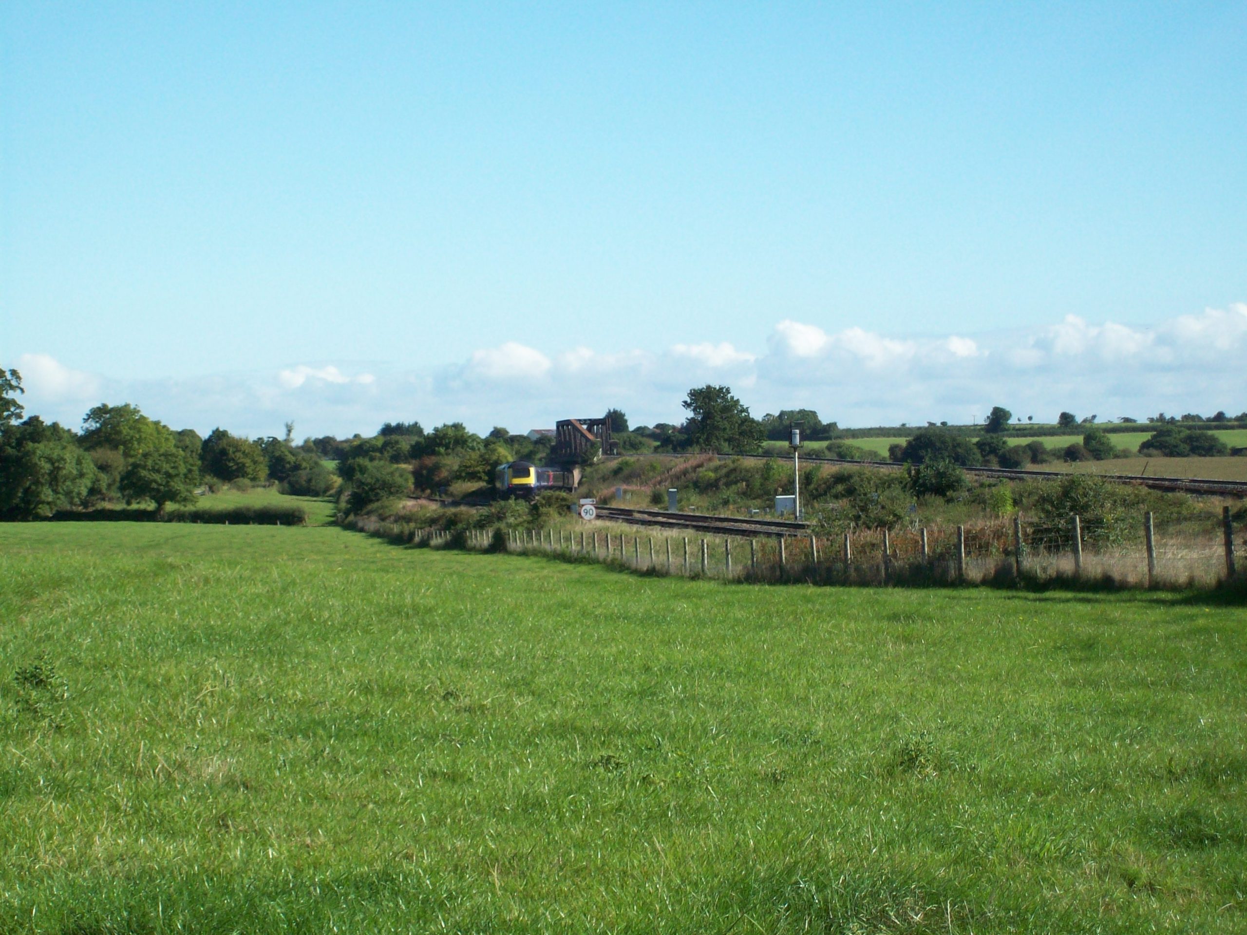
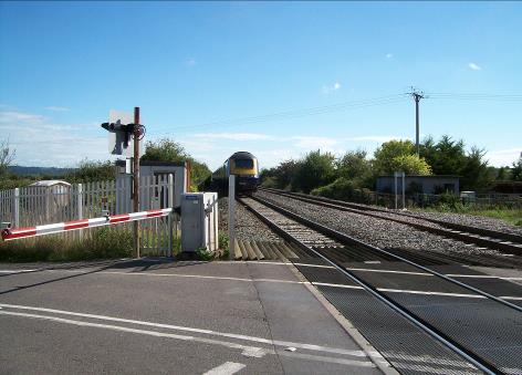
Cogload Junction
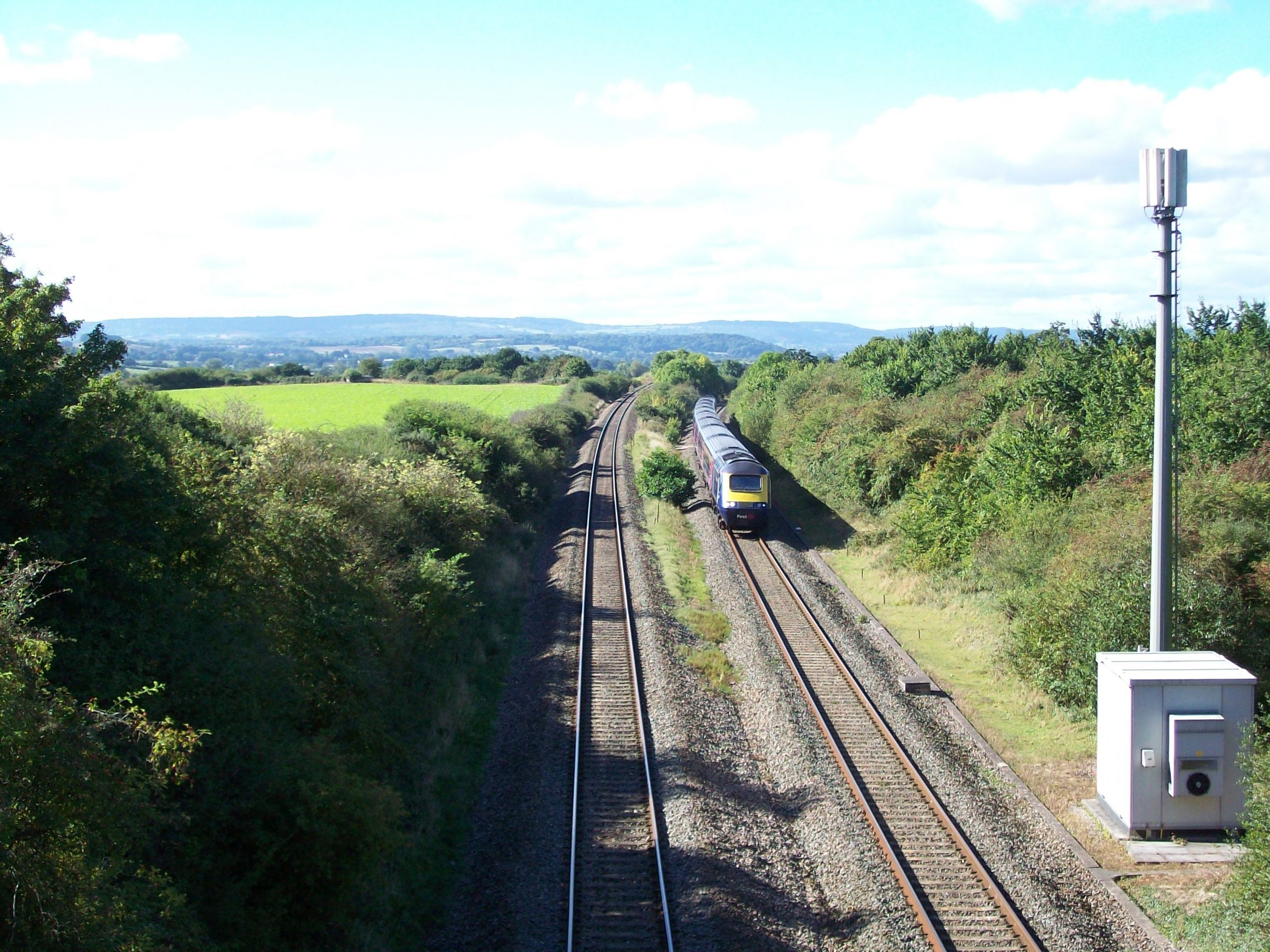
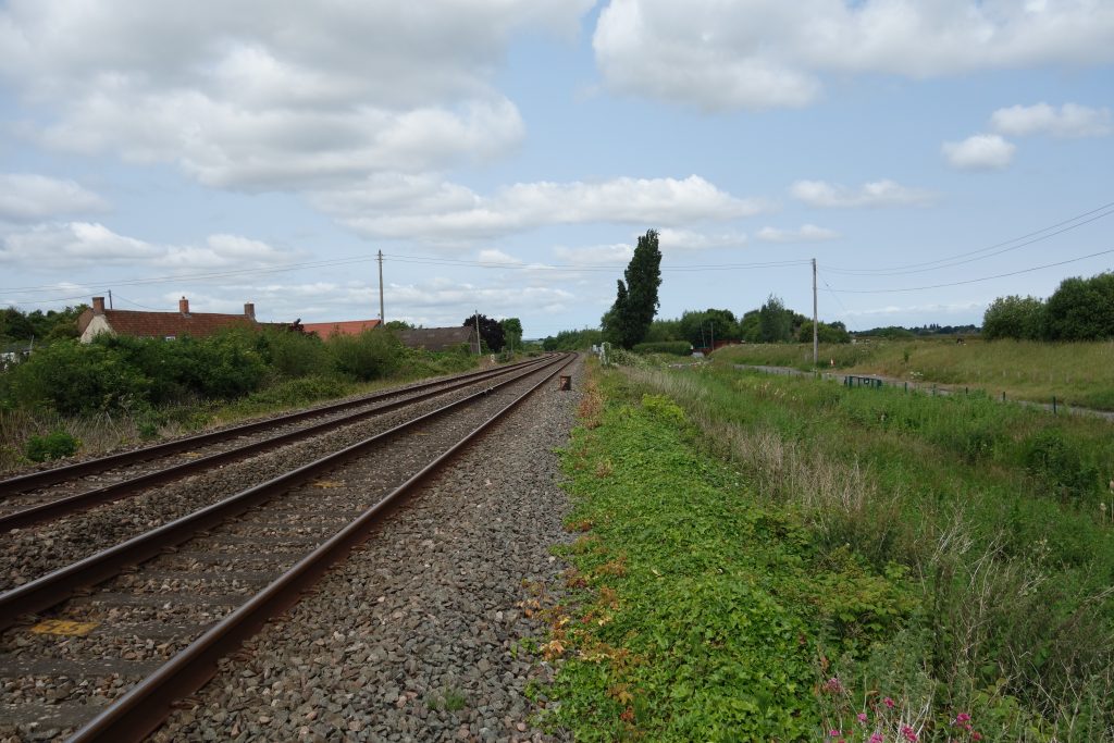
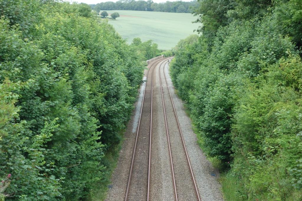
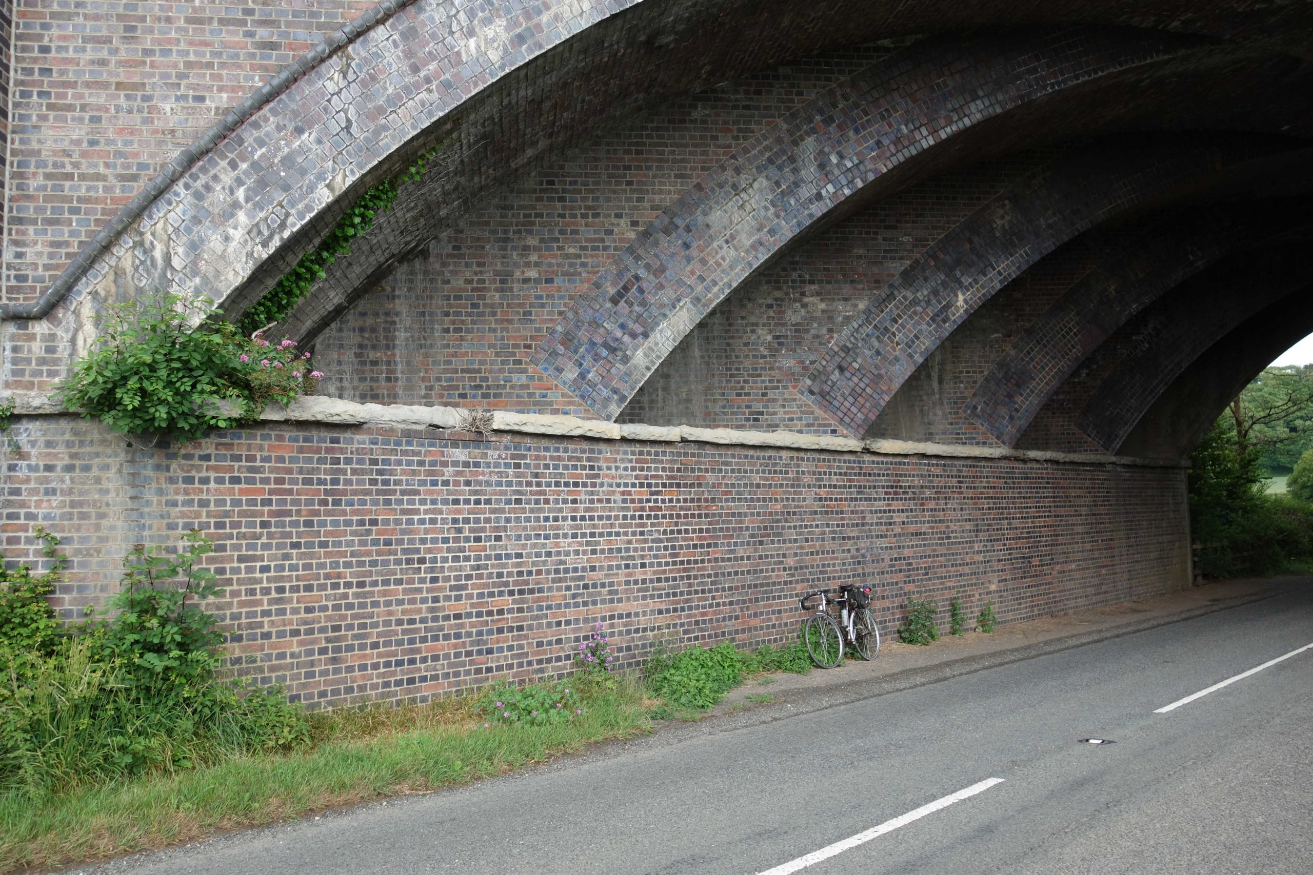
At Charlton Bridge on the canal, Charlton Road continues as an unmetalled track which is taken across the line by means of another Charlton Bridge. This one must have been built to replace an accommodation crossing just Up the line. There were other accommodation crossings on the quadruple line between here and Taunton.


Dog owners in towns and cities used to walk their pets along pavements and paths or at the local park. Dogs were generally the smaller breeds like “toys” or terriers and were always kept on short leads; most were trained. Lampposts were canine notice boards; gutters were the latrines. Dog licences cost 7/6 (37½p). Only working dogs on farms and shoots ran free.
The number of dogs being kept increased gradually over the years but during the plague many more creatures were bought, often to help those who blindly followed their ridiculous orders cope with isolation, loneliness and boredom. From five million in 1970, there are now an estimated 12 million dogs and almost nowhere can be found to escape from them.
Keeping dogs is often dependent on having a car; cars and vans are bought specifically for carrying dogs. These range from modest “hatchbacks” with a mesh screen to vans which, when the sliding door is opened, reveal a dog play pen equipped with food, water, towels, baskets, balls, bones and even wet weather jackets.
These vehicles are not just seen in popular places, such as seafronts and country parks, but at lay-bys, pull-ins and gateways—seemingly any flat verge will do—adjacent to a path or bit of open space that the dog owner will have come to think of as his own. Millions of motoring miles must be accumulated every day by dog owners seeking a variety of open spaces to exercise animals that are by nature territorial.
The scout groans when he meets them on the cycle trails. He understands that these are shared with pedestrians but, to his annoyance, dog walkers using them as linear parks, often far from their homes, put their charges on long leads or let them run. Any cyclist who, after slowing down or stopping, does not offer profuse thanks to owners who have gathered their dogs or brought them under control, is often subjected to a sarcastic, “That’s perfectly alright.” The scout would like to explain to them that not one farthing of the funding for the paths was justified on the grounds that they would become haunts for dog walkers; especially as they very often add to the traffic on the roads; and roads which would otherwise be quiet, at that.
And when the scout settles down in a lunch spot, carefully chosen for its view, its people watching potential or its shelter, it is not enough that he has to see the dirty, sniffing, piddling, crapping creatures, and hear them growling and barking; the next thing one on a long lead, or no lead, comes to his feet to beg or steal. And all the owners can say is: “Come away!” And to the scout: “He’s smelt food.”
Personifying pets is common, because they are often child substitutes or “friends”—best friends, even. The scout frequently hears running, one-sided conversations, not unlike those conducted on walkie-talkies. Dogs give dull but loud men another excuse to shout. “GOOD BOY!” and “Who’s a clever boy?” when the thing accomplishes some simple task. It’s often not clear which is the intelligent one. Infantilizing beasts with highly developed senses, just because they don’t use language—or one that can be understood by most humans—is insulting and wrong.
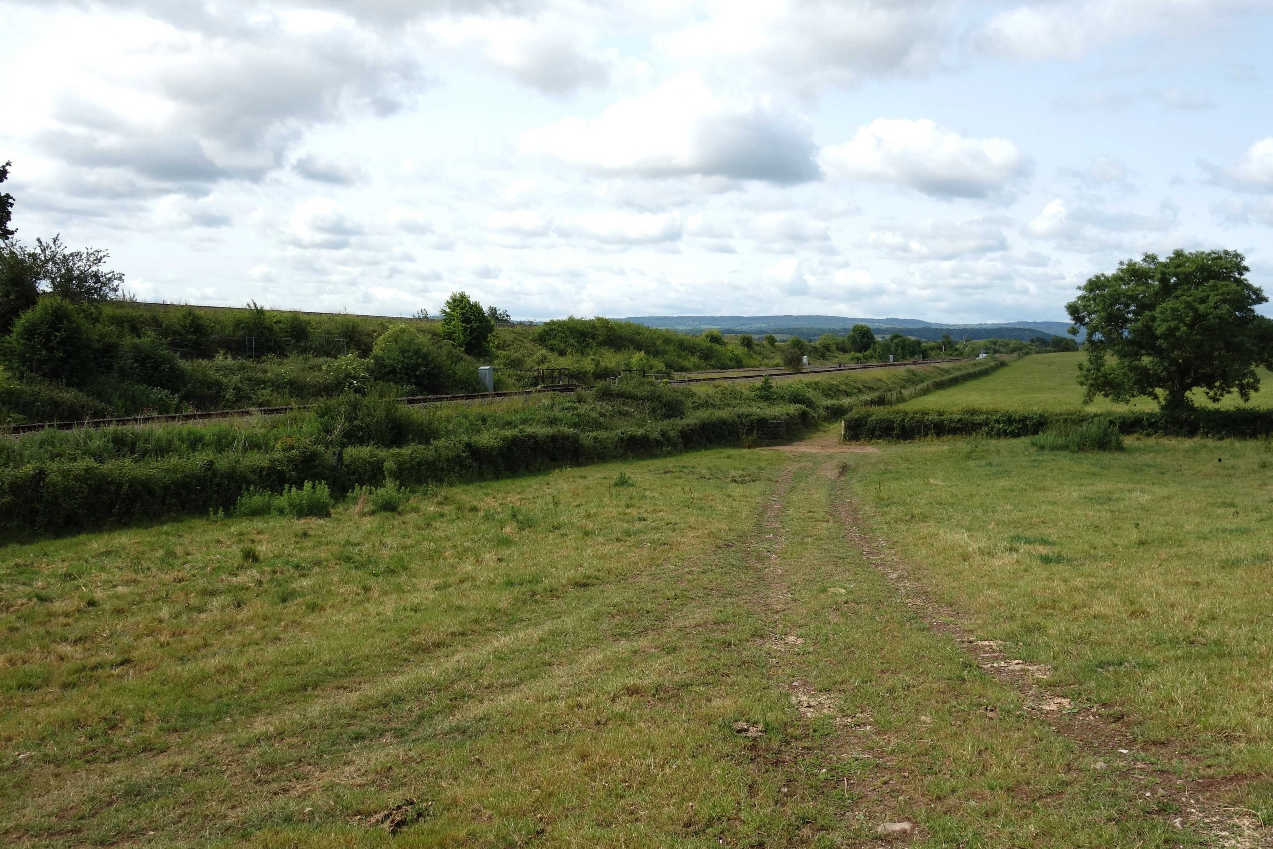
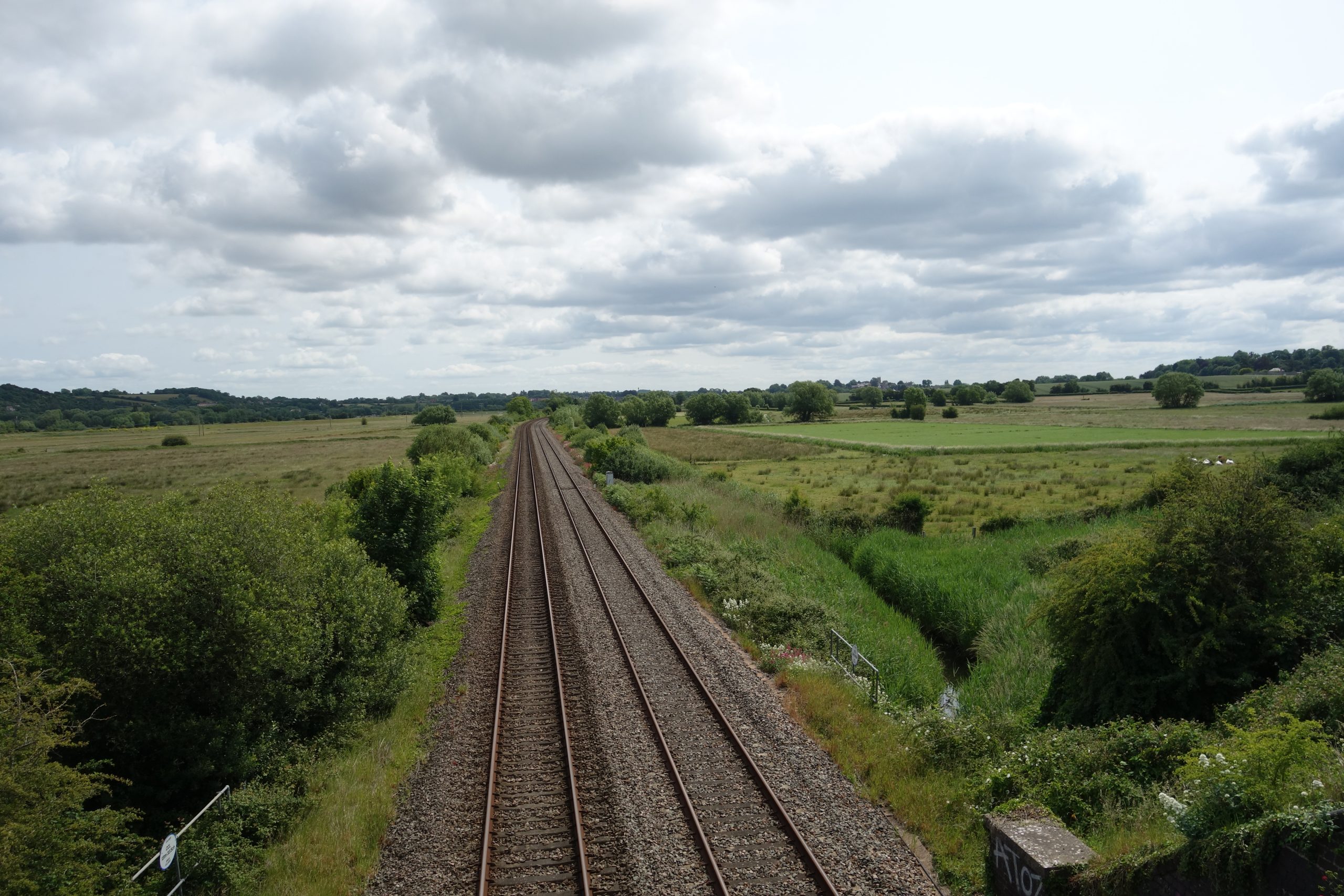
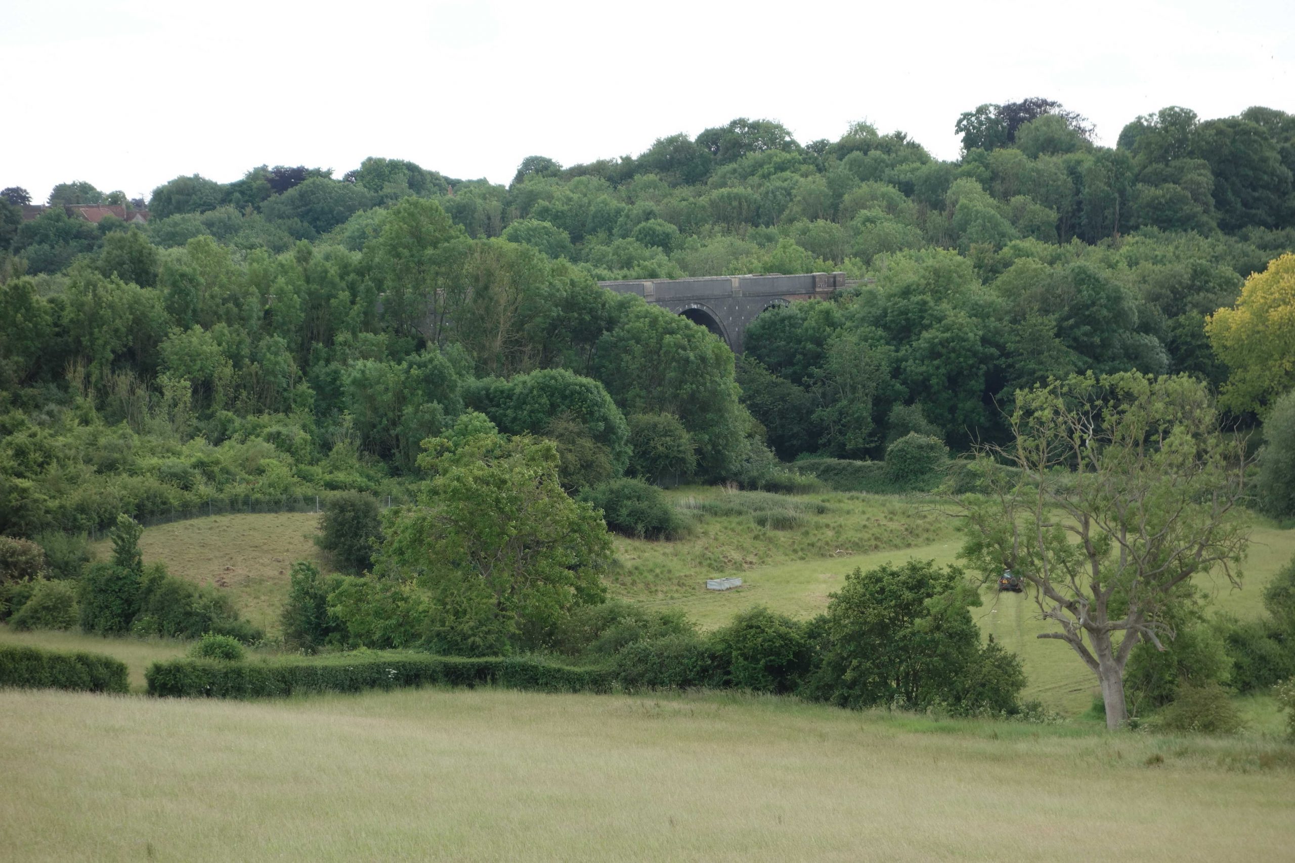
The fellow parked at Cogload, which is what prompted this rant, had driven along Charlton Road, a mile-long lane leading from Creech Heathfield Road. It ends at the canal and there is no vehicular right of way to the parking place; the accommodation bridge carries a public footpath which continues beside the River Tone. A trainspotting guide advises that eight cars can be parked here. Apart from the laziness and stupidity in driving all this way for no real purpose, what if railway staff needs to deal with a signalling or track failure, or if emergency services need to get access to the line? The scout dreads to think what all these places get like when there is a special on the way.


Here are some photos and a video taken from trains at the junction.
The scout left the canal to join the A361.


Articles from the July and August, 1905, editions of the Great Western Railway Magazine, entitled “The New Route to The West of England,” kindly provided by Michael Roach.
Lyng Halt
After the “new line” was built, Yeovil Branch trains continued to call at Durston. The Halt was opened in 1928.


Athelney


Black Smock Bridge

This 2016 view, taken from what had been the course of the old road, was not possible in 2025. +


It was around here on a previous ride that the scout remembered the words of David St. John Thomas, written in his West Country Railway History:
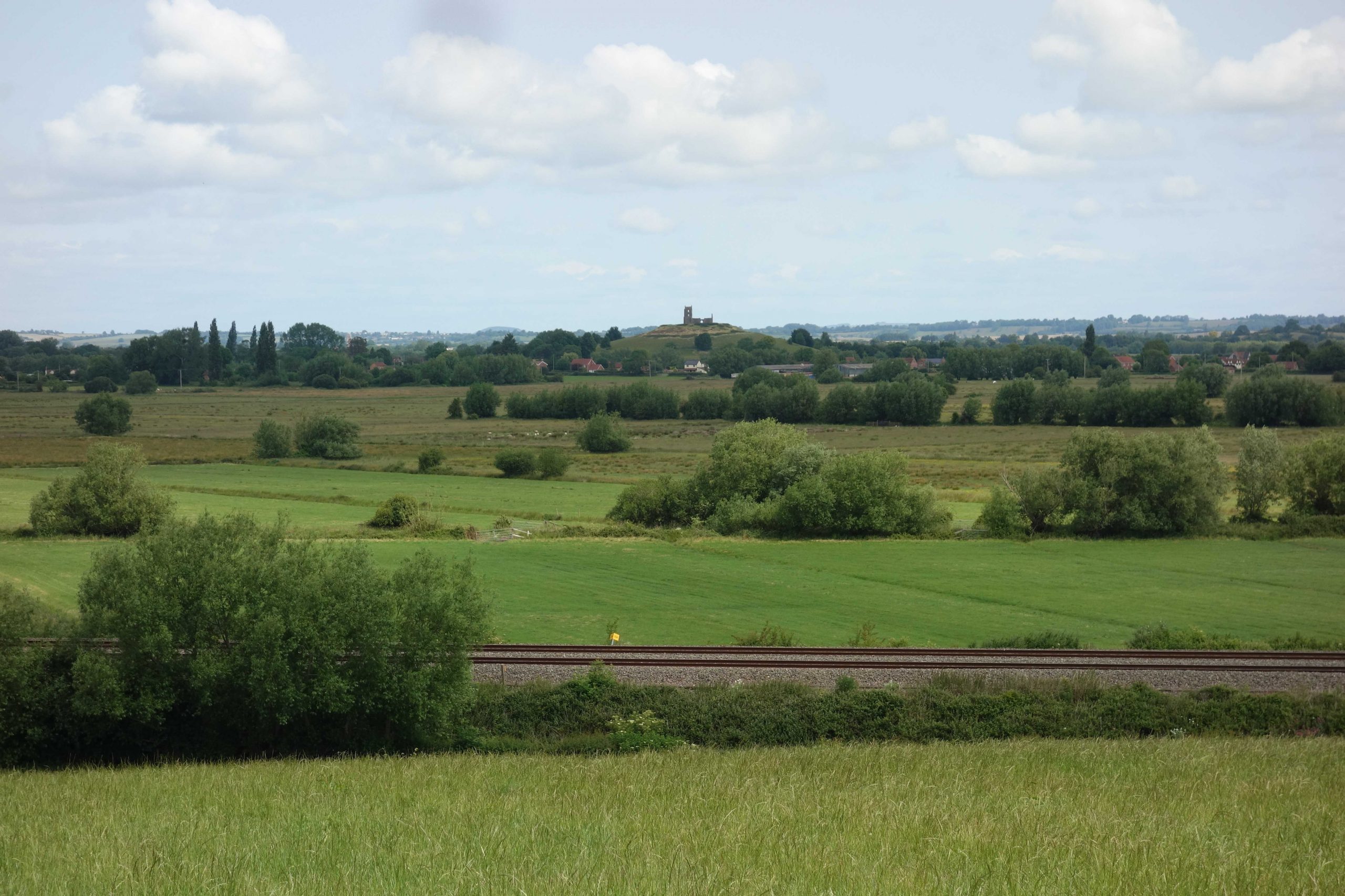
“The scenery and way of life in this flat country have changed less than anywhere else in the West, except moorland above the 1,000-ft contour. Except when the occasional express thunders across, carrying passengers for destinations which to the local inhabitants are mere names, there hangs an almost uncanny silence and stillness, perhaps broken by the flapping wings of a heron which has followed the Parrett—the Parrett which until flood-prevention schemes were effected in the 1960s each winter overflowed to turn the surroundings into a vast lake. The expresses have as little to do with the area as the aeroplanes overhead.”
Do the rooted people on the Levels see the trains in the same way as staff at Christow view the criss-crossing contrails in the sky on a clear day? They now and again look up and think of the life in those silvery specks; perhaps those on the Levels do the same with the trains and their passengers.
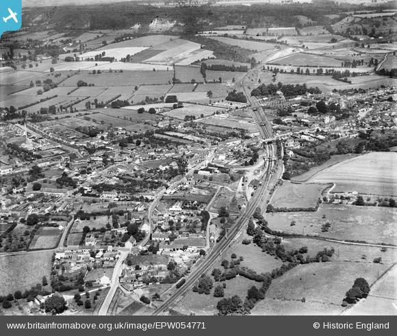
Quite the same could not have been said when trains called at eight stations between Castle Cary and Taunton. The stopping service was withdrawn and the intermediate stations closed in 1962, leaving the 27½ miles between Cary and the county town as the longest section without a station on the whole route.
Langport West


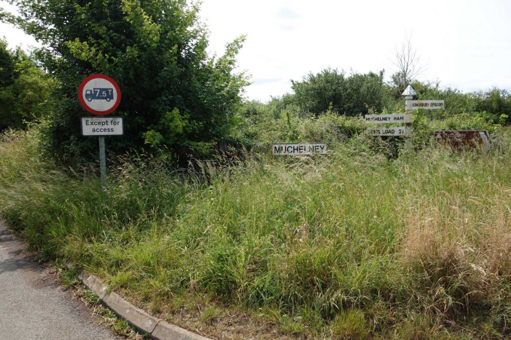
The scout made his way up The Hill and out towards Muchelney, where he was last after the inundation of 2014.
Thorney & Kingsbury Halt
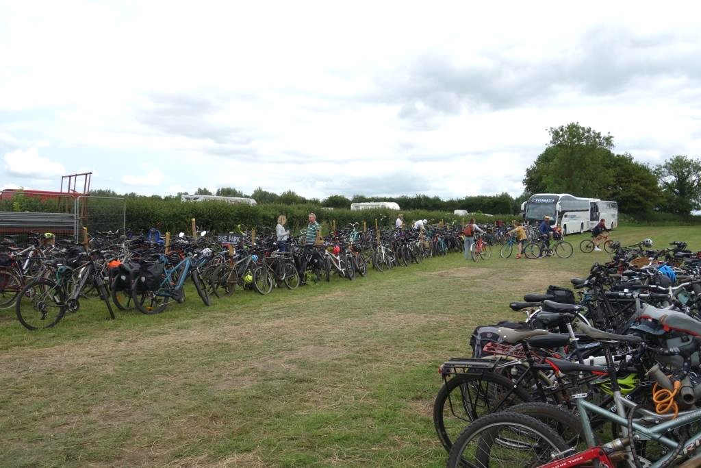
The Green Scythe Fair is held at Thorney Lakes, right next to the former Durston to Yeovil line. Cyclists, canoeists and those on foot are charged £5 for entry; car occupants pay £15 each.
Where Wetmoor Lane forks from Law Lane was neatly kept in 2014. While the scout was here, two cyclists went left and then came back. The brown sign at right points to Thorney Lakes.


The scout spent the best part of two hours wandering around the fair. It was far bigger than he had expected and the scything seemed to be overwhelmed by the mass of stalls; the ring had not a great many spectators.

Much of it was too “alternative” for the scout and he found himself observing how those who shun uniformity often choose to wear a uniform of their own; they all look alike in their individuality. And the scout is often struck by the “counter-culture” being more material—involving as it usually does, telescreens, aeroplanes, cars, vans, etc.—than his own frugal existence.
He had thought that he would bump into a pal who had said he was going to be there, but he wasn’t seen. And the folk from Bridford’s Fairhill Farm were doing such a roaring trade on their stall, selling books and scythes, seemingly without a break, that the scout could not even say “hello.”
Tiring of the crowd, and the prattery and pretence, the scout yearned for the solitude of the open road. As he sat on his saddle, a voice came from behind him: “Is that a Raleigh?” The fellow, who’d also cycled from Taunton (Kingston to be precise) on his “traditional” Pashley, delivered Bikeability training to primary schoolchildren. His enlightened employer paid him for his cycling mileage, which he thought of as not a bit like work. He had attended all 19 fairs and said that he thought it had become too commercialized.
Langport East
The scout left Langport with some lunch which he bought in Tesco, there being no Co-op. He turned to follow Tengore Lane.


Long Sutton & Pitney


Somerton


The earthworks still look bare, 30 years after construction.
The scout rode around the earlier county town and found the Co-op. He settled on a bench outside and ate a very late Tesco lunch. It was nearly closing time at four o’clock and the scout didn’t dwell for long, as he had booked his bike on the 1816 from Castle Cary and if he missed it there would not be another for two hours.
Right: Although the new stations were built without platform loops for the stopping services, these trains could be crossed to the opposite line to make way for fasts. Likewise, goods trains could be backed onto the Yeovil Branch at Curry Rivel.

The G.W.R. Magazine reported that the engineers had to reinforce the ground with rock on either side of the viaduct in order to build a stable embankment. +
Somerton Road Bridge
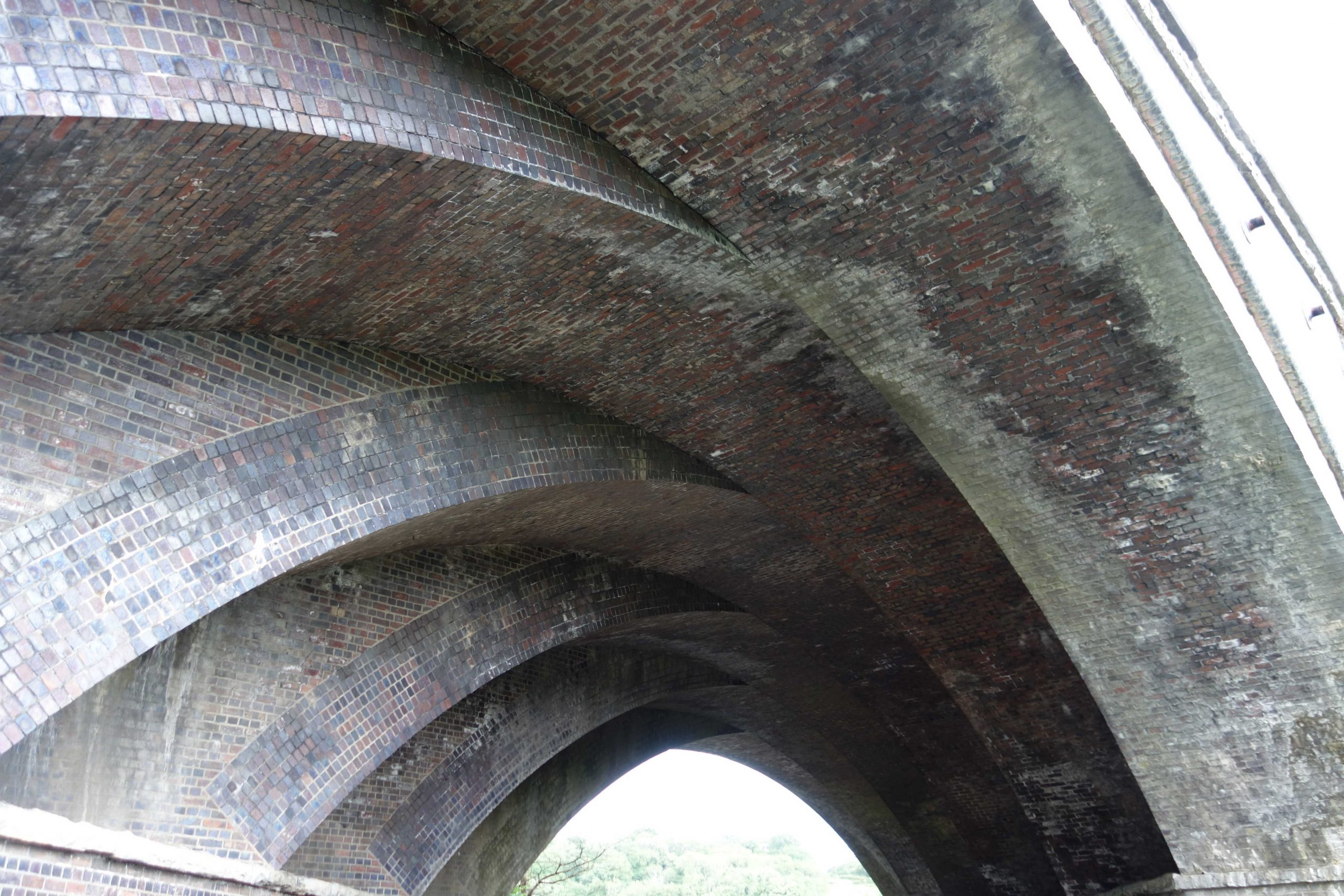
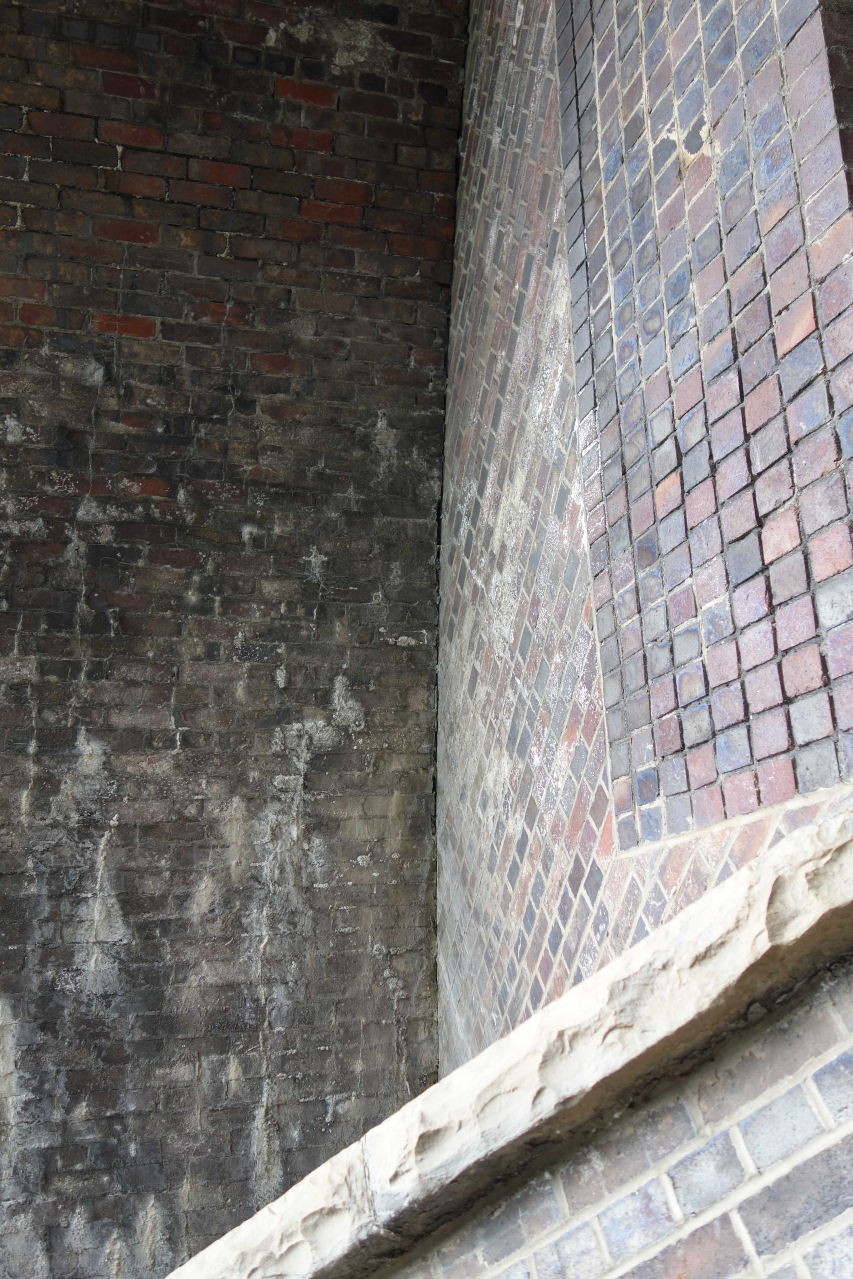
The construction of this bridge is quite unusual, it being composed of six parallel arches, seemingly abutting each other. It is thought that this was an easier method, involving simpler centerings, than building a skew bridge with complicated brickwork.


Just along the road is a striking building which can be seen from the train.
Charlton Mackrell


Keinton Mandeville
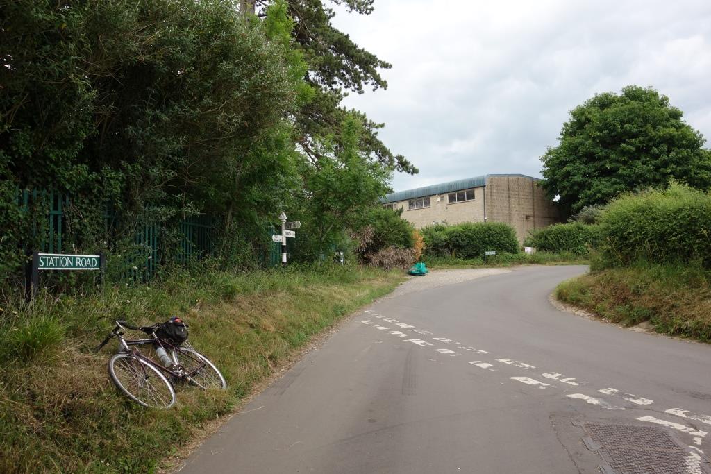
Alford Halt


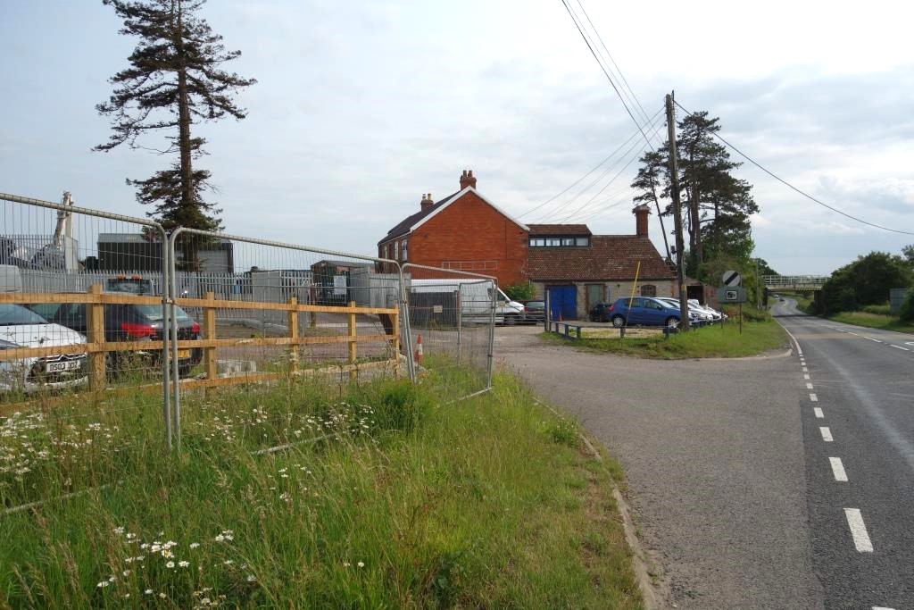
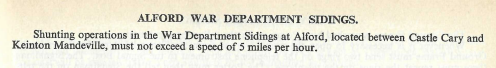
Alford War Department Sidings
An ammunition depot was built to the south of the line in 1940. There is a brief entry in the 1960 Western Region Sectional Appendix. These entries were often copied from the last G.W. appendix and it is not always certain that the sidings or works were actually still in use.
Castle Cary


