Several years before his journey on the Exe Valley train, the railway’s friend, Richard Holladay had photographed what were soon to become the ruins of the Teign Valley Branch.
Again, the scout has gone back, as near as possible, to where Richard had stood to take corresponding shots. These have been supplemented by a large assortment of library photographs which have not been published before and some more present-day views.
Exeter (St. David’s)
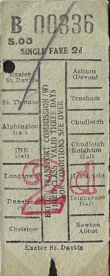
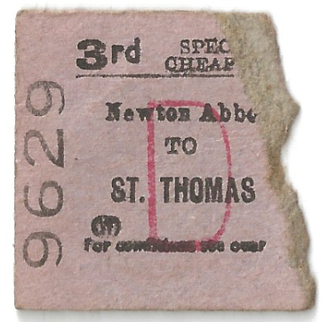
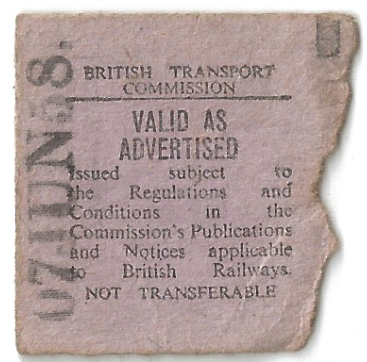
Below are tickets issued by the Guard on the Teign Valley train.

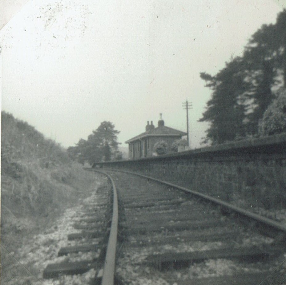
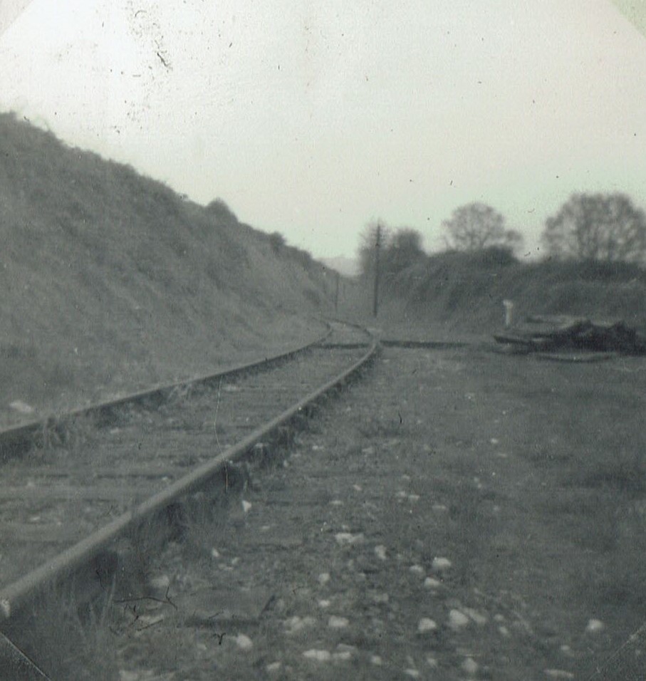
Exeter (St. Thomas)
“Those were the days – long gone but not forgotten.”
An old boy, who lived near Christow Station, well remembered how the trains would wait for passengers who were late and his father even had his own whistle, which he would use to let the train driver know he was coming. It was not unknown for the train to reverse back to the station on occasions to collect a really late arrival.
Twenty years after closure, he could still remember the times of the trains at the station. He recalled:
“The 10.20 p.m. down from Christow on Saturdays left Exeter (St. David’s) at 9.50 and was known as the “Boozer Special.” Anyone visiting the cinema had to see the end of the main film at the earlier showing and leave before the end of the last performance in order to catch the train at St. David’s, whilst the local drinking fraternity would catch it at St. Thomas. It was at this time perhaps that the personal service from porters and guards like Ted Boyles, Frank Pitts and Jack Harvey (a favourite with the children) really came into its own. The view of Cowick Street from the elevated St. Thomas Station was ideal for the guard to watch for the inevitable late reveller to come weaving his happy way down the road to the station. In the days of the blackout, one local character was often to be heard playing his tin whistle as he approached. Even when, on once occasion, he was found by his mates playing to a non-existent audience in a shop window damaged by a bomb blast, the train did not go without him. The guard was always ready to ensure that even the “happiest” passengers were ushered off the train at the correct station.
In the words of one of the locals: “Those were the days – long gone but not forgotten.”
The landlord used to ring the bell specially for passengers: “Come on, you Teign Valley bays.”
The extended Down platform of the station, cantilevered from the viaduct, can be seen.
In the 1930s, some Teign Valley lads could not afford the train fare but could run to the penny charge for leaving their bicycles in the shelter after they’d ridden over the watershed.
Courtesy of Exeter Memories.


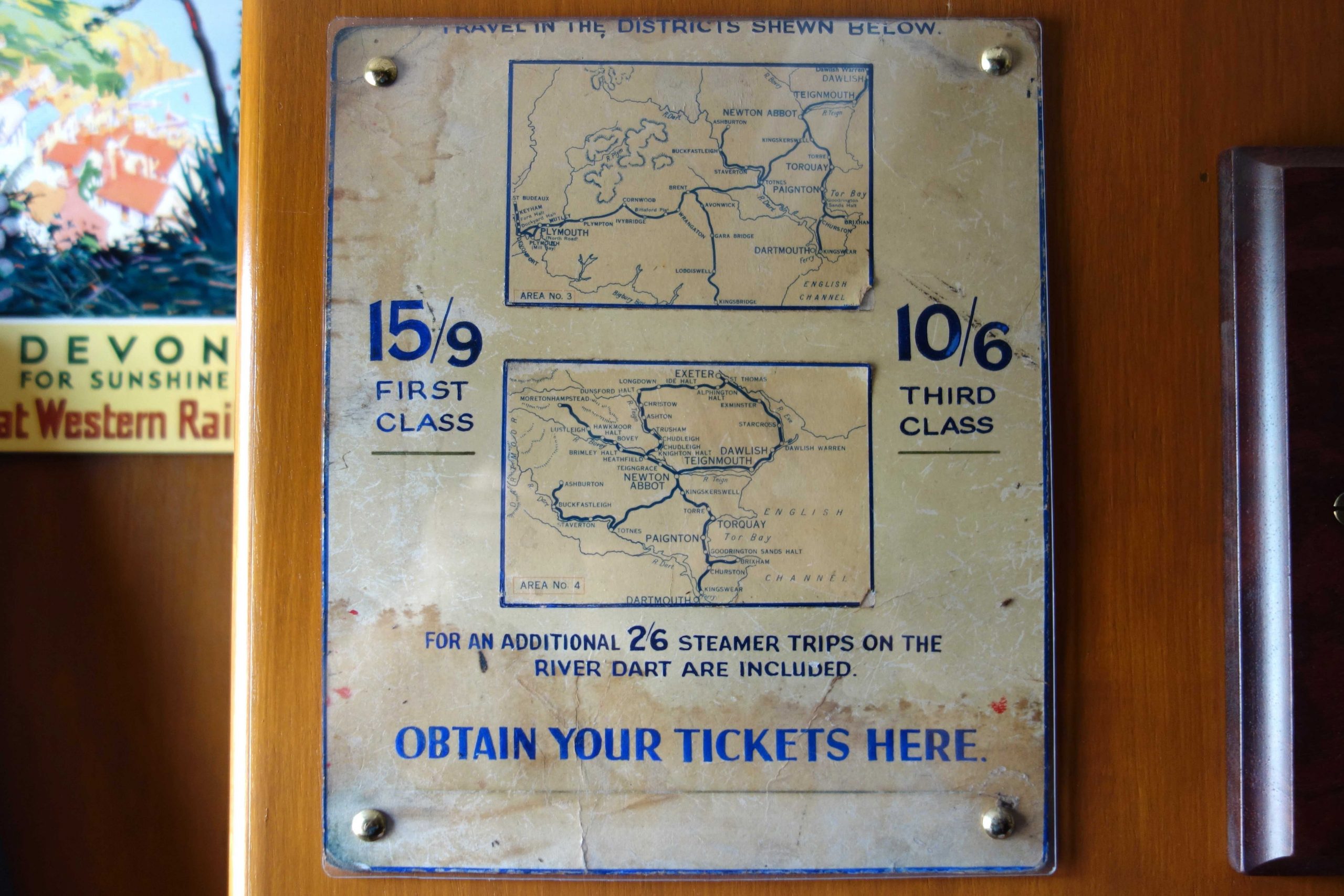
Was the Teign Valley excluded in 1957 to help the case for closure? +
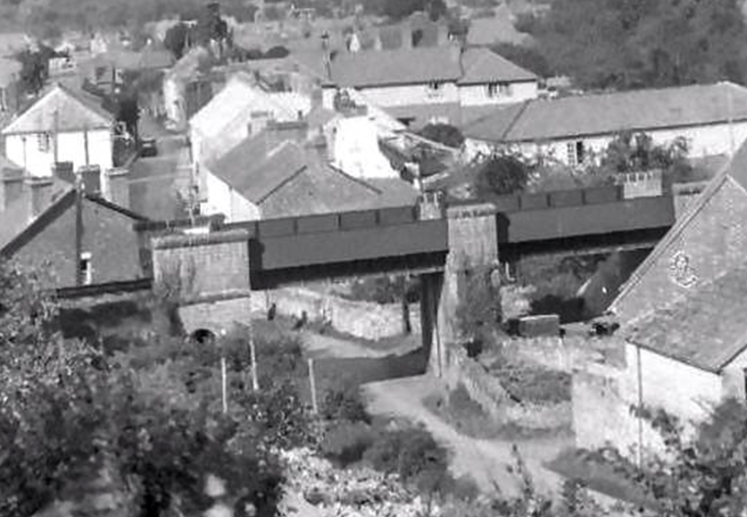
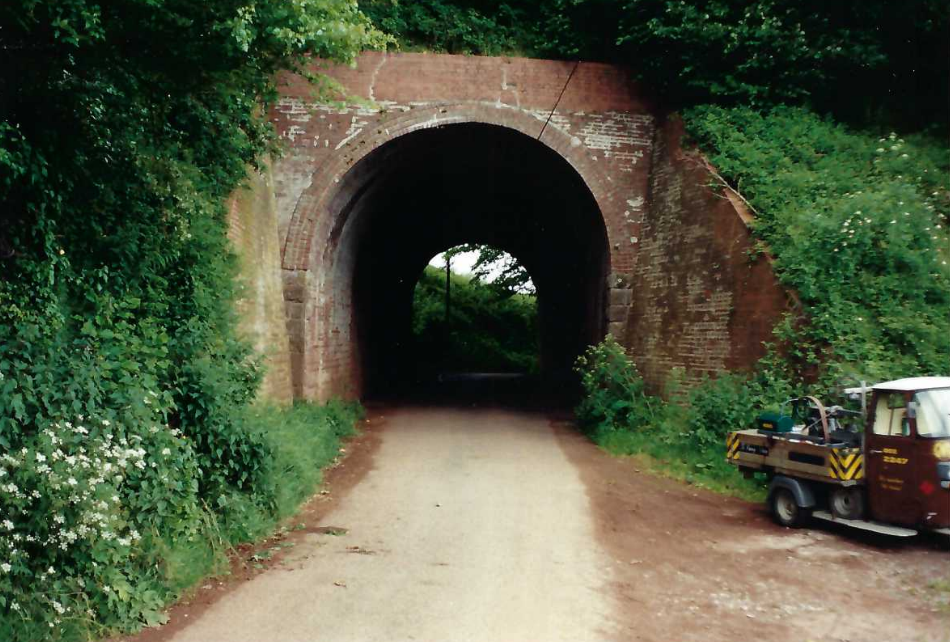
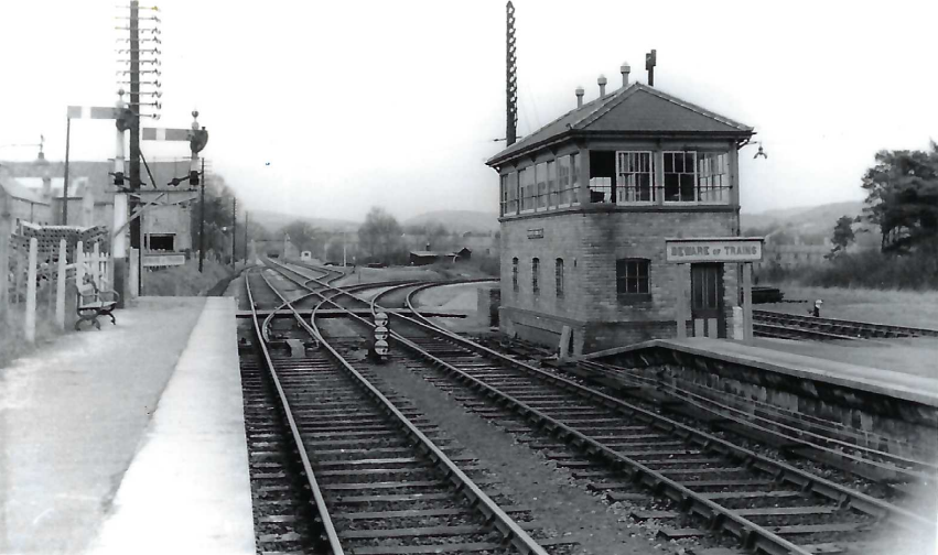
Exeter Railway Junction
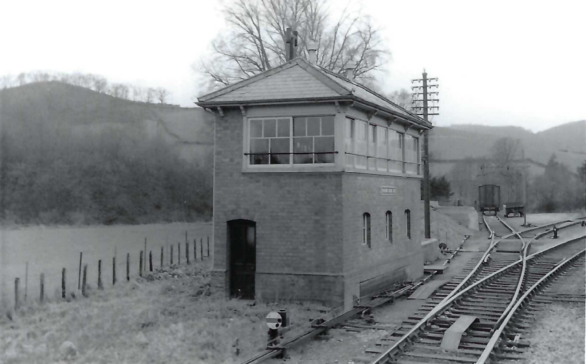
This junction was always known as City Basin by traffic staff because City Basin Junction was there first and both junctions were controlled from Exeter City Basin Signal Box.
Copyright: Roger Joanes. Shared under Creative Commons. +
The several junctions in more detail.
Exeter Railway Junction: Freight Train Departure.
What has become the train loco is standing on the former Basin Loop Junction, the line from which went beneath the main to join the City Basin Branch. The building occupies part of the former cattle market; its siding and extensive pens followed the wall nearest the train. +


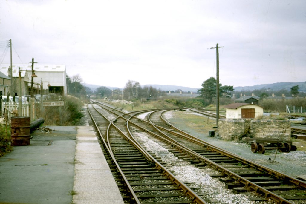
Not far beyond the bridge lie the gates of the scrapyard, beyond which the branch becomes a private siding.


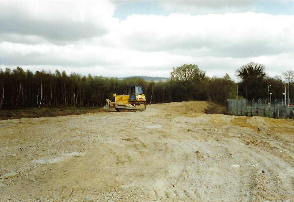
In 1998, a Sainsbury’s superstore was built on what had been Government Buildings. The developer was obliged to build the first part of the Grace Road Link, which caused the branch to be truncated and the embankment to be severed. The new road was never used in this form. Ten years later, the embankment was further reduced to build Marsh Green Road West.


A far from everyday purchase from Sainsbury’s
The firm had become the owner of the isolated section of railway embankment with its chaired sleepers still in situ. It was 2001, the year of the foot and mouth outbreak, and the only reason the sleepers had not been snapped up by the Min of Ag for its pyres was the fact that they were inaccessible to machinery; so the Teign Valley person was told when he found himself behind the scenes at the new store, dealing with a maverick Cornish manager who clearly didn’t like Devonians. “Contractors are paying £25 each for them so you’re going to have to do better than a pound,” he had said in the course of protracted bargaining. The T.V.R. did better the figure, but not by much, and the transaction was rung up on the till at the checkout; without the 180 sleepers having to be wheeled through.
This manager may have allowed access on the occasion of the walk organized to commemorate the centenary of the opening of the railway, but he had gone by 2003 and his dim successor refused. Sainsbury’s and E. Pearse & Co. were the only track owners who would not allow entry.
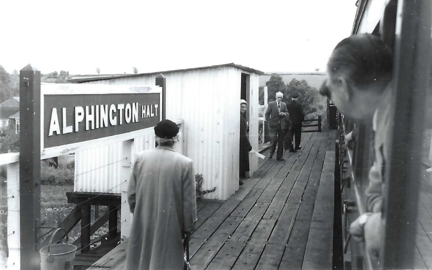
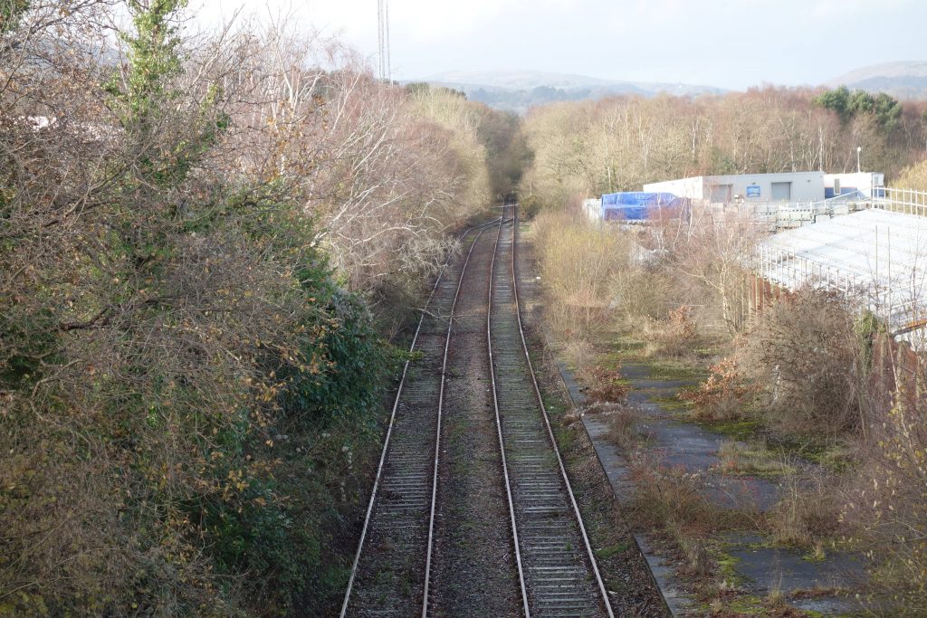
Alphington Halt
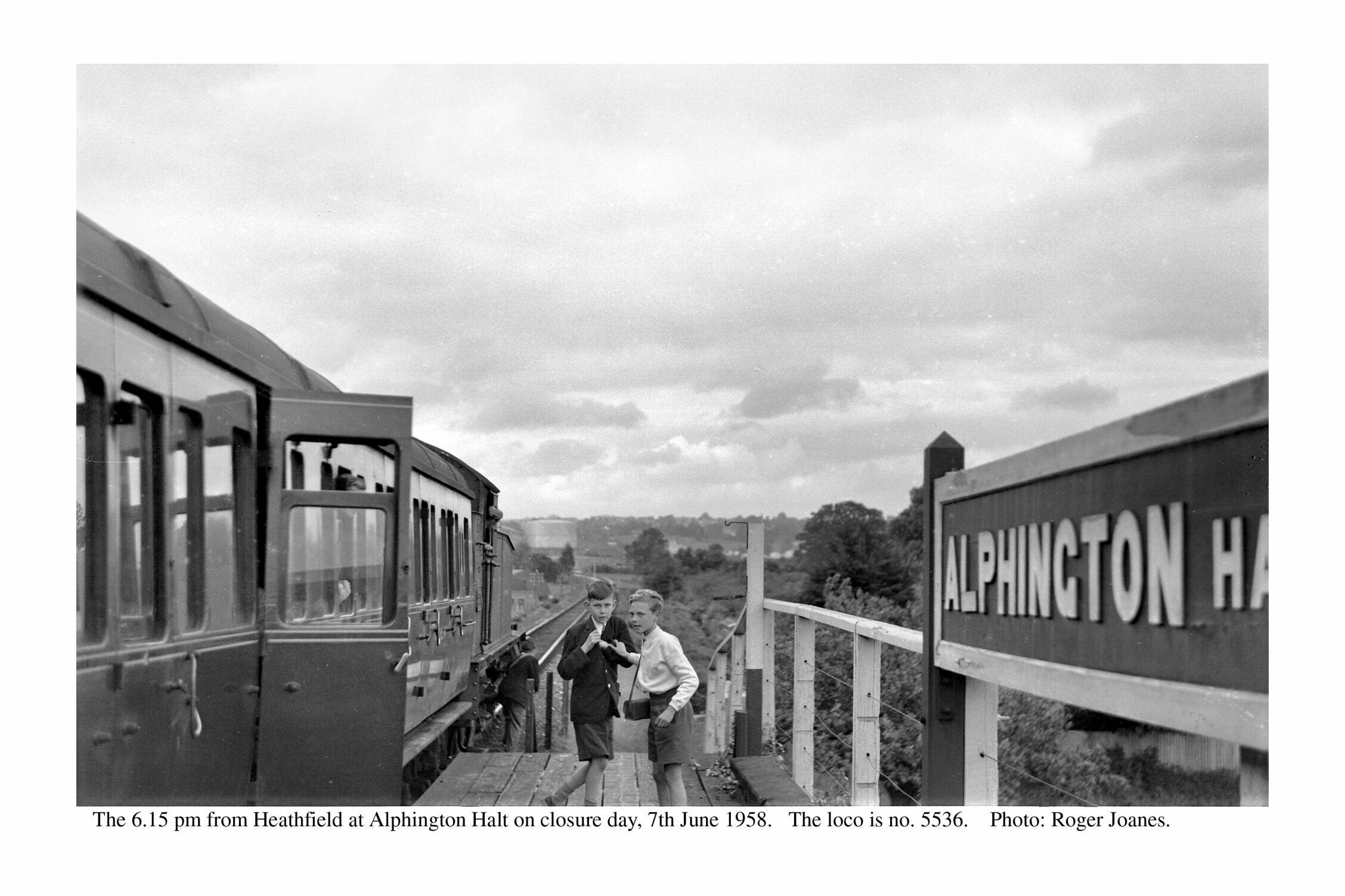
Shared under Creative Commons.


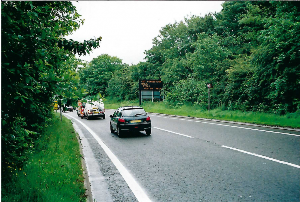
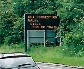
Erected on what is left of the railway embankment, between the former Alphington Halt and Ide Lane, an illuminated sign used sometimes to exhort motorists to cut congestion by walking, cycling or using the bus or train.
At the time, both railways that people coming into Exeter from this direction might have used were closed long ago. The former Southern main line reopened in 2021 as far as Okehampton but the sign has not been seen displaying advice to motorists about the new train service.
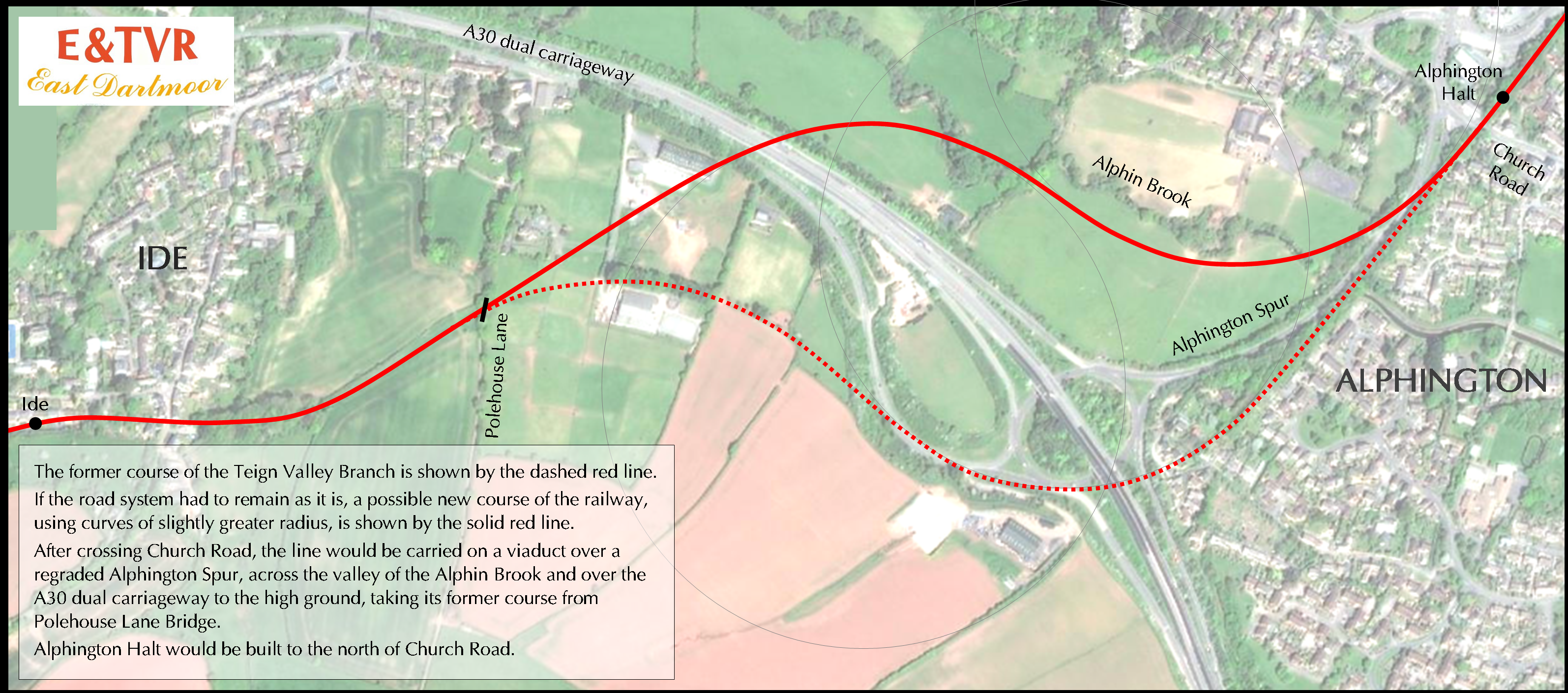
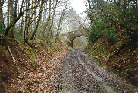
Less than 20 years after government paid for improvements to the line, Royal Marines were called in to blow the bridges. This is the second accommodation bridge between Ide Lane and Polehouse.
In 1986, enquiries were made about blowing up one of Scatter Rock’s concrete hoppers at Christow. The Royal Engineers said that they had no explosives and the Royal Marines said that the structure was too close to properties.


This demolition was also recorded on a short film.
11th February, 2022: The scout passes the turning into Polehouse Lane almost every week. It occurred to him that he couldn’t remember ever having gone left at the far end and taken the road down to Alphington.
When leading the commemorative walk from the junction to Christow in 2003, the scout had gone ahead with the intention of sending the bulk of the forty and more participants directly to Ide; about half a dozen that he had judged young or fit enough, he would take along the more challenging route via Polehouse Lane Bridge.
He remembers being horrified that a great many of the forty judged themselves to be young or fit, including several men who were grossly overweight.


After taking these shots, the scout continued up the hill and turned left into Markham Lane. He quickly came upon someone on the road with a tripod, which he thought at first was a surveying instrument. When he realized that it was a fellow filming, he drew up quietly and waited. It turned out to be John Ayres, the well known B.B.C. Spotlight reporter. The scout, despite having been watching the chap’s 2014 coverage of the Dawlish Débâcle only a few days before, could not think of his name and so “you’re on the television” had to do.
He was filming (two seconds in the broadcast) for a piece on the proposed housing development nearby, which he discussed with the scout along with numerous other subjects, most notably the sea wall. The story he told the scout will be repeated on the railway’s web pages.
How fortuitous it was that the scout’s decision to photograph an old bridge that day led to him having twenty minutes alone with the reporter who was first on the scene at Dawlish.
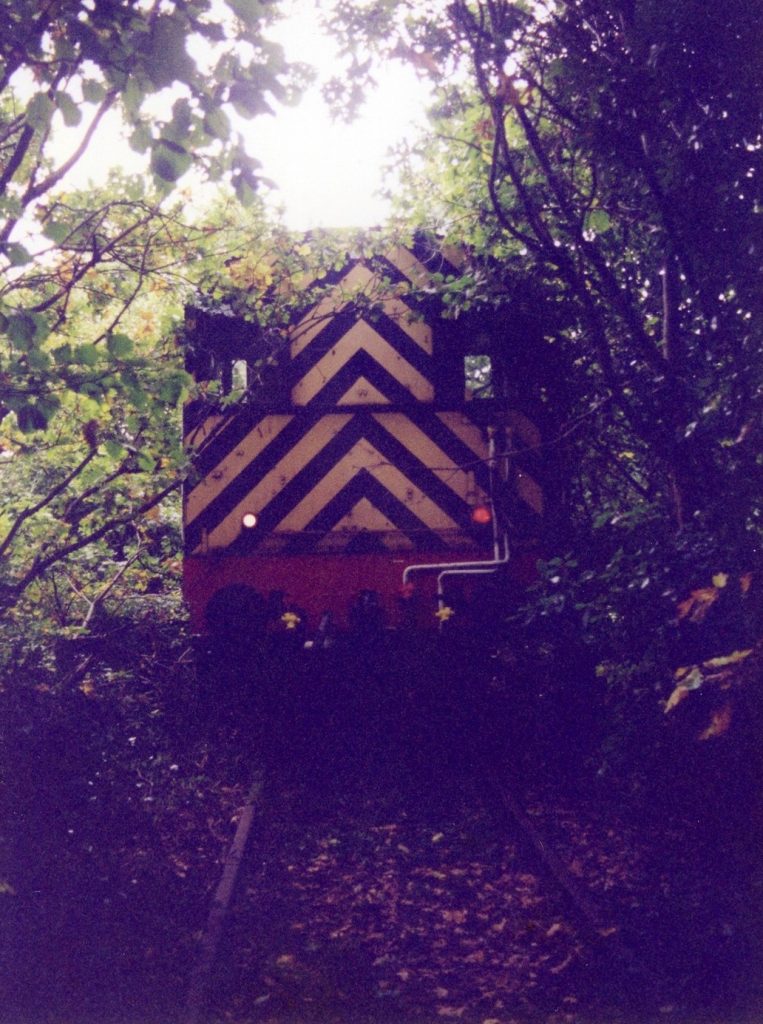
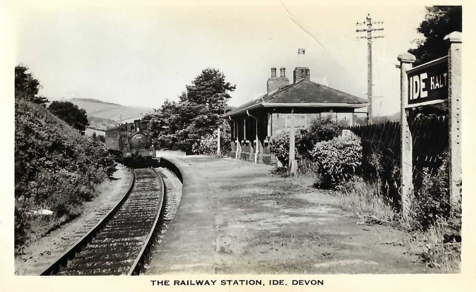
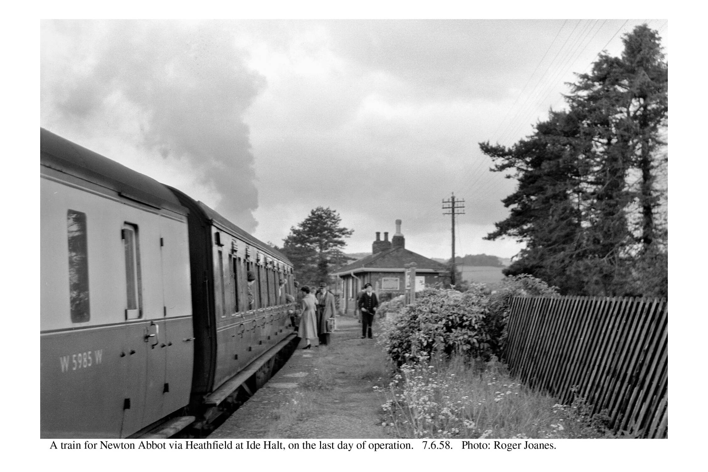
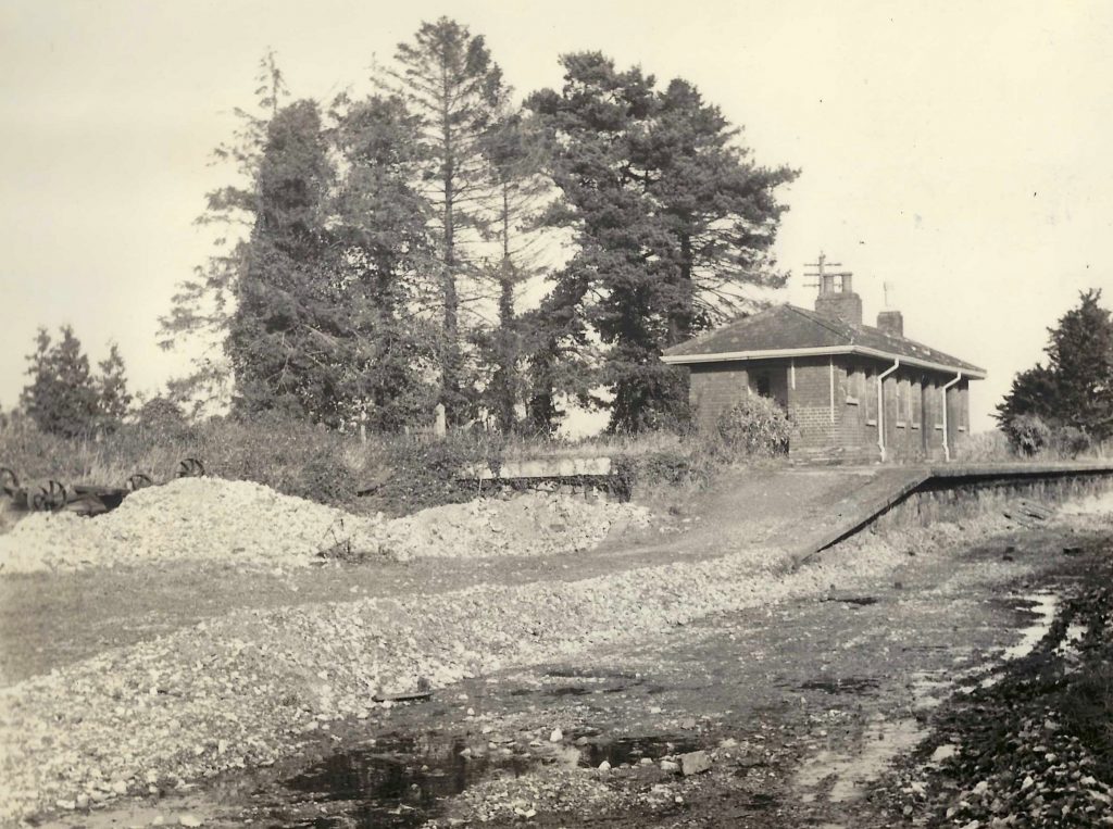
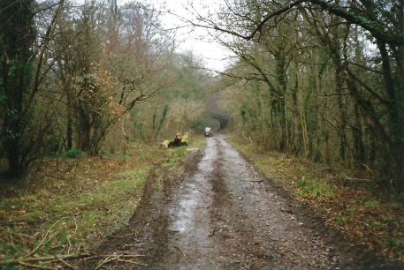
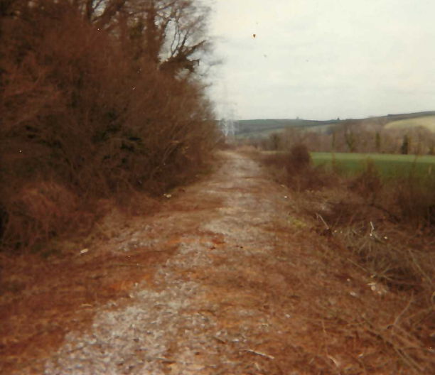
Ide Halt
From 1935, a camping coach had been berthed in the short chute siding.
Next to the pile of sleepers is the motor trolley “run-off” at 2 miles 8 chains.
The white post marks the change in gradient from the short relaxation through the station at 1:204 to 1:58 for the two and a half miles to the top of the incline at Longdown.
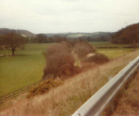
For many years, this was the only dwelling built on the entire course of the railway. There are now another in Ide and one, or two, in Alphington.
Looking towards Exeter, one boundary of the filled in “Devon Cutting” can be seen in the field at centre right.
A public footpath and farm track went beneath the span at right.
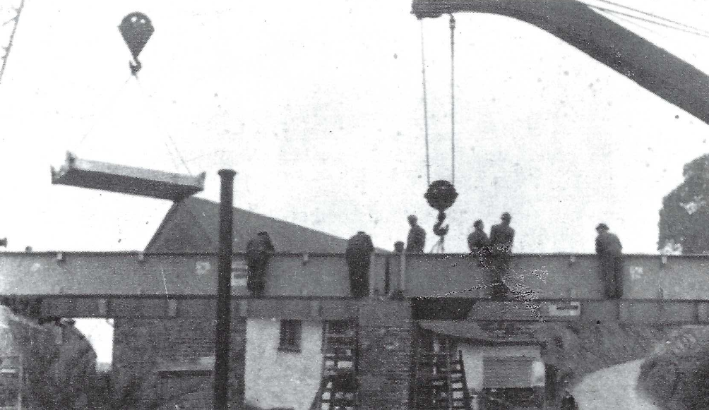
Commenting that the men have no harnesses or protective clothing is not criticism of modern health and safety requirements, which have much reduced the hazards of this sort of work. But knowing that the men and materials would have come by rail and seeing the lifting being done by rail-mounted cranes, does call into question today’s methods, which rely heavily on road vehicles and plant.
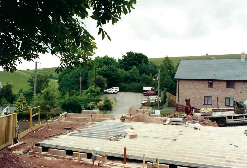
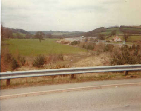
The new Ide Community Orchard overlooks the railway and fine views of the station site and village can now be enjoyed. Sadly, the quiet there would have been here once is drowned by the constant drone coming from the A30 dual carriageway.


In May, 2024, the course of the line above the valley of the Alphin Brook, around Ide, was viewed from Hambeer Lane.
In March, 2025, the scout went to see the work done by National Highways at Halscombe Lane.
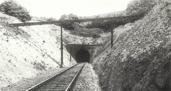
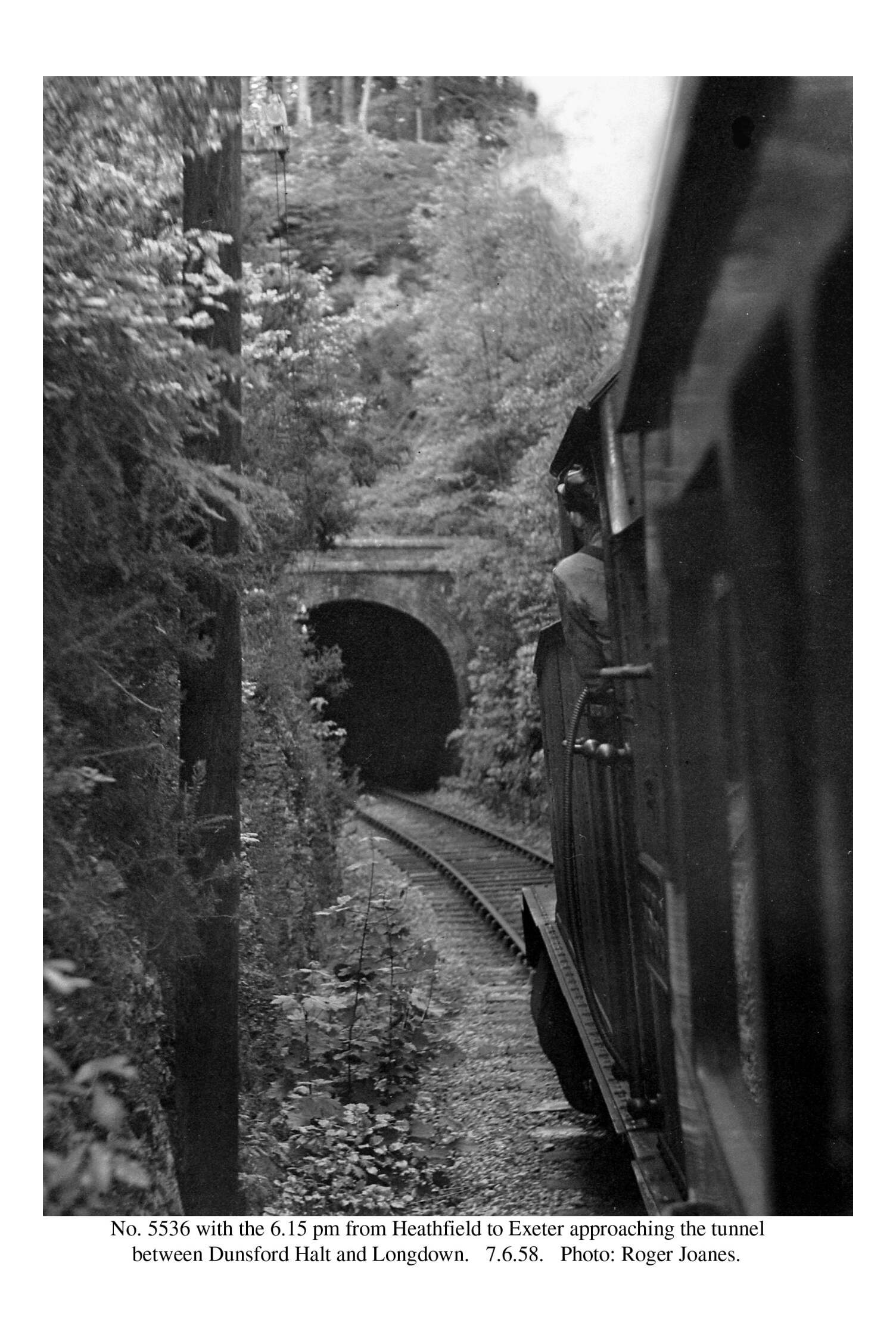
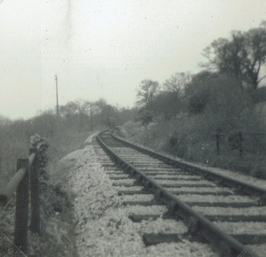
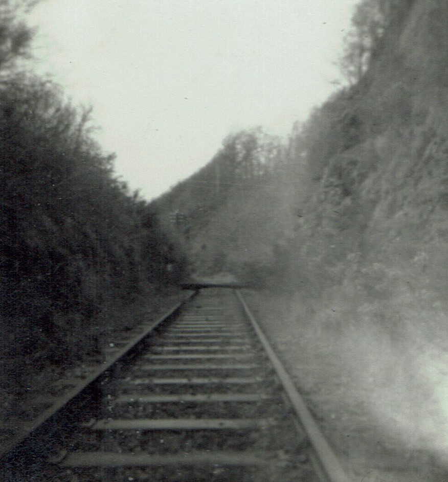
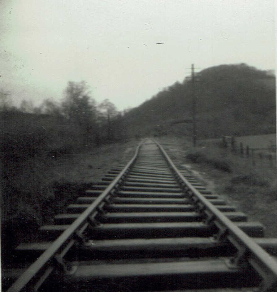
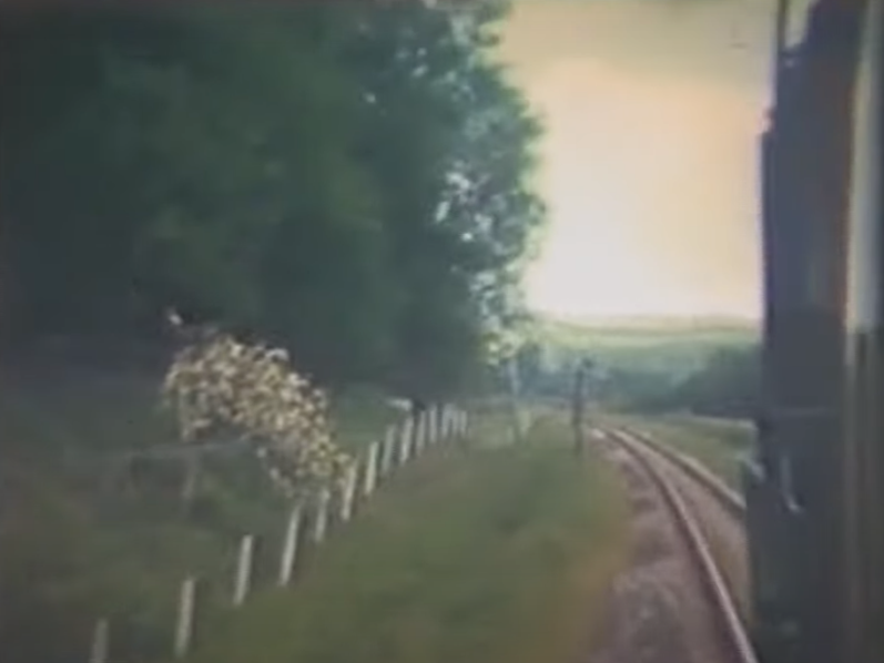
It is hard to place this exactly. Judging from the telegraph post being on an embankment, the train could be passing Rainbow Brake, or be above Fordland Farm, or be passing through Pond Field Covert, all within Perridge Estate. The camera is facing in the Exeter direction and in a few minutes the train will enter Perridge Tunnel.
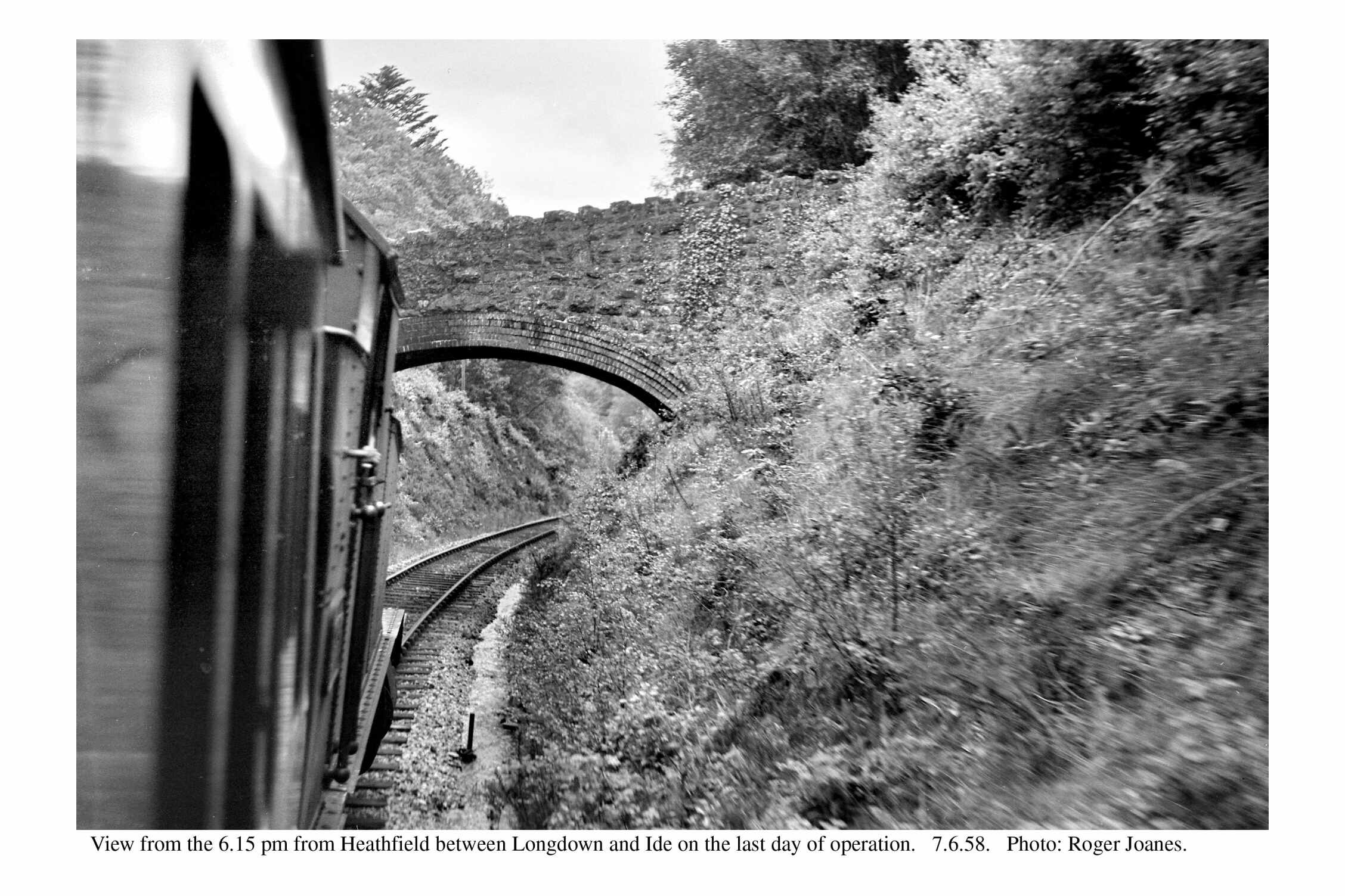
Copyright: Roger Joanes. Shared under Creative Commons. +
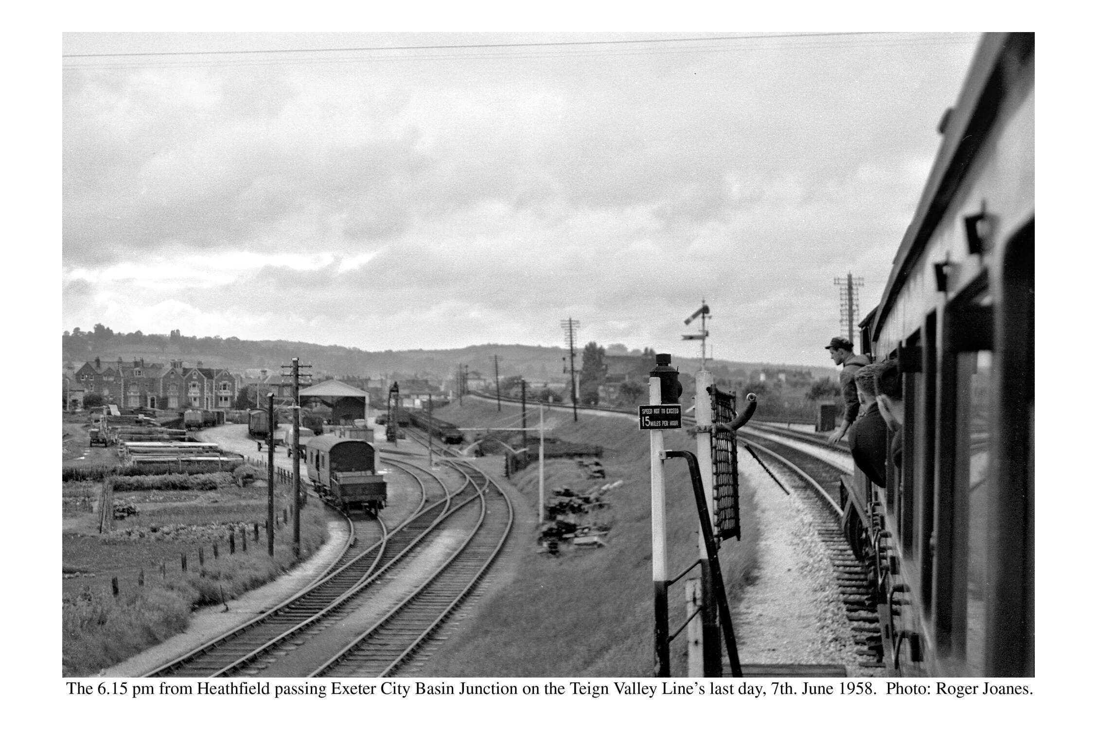
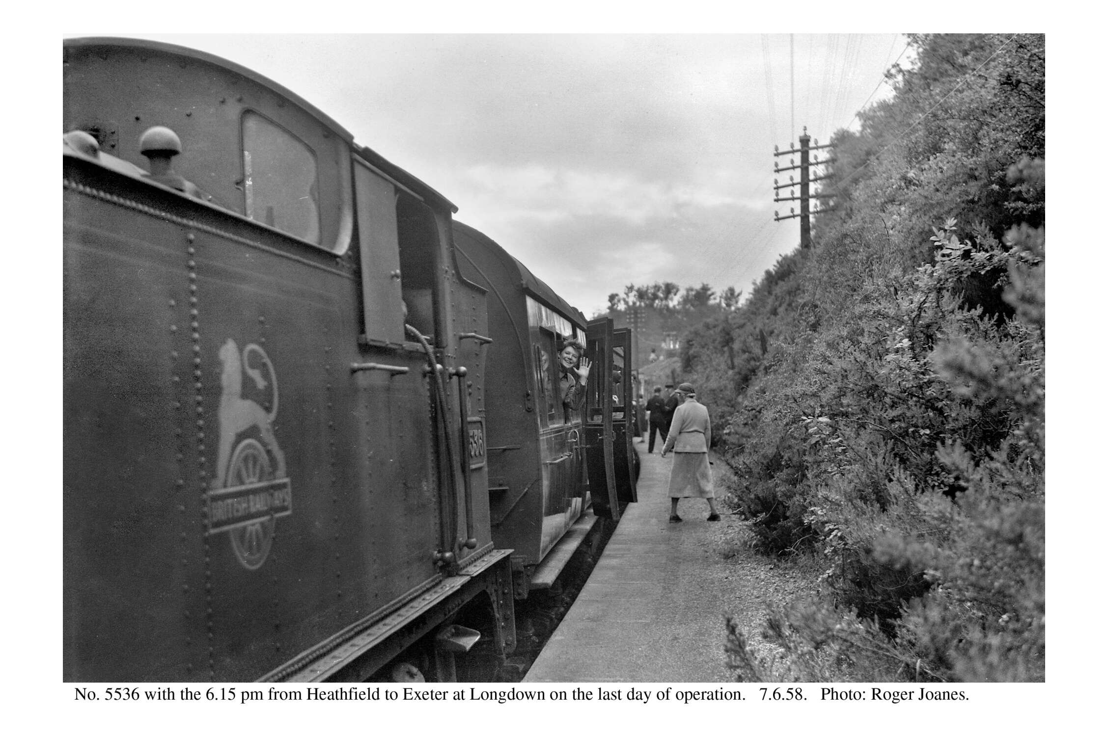
The passenger service was withdrawn on and from Monday, 9th June, 1958. As there was no service on Sundays, the last train ran on Saturday, 7th June.
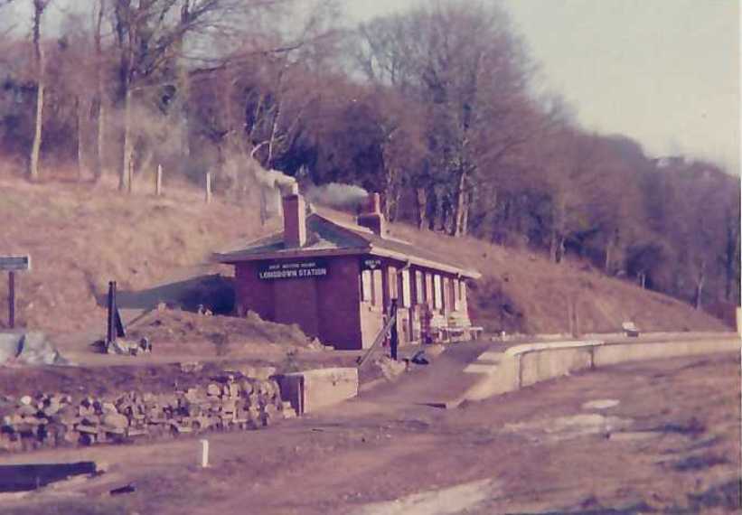
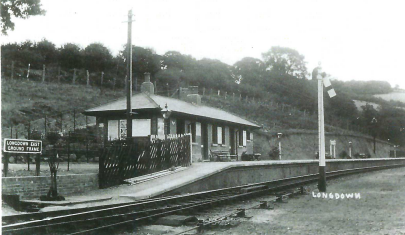
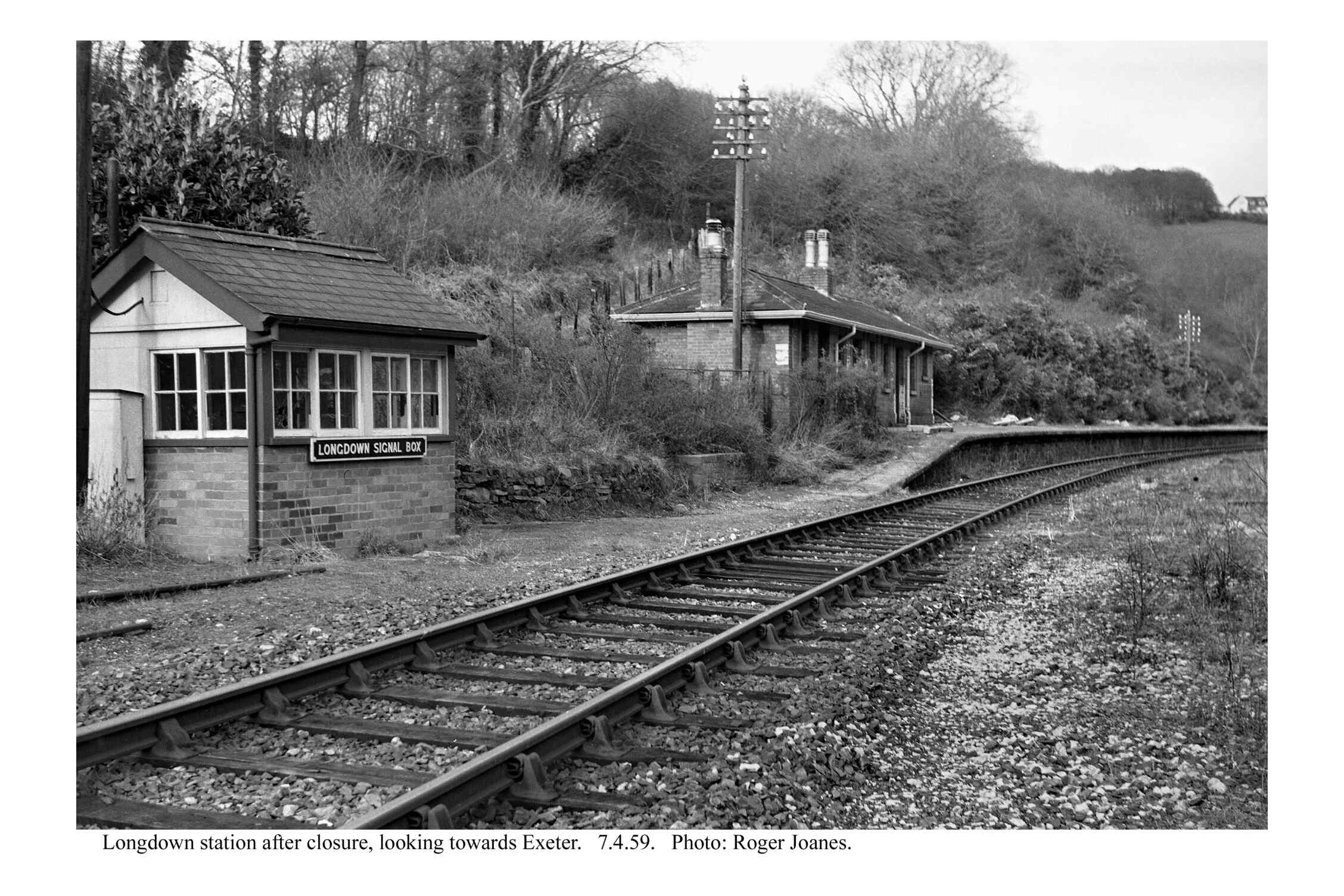
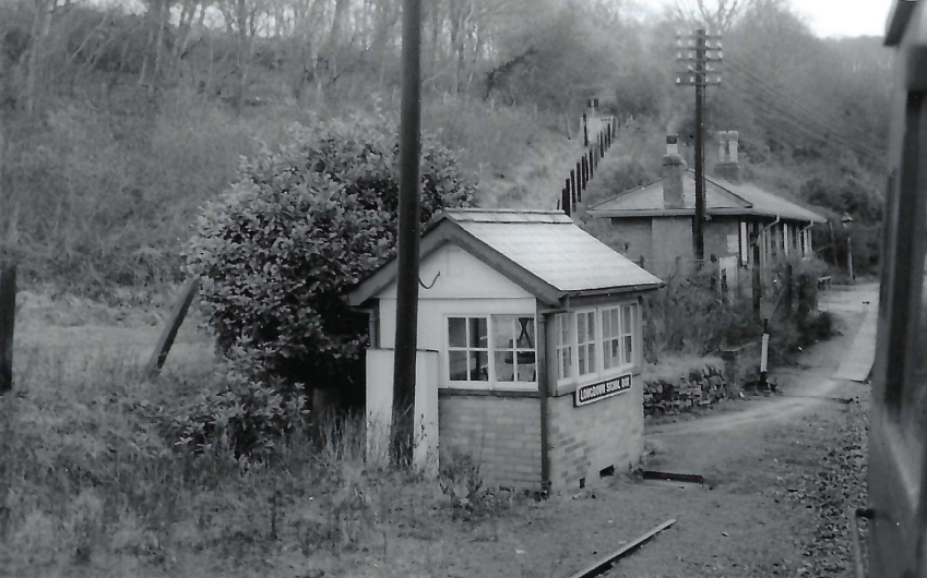
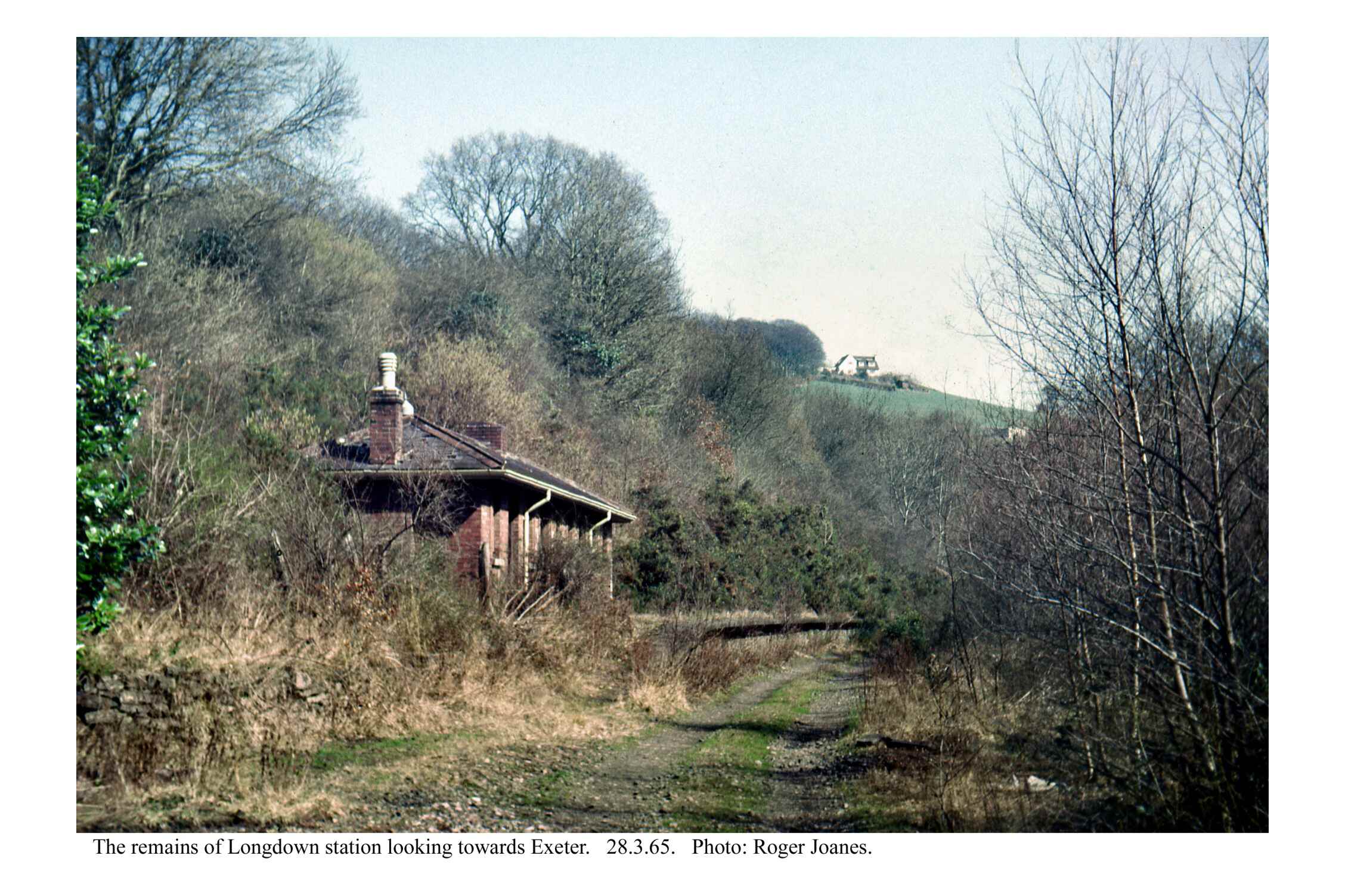
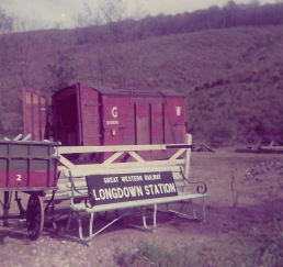
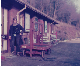
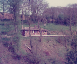
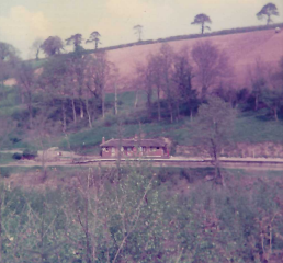
Longdown
The project which continues today at Christow was started at Longdown in 1975 with the intention of rebuilding the one and a quarter miles of line to Dunsford Halt. This was then all part of the Culver Estate, whose owners wanted to open a woodland park, not a commonplace at the time.
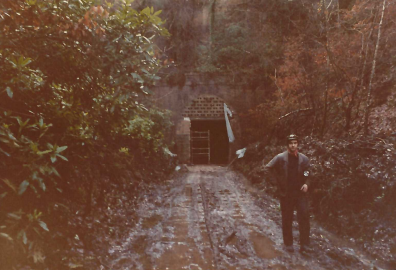
Bought back for a peppercorn after closure, along with Culver Tunnel, the station was heavily damaged by ruffians from Ide.
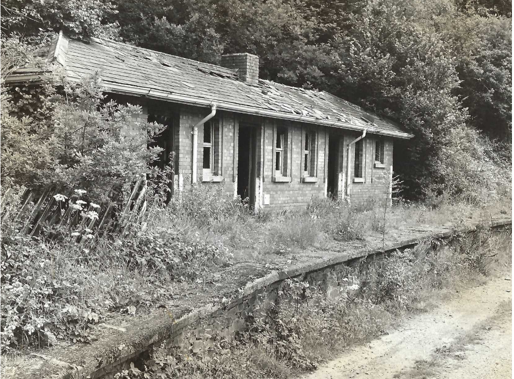
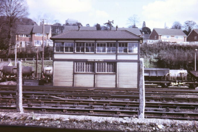
The slates and ridge tiles used to repair the roof came from Exeter East Signal Box, closed in 1973.
July, 2022: It was agreed that Longdown’s running-in board could return to the station on the occasion of a guided walk along the line and so the scout went along beforehand to measure the posts which he had put up in 1977.


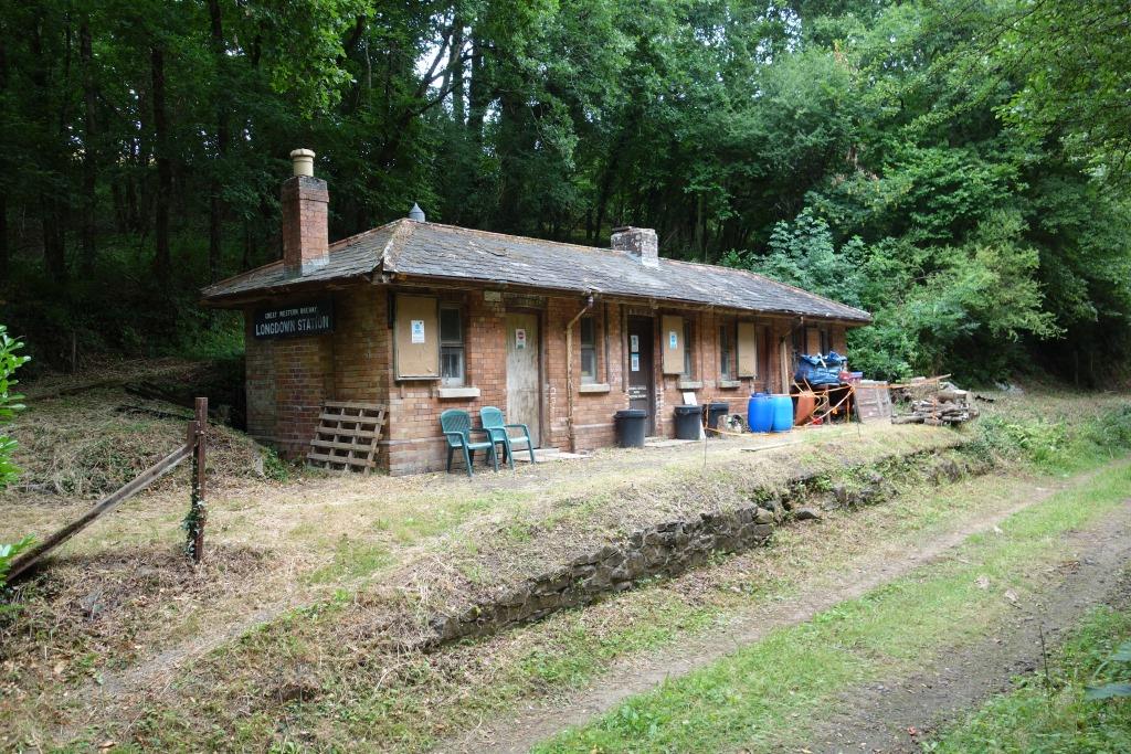
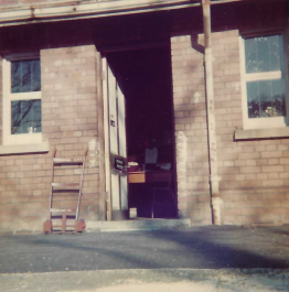
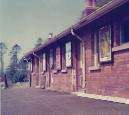
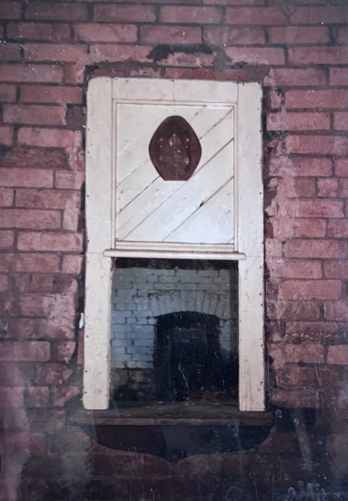
All three of the Exeter Railway’s buildings were near identical, except that Longdown’s arrangement was a reversal of the other two. Originally, there were two rooms reached from the nearest door, but when the station became a block post in 1916, the dividing wall was taken down to help accommodate the large token instruments. In the photo below, the chimney is seen marking the dividing wall, whereas here it has been moved to the end wall.
Christow’s two rooms were made into one when an extension provided a spacious Station Master’s Office. Ide’s building remained the same.
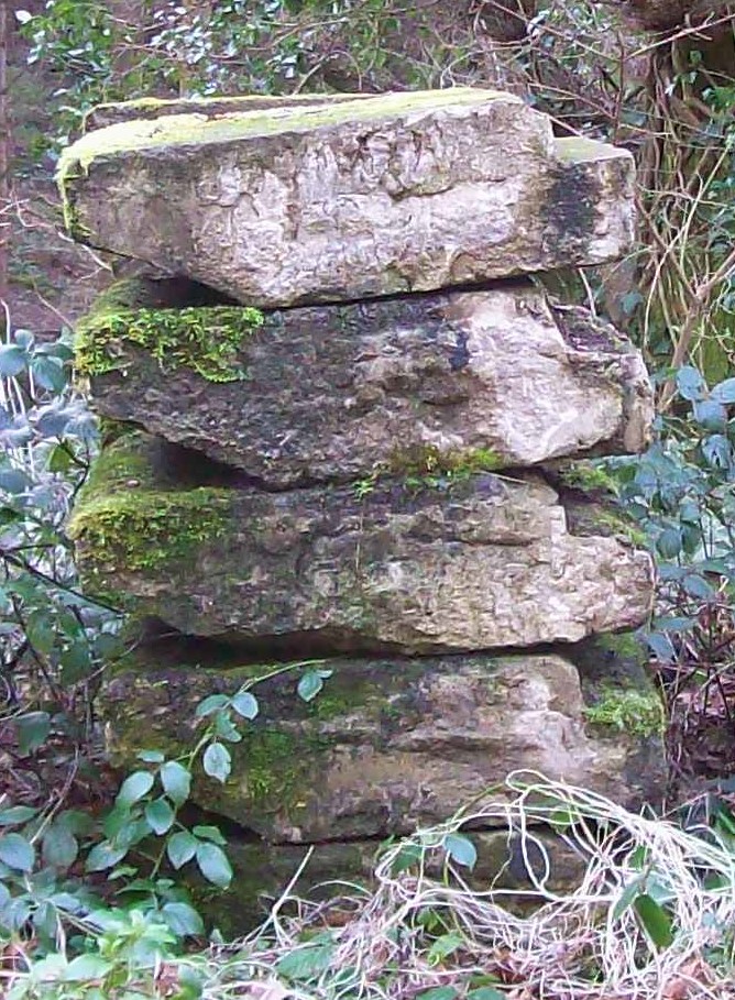
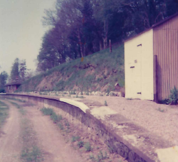
The mortar soon perished in all the Exeter’s platform walls and the very heavy, concrete-cast edgings began to lean. Remedial work was done at Ide and Christow. At Longdown, the lean became so bad that the only safe course was to take the edgings down, which the estate did in 2013, neatly stacking them nearby.
The path to the village rises behind the building. It is less than a mile from here to the war memorial.
A collection of photographs taken in 2009 and 2013.
The building is unaltered in this photograph.
The turnout led to a short loop siding.
Much of the formation upon which the 1943 goods loop was installed had already been made, possibly from surplus construction material.
Common Piece Plantation, the wood seen on the hill at right, is on the edge of the village.

The last of the Air Raid Precautions
At the outbreak of war in 1939, a blackout was imposed. To make moving around in the dark easier and safer, corners of buildings, doorways, steps, posts etc., were whitewashed. The whitewash remains on the doorways seen above and on the far corner.
Some station platform edges had been whitened before but the practice became widespread during the war and it continues to this day.
Strangely, a residue of whitewash is seen on the S.M’s. doorway in the 1978 photo at right.
It would be impossible, or in some cases very hard, to take these 1977/78 photographs today.


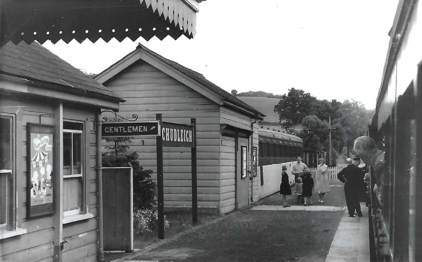
“ALL STATIONS TO HEATHFIELD,” which had “ALL STATIONS TO EXETER (ST. DAVID’S) on the reverse, seen propped behind the downpipe, had been “KING’S CROSS TO EDINBURGH” in white on blue. The scout found it on No. 1 platform at St. David’s. No one could explain how it had got there. Mark I carriages had brackets above the cant rail for destination boards.
It can be seen be seen lying on the ground in one of the gallery images above.


Photographs of the Perridge Tunnel “last shot” ceremony and the opening day train in the Eden family album.
Copyright: Roger Joanes. Shared under Creative Commons. +


Courtesy of Mark Chambers.
Proof that the Teign Valley is set to reopen.
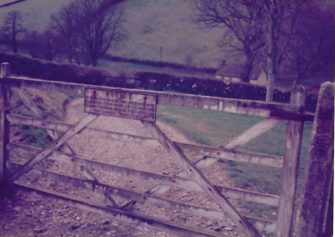
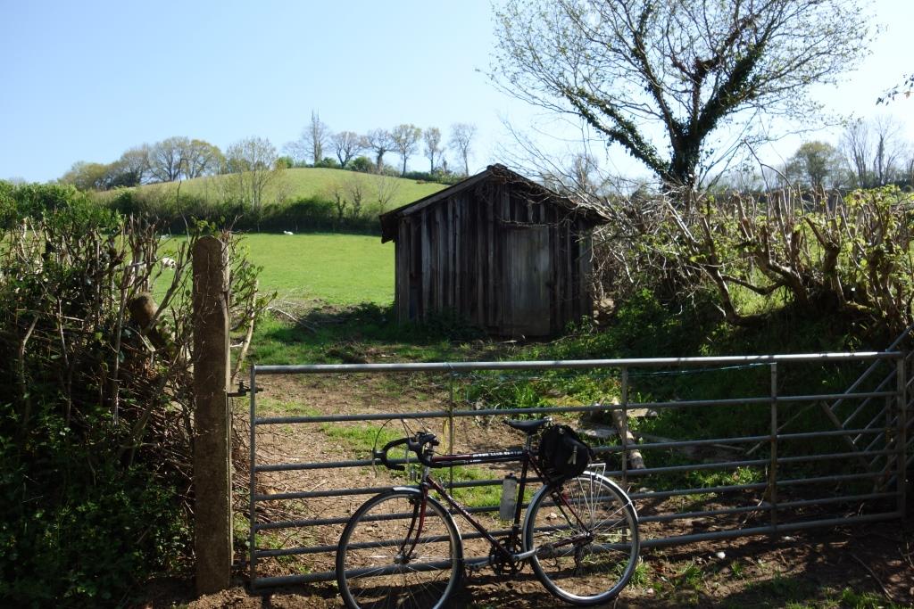
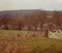
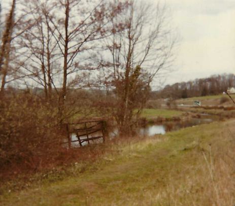
Over the opposite gate, the Guard of a train might once have chucked a rolled up evening paper for the farmer—or the morning paper after it had been read.
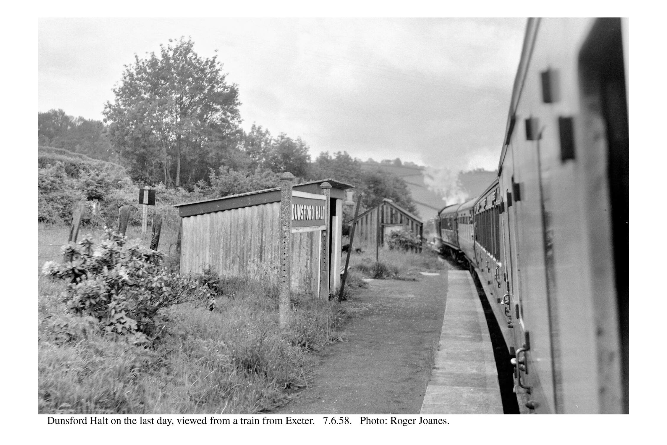
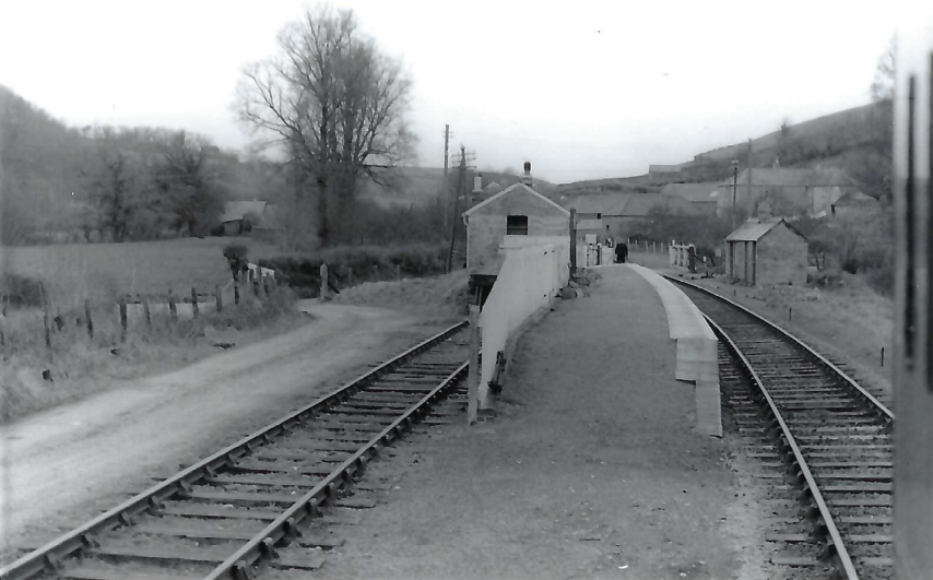
Dunsford Halt


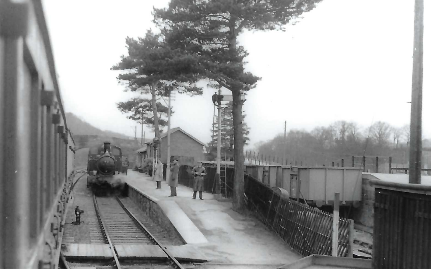
Christow
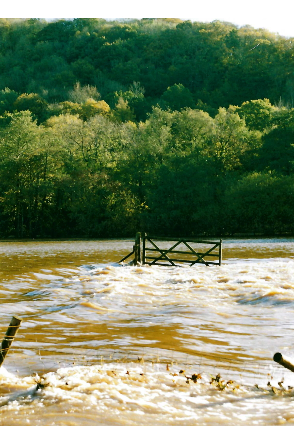
It must have been on another occasion that Richard visited Christow. At a guess, the photos below were taken at the same time as the one which follows showing the scoured embankment near Ashton River Bridge. This was caused by flooding in October, 1960.
If this is the case, then Christow had been cut off in both directions.
The milepost can be seen at left, ahead of where a sleeper has been placed across the rails.
The line here is rising at 1:75 before steepening to 1:64 for most of the climb to Longdown.
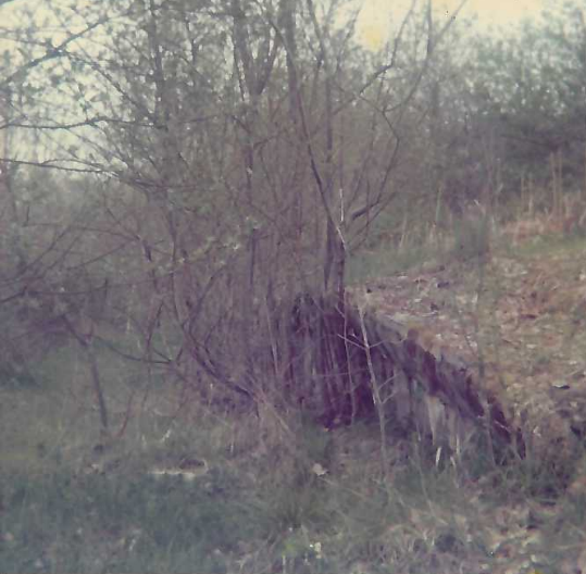
The bridge rail milepost is still there; one of its faces was mocked up for this photograph.
Access courtesy of Mr. & Mrs. Angeloni.
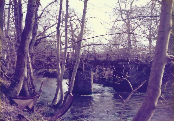
The bridge had eight spans, with two across the river. It was redundant by 1930. Not long after this photo was taken in 1979, the midstream pier was removed. The foundation for the river piers was simply sacks of dry concrete mix laid on the shale and compacted.
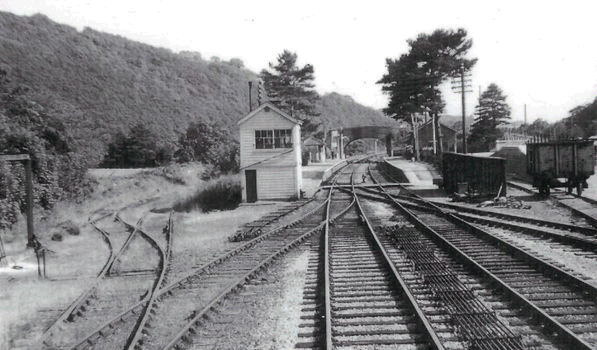
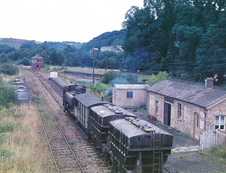
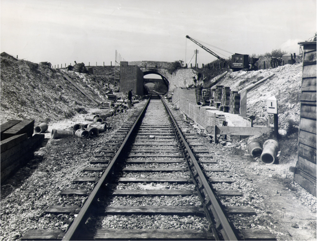
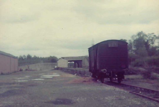
Track Recovery at Christow, 1959.
Demolition of one of Scatter Rock’s stone hoppers in 1988.
The wall at left, the point rodding and the extended Down Main were all new in 1943 but Richard found them derelict 17 years later. Many features, however, have survived.


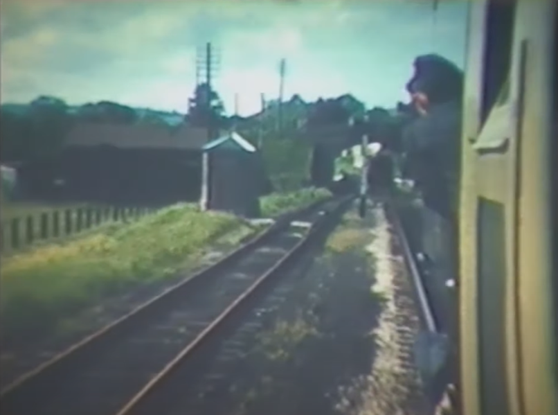
When the track in the foreground below was cleared of scrub, a scaffolding platform was erected so that visitors could experience the “Driver’s Eye View, 1957.”


The Railway’s War Effort at Christow.
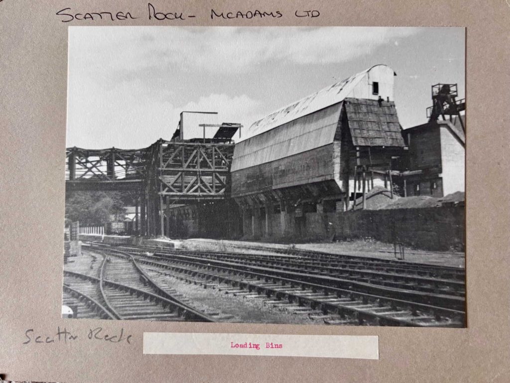
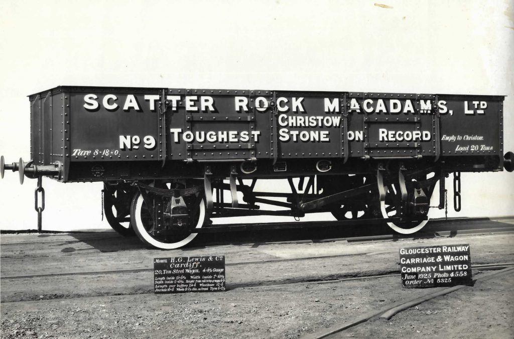
Side tracks from the aerial ropeway extended over the bins, which contained differing sizes of crushed stone. By means of the shoots, most stone was loaded into trucks standing on the “gravitational” private sidings. But apertures beneath the bins allowed stone to be dropped onto a conveyor for casting concrete and making tarmacadam on site.
The lower terminus of the ropeway is marked by the wooden bridge protecting the railway.
Scatter Rock quarries closed in 1950.
The bins beyond were demolished in 1989.
Courtesy of Mark Chambers.


Philip Shepherd kindly provided the next two photographs, together with the story from August, 1955:
“According to my father’s photo album notes, as a family we walked from Alphington Halt to Christow, planning to get the train back to St Thomas. After a while we were told that the train was cancelled due to flooding of the line. Here is our Devon General rescue bus! The total passengers picked up seems to be nine plus our family of four out of shot, The guy waving is a family friend urging us to move!”


Copyright: Roger Joanes. Shared under Creative Commons. +
The dock at right had been recently raised to allow mineral wagons to be loaded with barytes for Laporte at Luton.
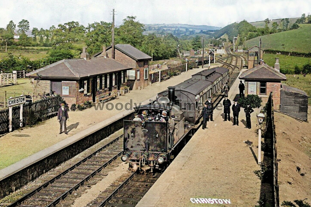
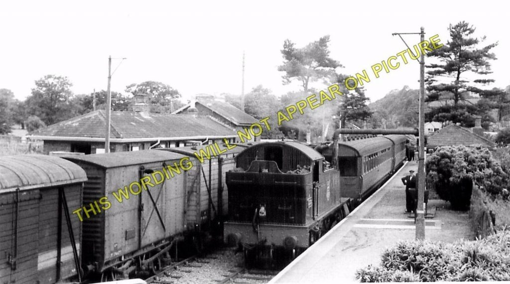
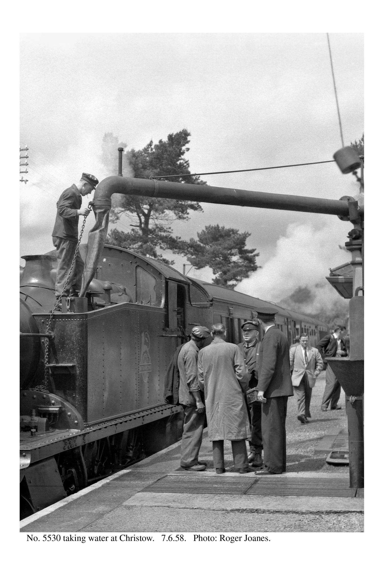
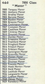
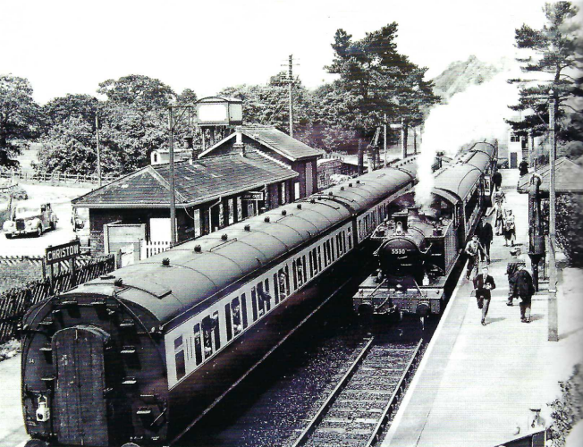
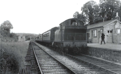
“Cockington Manor” waits in the Up platform at Christow, its tender bearing the lion and wheel of the new British Railways. +
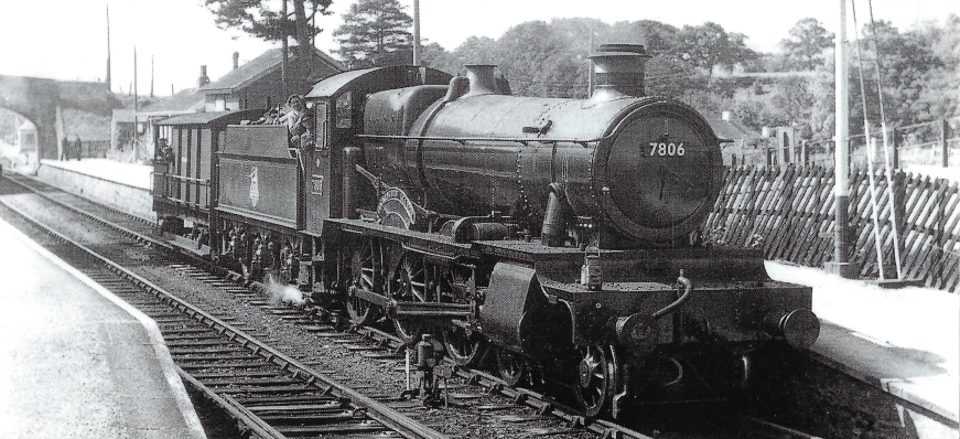
Here is one in steam on the less severe gradients of the Kingswear Branch.


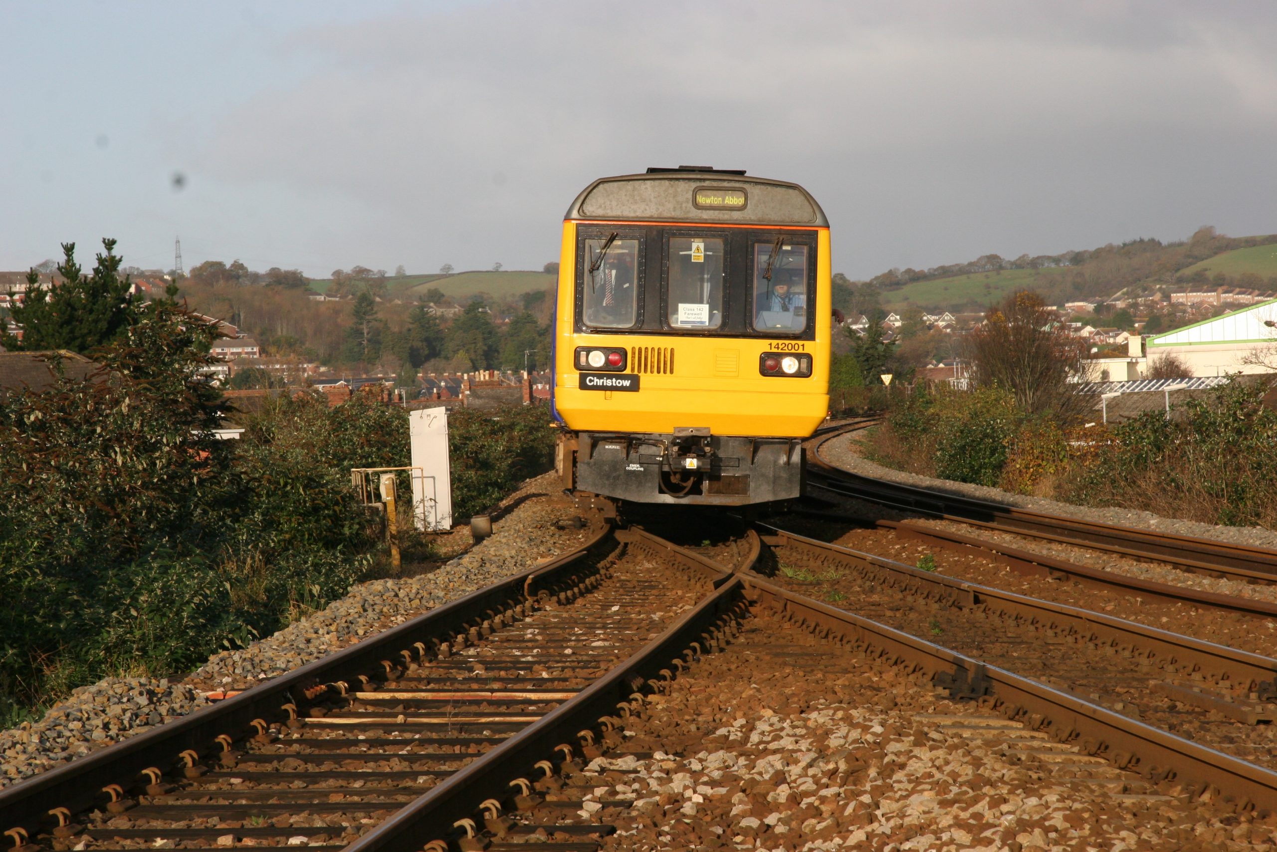
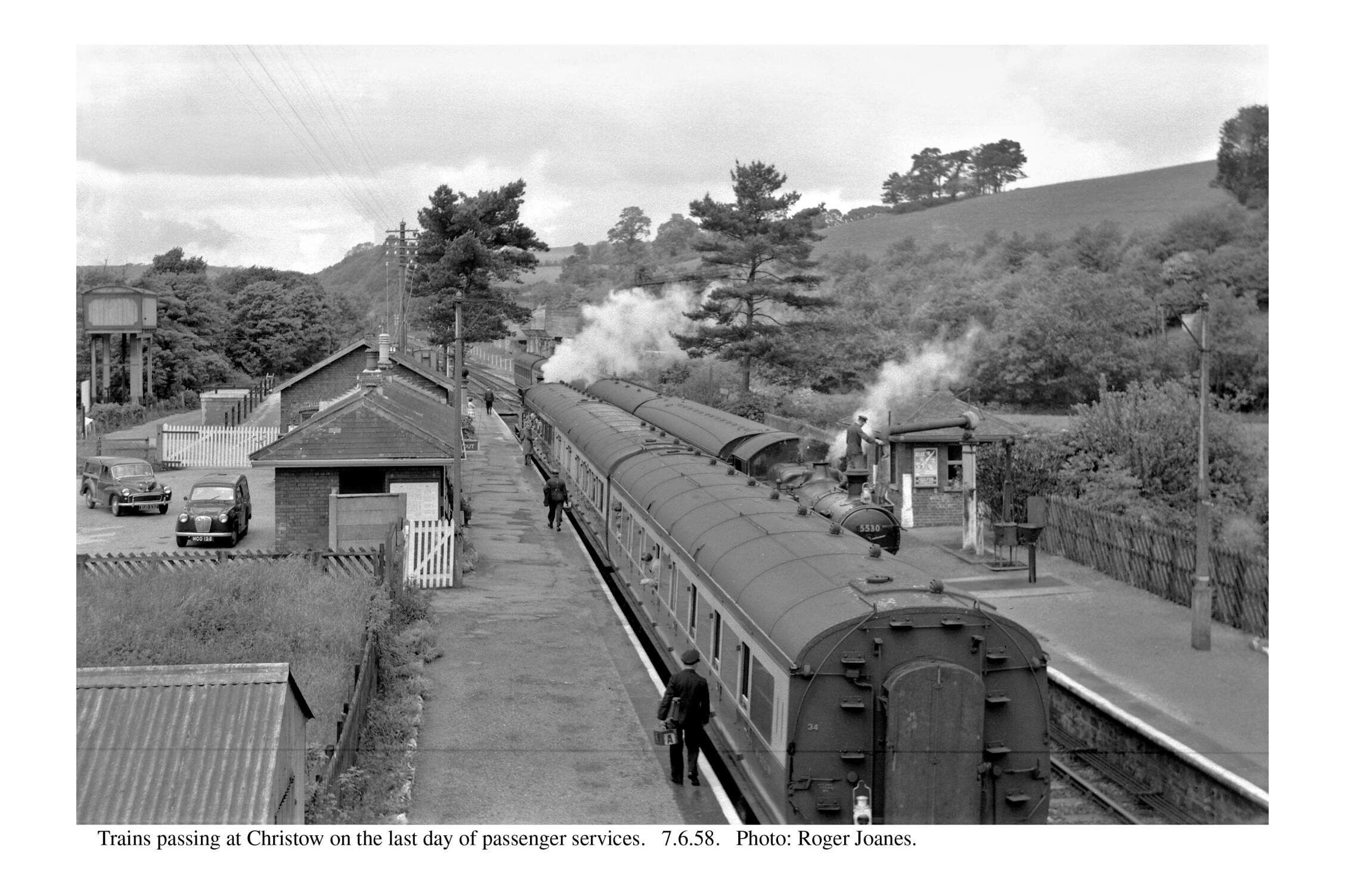
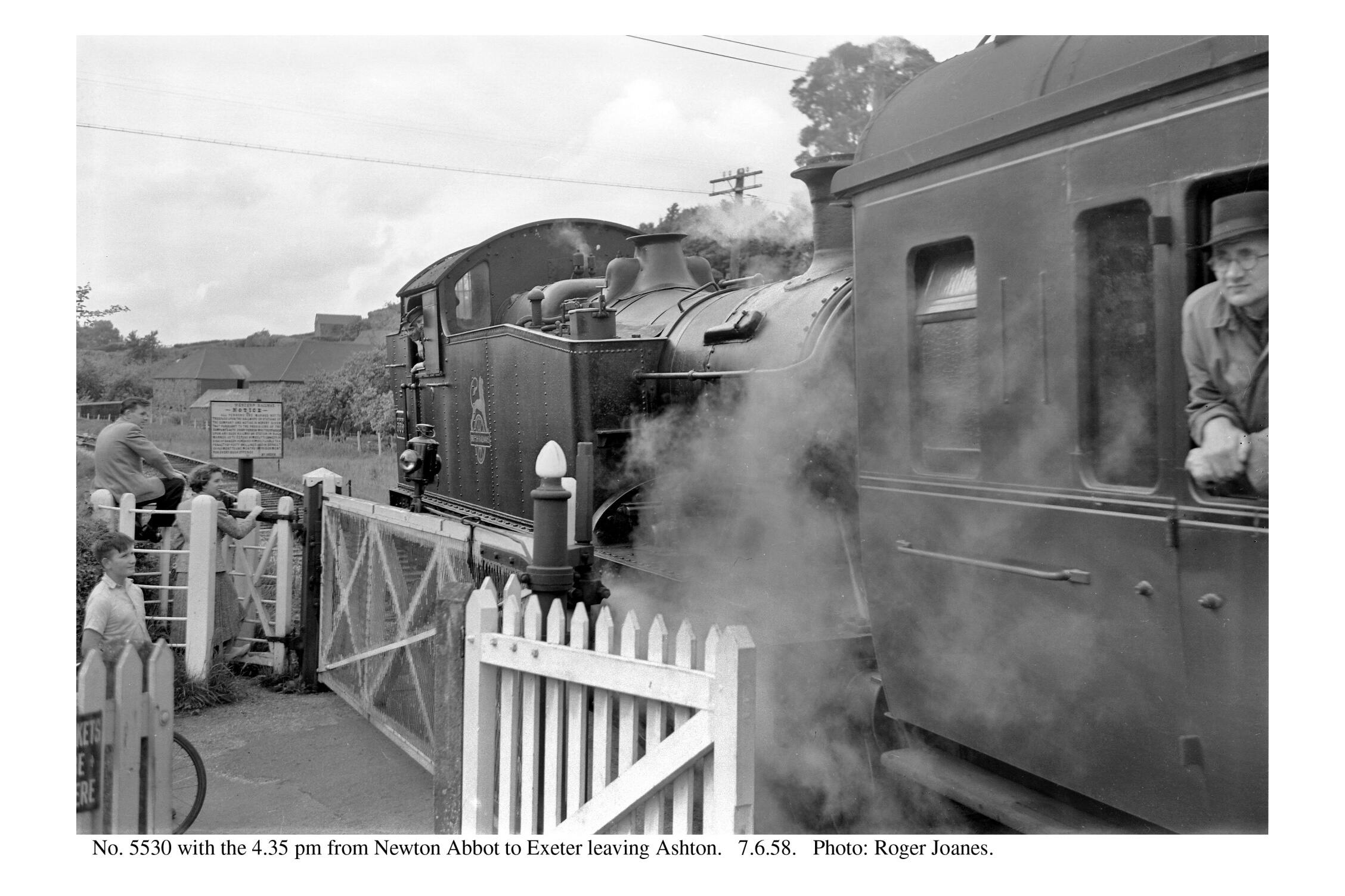
Some people, anxious to say that they had travelled on one of the last trains but not wanting to go all the way to Newton Abbot and back, or vice versa, took advantage of the crossing of trains at Christow. The last opportunity to do this was the 5.58 p.m. Exeter to Newton Abbot (Christow 6.28 – 6.38 p.m.) crossing the
6. 5 p.m. Newton Abbot to Exeter (Christow 6.37 – 6.40 p.m.).
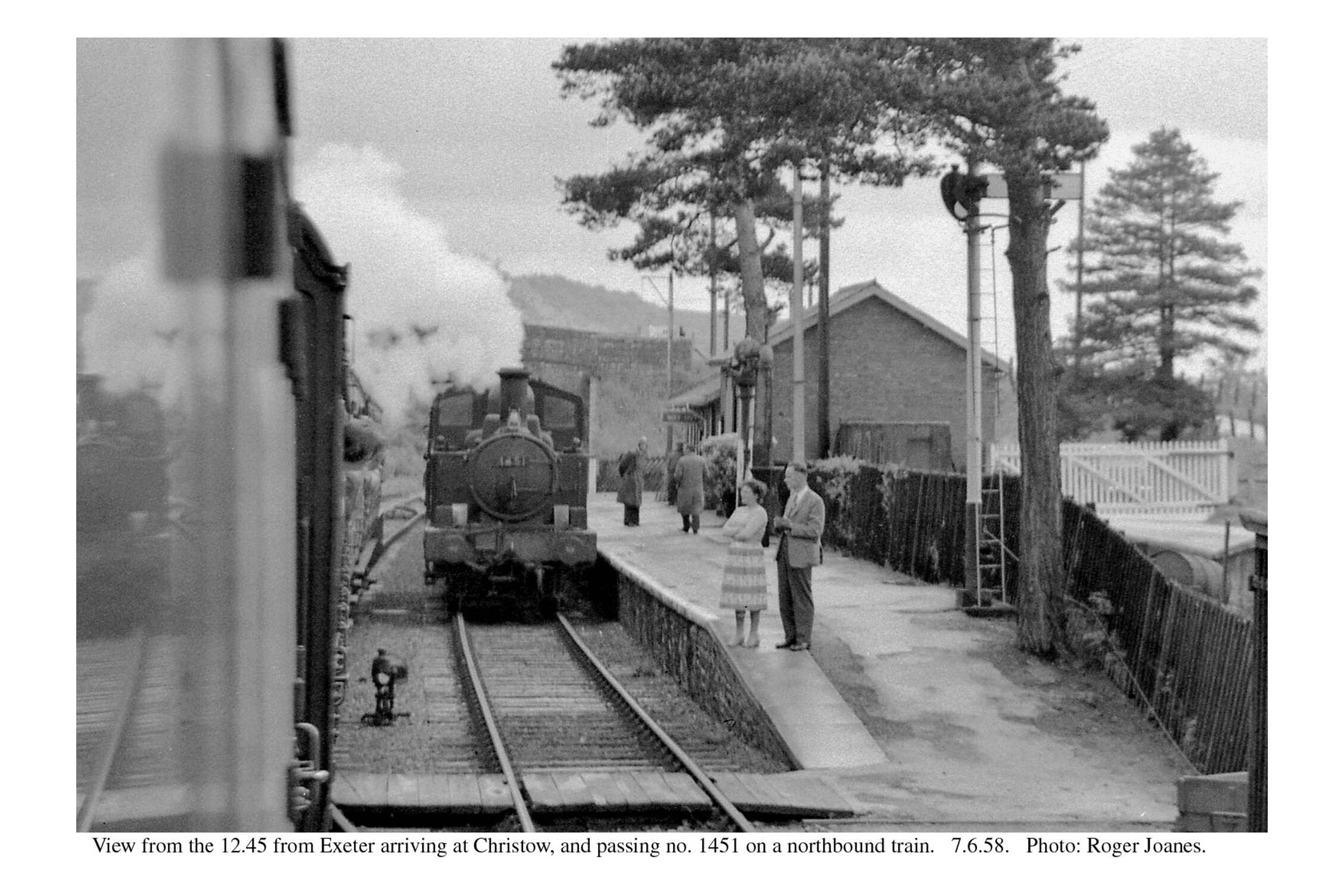
All the trains on the day were strengthened. No. 1451 on the Newton Abbot to Bampton train has its maximum load of three coaches, this being governed by the incline from Christow to Longdown.
The last two trains of the day, the 8. 0 p.m. Newton Abbot to Exeter and the
9.30 p.m. Exeter to Newton Abbot were made up to six coaches and hauled by 2-6-2T No. 5533. The gradient is more severe between City Basin and Longdown than between Christow and Longdown, and this was reflected in the load tables. According to the book, a 53XX could have taken seven coaches to Exeter, but the maximum was only six (not to mention 20 tons of passengers) from Exeter back to Newton Abbot.
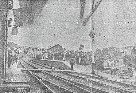
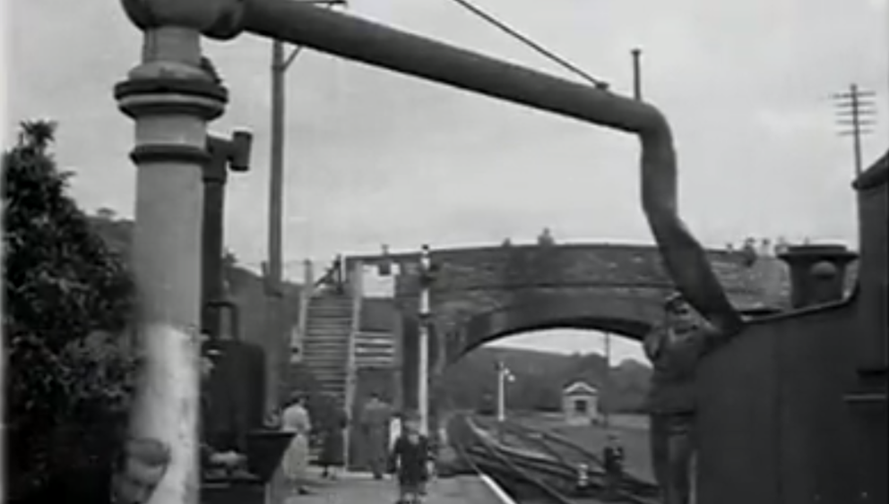
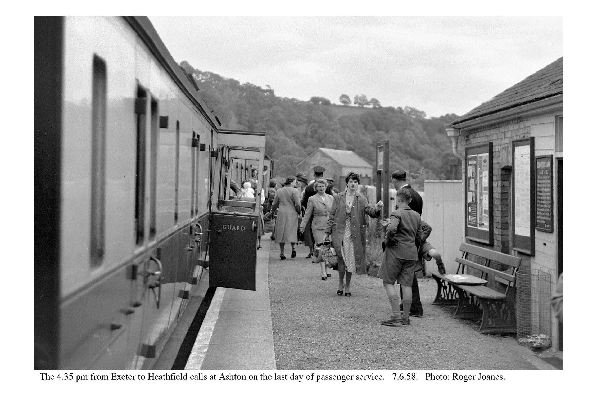
The very last train left Exeter 18 minutes late after “Auld Lang Syne” had been sung by children and station staff on the platform and a wreath placed on the engine. Driver George Russell and Fireman John Thompson, with two Guards including W. Collecutt, who had been 44 years on the line, were in charge of the long train and its 500 passengers. The stations and halts were unwontedly crowded with onlookers and the train had to platform twice at each place, to the accompaniment of singing and cheering. The longest stop was at Christow where the loco was watered. A bugler provided music and the Guards had great difficulty persuading people to re-join the train. Eventually it left, to the explosion of fog signals, but Newton Abbot was not reached until 11.35 p.m., 60 late.
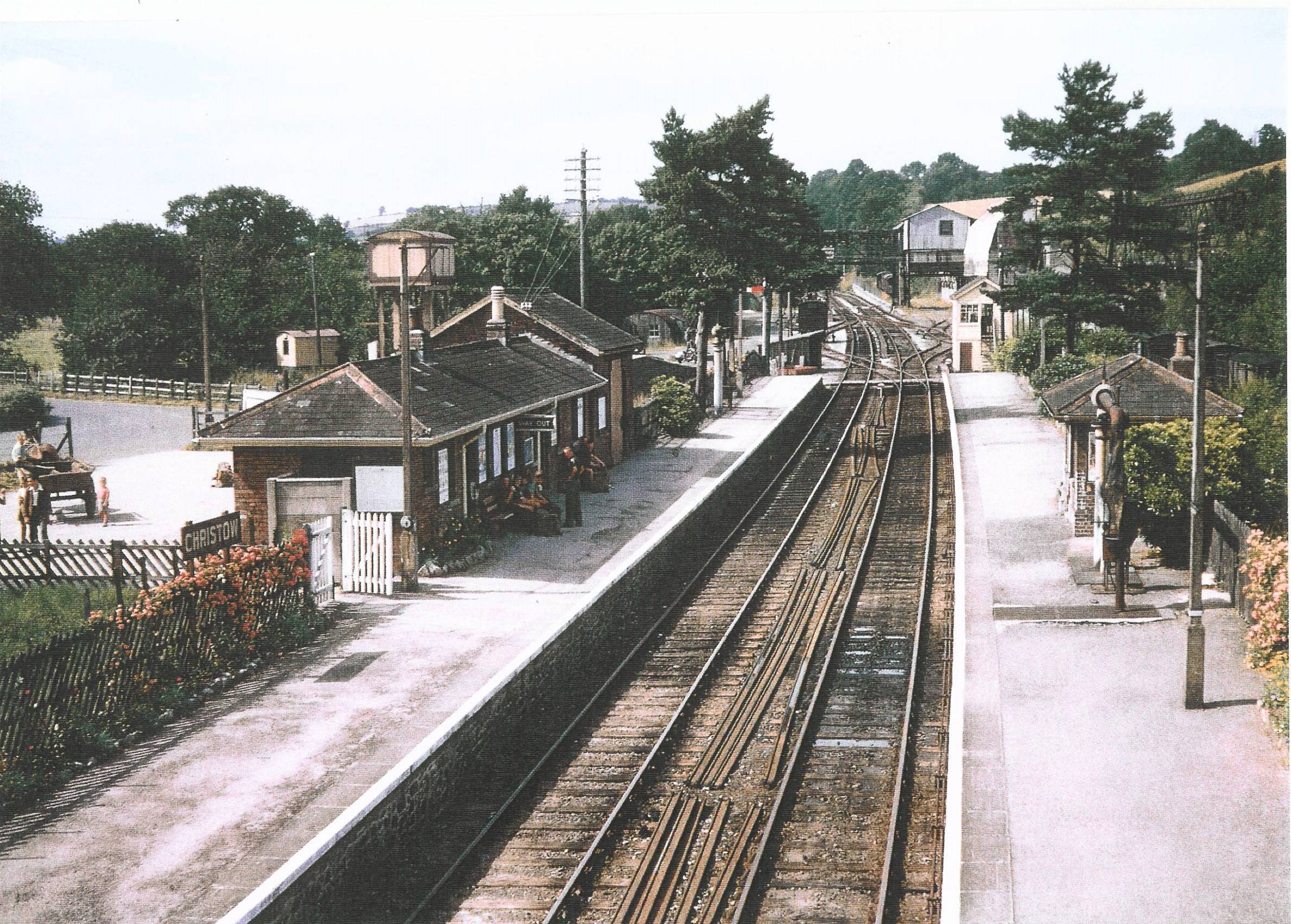
The paint may have faded but the station is still fully staffed and equipped. The latest posters are displayed and all is in order; the railway routine would have been observed until the end.
The Exeter Railway, which had made the Teign Valley line into a through route, had been the second to last opening in Devon and it was also the second to close, after the Princetown Branch. In 1958, people may have thought that these closures were isolated events, to be mourned but at the same time accepted as inevitable. They did not know that more and much worse were to follow in the ensuing decade.


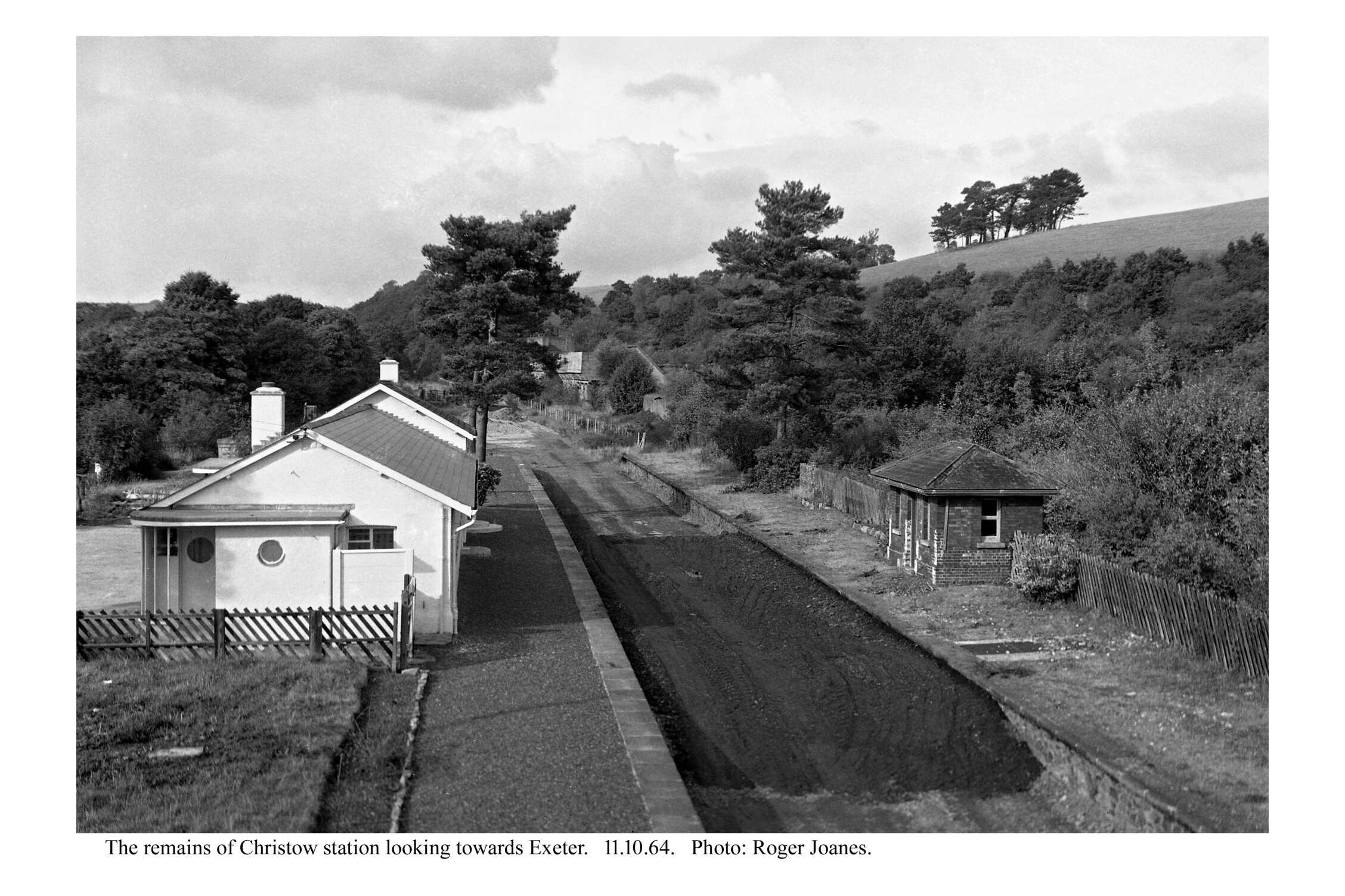
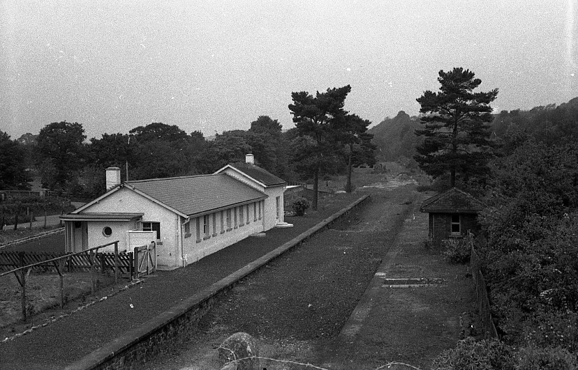
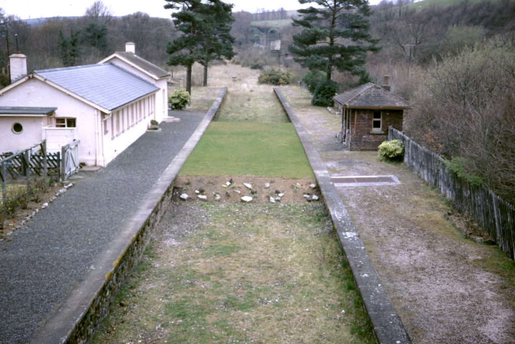
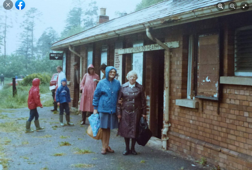
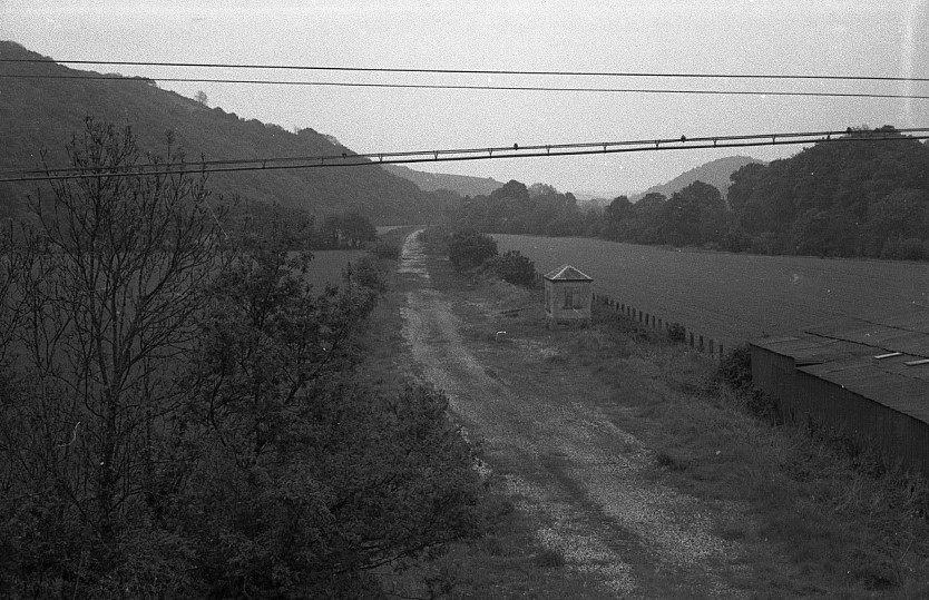
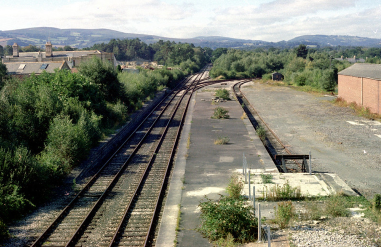
In 1994, the station came up for sale and in July the scout took the opportunity of wandering around it and taking the photographs below.


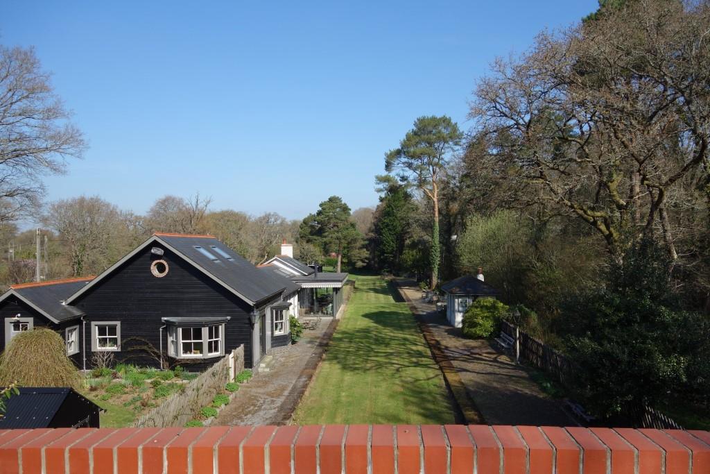
Despite there often being more cars parked on the frontage than would ever have been seen when the station was operational, it remains dead; there is, after all, only one thing that will bring a railway station back to life.
The old station is seen here in April, 2025.
Repairs to Christow Station Bridge in 2022 were part of National Highways trying to redeem itself.
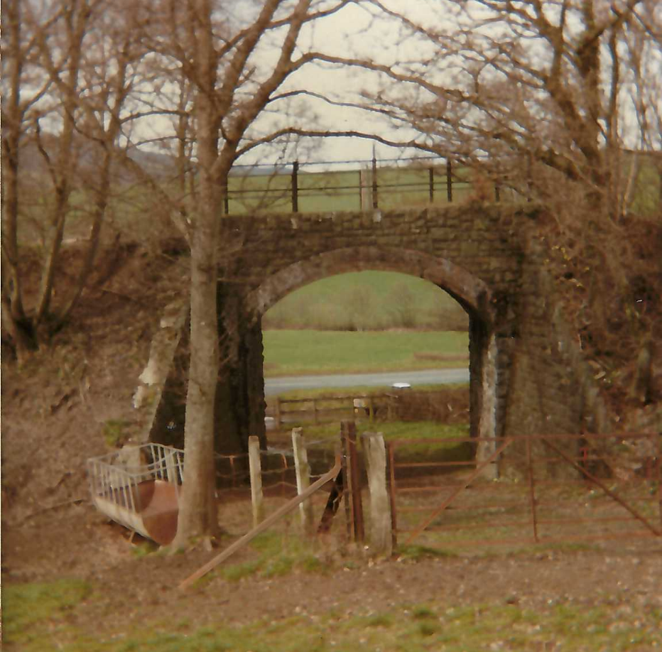
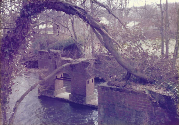
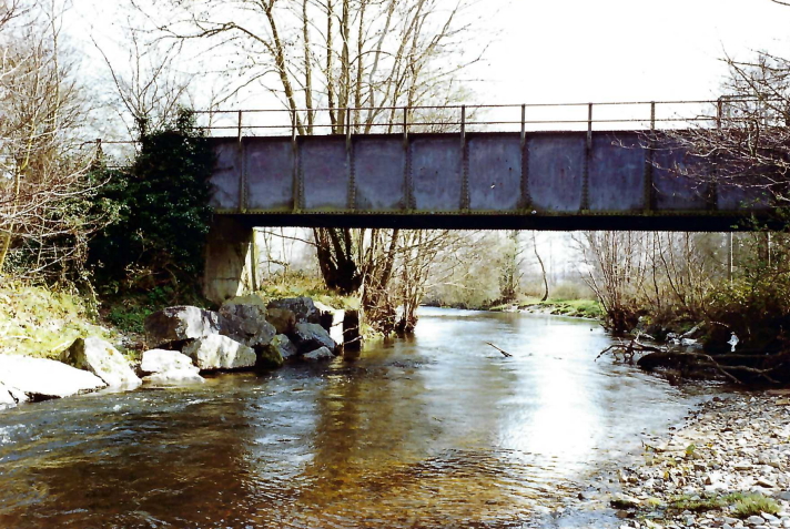
From 1882 to 1903, this had been Teignhouse siding, the terminus of the Teign Valley Railway. An end-on junction was made with the Exeter Railway just this side of the bridge. At left is the Refuge Siding and the wagon weighbridge.


Ahead of the hanging track can be seen the accommodation crossing which gave access to the riverside meadow isolated by the railway. Beyond, the parapets of Ashton River Bridge can be seen.
At first glance, the hill could be mistaken for Scanniclift Copse, meaning that Richard was looking towards Christow. But the telegraph pole would then have been on the other side of the line.
The trees make the hill look less imposing.
Access courtesy of Mr. & Mrs. Baber.
With the exception of the Ide postcard and the Express & Echo view of Longdown, the black and white photographs above are the copyright of Richard Holladay. http://www.exeterfoundry.org.uk/about.php


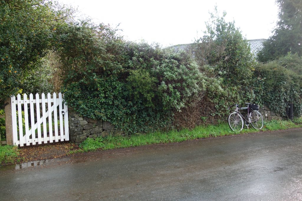
Ashton
Before the war, recognizing that Ashton had once been a terminus, the timetable still showed the route as “Exeter, Ashton and Heathfield.” Later it was usually “Exeter, Christow and Heathfield.”
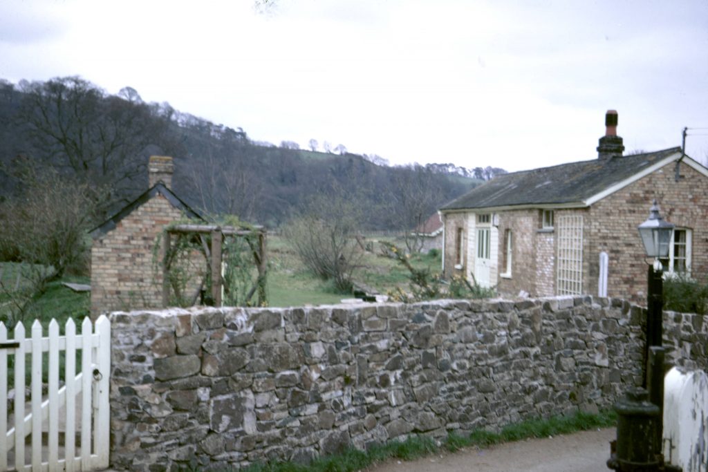


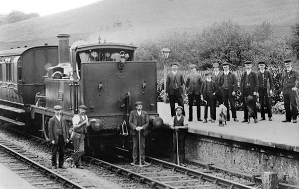
As well as the Station Master and porters, this then being an isolated standard (“narrow” to G.W. men) gauge line, with its own loco and rolling stock, there were also Driver, Fireman, Fitter, Cleaner and Guard based here.
The Crediton and Chudleigh turnpike is unusual in having no surviving toll houses or milestones. Although there are none of the features of a toll house, it’s possible that this once stood guard over the crossroads.


The “Sound Whistle” board (it’s actually made of iron and weighs four stone) which was positioned on the approach to Whetcombe Crossing in the Down direction is kept in the “Temporary Booking Office” at Christow.
The scout called at Crockham on the day he came across the board and asked the Quarry Manager if he may recover it. The manager said that he would have first to offer it to Dick Lyster, an employee and railway enthusiast. Dick fortunately declined the offer. In fact, he went home and came back with a piece of rail that he said he had recovered from the East Cornwall Mineral Railway. This is now also in the T.B.O.
These boards were normally painted with black or white letters on the opposite background. The scout seems to remember that this one had clearly been painted with red letters.
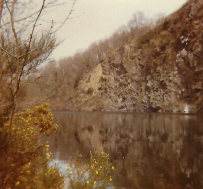
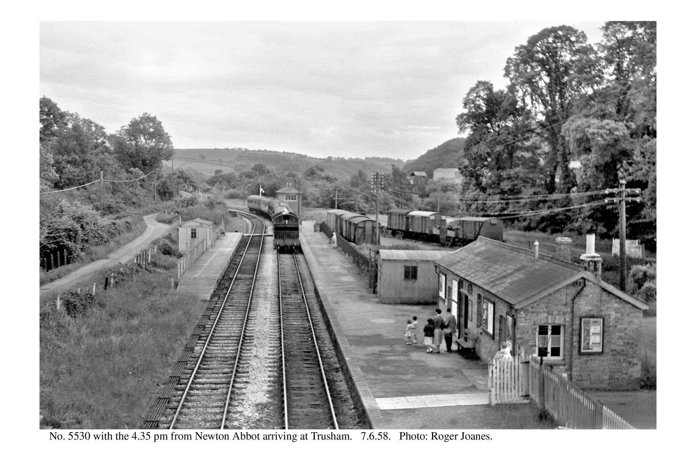
Trusham
The brick parapet, partly renewed at great expense, has been damaged.


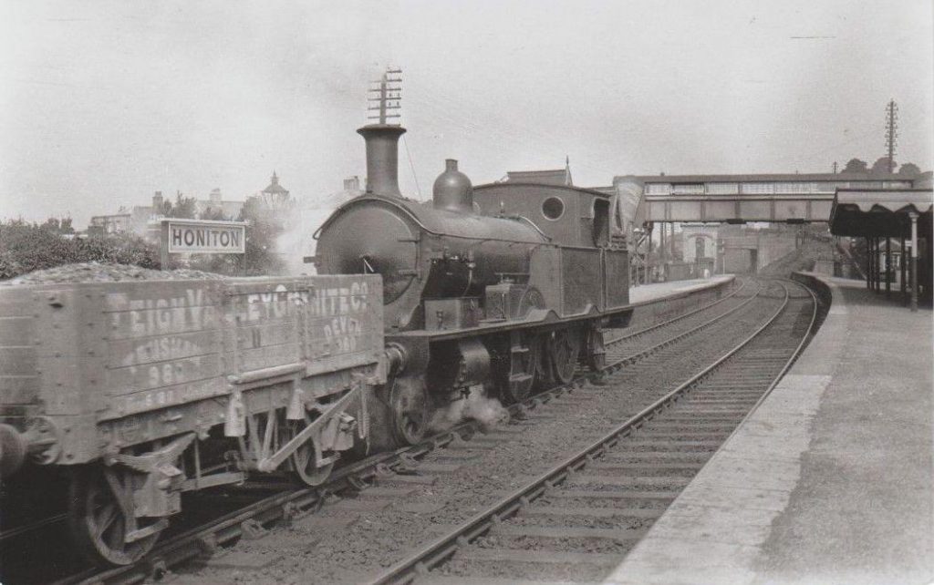
The wagons seen are PRESFLOs loaded with cement which will be discharged using compressed air.
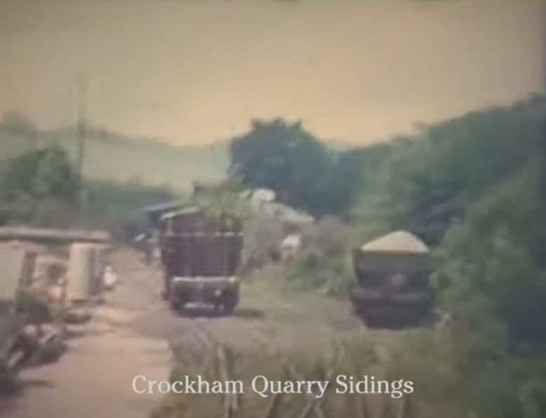
Crockham Quarry’s buildings can be seen in the distance.


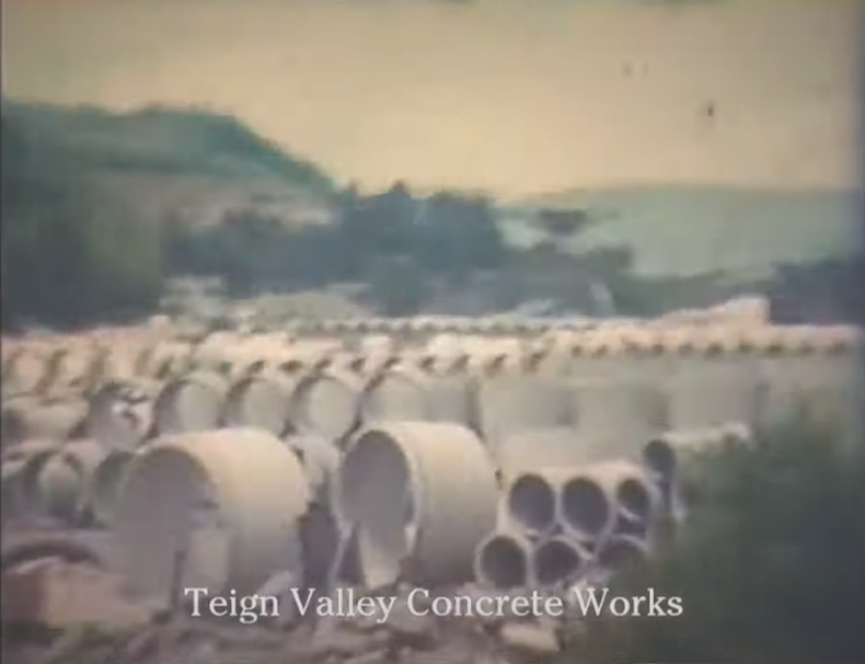
The valley road was diverted in the late 1990s after the closure of Crockham Quarry and the Concrete Works.


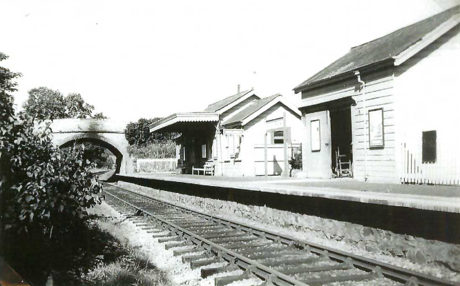
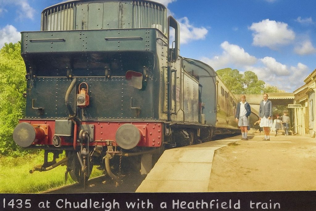
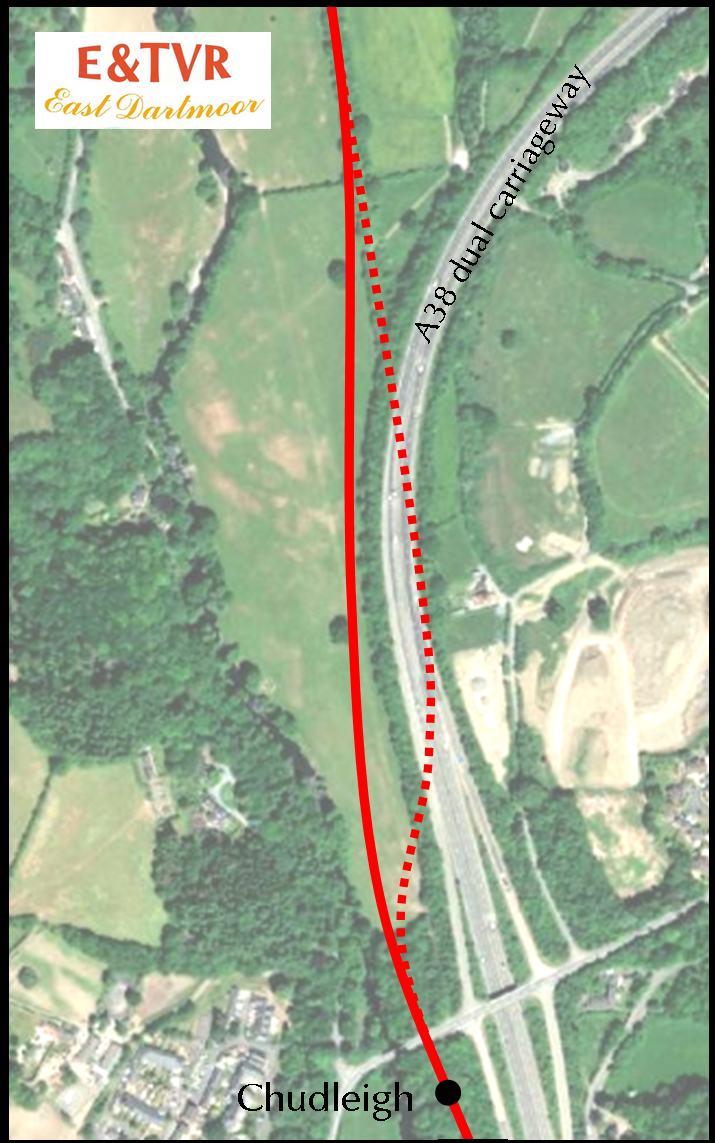
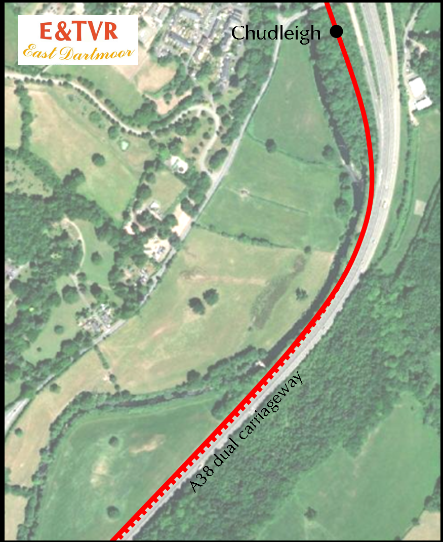
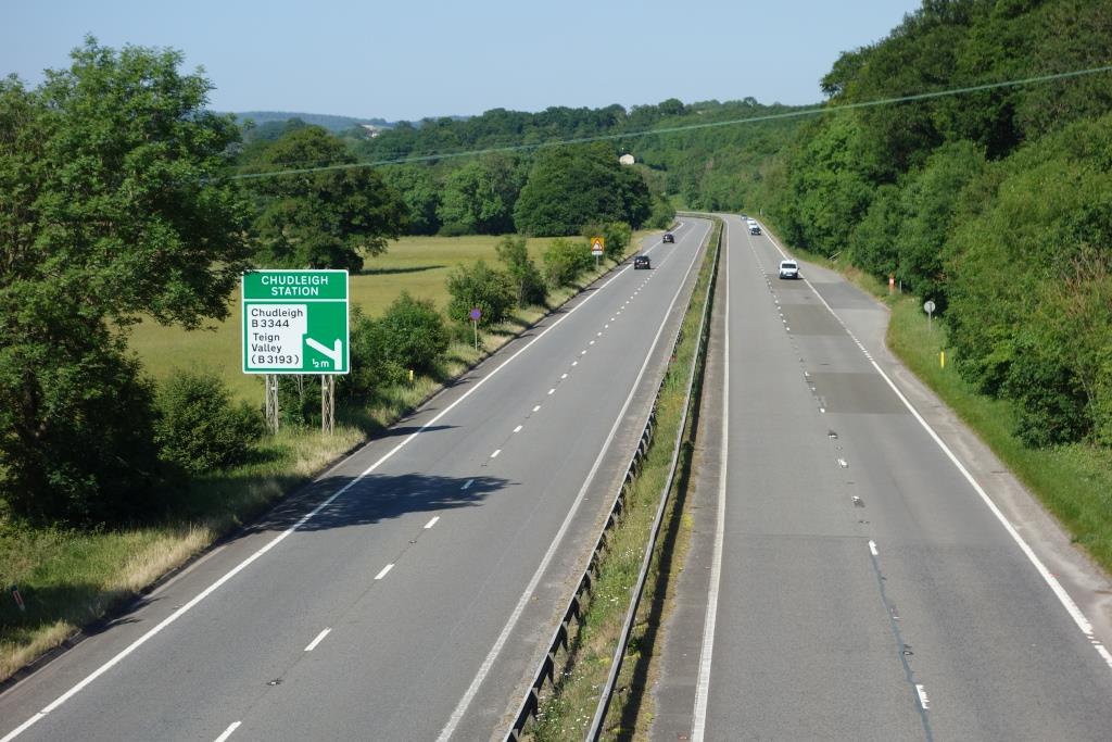
Chudleigh
It is commonly thought that Chudleigh Station is buried beneath the dual carriageway. In fact, the station was beside the river and the site is still visible. It can be positioned by the overline bridge, now flanked by concrete additions.


The gradient of the turnpike from the existing river bridge to the railway bridge was limited by the Act and thus the station had to be very low lying. It was regularly flooded but trains from Exeter could run as far as a short platform, where the line was slightly higher. In times of flood, buses would substitute between Chudleigh and Heathfield.


The station had been officially closed to freight traffic in 1965 and the line beyond only led to Crockham Quarry and the concrete works, whose sidings had been deemed unfit for use in November, 1967.
The station closed completely in July, 1968.
R.K. Blencowe.
Devon County Council, doing its bit to provide for universal car ownership and the explosion of road freight transport, had acted for the Ministry of Transport in designing the Chudleigh Bypass; its route had been decided upon in principle many years before.
Accommodating the branch railway would have added £100,000 to the £3.9-million cost of the new road. In the event, B.R. was happy to give it up and closure of Chudleigh in 1968 was quickly followed by the start of road construction. The bypass was opened in 1973.
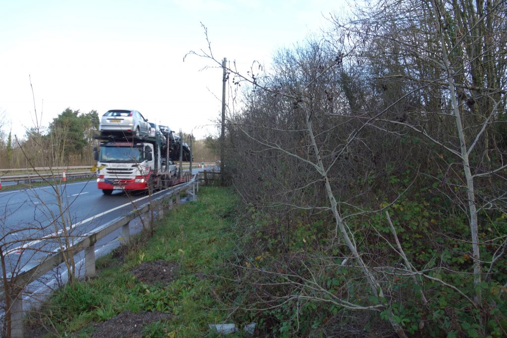
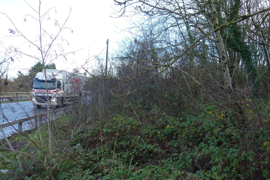
The incursion of the road was not as bad as many believe and was only total between Bellamarsh and Knighton Heath.There is still an unobstructed path for a new railway beside the dual carriageway which could be made as flood-resilient as the road.
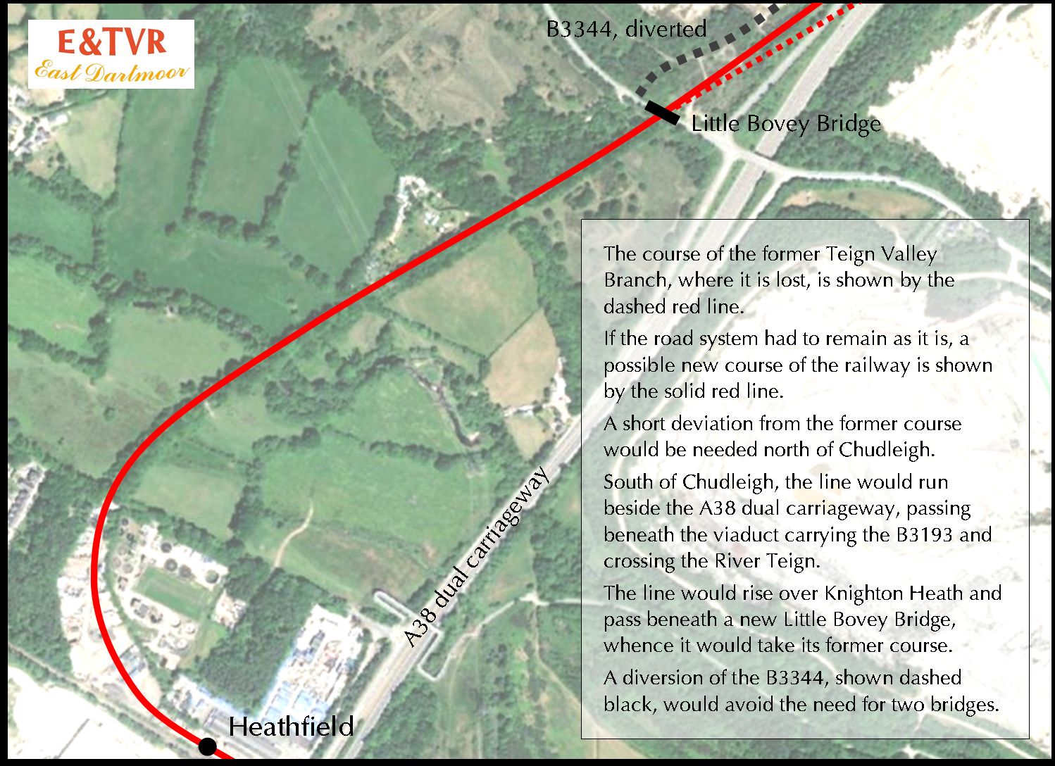
The cost of all this work would be about the same as widening the A386 between Newton Abbot and Heathfield (£33-million in 2022). +


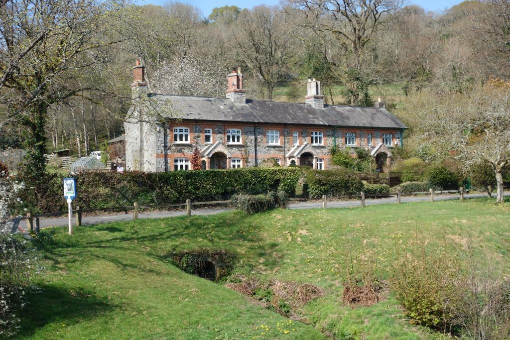
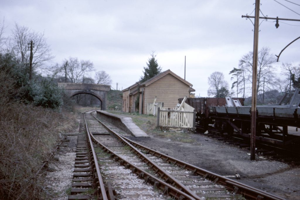
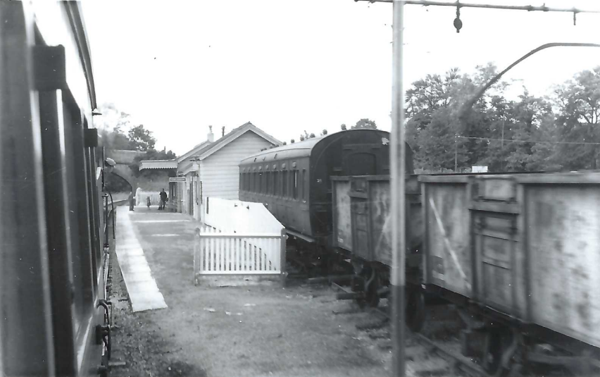
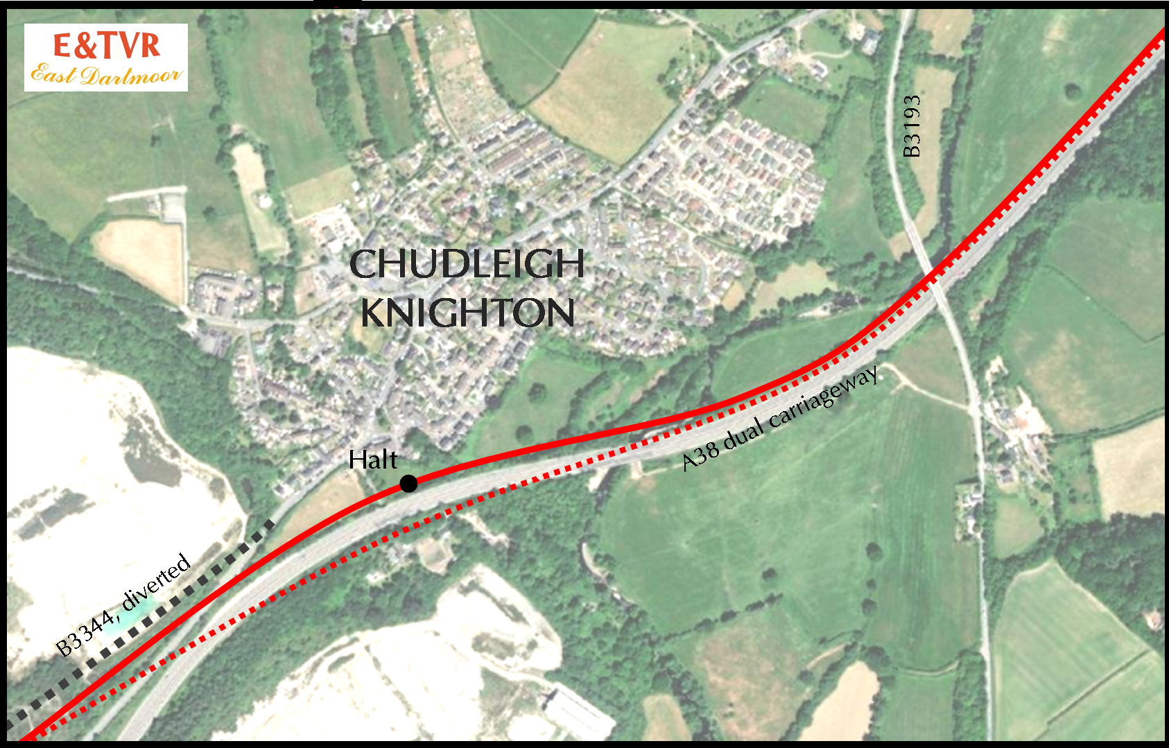
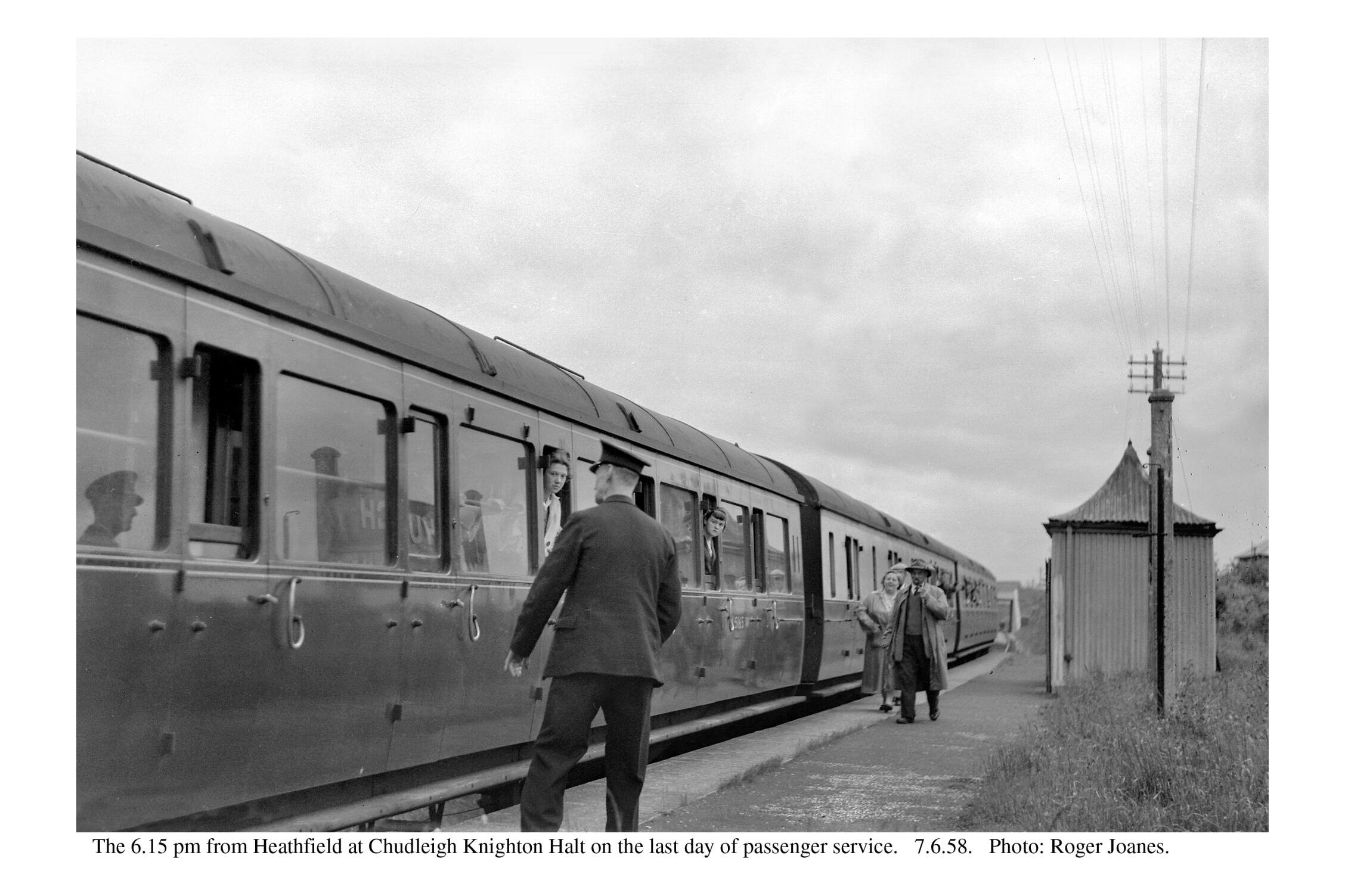
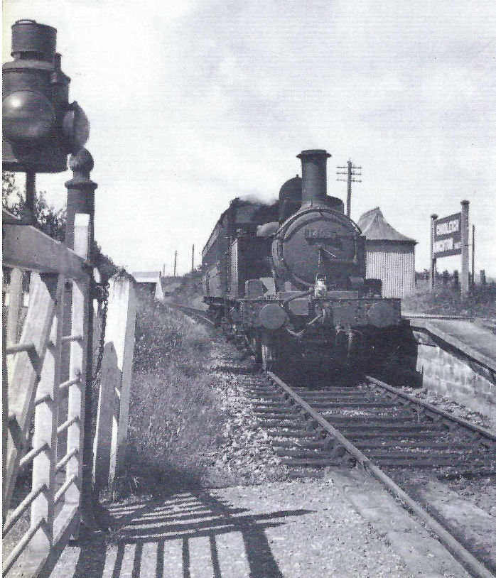
Chudleigh Knighton Halt
But the new B.R. would have no room for residual operations like this and very soon the railway, the loco and everything seen here would be gone.
Until now, this is the only one of the photographs taken by Peter of Teignmouth to have been published and is fully described in an entry under “What’s New?“
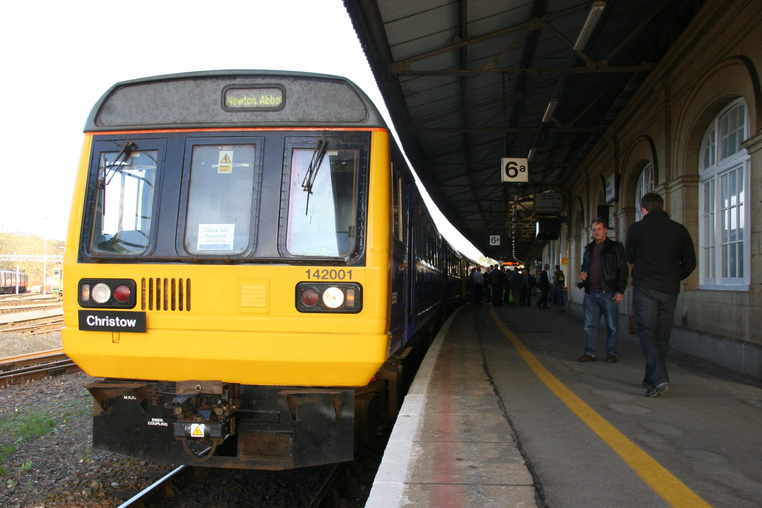
Of all the locomotives which may have been chosen to represent those that traversed the Teign Valley over the years, there is displayed in the railway’s small exhibition room a model of the last—a wretched diesel.


No mention of the rebuilding of the 1877 Knighton Bridge, which carried what became the A38 over the Teign Valley Railway at Chudleigh Knighton, has ever been found and were it not for a set of official B.R. photographs recording the commencement of the works, the scribe would have known nothing of what happened here; although there are glimpses of the new bridge in photographs taken from the level crossing.
The lower right plate below shows the bridge’s condition. Timbers temporarily buttress the spandrels, whose failure may have been caused by weight of road traffic, poor construction or subsidence.
The photographs must have been taken between 1948 and 1955. In the aerial photo which follows, the road is unaltered; the 1955 Ordnance Survey shows the new bridge.
The lookoutman present tells that trains were running and so it’s a weekday. It’s daylight and it’s the main Exeter to Plymouth road: how long would it be before a photographer would never be able to catch it even momentarily free of traffic?
In the two views taken at track level, men appear to be excavating and loading a bucket by hand ready for the foundation of the southern abutment of the new bridge, whose construction would not interfere with road traffic until each end of a new road formation was connected, whereupon the original bridge could be demolished.
The new concrete beam Knighton Bridge was built on much more of a skew and after it was opened the road had very nearly recovered its original turnpike alignment.
Unlike the original, the new bridge would span only the single line. It would be fanciful to think that clearance was provided for overhead electrification.
Over the extent of the works, the telegraph lines have been taken down, gathered and tucked inside a running rail.
It can be seen that the track had two-hole fishplates and close-sleepered joints in the 45-foot rails.
Beyond Knighton Bridge in the upper left plate can be seen Little Bovey Bridge.
Heathfield to Christow was mostly easy work for locos, but in leaving the Bovey Valley and cutting through Knighton Heath to the Teign, there were short lengths of 1:66 in both directions.
All that is seen here would be obliterated by the Chudleigh Bypass, opened in 1973.


The four photographs in the gallery above were obtained from British Rail and were marked copyright of British Rail/O.P.C.
April, 2021: Since writing about the “new” Knighton Bridge, another official works photograph has come to light, this one showing construction of the abutments well advanced.
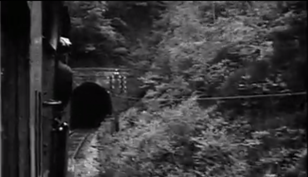
And the scribe, returning after a very long time to a full-length print of the only known film of this section, was reminded that one view from the carriage window is of the train running along the near three-quarter mile straight beneath Little Bovey and Knighton bridges.
https://youtu.be/M_x3Fg8Yb0I?t=731


Above left is the point at which the old turnpike, later the arterial A38, curved to cross the Teign Valley Railway. The scout’s bicycle must not be far from where the official photographer was standing in the top right of the set of four. The road through Chudleigh Knighton is now the B3344 and it continues from here on a new course parallel with the dual carriageway, out of sight at left.
The scout looks back towards the village in the photo at right. Little Bovey Bridge once stood in the scrub to the left of the bench and the road from the A38 once passed across the picture. The railway passed diagonally at a lower level.
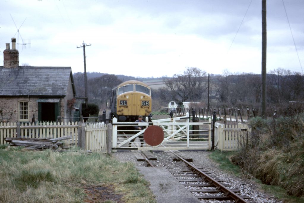
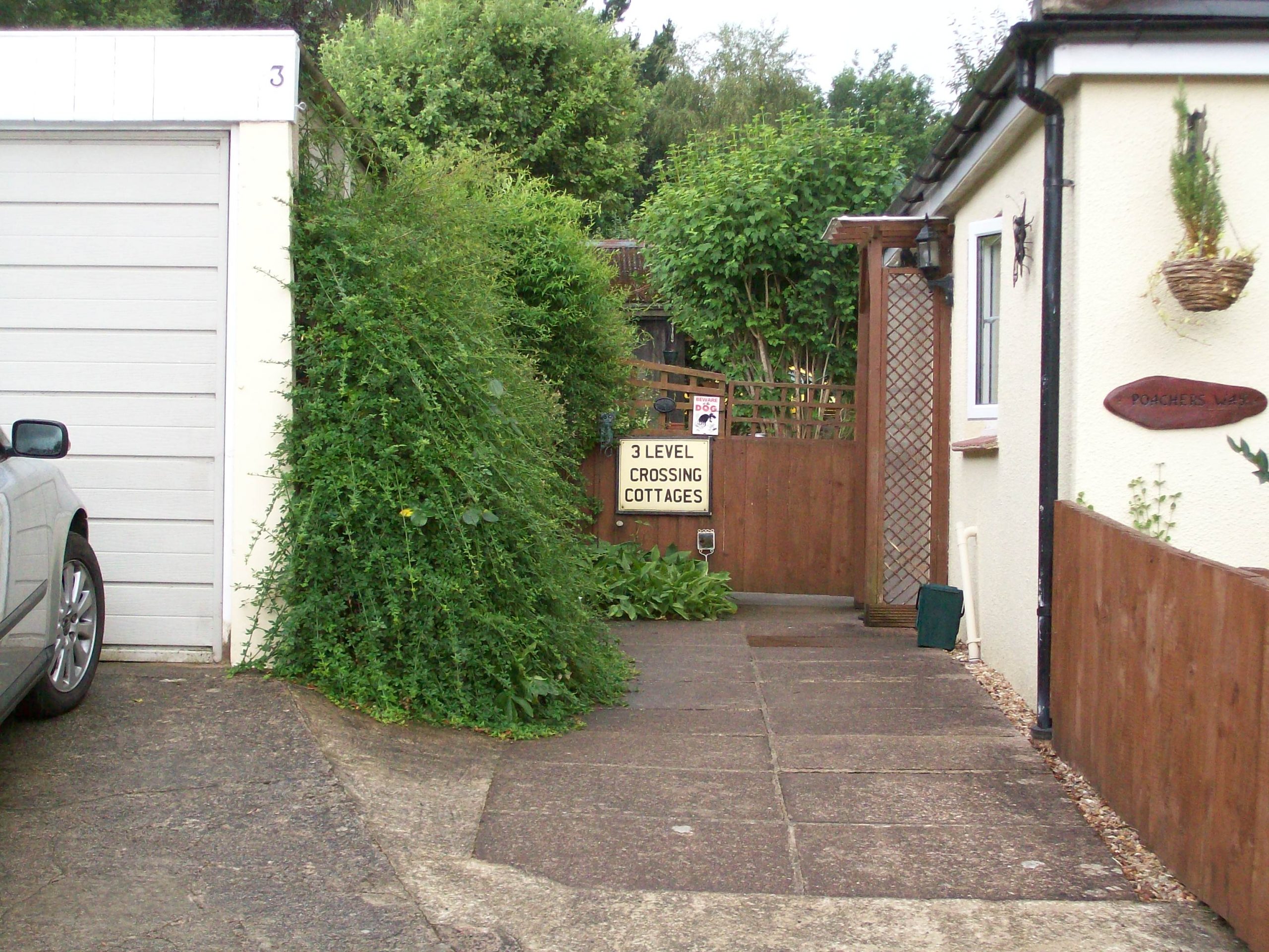
Bovey Lane Crossing
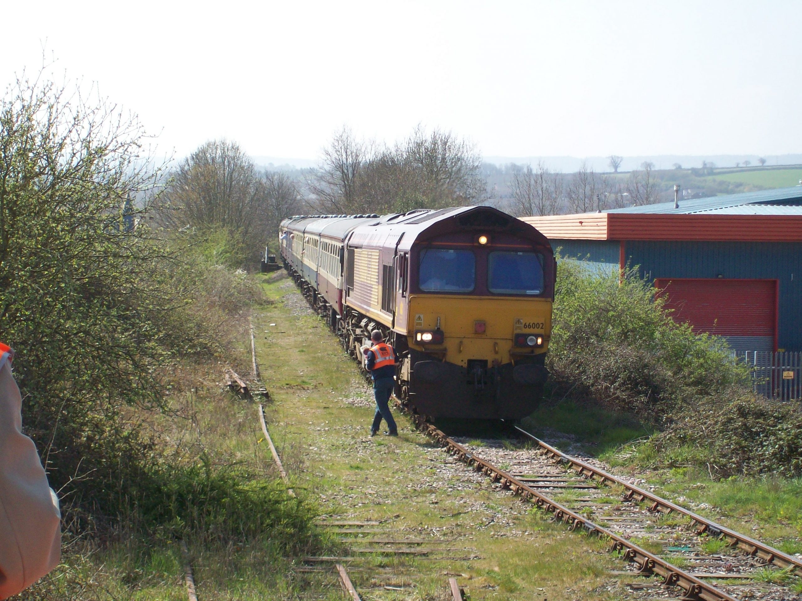
The only track remaining between Marsh Barton and Heathfield lies in the road here. The county council’s plans to remove it were thwarted by local opposition.


Heathfield
The huge quantity of track sections, both at right and in the “vee” of the junction, cannot be fully explained. It is likely that the chaired concrete-sleeper sections at right are for re-laying the line between here and Gulf Oil’s new terminal of 1966, half a mile towards Bovey. (B.R./O.P.C.)
This junction and the four, long passing loops greatly increased the capacity of the branches as a diversionary route.
The double line, becoming single, at left is still open for goods traffic to Bovey. The Teign Valley bay platform line, behind the hut, is used for unloading wagons. The far siding was new in 1961 and served van Geest’s banana-ripening shed. The signal box stood where the trolley wheels lie.
In July of this year, the remainder of the Teign Valley would be closed, save for the line as far as Bovey Lane Crossing, left as a headshunt.


The junction and the branch as far as Bovey Lane remained until 1983. In 1996, the course of the branch, the station yard and the bay platform were sold and over the following years became another scruffy “business park.” https://www.teignrail.co.uk/political-campaigning.php#heathfieldstation https://www.teignrail.co.uk/whats-new.php#boveylane
The Bristol Auction, at which the land was sold as Lot 13 for £48,000.
A branch lying across the rails of the Down Main marks where the double junction was and the pent-roofed building at top right stands on the course of the Teign Valley Branch, whose bay platform was at middle right.
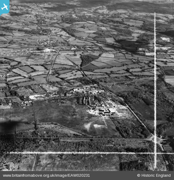
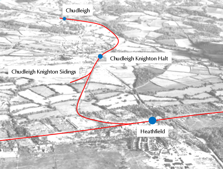
Discovered only recently, this is one of a set of 12 aerial photographs taken while circling “Candy & Co. Ltd., Great Western Potteries,” mostly in 1948.
The one below, taken from the south-west, has been chosen because it affords a splendid view of the Teign Valley line as far as Chudleigh, whence it it hidden.
In accordance with the terms of use, the image is reproduced uncropped, with attribution.
To aid following the two railways, they have been picked out in red on the faded clip which follows.
The find is especially rewarding because it has produced the only known sighting of Chudleigh Knighton Sidings, installed in 1943 to serve the U.S. Army fuel dump (P.O.L. (Petrol, Oil, Lubricant) Depot) scattered on the heath. The facility was used for a few months before and after “D-Day,” but in the aerial view two lines of wagons can be seen. Possibly the sidings were used to store surplus freight rolling stock.
Part of the formation can be traced today and thanks are due to the railway’s friend, Stephen Szypko, for exploring the area and identifying the remains.
The curvature of the A38 over Knighton Bridge is revealed, as well as the residue of its original straight course.
Incidentally, the disturbed area seen alongside the A38 at the bottom of the photo is the remains of the U.S. Naval Construction Battalion Depot.
By entering “Britain from Above” and registering, the high resolution version of this image can be viewed in great detail.