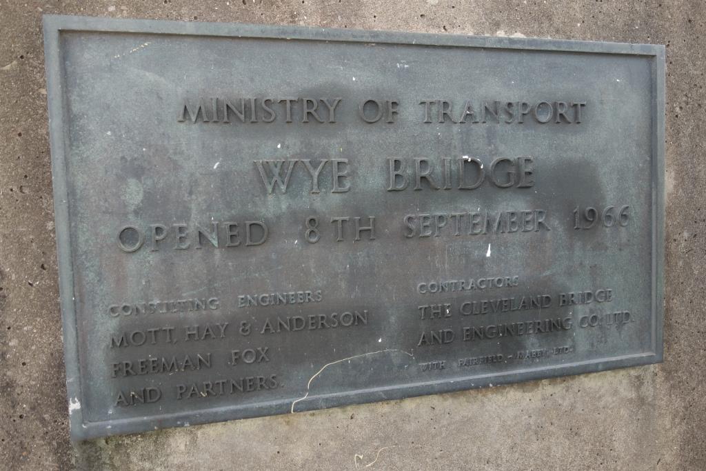
The scout had got as far as the former Severn Bridge, where it crossed the Gloucester and Berkeley Canal, in 2022 and determined to go back and ride along the towpath, perhaps the most interesting way of reaching the city and county town.
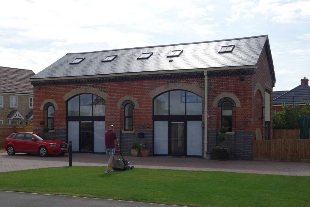
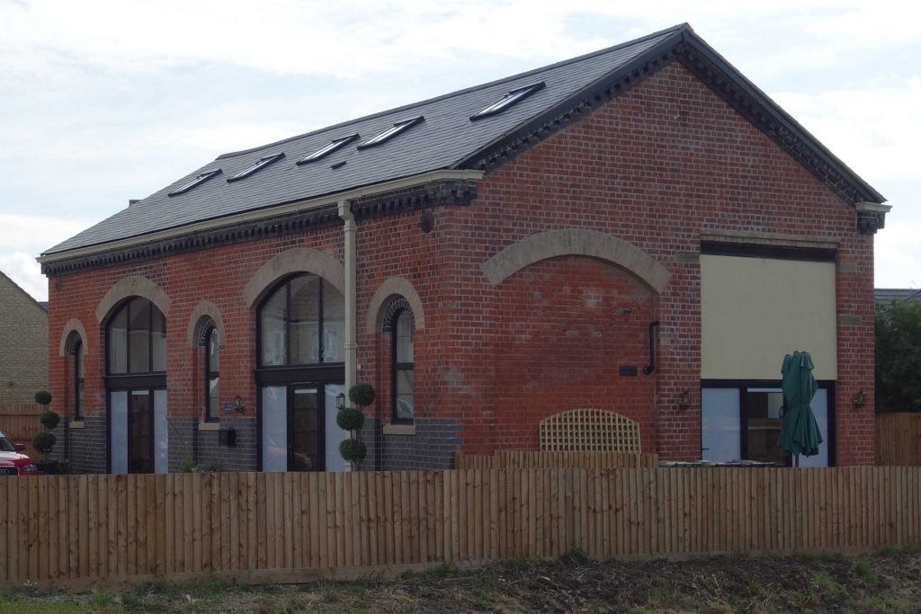
Once again, he detrained at Cam & Dursley, this time going in search of the former station’s goods shed, which he had missed in 2022.
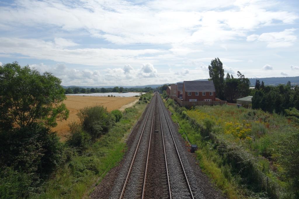
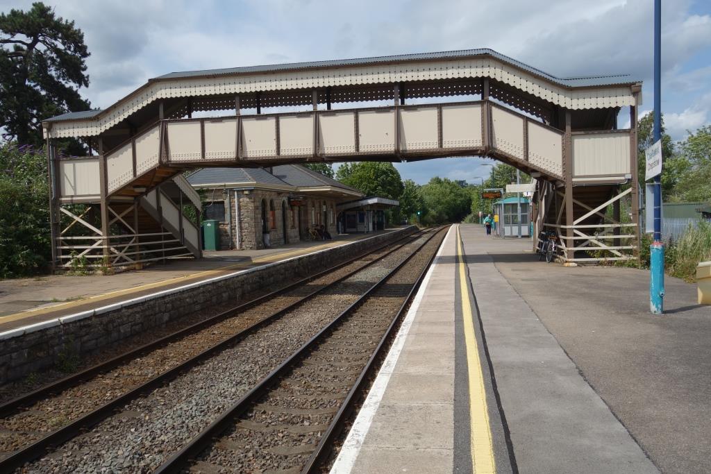
The present day station is seen from the bridge carrying the A4135 over the railway. Coaley Junction, the original station, closed in 1965, lay in the foreground. The Dursley branch, closed in 1962, curved to the right.
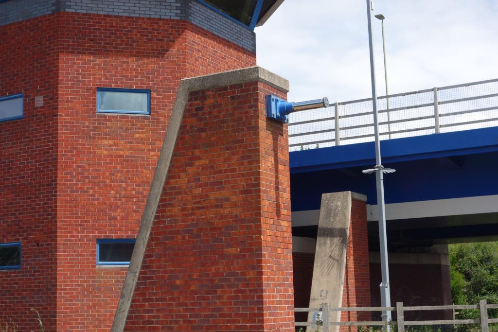
The goods shed is now surrounded by new housing. The owner was mowing the lawn and was happy to discuss in detail the building’s purchase and sympathetic conversion.
It had been used by a builder and was in a rough state. When rendering on the lower courses was removed, the brickwork was found to be poor. Finding it impossible to match the red brick, the owner had chosen blue.
The scout took the same route to Berkeley Road, where he found the Prince of Wales Hotel, beside the A38, reopened.
Beside the entrance to the former station stands a building whose purpose the scout pondered. It could have been connected with the extensive cattle pens which were once on the other side of the entrance.
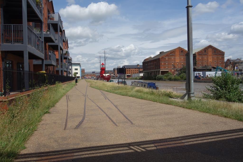
The scout avoided Berkeley and turned just beyond the bridge to go via Breadstone, picking up the previous year’s route at Station Road.
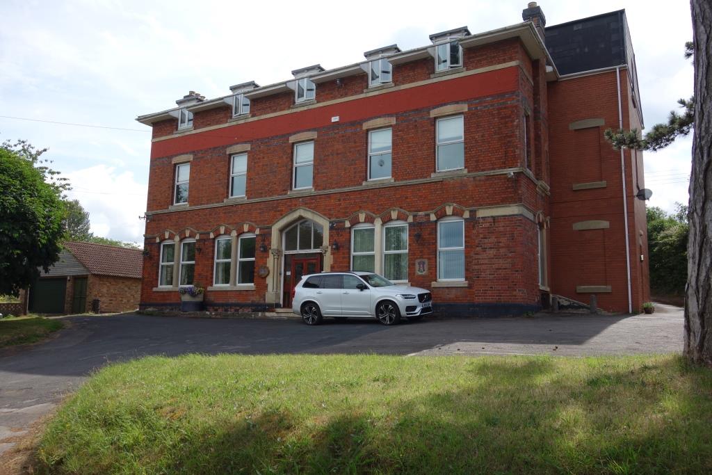
Where Oldminster Road turns to cross the Severn Bridge line at Sharpness Station stands a fine building which the O.S. shows as having once been a public house.
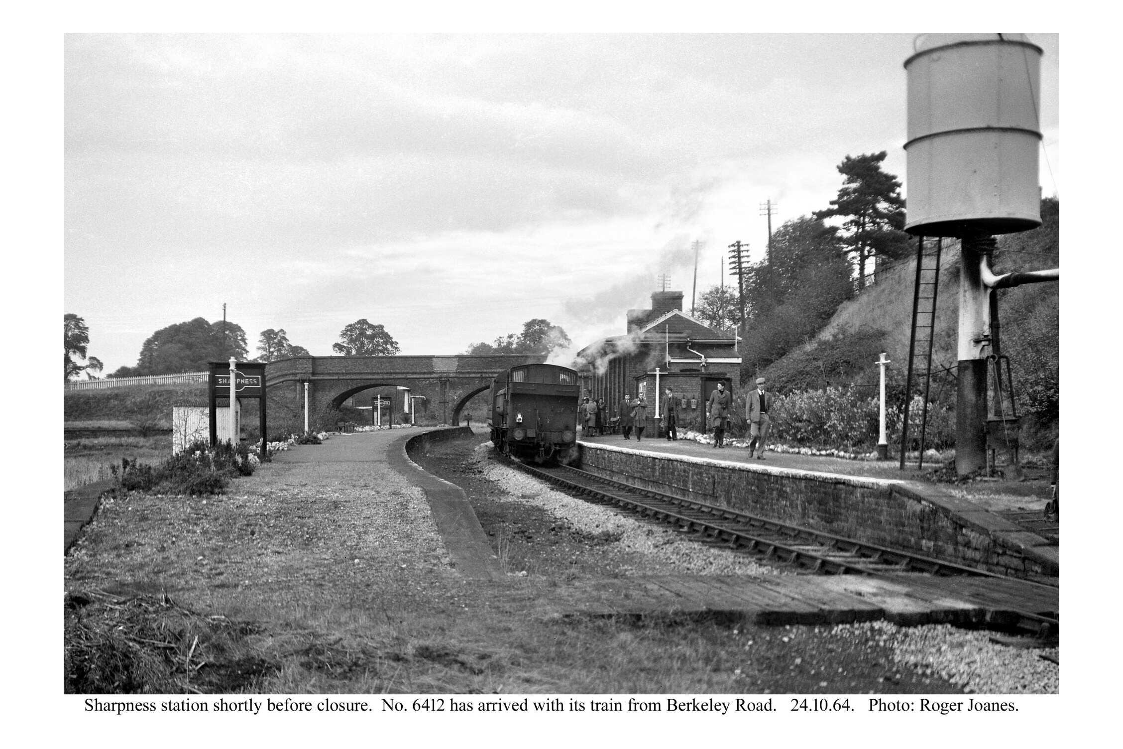
Peering over the parapet of the bridge, the scout could just make out the former Down platform. The pedestrian entrance to Up platform lay on the corner; there was no vehicular access.
The steps to the Down platform have been removed and the gap in the parapet closed. Are they Midland-style running in boards, set at right angles to the platform? Copyright: Roger Joanes. Shared under Creative Commons. +A sunnier view from the bridge than the one taken in 2022.At left was the continuation of the high level line. A loop descended to the lower level, while the high level line went to the right and continued behind the terrace of houses on Dock Road. A reversal took the line out onto a viaduct to staithes above the basin. Another line behind the camera led to a staith above the canal.
The scout went as far as the bank of the Severn, passing the locked up Vale of Berkeley workshops, before heading for the original canal basin to start his ride to Gloucester.
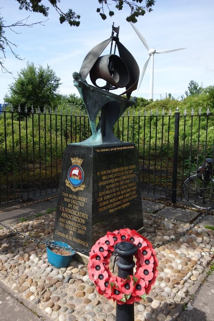
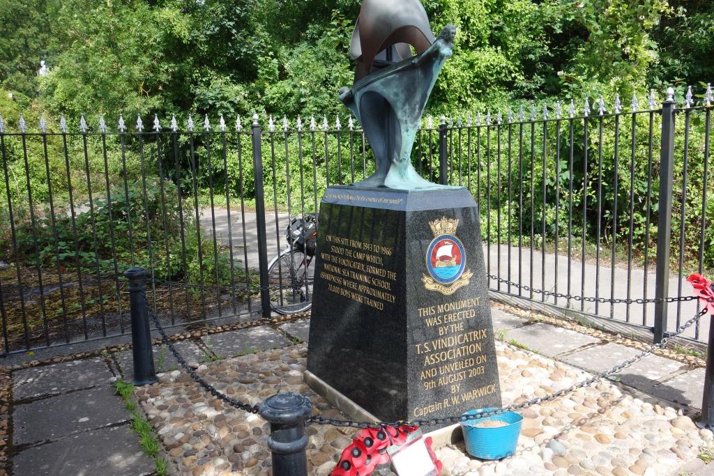
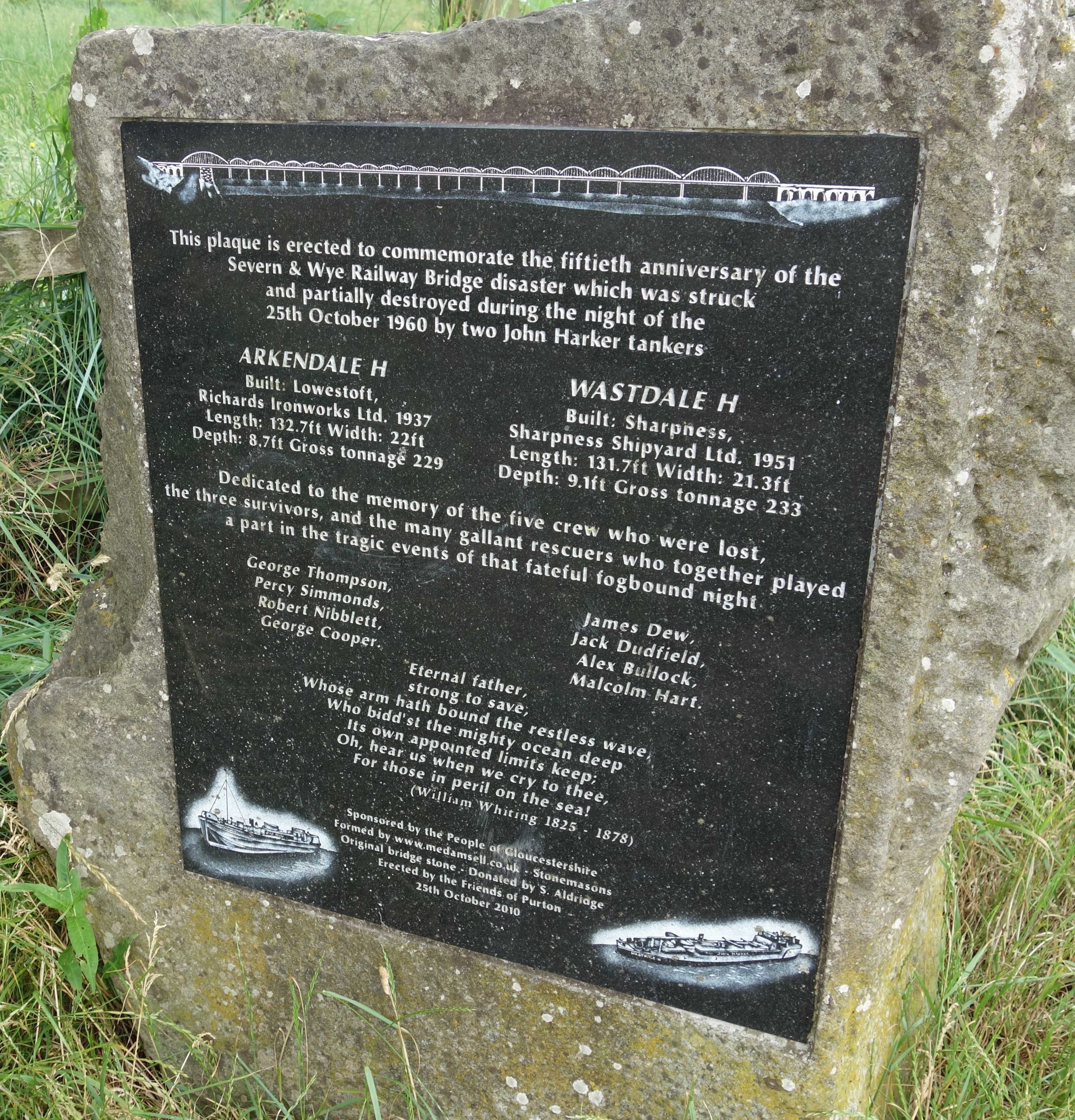
On this occasion, he stopped to look at the memorial which shamefully, in his eagerness to see the bridge remains, he had ignored the year before.
IN 1939 THE GRAVESEND SEA SCHOOL WAS EVACUATED TO THE SHIP VINDICATRIX WHICH WAS BERTHED NEARBY ON THE CANAL. BOYS AGED 15 TO 17 WERE TRAINED FOR SERVICE IN THE MERCHANT NAVY. DURING WORLD WAR II MANY GAVE THEIR LIVES SERVING THEIR COUNTRY. They are not forgotten
ON THIS SITE FROM 1943 TO 1966 STOOD THE CAMP WHICH, WITH THE VINDICATRIX, FORMED THE NATIONAL SEA TRAINING SCHOOL (SHARPNESS) WHERE APPROXIMATELY 70,000 BOYS WERE TRAINED
“The school was a passage through which our dreamsbecame reality. Thecamp site was hallowed by the essence of our youth”
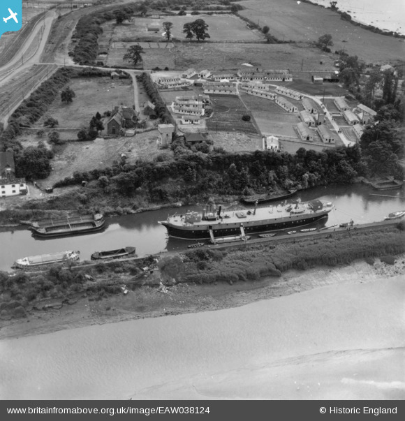
Vindicatrixhad an extraordinary life, beginning as the fully rigged Arranmore, built in Glasgow in 1893.
In this 1951 aerial view, the ship is moored in the “old arm” of the canal. The later accommodation camp is seen above. Thinking he may find another way down to the canal, the scout followed a path into the now wooded area, only to find a maze which took him back to the start, where he took the route he knew. At top left are seen the high level lines.
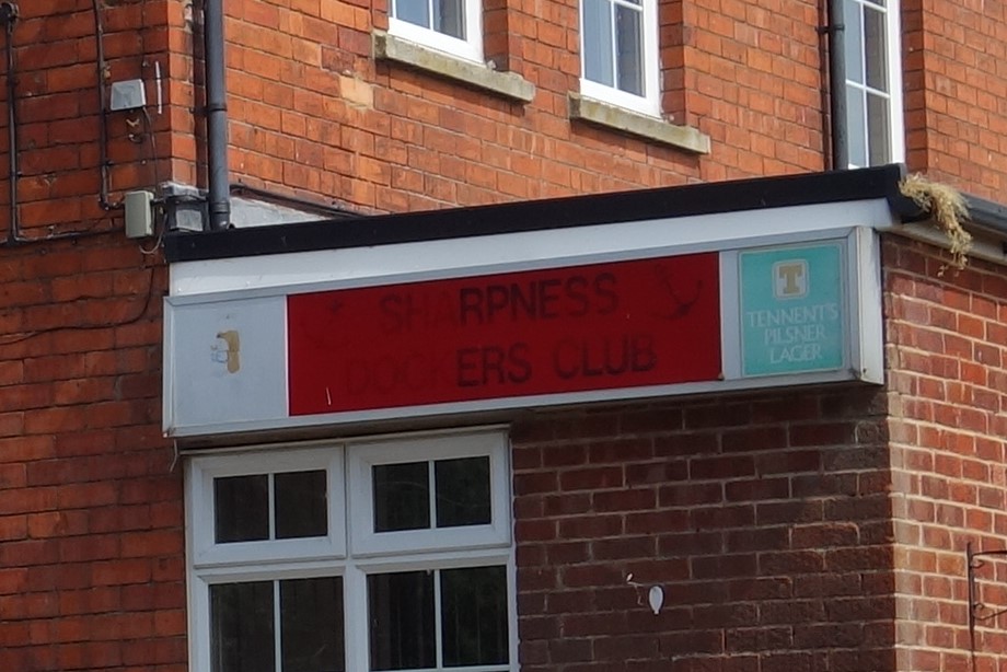
Another feature which the scout had noticed but not attached any importance to was the Sharpness Dockers’ Club, perhaps because its sign was far from clear.
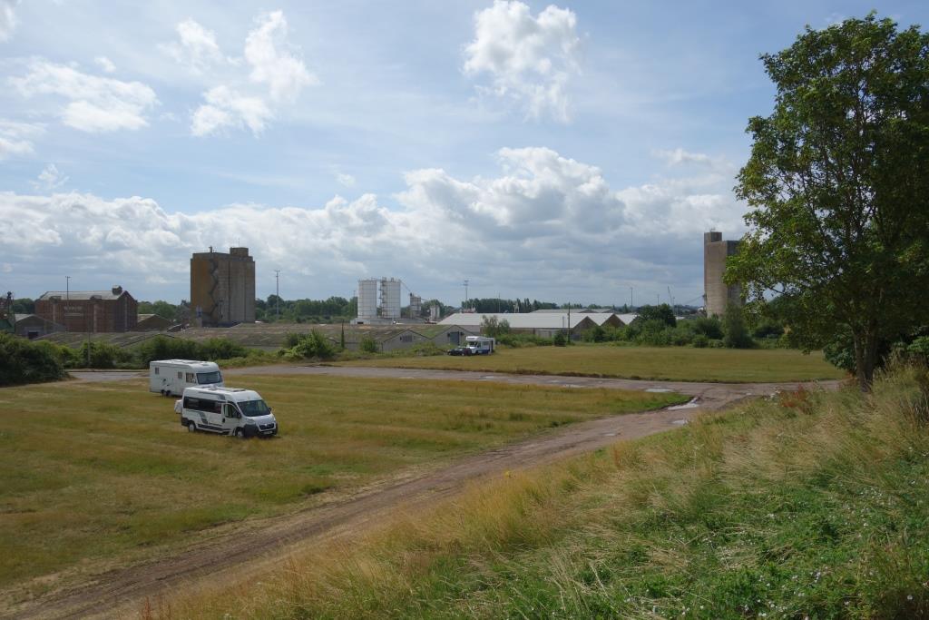
The view from the front of the club. The furthermost camper van is parked on the course of the high level lines.
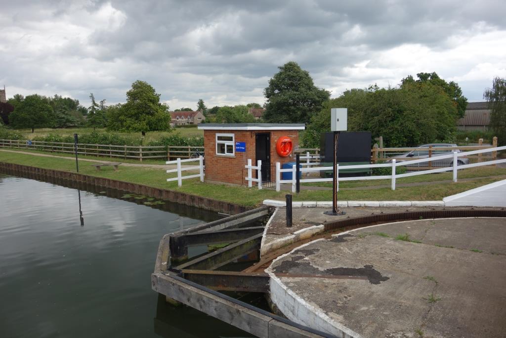
Then the scout descended to the canal.
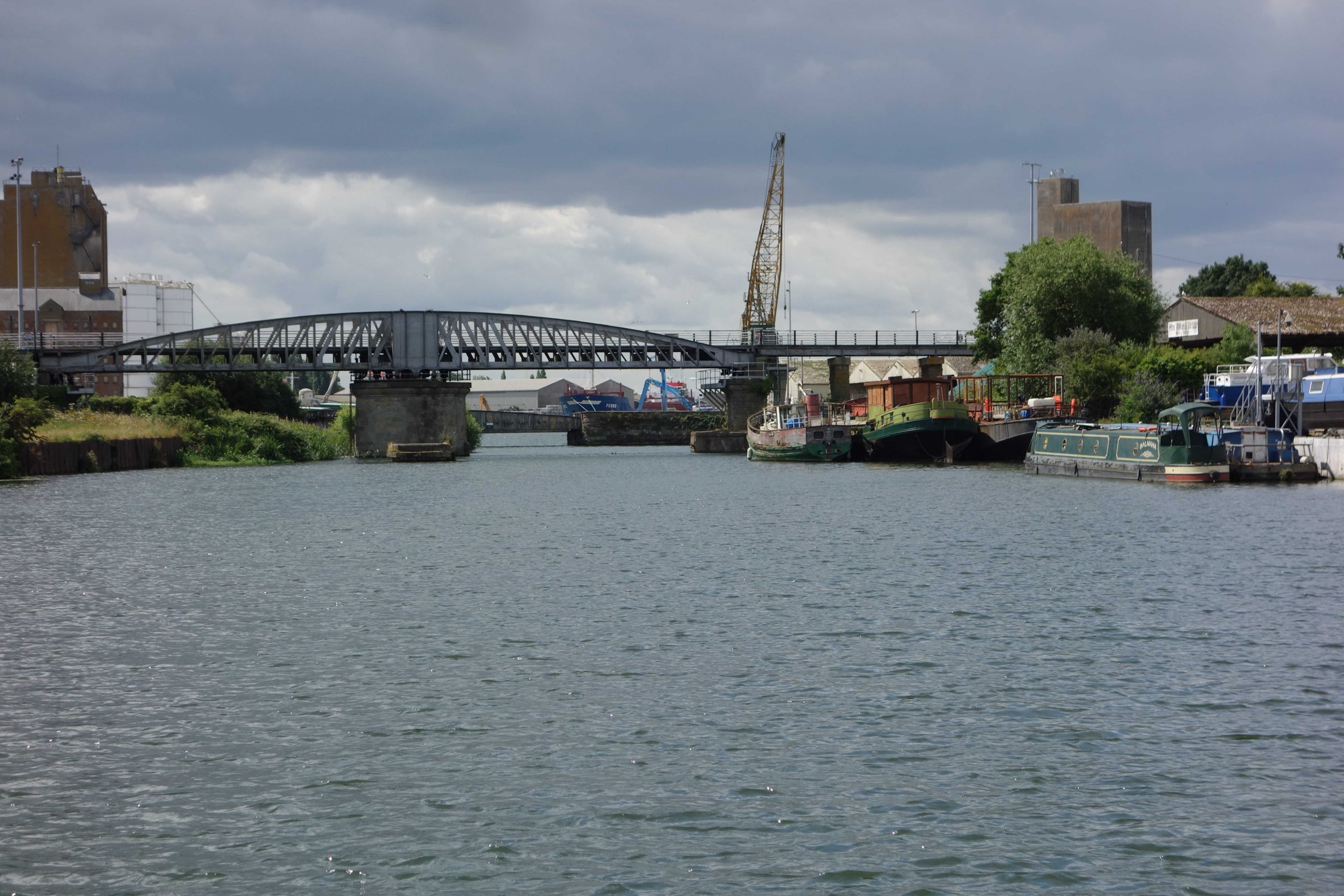
The tide had been out when the scout looked towards the road crossings in 2022. +Misery that he is, the scout is always gladdened by the sight of an empty path. He stopped to take the same view of the swing bridges, this time in sunshine. +
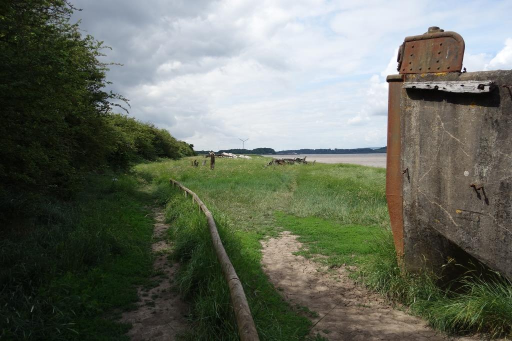
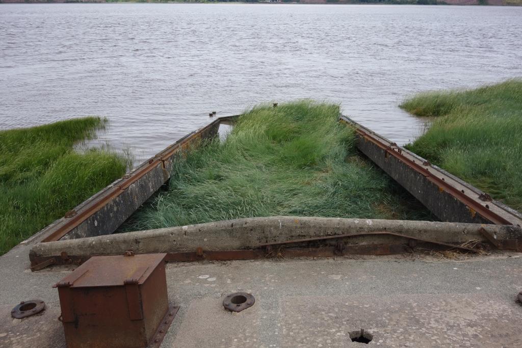
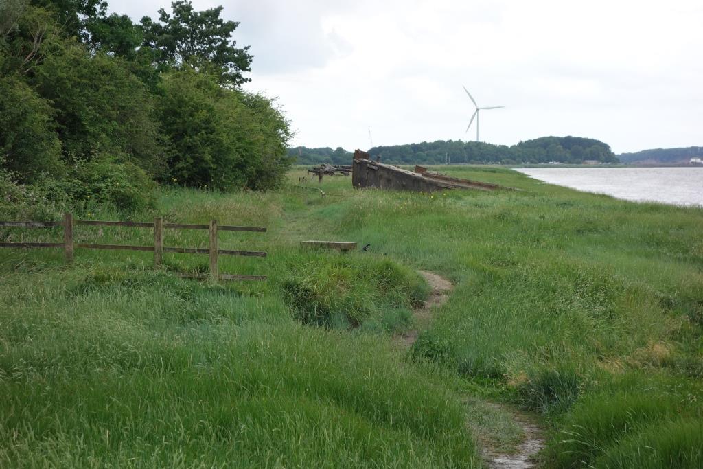
In 2015, the scout had seen old tubs beached at Lydney to help defend the bank of the estuary. At Purton there is another “graveyard,” the largest in mainland Britain, where all 86 hulks have been identified and recorded.
A path runs past them. The scout went down to have a look at the far end and chose a World War II ferrocement barge or lighter as a vantage point.Looking downstream from the bow of a ship built when timber was in short supply. The scout is familiar with concrete construction, because a yacht made of this material had been “berthed” on Bridford Mine while its owner worked on it on the early 1990s.
The old ship’s last function is to hold the mud in place.
Looking towards Sharpness from where the meandering loop rejoins the towpath.
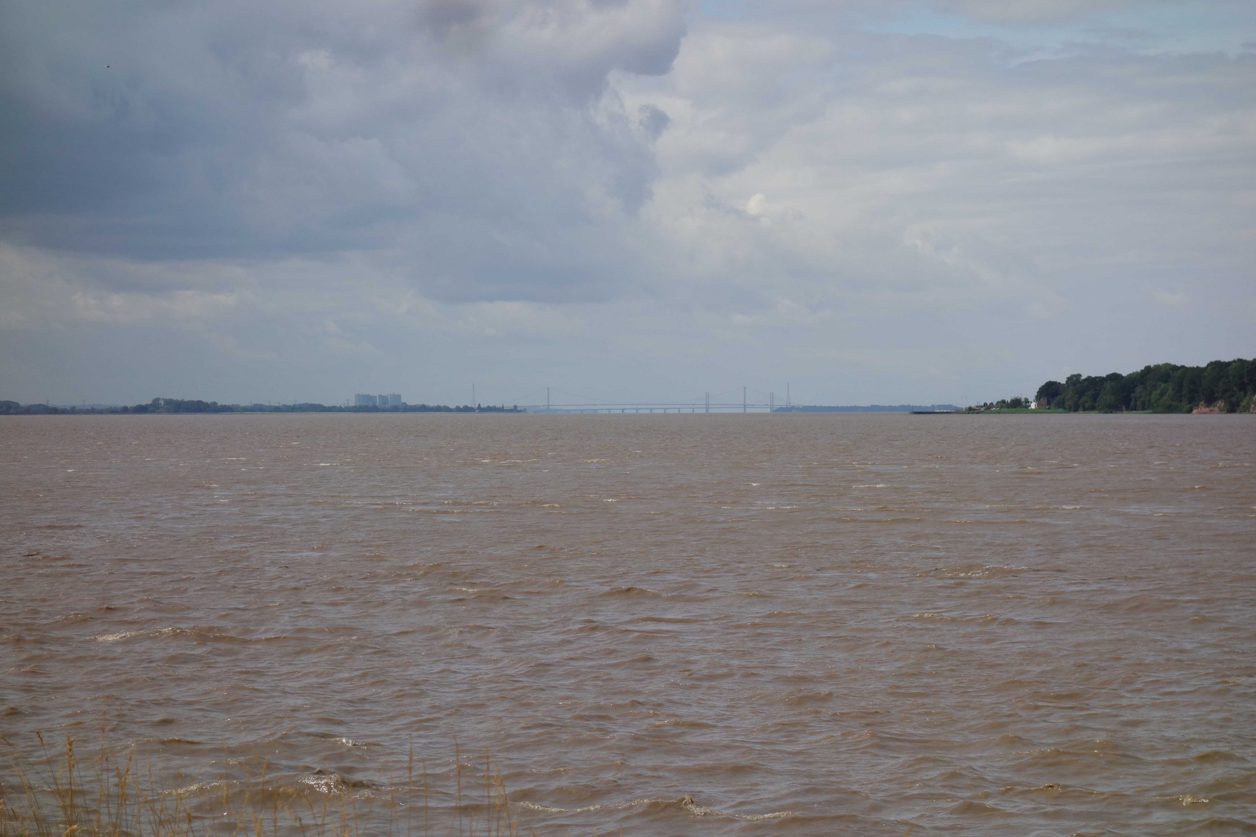
The memorial to the Severn Bridge Disaster. The two tankers had been making for Sharpness but, in the confusion of a heavy fog, were driven upstream by the tide. Their wrecks, blown up, can still be seen where they sank. The Severn is particularly treacherous above Sharpness, which was one of the drivers for the construction of the canal. +
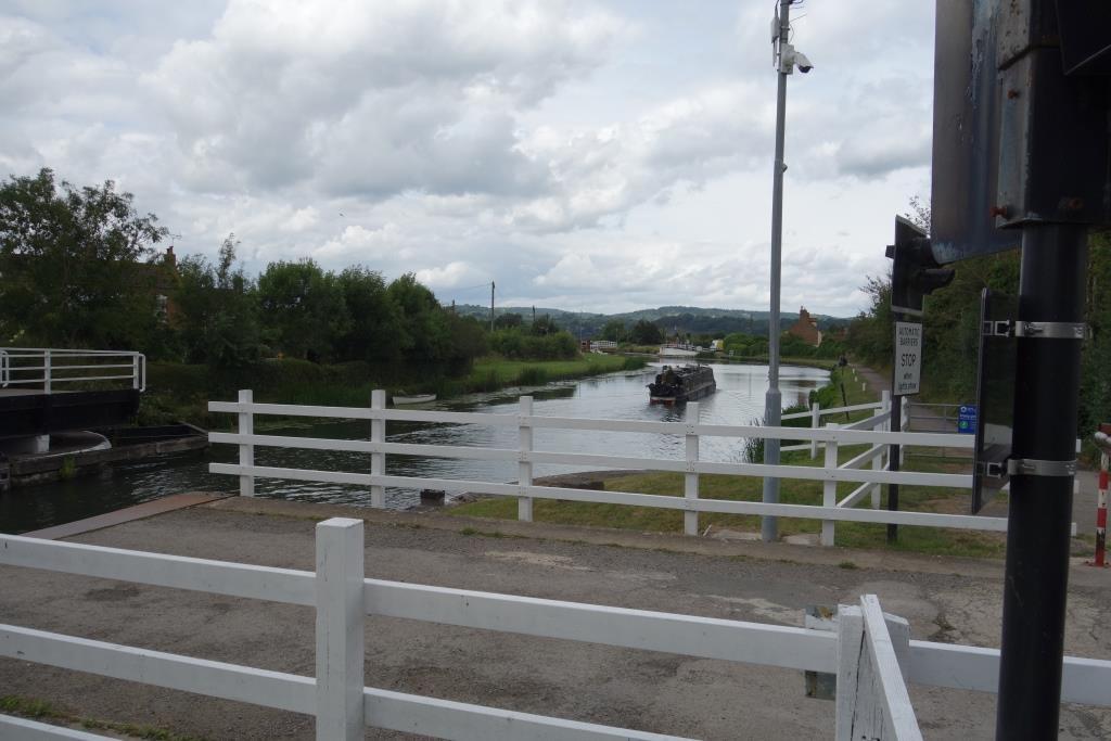
Soon after resuming his passage along the towpath, the scout came upon the first swing bridge. Not having done any reading and having only the experience of Exeter’s ship canal to draw upon, the scout was surprised to find that the bridge was manned. But this is a ship canal on a grander scale.
The bridgekeeper at Purton Lower was leaning on a railing outside his box and the scout called to him, asking how many times in a day he had to open the bridge for vessels, to which the reply came that it could be twenty or forty. Another bridge, Purton Upper, lay a short distance away, operated remotely by this keeper.
As the scout approached Purton Upper, the warning sequence commenced and the bridge began to open for a narrowboat, whose owner must have radioed the keeper.
A narrowboat makes its way towards Purton Lower …
… while Purton Upper closes behind it.
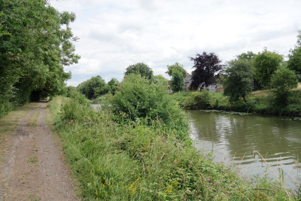
The path was not as good as the scout had expected; in places it was very poor, or not easy to ride a tourer with drop handlebars along. Signs warned that the path was only suitable for off-road bicycles. Very few people were met on the towpath. The scout was mindful that the rushes would not stop him going into the water, should he lose his balance, as he had done while riding alongside the Exe Estuary the week before.The view towards Gloucester from Patch Swing Bridge.
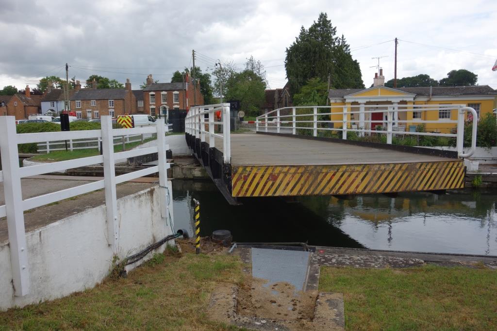
The keeper’s box at Splatt Bridge.
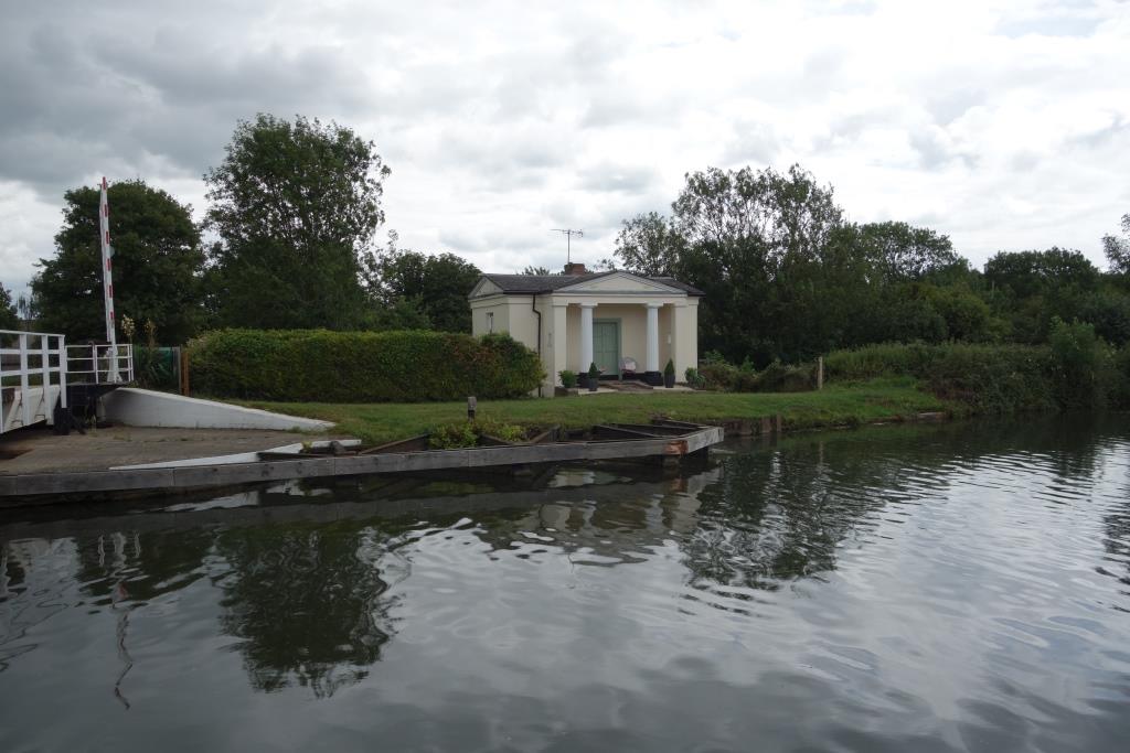
Passages during the night to catch the tide at Sharpness meant that keepers had to live by the bridges. This is one of eight Grecian-style houses that are now privately owned.
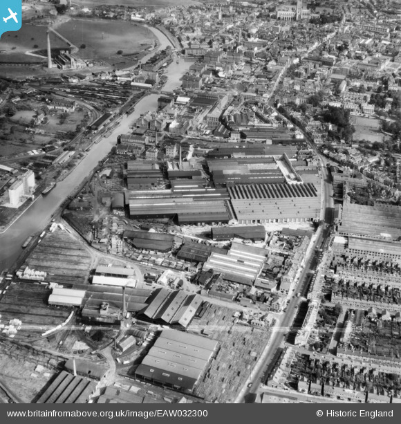
Part of the former Cadbury’s chocolate factory at Frampton, which closed in 1982.
The Cadbury’s factory in 1932. This was what England looked like before the infestation of scrub, when the countryside was well managed.
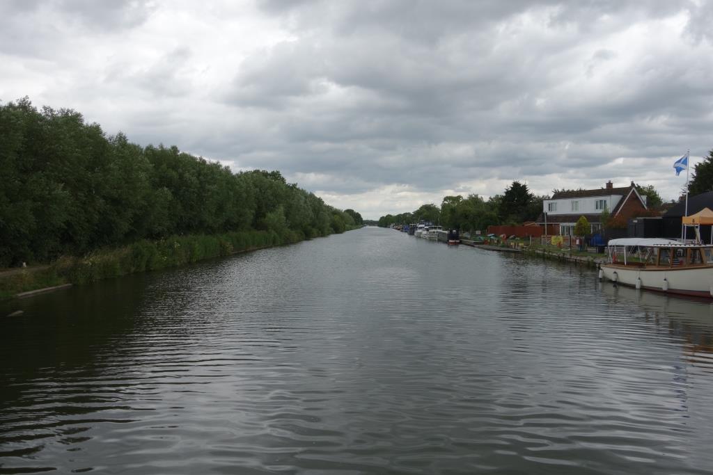
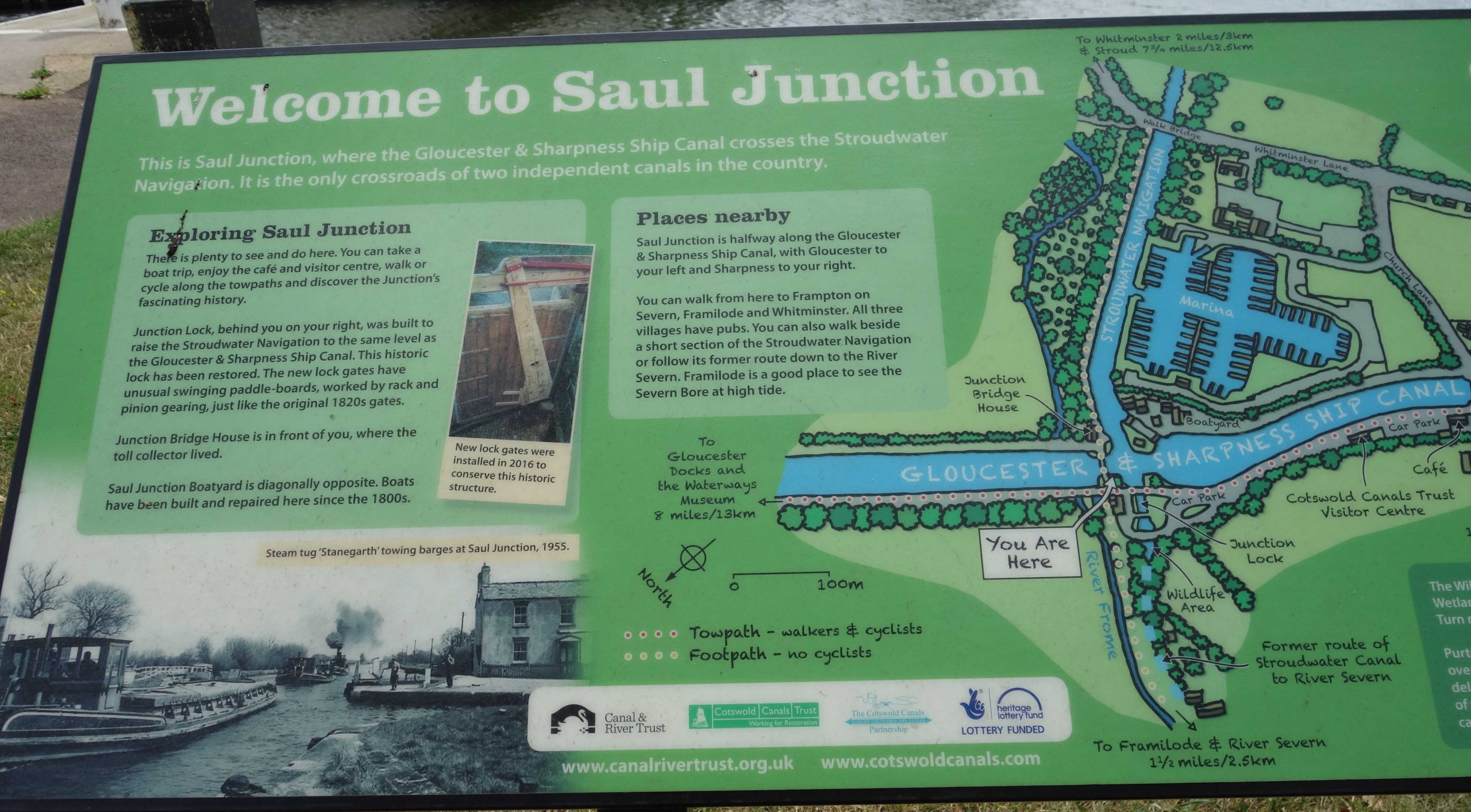
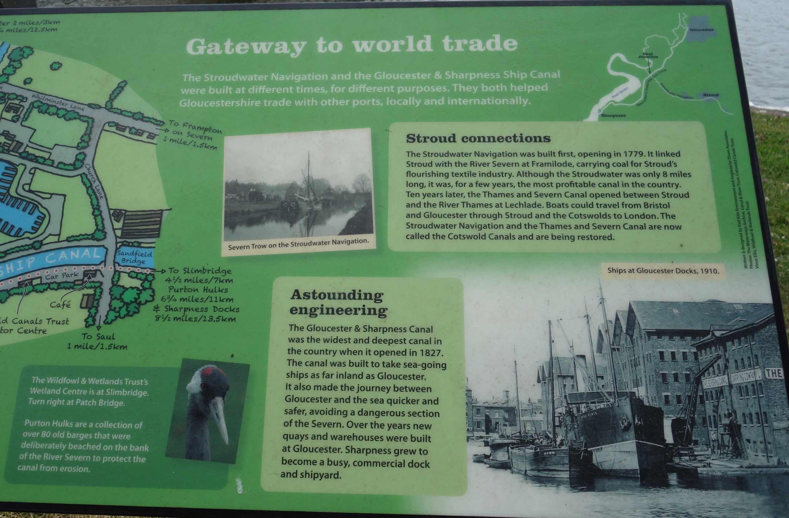
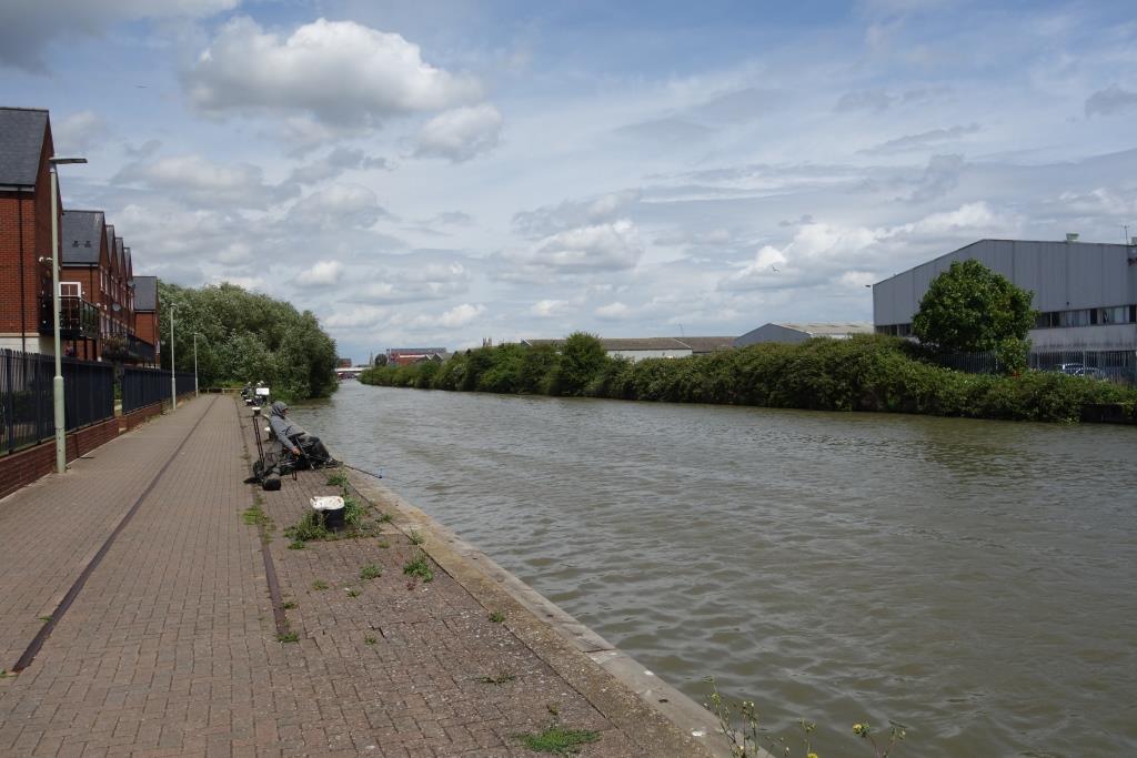
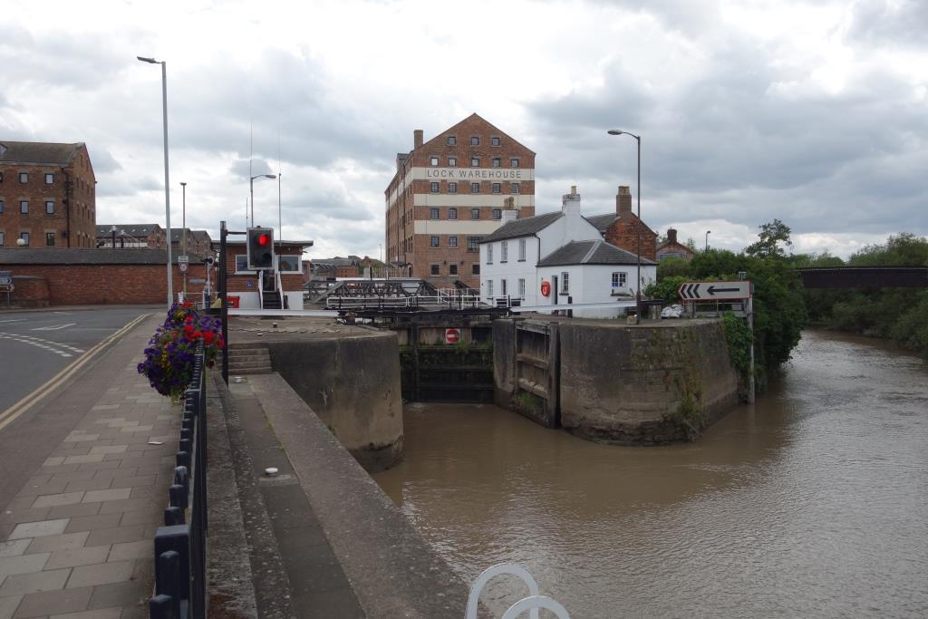
A little farther on is Saul Junction, where the Gloucester & Berkeley crosses the earlier Stroudwater. This is the only crossing of two independent canals in the country.
++The path was better in places but still needed constant attention, lest some defect pitch the rider into the water, which is up to 18 feet deep.
Netheridge Bridge was built in 2006 to carry the Gloucester’s south west bypass over the canal. It has sufficient clearance for most vessels to pass without the need for the bridge to swing. The scout did not know that a very severe bend in the canal was straightened and that the bridge was built on the new cut. Two arms of the former alignment, always a constraint on shipping, remain but the scout did not notice what had been done, being somewhat in awe of the new bridge. In the end, the historical reason for the bend was overcome by road development, long after commercial shipping had ceased.
The scout guessed that behind the brick facing of this buffer lay a very strong lump of concrete.
Way back along the path, the scout had spotted a purple bag which looked as if it had been dropped. If he could have been sure that he would be taking it in the right direction, he would have picked it up.
By the time he reached Hempsted Bridge, the one beyond Netheridge, he had forgotten about the bag; that is, until he came upon an older cycling couple. The lady asked if the scout had seen a bag and he was pleased to be able to say that he had, but regretted having to tell her how far back her chap would have to ride to retrieve it. The scout was certain that it would still be beside the path but naturally felt rotten that he had not been able to hand it over.
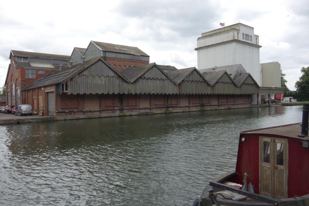
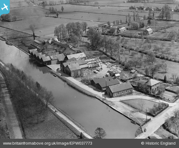
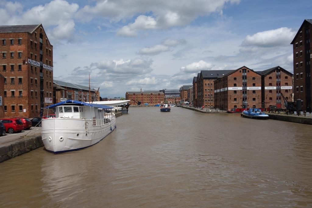
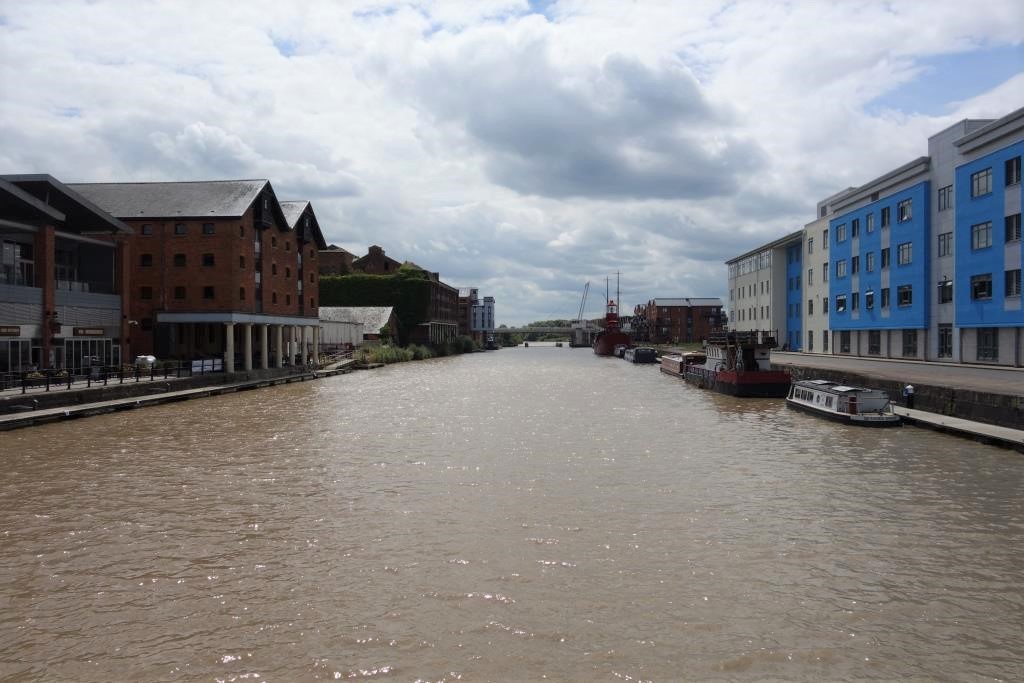
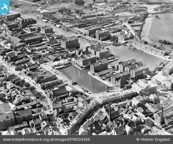
The scout was surprised that the path left the canal for a short distance. It soon emerged onto an expanse of wharf where the first rails were seen embedded. These were modern “plants” but there were lines to the left, reached by way of the New Docks Branch. On the opposite bank, in the distance, there was once the large factory of the Gloucester Railway Carriage & Wagon Company. The cathedral is just visible to the left of centre. Gloucester Railway Carriage & Wagon Works is seen at the centre of this 1950 aerial view, with timber yards below. Llantony Yard and the East Channel of the Severn are at top left. The cathedral is at top right.On the opposite bank once lay timber yards.Looking from beneath the new High Orchard Lift Bridge, lines which tally with the O.S. are seen. These once led from Llantony Yard and continued along the wharves. Lightship “Sula,” built in 1959, is seen moored. She now offers accommodation and caters for events.From Llantony Bridge, the docks are seen, now surrounded by gentrified warehouses, labelled as if they were still functional. The lifting bridge, which the scout saw operate, was once a swing bridge which carried a railway.Looking back towards Sharpness from Llantony Bridge.A former British Waterways’ building was home to a furniture recycling project.
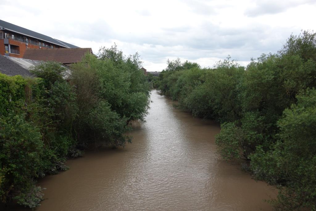
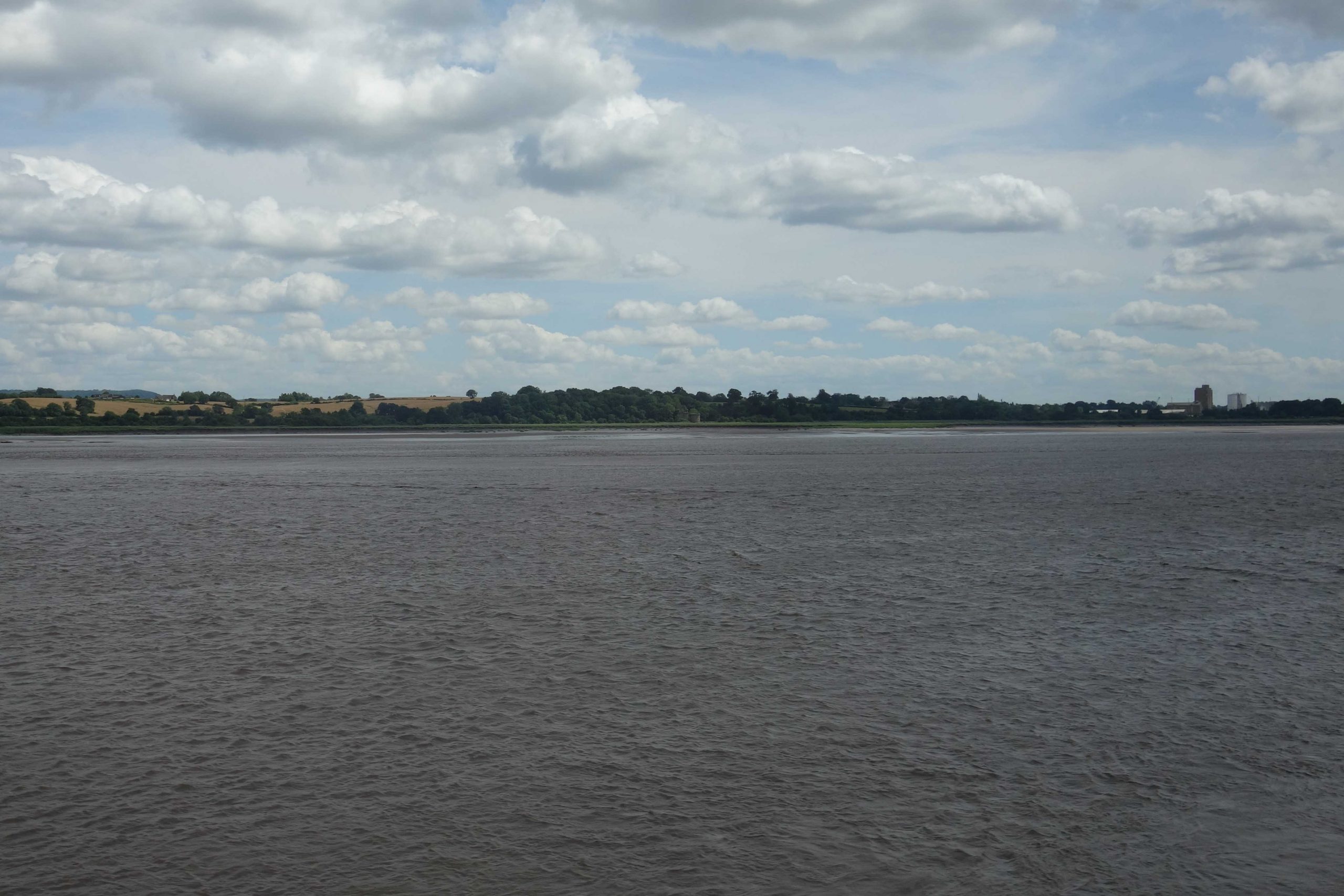
What the scout had thought was perhaps a man-made East Channel of the River Severn, is in fact an original, or near-original, course. The scout is looking downstream from a footbridge.
The lock which connects the docks with the East Channel and the rest of the waterway network. North Warehouse is seen at left. The lock has a lift bridge across it. This had once been a swing bridge with a railway track. Seeing a fellow in the control cabin here, the scout realized that this was his last opportunity to ask the questions that had come to mind on his ride, so he went to the foot of the steps. The Canal & River Trust employee was happy to talk at length about the organization and the canal and wished the scout an enjoyable ride. Bristol extracting for the city’s water supply provides a considerable income for the canal.In this 1928 view, Victoria Dock is at centre. The G.W.R. Docks Branch is at top right, where it crosses the East Channel by means of a swing bridge to reach Llantony Yard.
The scout had in mind a train to Chepstow which would allow him to continue his ride and get back to Temple Meads in the early evening. This did not leave much time for a tour of the city and certainly did not allow an exploration of all the railways which have been obliterated.
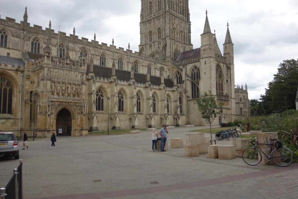
He went for a quick look at the Cathedral Church of St Peter and the Holy and Indivisible Trinity and then did some more wandering in the general direction of the station.
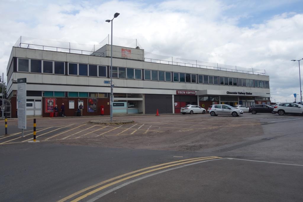
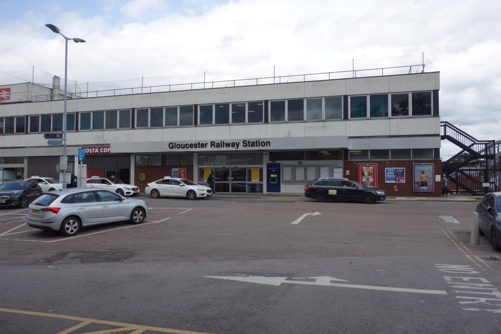
The dismal frontage of the station, since the closure of the former Midland’s Eastgate in 1975, the only station in Gloucester. This was the G.W.R. station, Gloucester Central under the Western Region.Had the scout known that there was a Pumpkin at the station, he would not have bought his lunch at a nearby convenience store. Nevertheless, doing so enabled him to wander around the station before his train left.
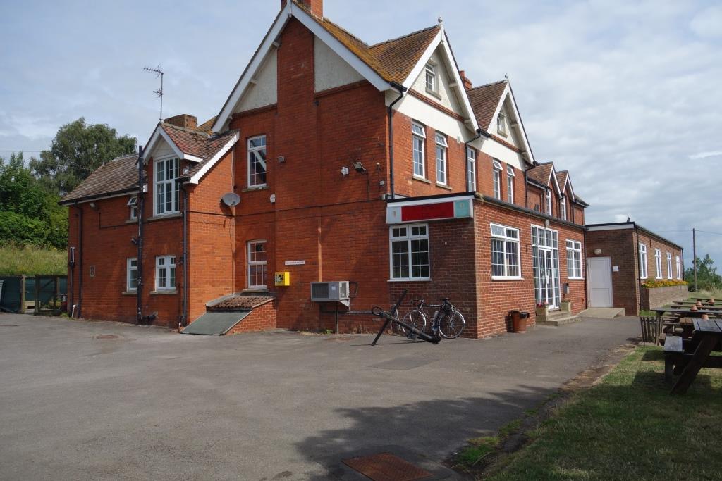
The Station Hotel where the scout stayed the last time he was here. He had caught the bus to Alan Keef’s annual open day near Ross-on-Wye and the following day he went on to Kidderminster for a trip on the Severn Valley line.
It is certainly not always the case in towns and cities that railway and bus stations are close together. Exeter is an example of a distant relationship between the two.At 659 yards, Gloucester’s Down platform is the longest unbroken one in the country. The line is now bi-directional and a crossover suffices instead of a scissors. +
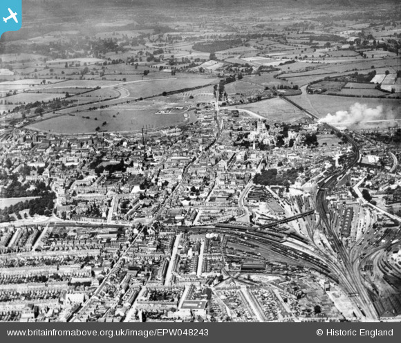
Copyright: Roger Joanes. Shared under Creative Commons. +The bottom right is dominated by railway installations: the Midland station, later Eastgate, with the Great Western’s, later Central, above. The long footbridge linking the two passenger stations stands out. Lines to Cheltenham, Bristol and Swindon leave the picture at bottom right; the Midland’s line to Tuffley Junction goes off at left; and the line to South Wales is seen heading for top centre. The A4073, a Roman road, passes through the centre heading for the Over Causeway.
From the train, the scout looked across at the canal which he had followed earlier. The pillar of the swing bridge and the abutment can be seen at centre. +
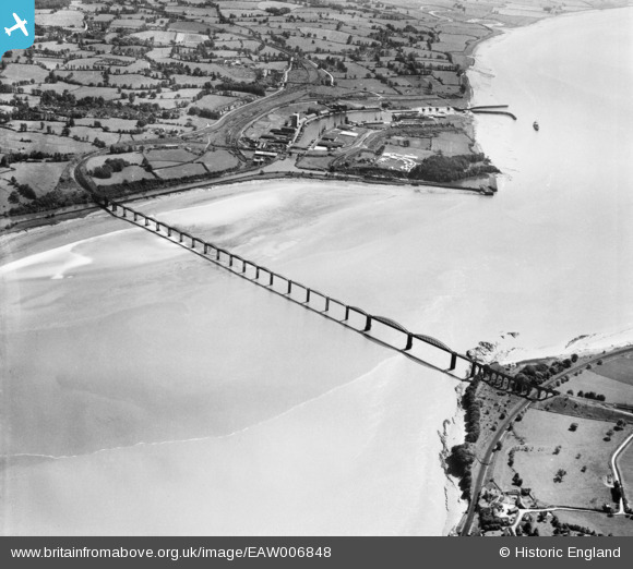
In this fabulous 1947 view, the Gloucester to Newport line is seen passing beneath the Severn Bridge approach viaduct at bottom right.
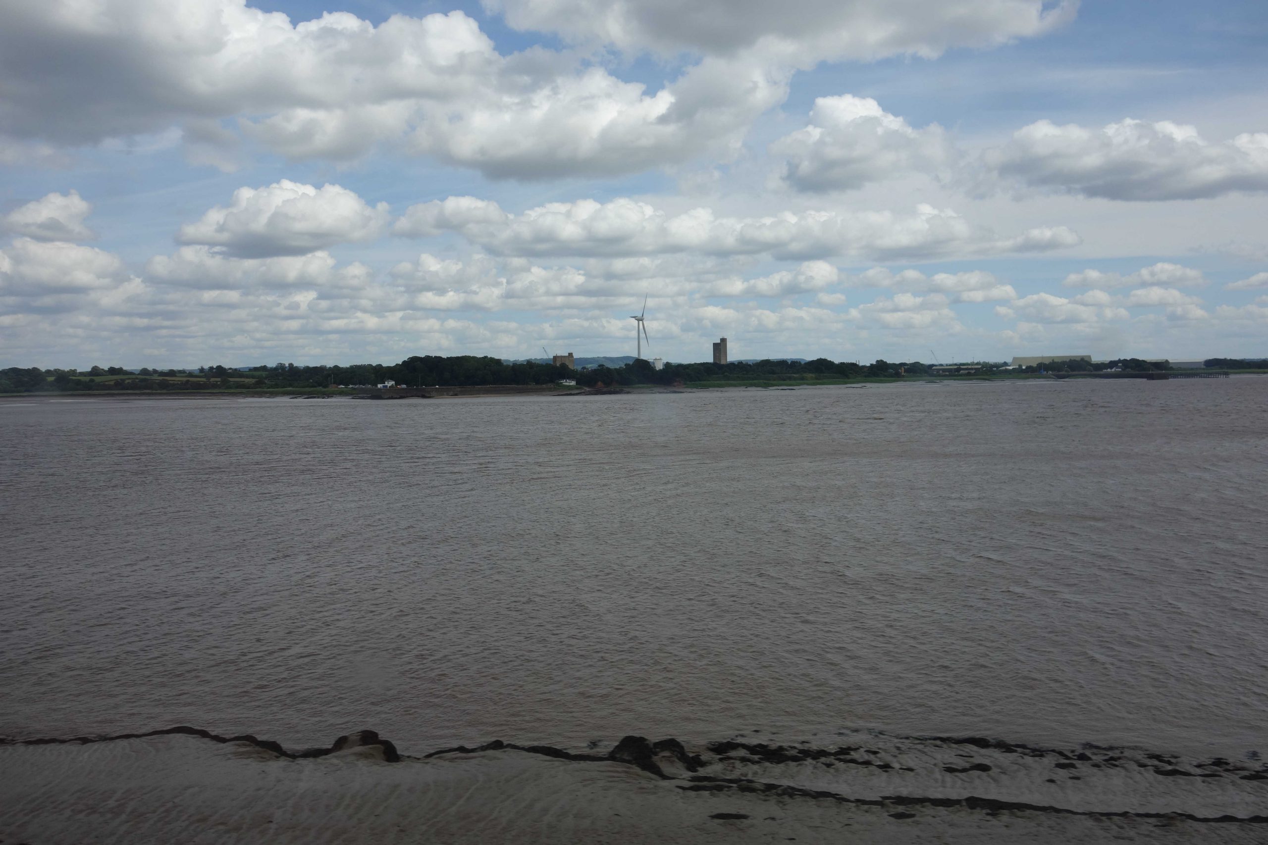
Sharpness from the train. +
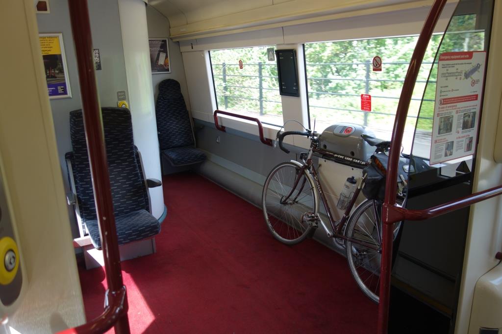
This space on the Class 170 D.M.U. is reminiscent of the guards’ compartments that the first generation of units had, but it has to be shared with seated passengers, disabled people and pushchairs.
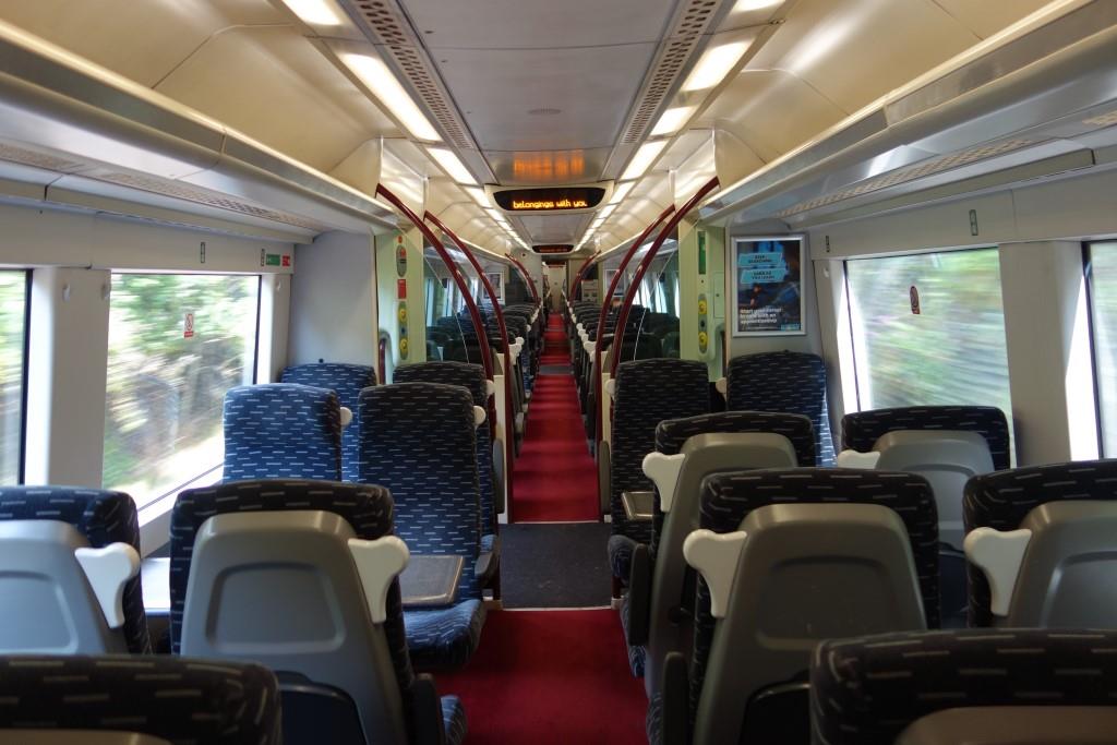
The service was very sparsely laden.
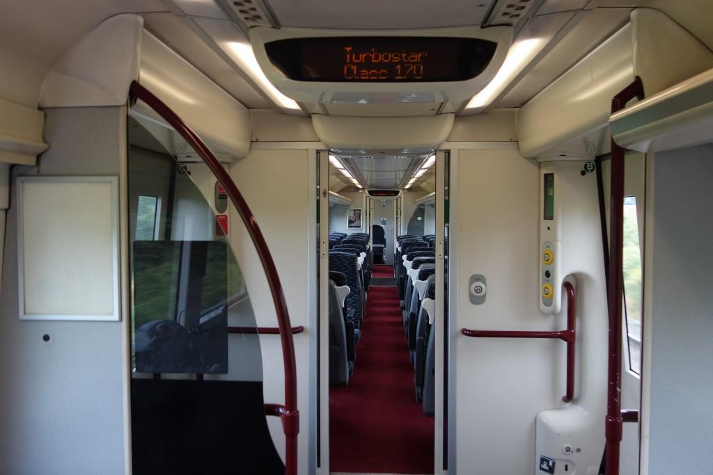
Before the train left Gloucester, the scout had seen that the door to the driver’s cab was open so had gone to have a look. The driver was lurking on the passenger cushions and pushed the door to, with: “I can’t let you photograph there.” But he was happy to chat about the units and the work.
It is doubtful that many passengers want to know what class of unit is provided.
Chepstow
Looking back towards Gloucester. A line descended beside the embankment leading towards the bridge over the Wye to serve Bridge Works (iron foundry and engineering). Lines served the later shipyard below the station. The main span of Brunel’s tubular suspension bridge was replaced with an underslung truss girder in 1962.
This 1921 photograph captures a magnificent scene, far removed from today’s sterility. The station is at centre left. The First World War National Ship Yard dominates. This became Fairfield’s. A housing estate is now being built on the site. The railway’s Chepstow Bridge can be seen, with the line to Gloucester leaving the picture at top right. When he got home, the scout looked through his papers and found the wording on the maker’s plate attached to Marsh Barton Bridge in Exeter. “FAIRFIELD S & E [Shipbuilding & Engineering] CHEPSTOW, MON 1960.”
For some reason the early station had almost continental platforms. In an extraordinary move to rectify this inadequacy, in 1877 the whole station building was lifted 22 inches. Firstclass Café keeps the building in use.
In the back of one of the publications held at Christow, this was found, with the S.M.O., Chepstow stamp. The stamp would soon be replaced because the G.W.R. had ceased to exist on 1st January. In deciding upon a three letter code for Christow, “CHR” was chosen and “CHW” was allocated to Chepstow. +
The scout had once ridden here from Severn Beach but had not ventured into town. This time he continued across the busy A48 bypass to Beaufort Square.
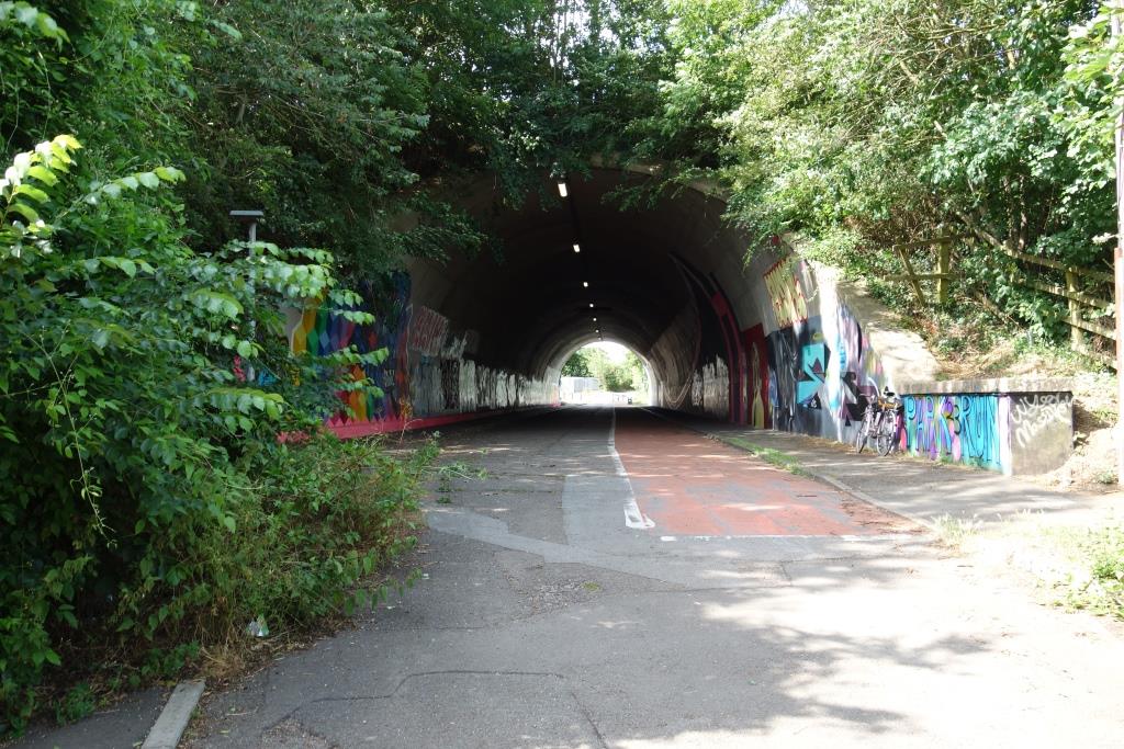
It was about a mile and three-quarter ride from the town to the start of the path leading to the downstream side of the Severn crossing. The scout has just passed through the tunnel beneath the M48 and is about to climb the path which goes off to the right by the painting.
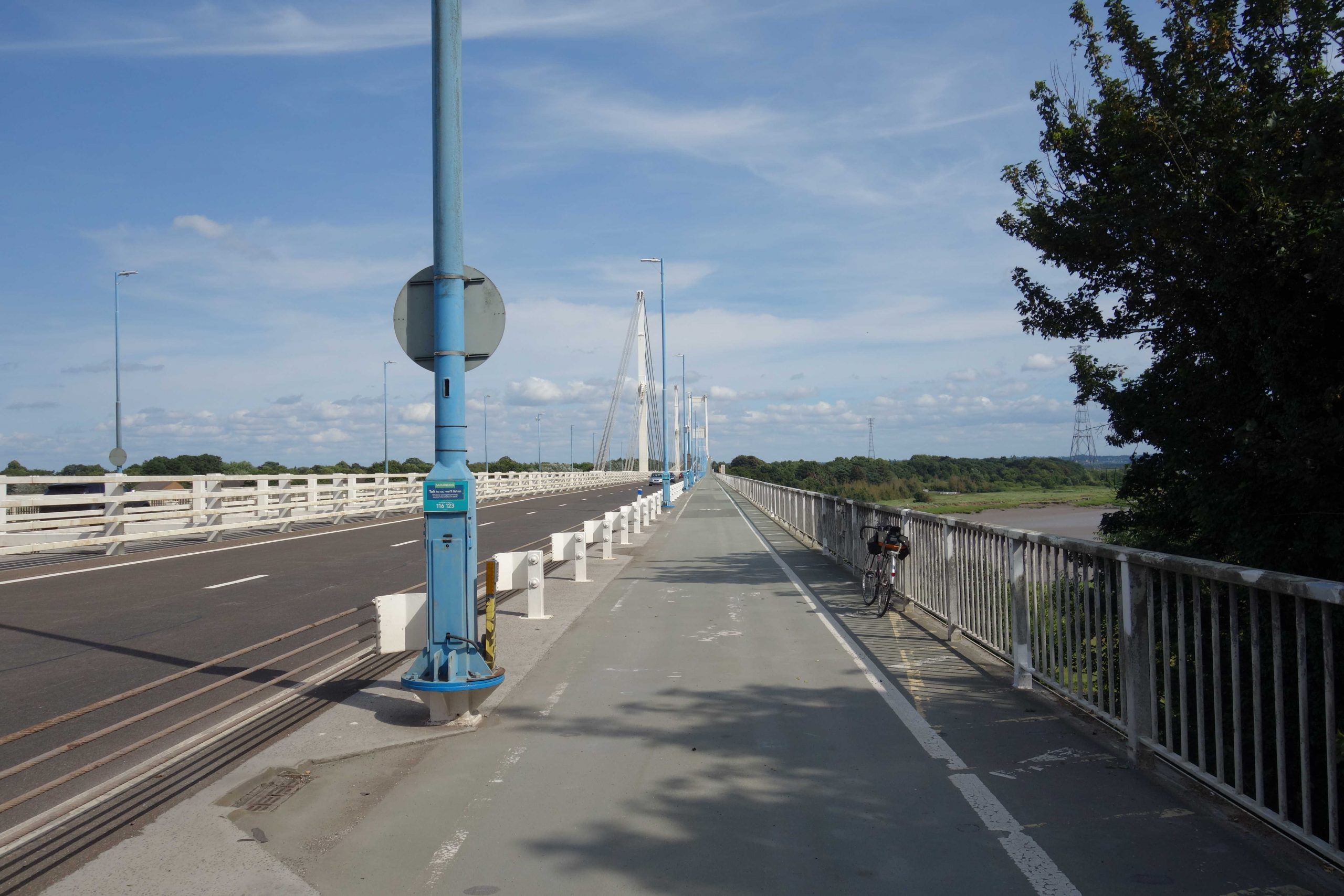
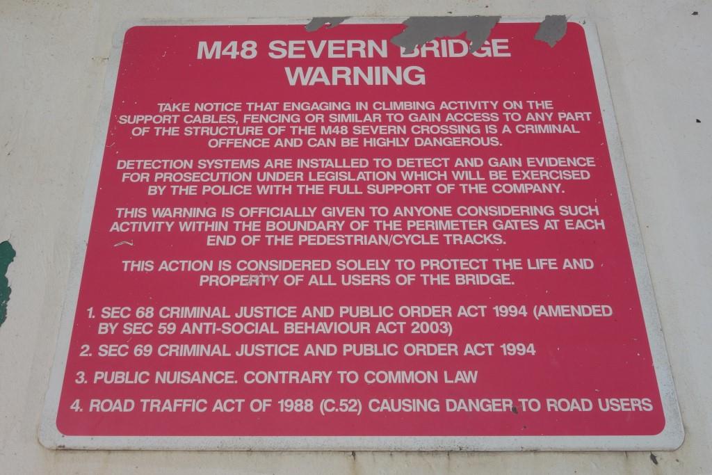
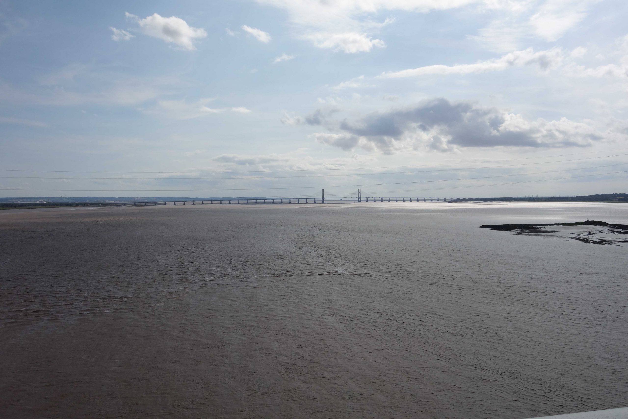
What is commonly referred to as Severn Bridge is in fact four separate structures, starting with the cable-stayed Wye Bridge.
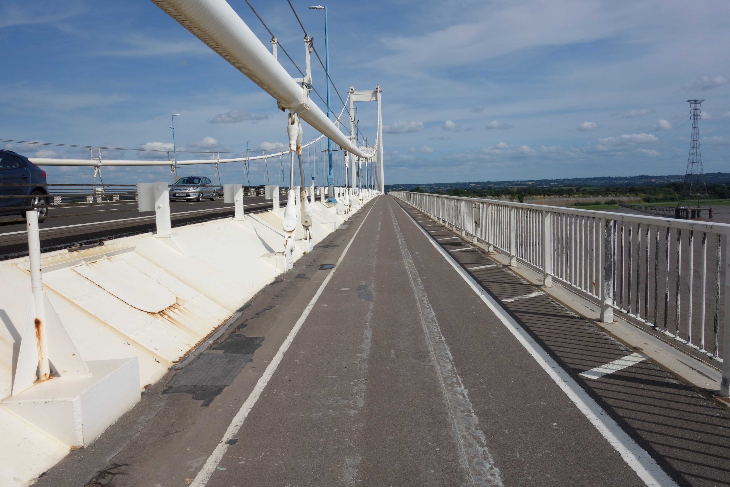
The scout was expecting the wind to be stronger than it was when he ventured out onto the first bridge. He wondered under what conditions the path would be closed and was later surprised to find this advice from National Highways: “We don’t routinely close the shared paths during wind events. We may need to close them if there is a critical incident on the bridge or a severe storm. Otherwise shared paths will remain open.” +
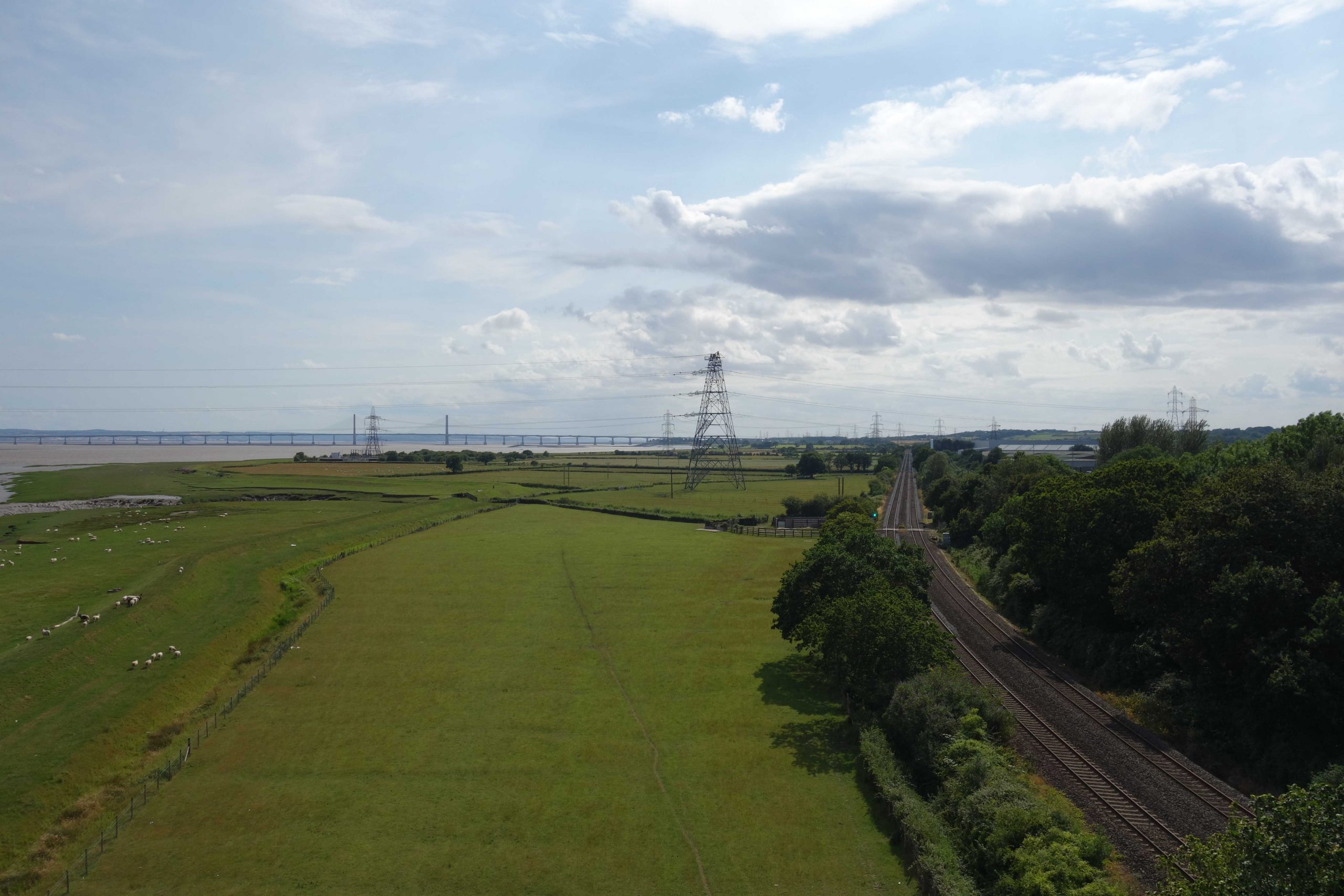
The South Wales line passed beneath the bridge. +
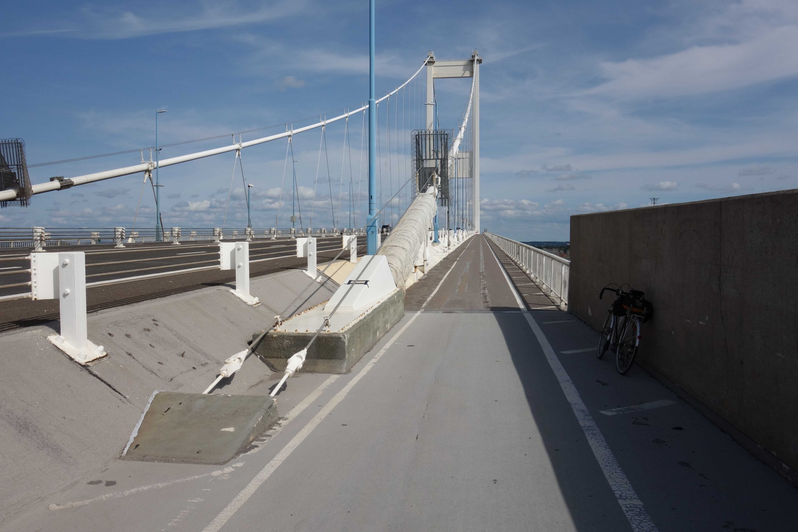
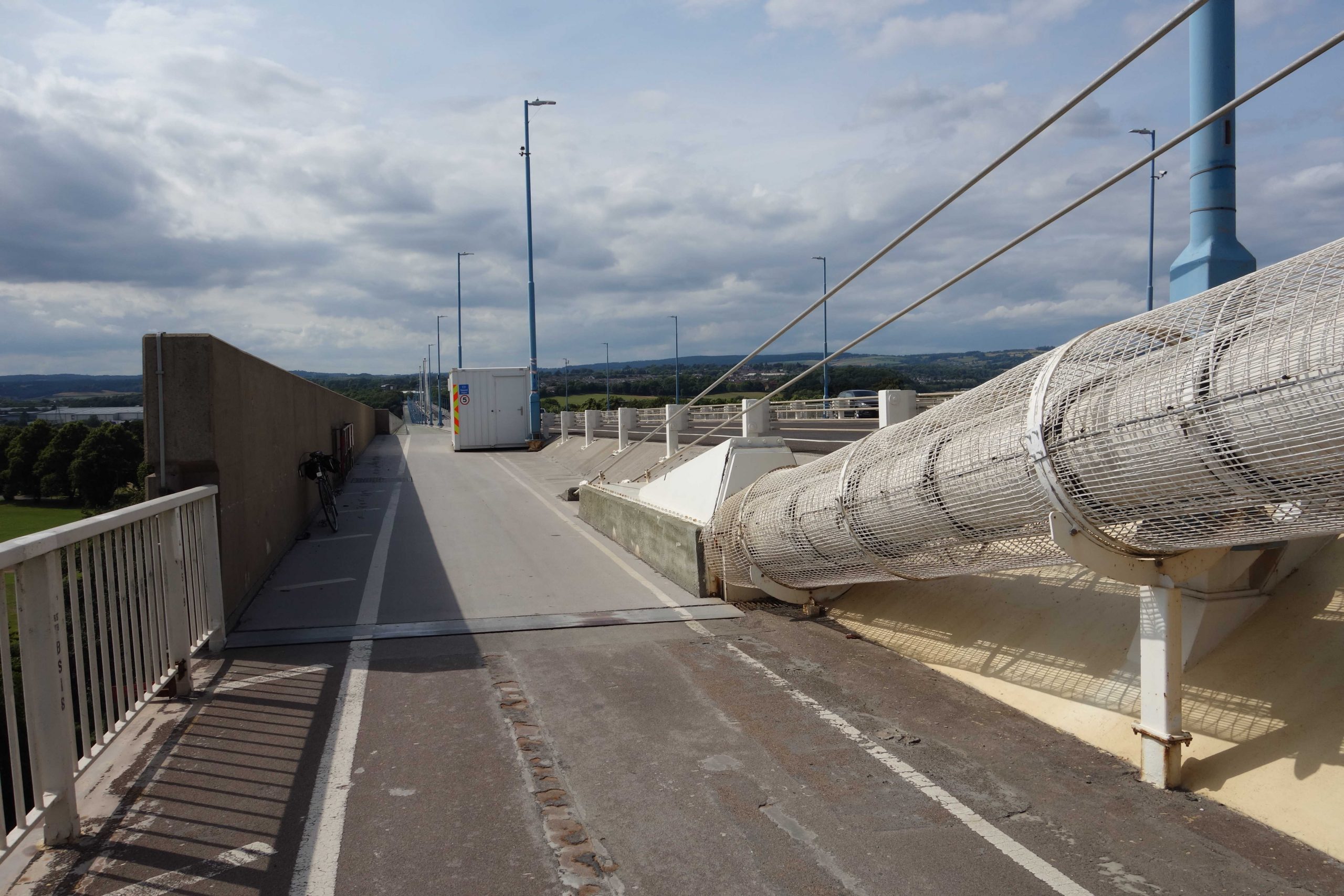
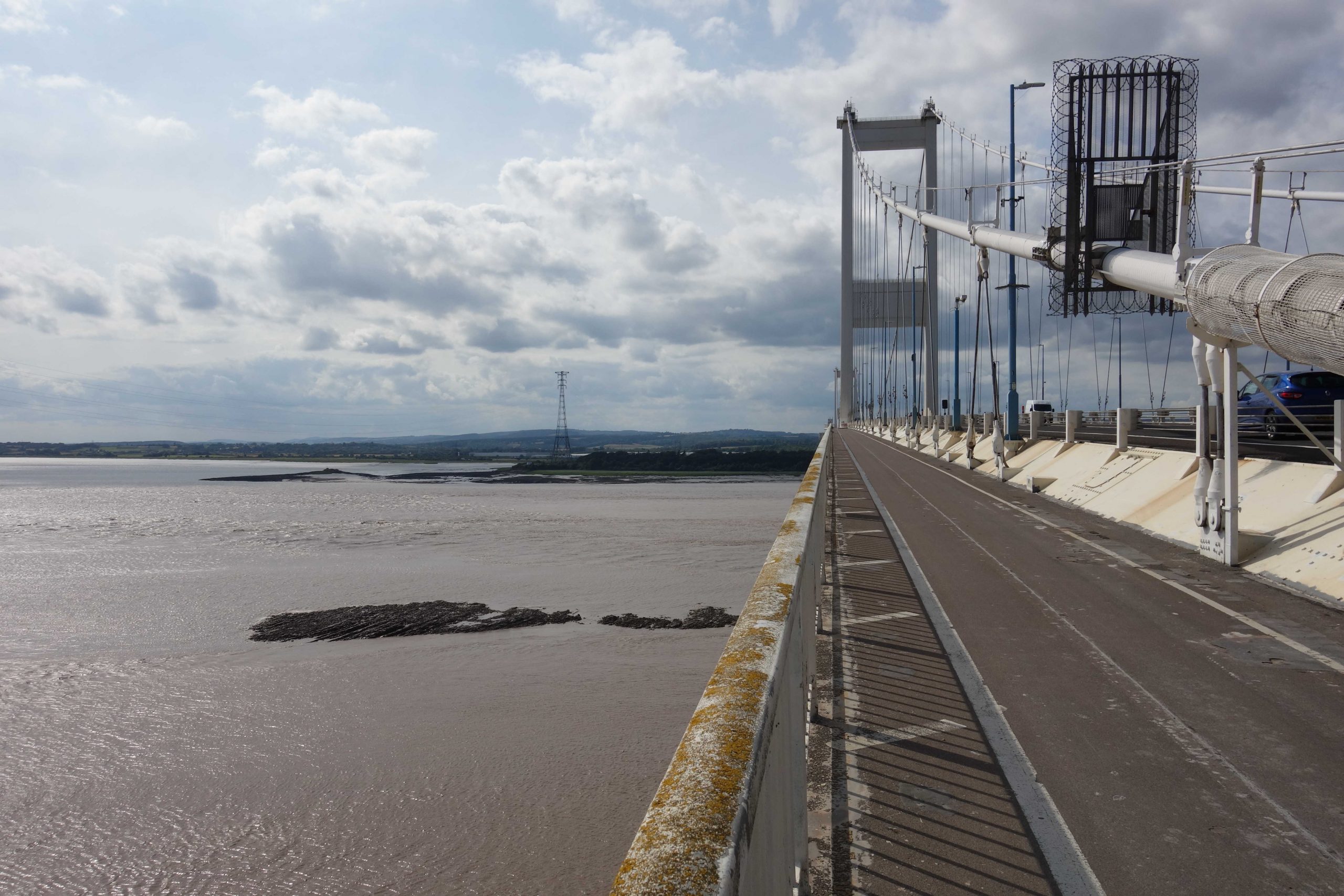
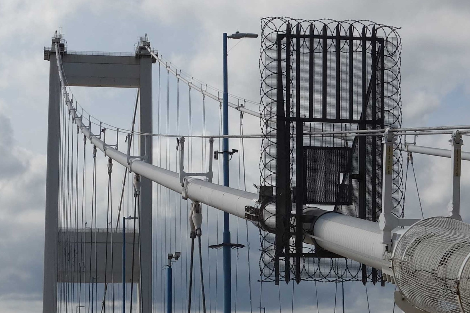
The scout has crossed the Beachley Viaduct, supported by concrete piers, and is about to climb to the first tower of Severn Bridge. He is standing on the massive cable anchorage. + The scout has always wondered whether it would be possible, with a large angle grinder, not to cut the cable, but so weaken it that the bridge would have to be closed. Perhaps it is appreciation of how vulnerable this section of cable is that it is protected by a cage. +
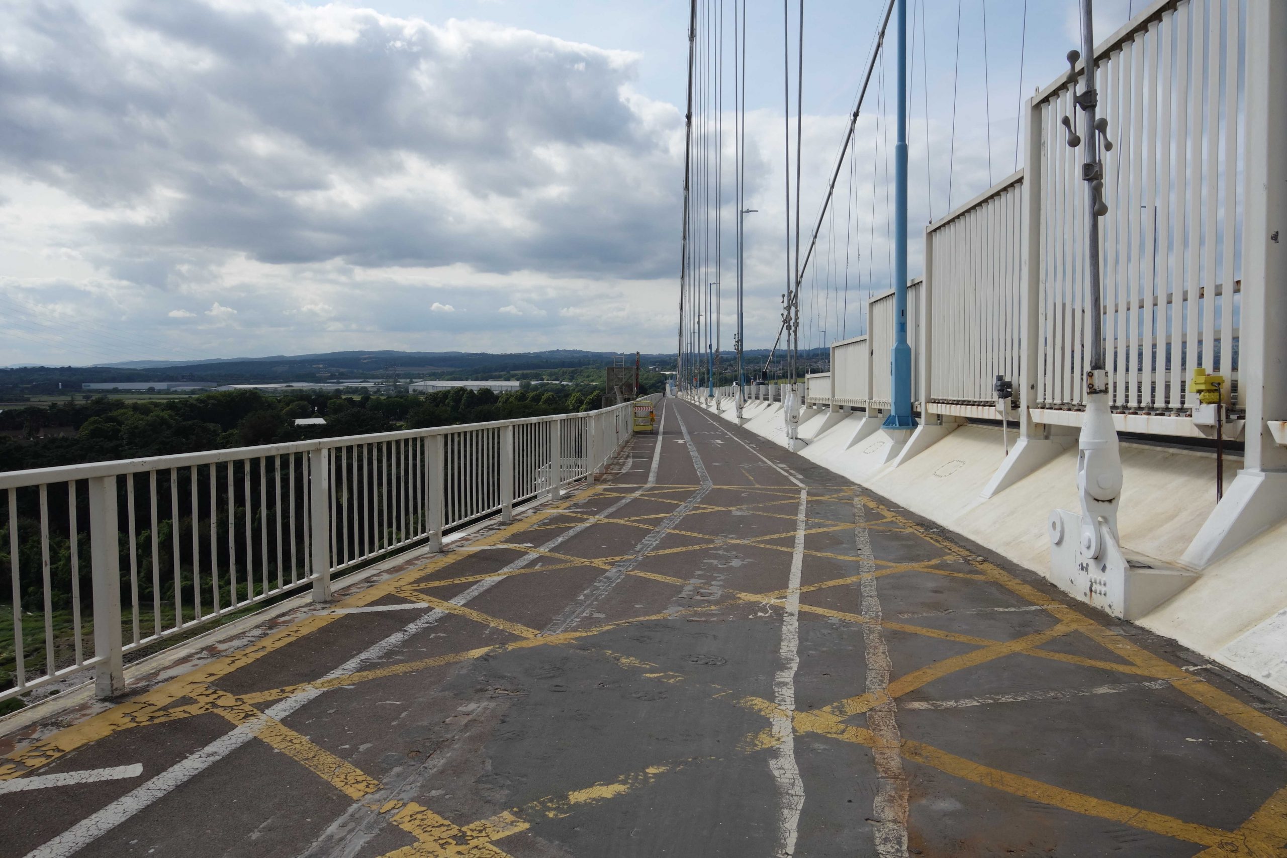
The panels at left are thought to prevent or reduce winds eddying around the towers. +
The steel towers can be climbed inside. +
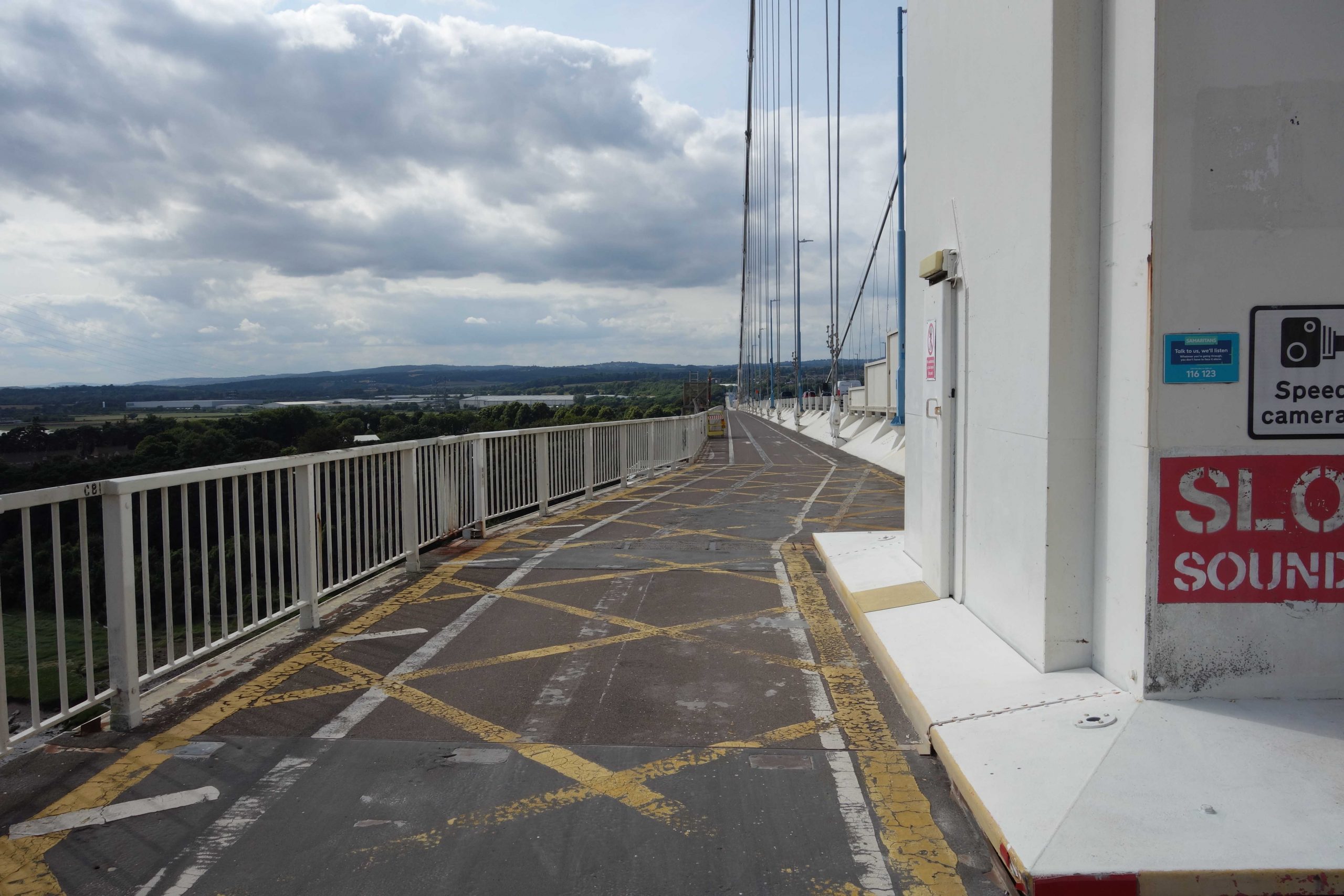
Looking back towards Wales. +
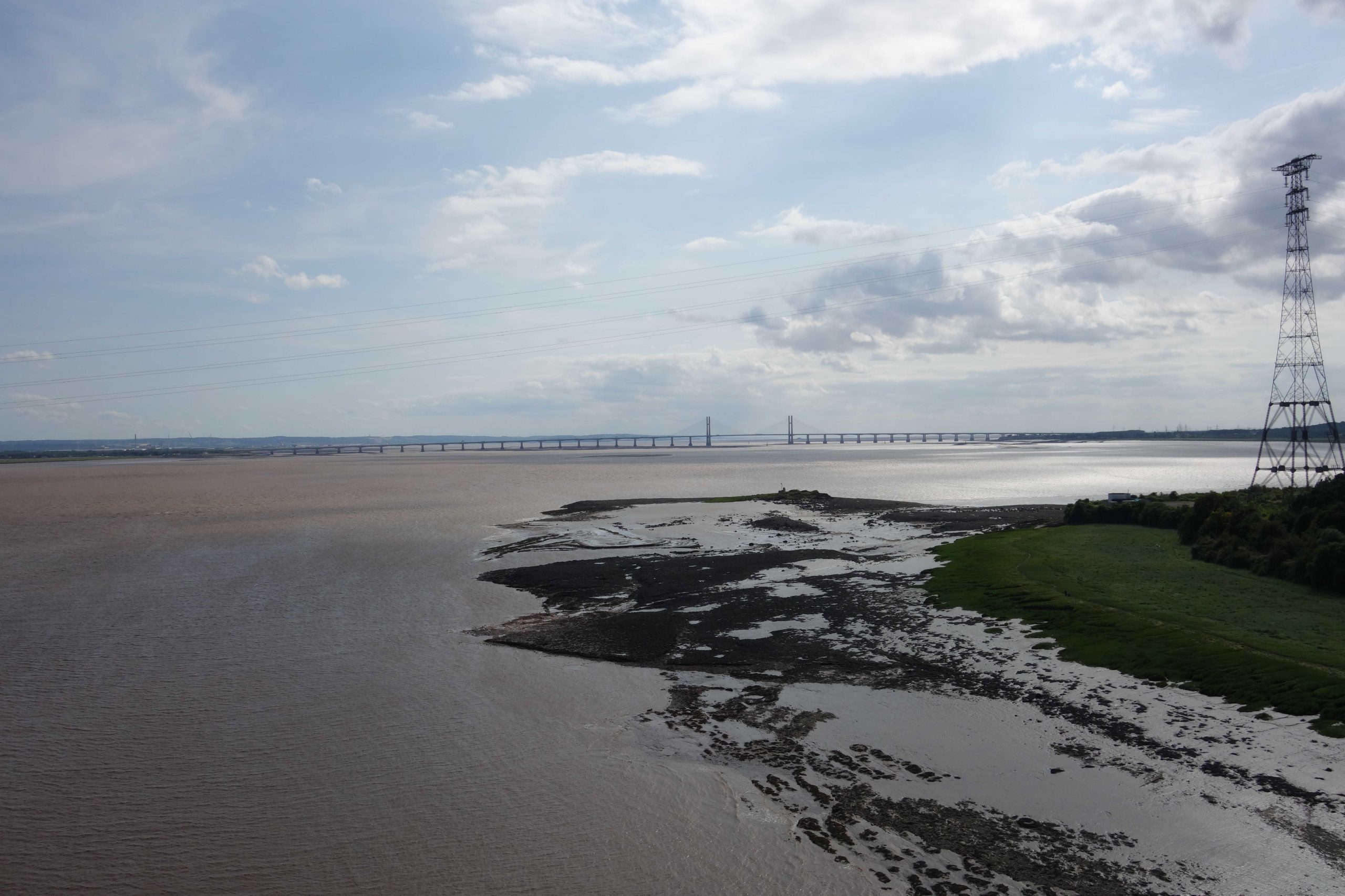
There was a shipyard at Beachley with a lot of accommodation for workers. A web of lines served the complex, at the end of a line which joined the South Wales near Wye Valley Junction in Sedbury. + At the centre of the suspension bridge. The aerodynamic steel deck sections were made in Chepstow by Fairfield-Mabey and floated down the Wye. +Downstream is the Prince of Wales Bridge carrying the M4, opened in 1996. Denny Island is framed by the cable-stayed Shoots Bridge at centre. + The view back towards Beachley. +
The very hostile gate is not there to stop Teign Valley staff climbing the cable. +
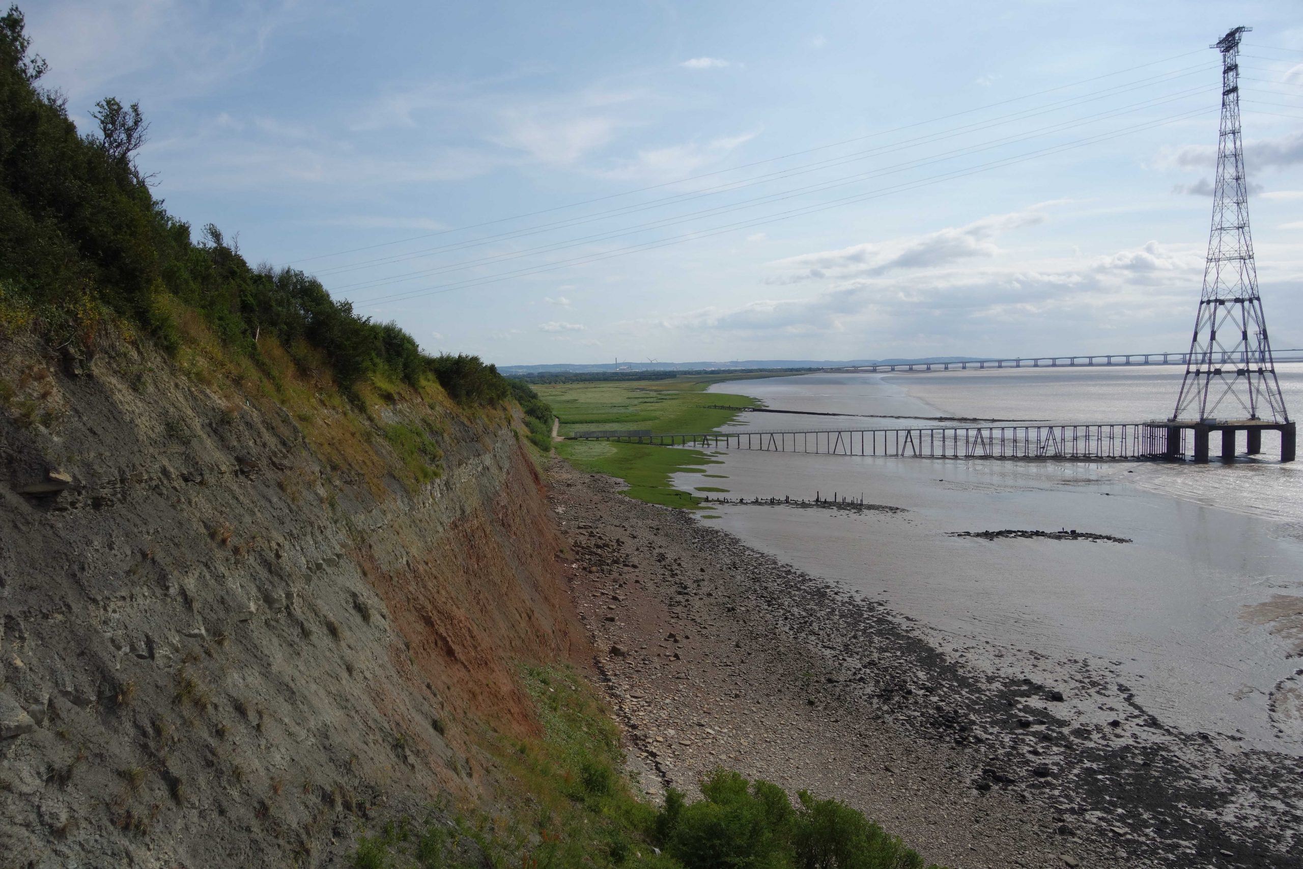
The pylon stands at the end of a jetty presumably because it is at the maximum span from Beachley. +
The scout has reached the cable anchorage on the English side.
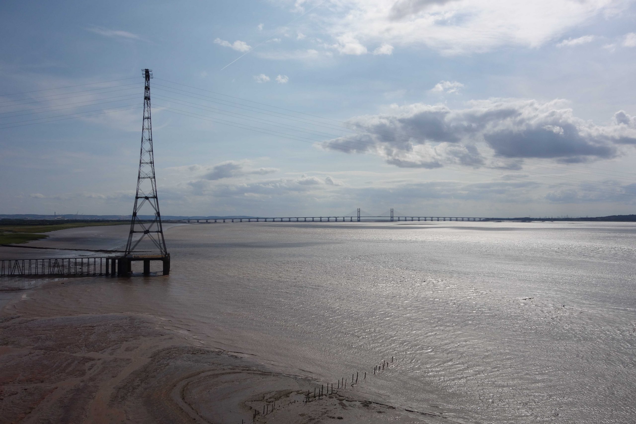
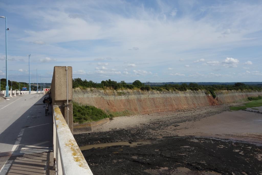
And now the scout has crossed the Aust Viaduct to reach the land, where he gazed for a while at the fascinating cliff face. Fossil hunters are known to search the beach below for newly exposed evidence of life long ago. +
The scout followed the bridge access road and turned onto Passage Road, which was blocked part way because of flood defence works. The scout did not think to go and look at the nearby old pier, from where, until 1966, a car ferry crossed to Beachley. A photograph from Old Passage would have been a fitting end to his series. Aust had been a crossing point since Roman times.
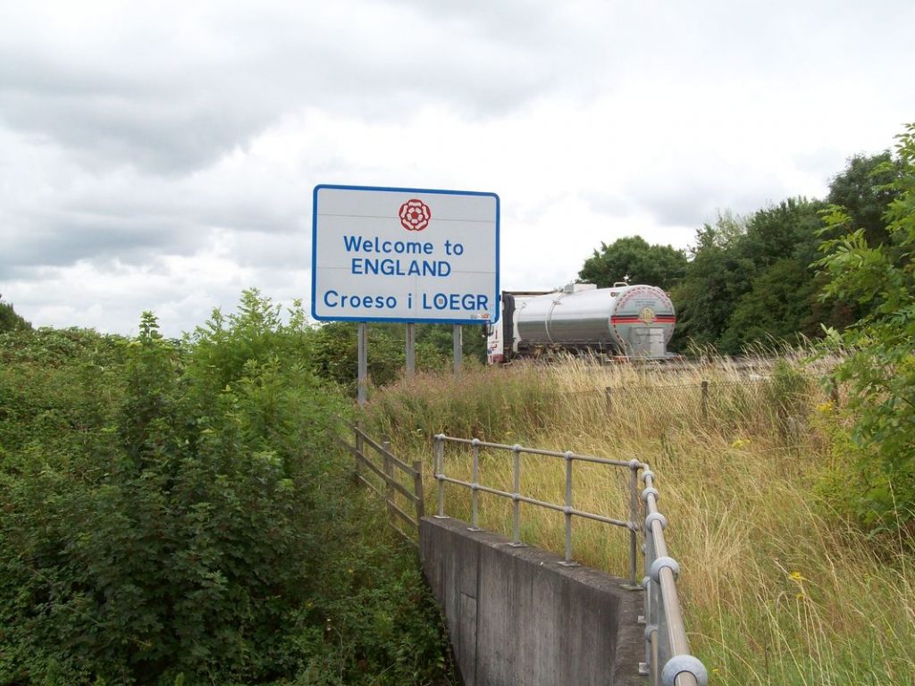
After a quick detour to look at the village, the scout headed along Severn Road, turning onto Northwick Road and then following a path beside the M4. This took him past the “Welcome to England” sign, which he remembered seeing in 2017.
The sign was more visible in 2017.
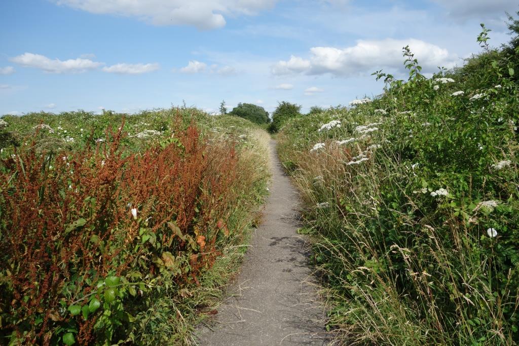
The scout wonders how in the long run the counties are going to maintain all the miles of little-used paths that have been created in recent years.
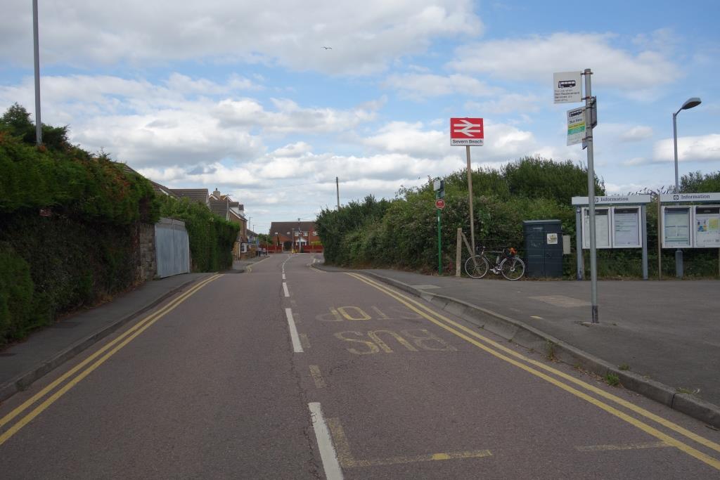
The path joined New Passage Road and the scout mistakenly went the wrong way. He recognized a grounded van body and about-turned, quickly reaching Severn Beach.
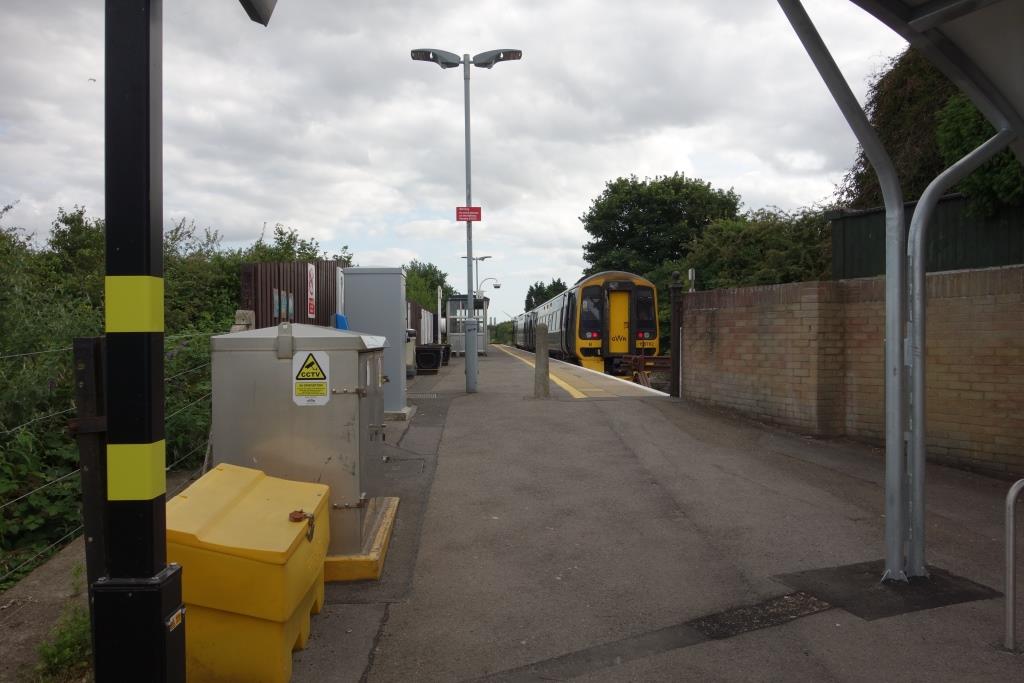
As he was looking at the timetable, a train pulled in and disgorged its passengers. The scout noticed that the guard and driver retreated to their ends and spent the 38-minute layover apart, when once they would have shared a can of tea and smoked a cigarette together.
The hump in the road is the former level crossing of the line which continued to Pilning.
The scout went to the shop to buy a cold drink and then had a nap before departure at 1801.
From the train, he saw the siding leading to the SUEZ Recycling and Recovery EFW [Energy from Waste] Plant which he’d photographed when newly re-laid in 2016. It had been pleasing to see the rail facilities provided long before the plant opened.
The scout caught a four-car H.S.T. stopper from Temple Meads, which was late arriving and was delayed further as the guard turned away five young tribe members with bicycles who wanted to travel to Weston. The train was held at Highbridge as the driver of an Up had reported an obstruction. It was 30 late arriving at St. David’s.
The guard had been on his feet the whole time and kept passengers informed all along. After he was relieved, the scout walked with the guard as far as the bridge and told him that he was doing a fantastic job.
When the scout returned to the utilicon, he had ridden 50 miles. And he still had his shopping to do. Arrival at Christow was 2206.
The E. & T.V.R. scout, having on occasion sent a few photographs to the esteemed elders of the Cornwall Railway Society, in time rather got into the habit after his outings of submitting a short story, often under the general heading of “Route Learning” or “Route Refresher.”. Read more