
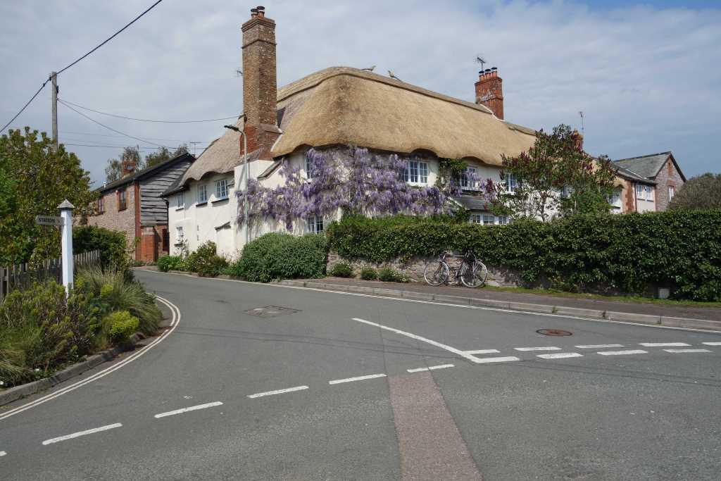
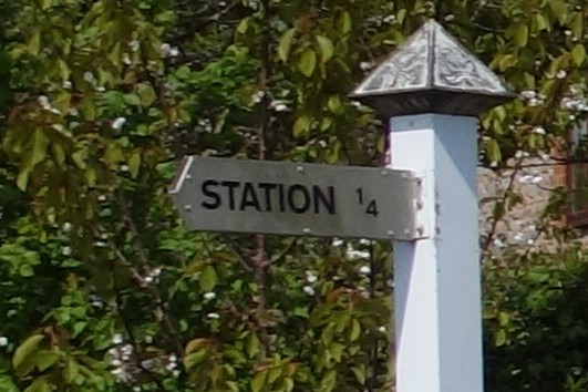
The scout’s memory of the branch goes back to joining a train of green carriages behind a steam engine in the Up Bay at Central Station.
Exmouth frequently draws the scout throughout the year but he seldom now uses the trains.
Typically, all the points of interest with which he is most familiar he has scarcely photographed before now.


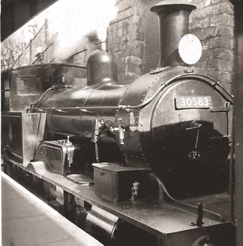
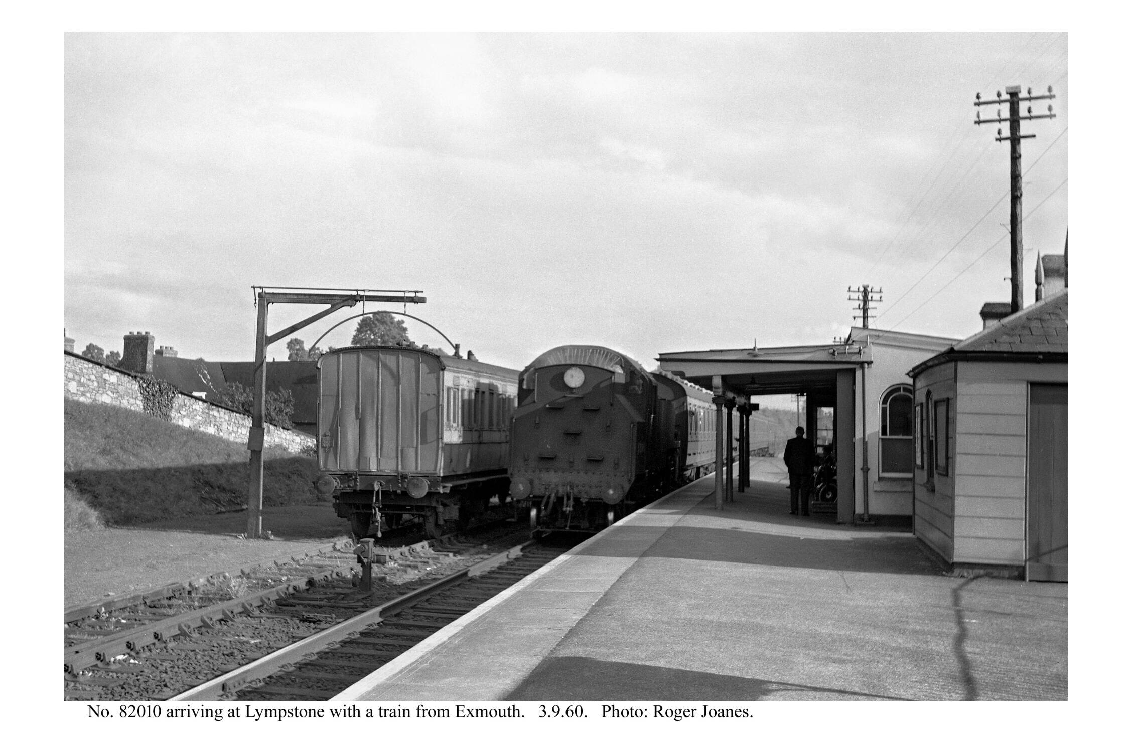
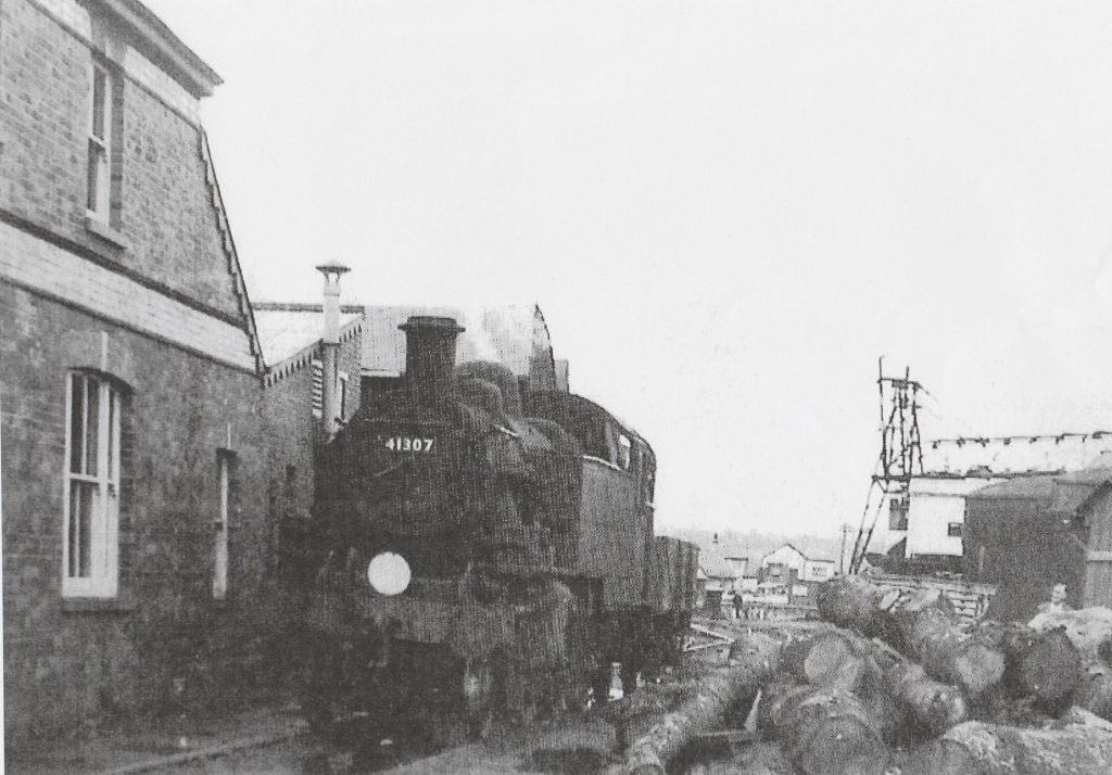
The locomotive, Adams “radial” No. 30583, built in 1885, was one of the three kept to work the Lyme Regis Branch and shedded at Exmouth Junction. The loco survives on the BlueBell Railway.
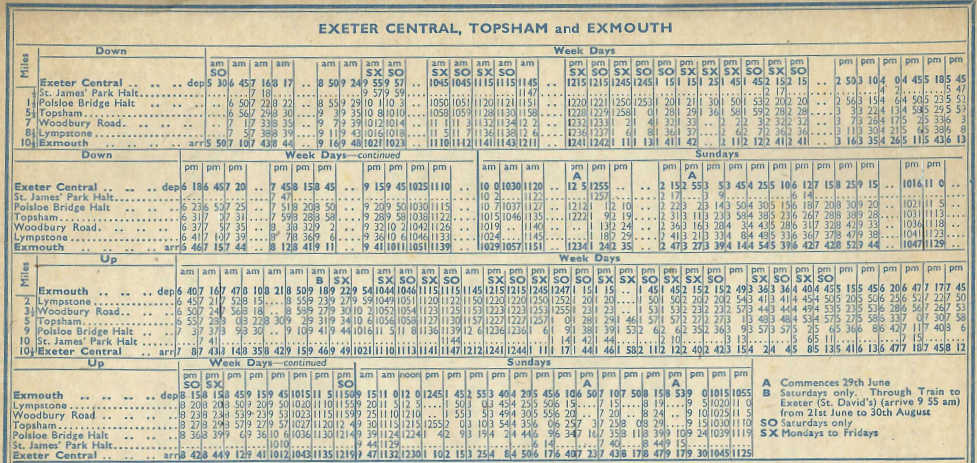
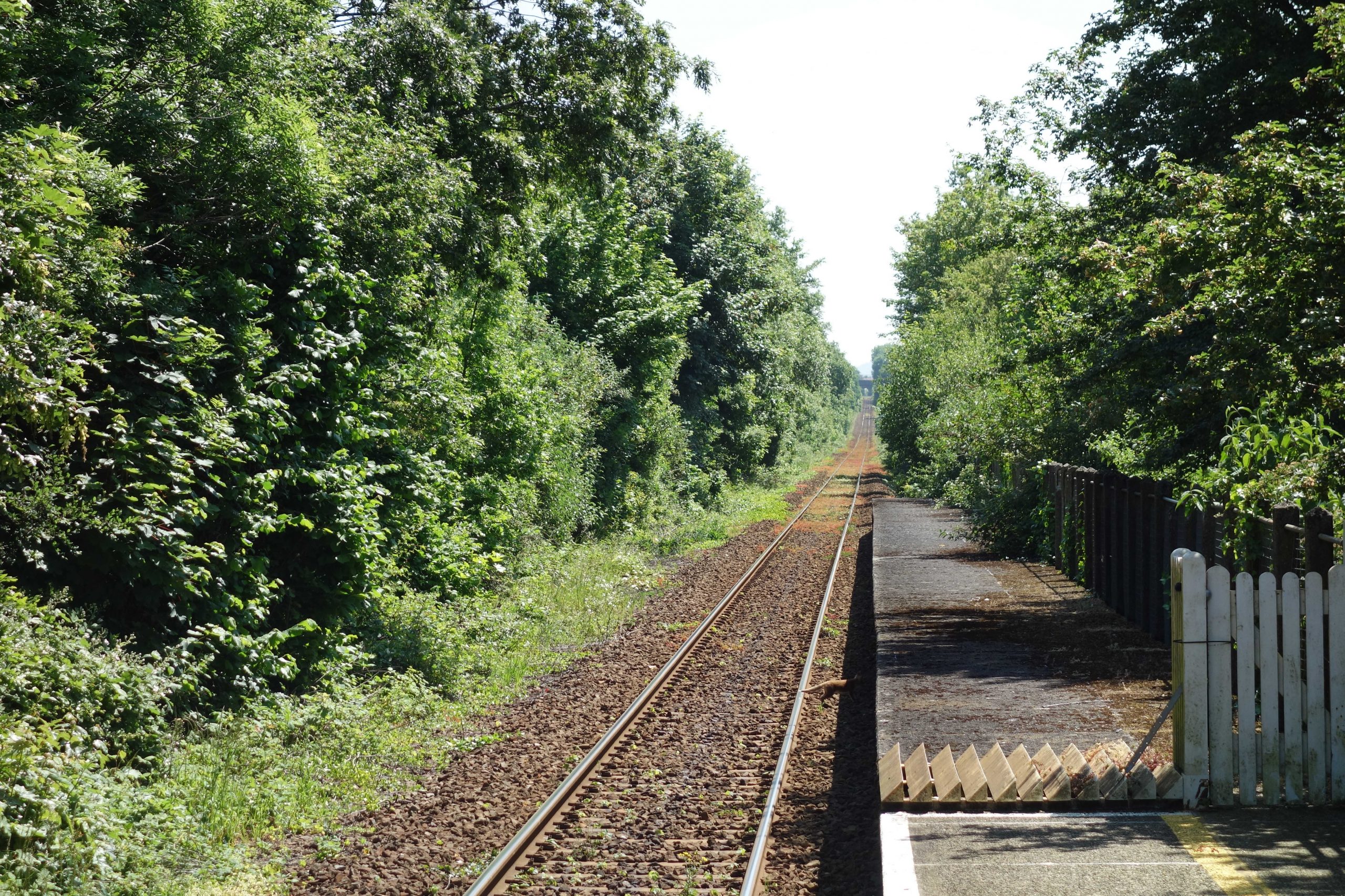
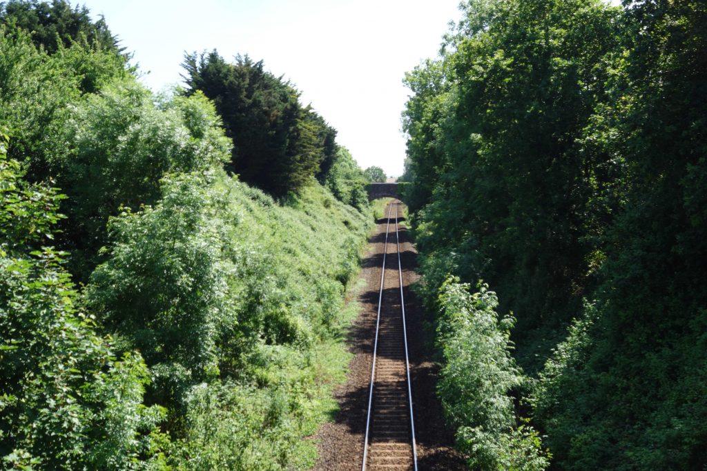
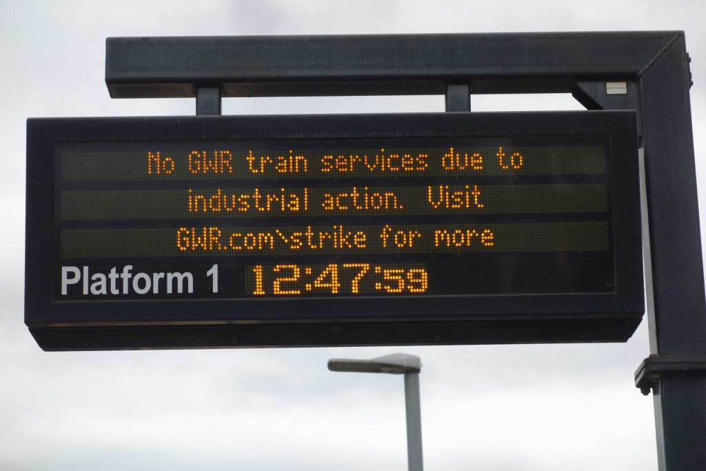
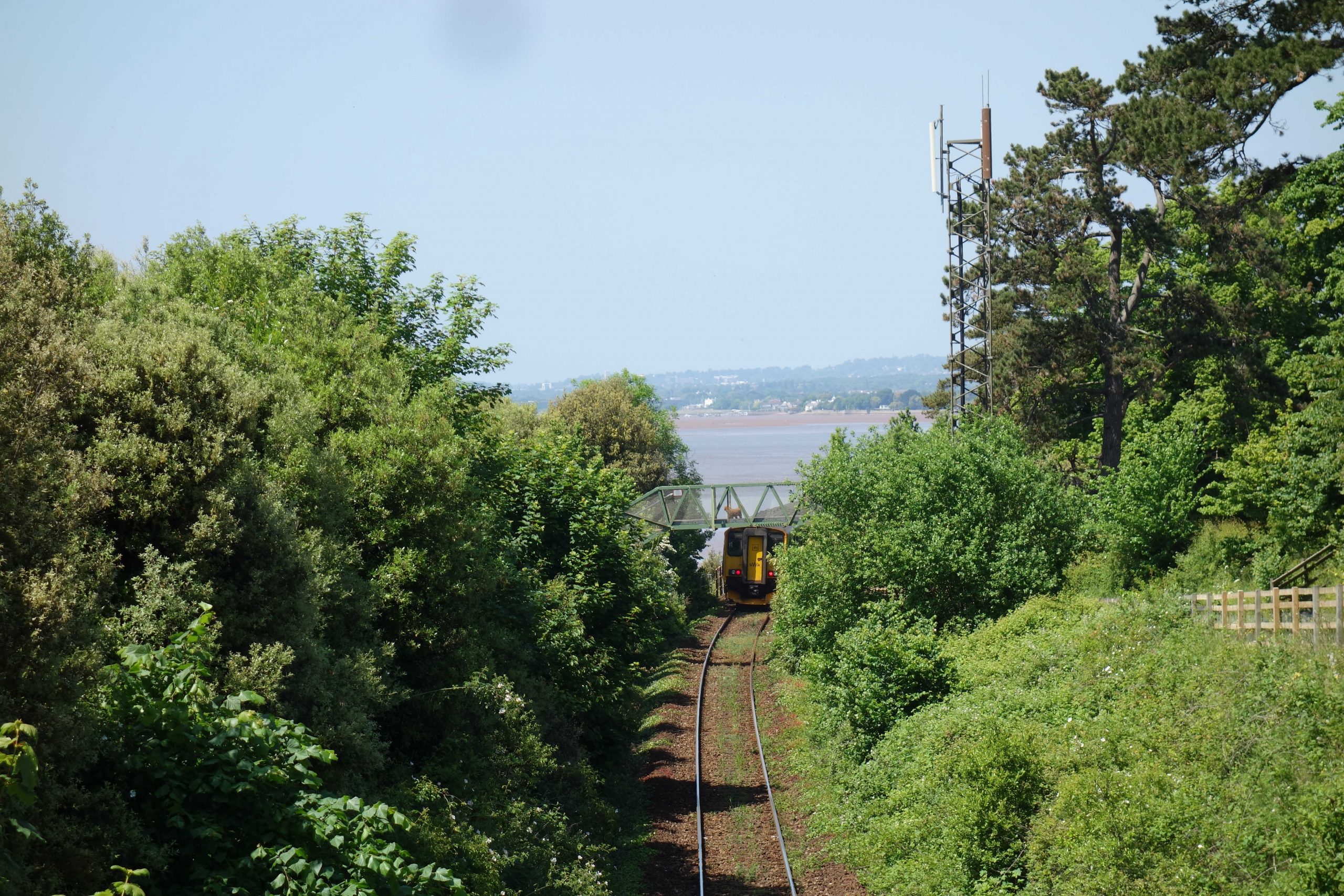
The line continued to be worked as the Southern had done, with all trains starting from or terminating at Central Station. The Central to Exmouth time varied between 26 and 31 minutes for all-stoppers. Far fewer trains called at St. James’ Park
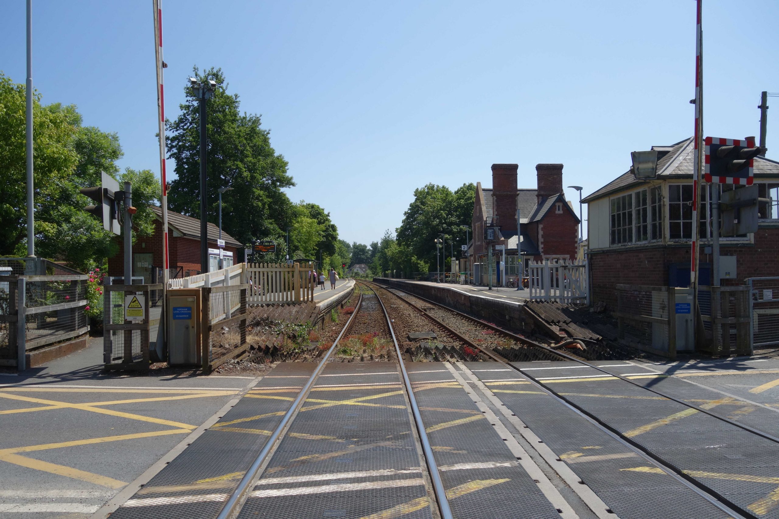
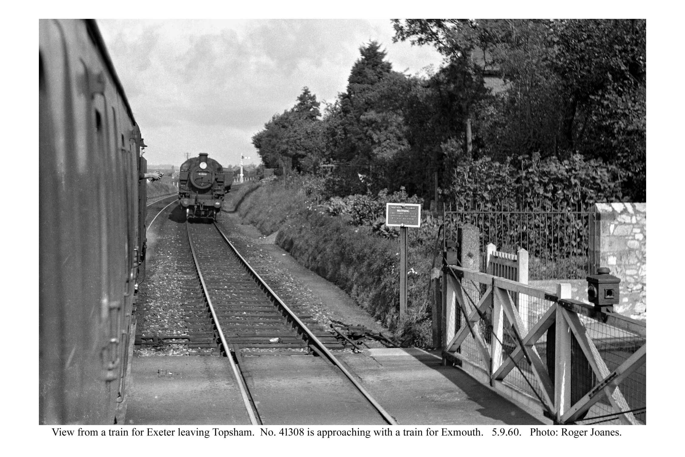
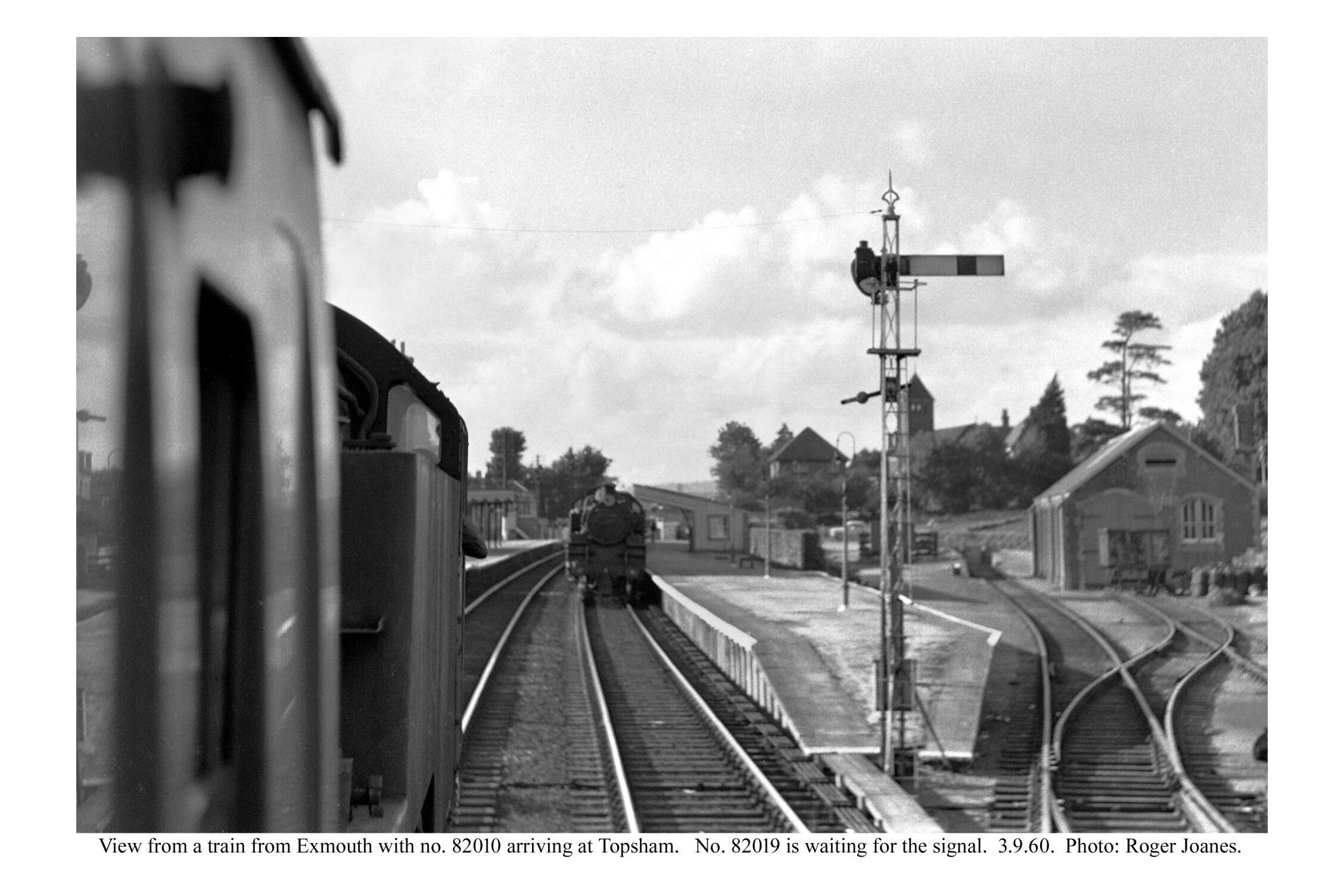
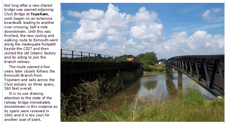
Crossings generally occurred at Topsham, the halfway station, but in those days Up trains did not have to wait for the single line.
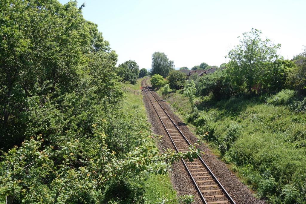
Topsham Quay had closed in 1957 but goods trains still served Newcourt, Topsham and Exmouth. It is thought that the brickworks, Digby’s and Odams’ sidings had closed by 1958.
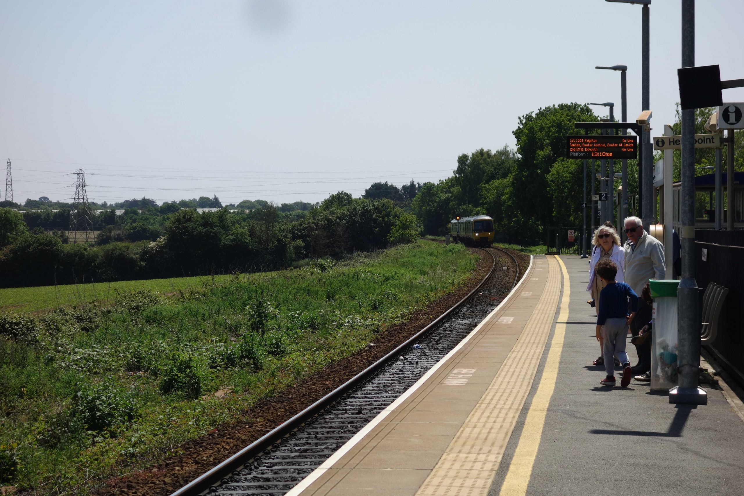
In the 2025 Monday to Friday timetable, there are 36 trains in each direction. The all-stoppers take between 27 and 31 minutes, making two more calls than in 1958. Trains calling a five stations take as little as 22 minutes. Nearly all trains work to or from Paignton. +
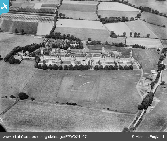
Exmouth Junction
In January, 2024, the scout found the approach road to the old complex closed. Having missed many opportunities in the past to photograph the junction, he would now find it very difficult.
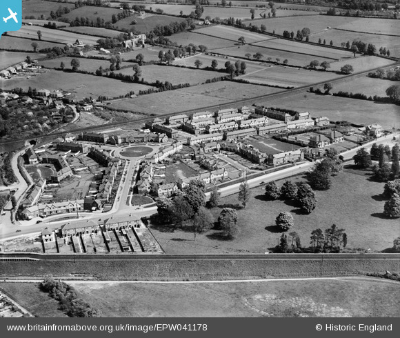
The 1910-built St. Mark’s Church, which stands beside Pinhoe Road, is seen behind while the only surviving building of the old complex, the base of the water tower, lies at right.
Exeter Central never had a bay platform to the west and the scissors crossings which once allowed portions to be attached and detached from through trains, or trains to pass one another, have long gone. Thus, D.M.U’s. terminating from the west often have to work empty to Exmouth Junction and back to clear the platform.


This is looking from the Downside towards the junction. There are now houses on both sides of the line here. Apart from the brickworks’ landscaped clay pit, all trace of industry has gone.
The scout can remember being on the lineside here in the mid-’70s with an S. & T. inspector, looking at telegraph poles which had just been felled with a view to recovering them for the project at Longdown.
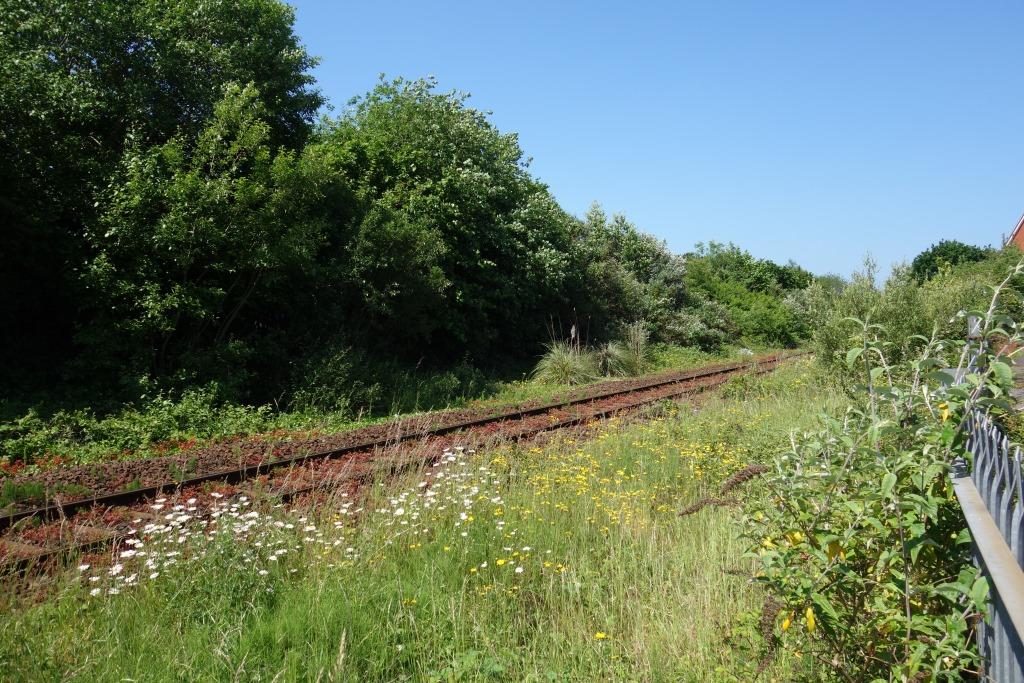
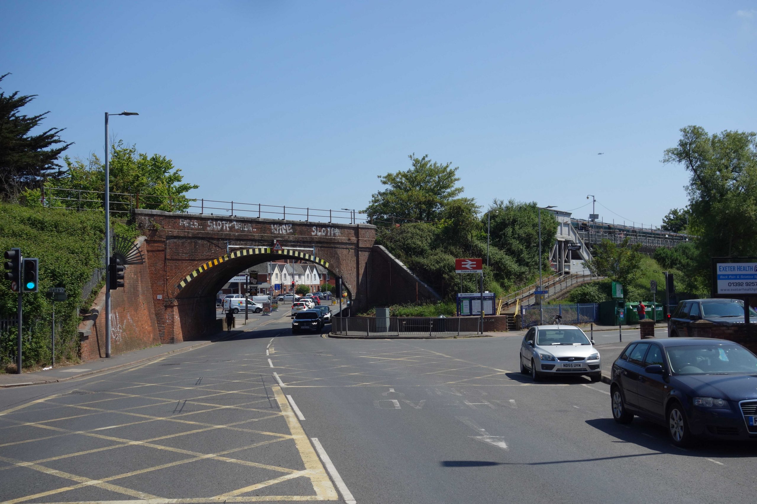
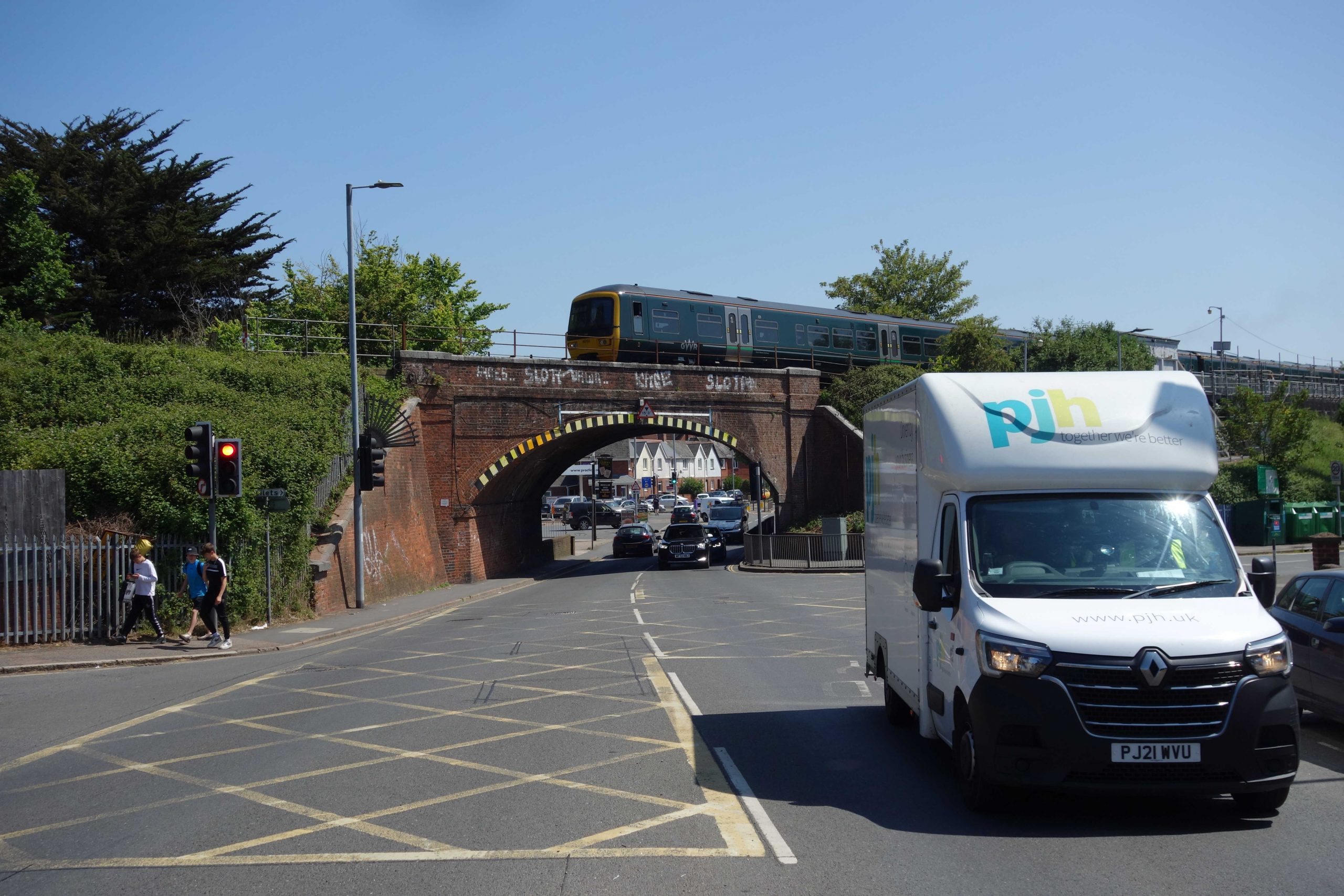
Polsloe Bridge Halt
A year after the “rail motor car” service was introduced on the main line, another began on the Exmouth Branch as far as Topsham, serving Lion’s Holt and Mount Pleasant, and new halts at Polsloe Bridge and Clyst St. Mary & Digby.


.")

New housing on Widgery Road spreads east from the city, just as development continues to do, but on a vastly greater scale.
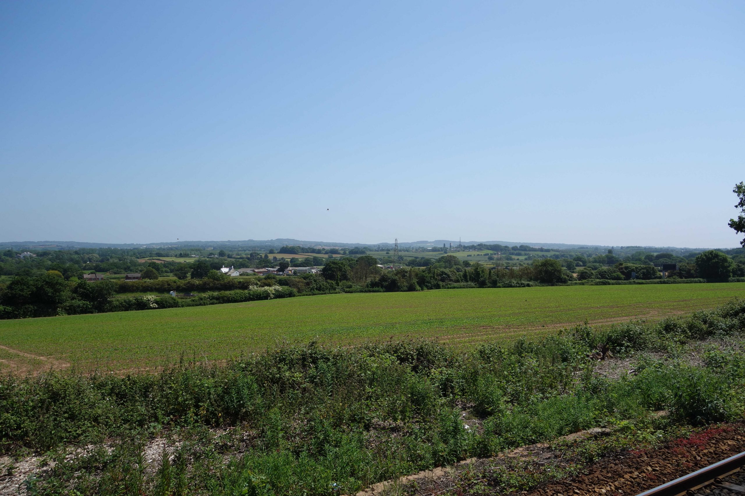
The Southern main line, above, lies in open country. Today, a passenger gazing out of a train window would continue to see Exeter’s sprawl for another four miles.
The grounds at lower left, above the railway, were attached to Honeylands House, which, in 1923, had been donated to Exeter City Council by a member of the Wills tobacco family for use as a sanatorium. The scribe remembers that there was some controversy when the grounds were sold for a housing development.
Fortunately, the area beneath the railway remains green. Once called Polsloe Bridge Playing Fields or “JLC,” it is now known as Hamlin Lane Playing Field. A miniature road system laid out as a children’s cycle training area, which fascinated the scout when he used to see it from the train, is still there.
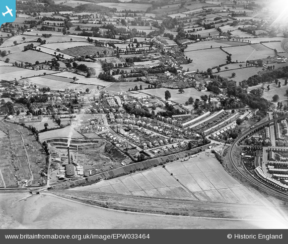
Only four motor vehicles can be seen in the 1933 aerial view and only two of those are on Pinhoe Road, an arterial route.
A certain high-mindedness is evident in the Widgery Road development, entirely missing from the later wretched spill of Exeter. The housing is low density; there are large gardens and open spaces. The roads are narrow, with grass verges, intended to become tree lines.
The scout went to see it.


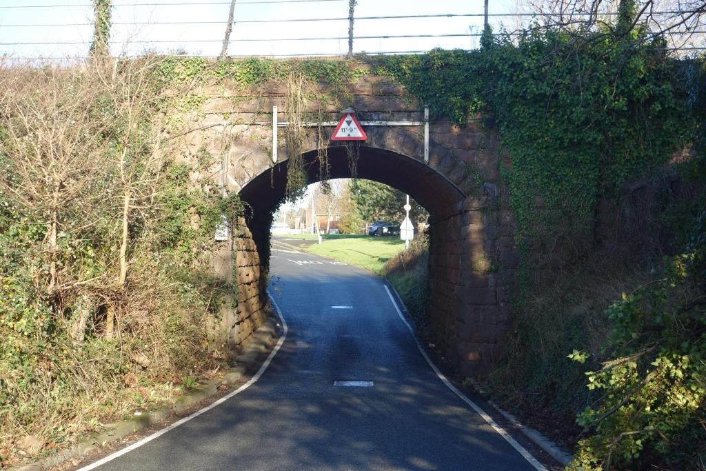
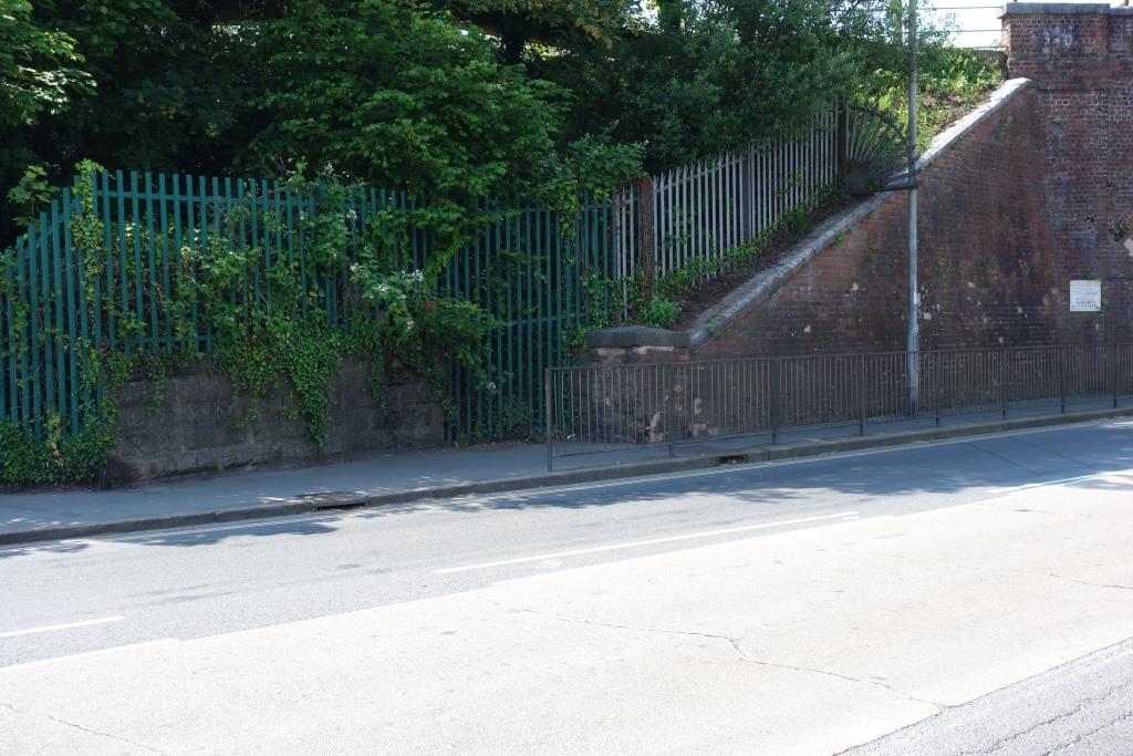
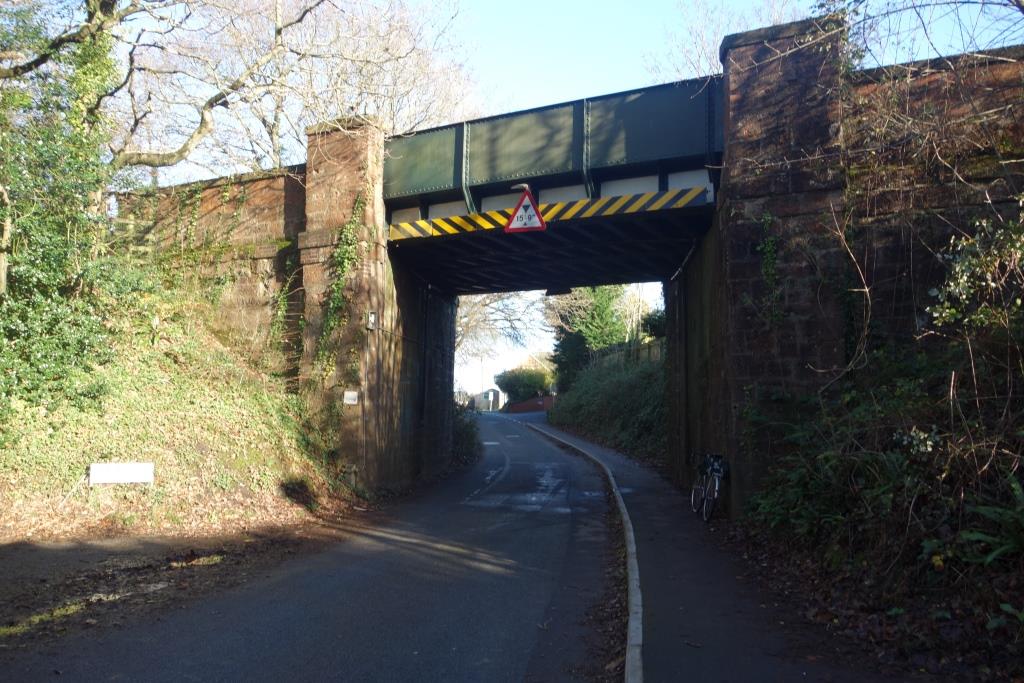
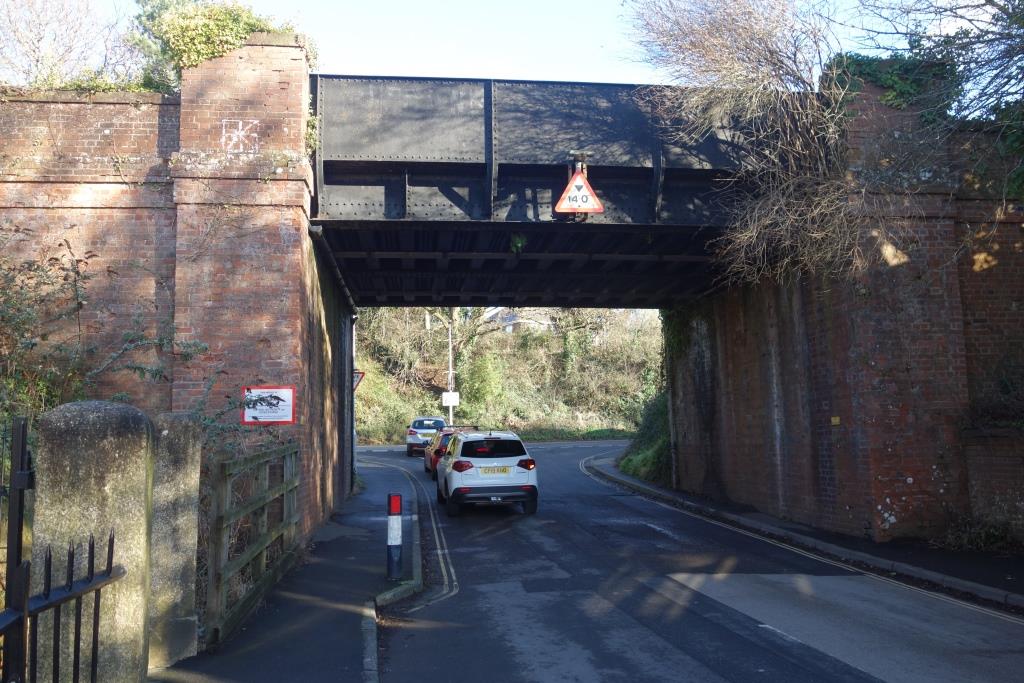
This is Whipton Lane bridge, now on Vaughan Road.
The officer who inspected the 1908 doubling of the line stated in his report that all six underbridges had been extended. Yet none of them show any of the usual signs of having been altered. The line was widened on the Downside. If Whipton Lane Bridge had been extended, it most likely would have been done by abutting a brick-built bridge next to the existing.


The fasces was the ancient symbol used by the Italian fascist movement yet there was obviously no reason in the 1930s for it to be blacked, unlike the equally ancient fylfot. These and Drake’s motto are unlikely to be noticed by those who may like to deface them and to rewrite history.
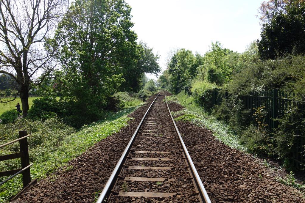
The bridges between the junction and Topsham were either built originally for a double line or they were all rebuilt for the 1908 doubling.


Clyst St. Mary & Digby Halt/Digby & Sowton
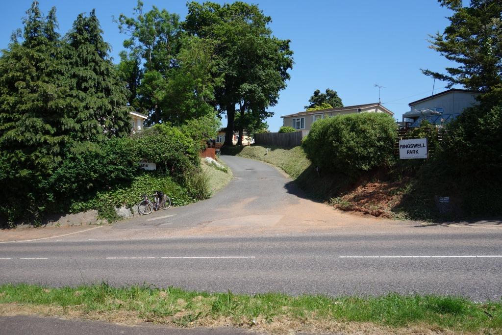
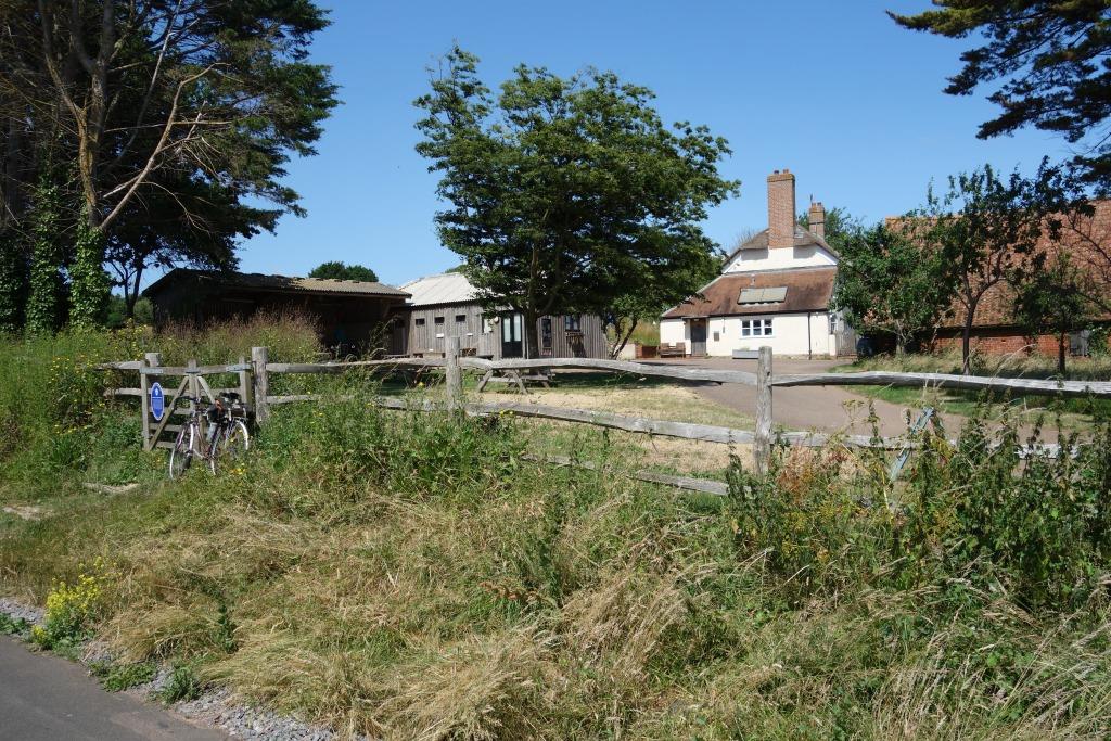
Clyst St. Mary & Digby closed in 1948, so the scout cannot claim, because of its proximity to Ringswell Caravan Park, that it was his first “home” station. The later Digby & Sowton opened in 1995, by which time he was living in a 27-foot caravan.


Woodwater Lane can be seen behind the hospital and running down the right hand side of the photo. The hospital drive ran from the corner at middle right to Sidmouth Road.
The Exmouth Branch is glimpsed at bottom right.
The scout’s Mother was a nurse here in the early 1970s, when the place was usually just known as Digby. The hospital closed in 1986.


The scout remembers going to the hospital one summer’s evening to see his Mother on night duty. Afterwards he rode to this bridge and then on to Newcourt. The motorway had not been built and there was nothing to the east but open country.
In later years, before the trees grew up, the view east was a sea of steel rooves that could easily have been Basingstoke.


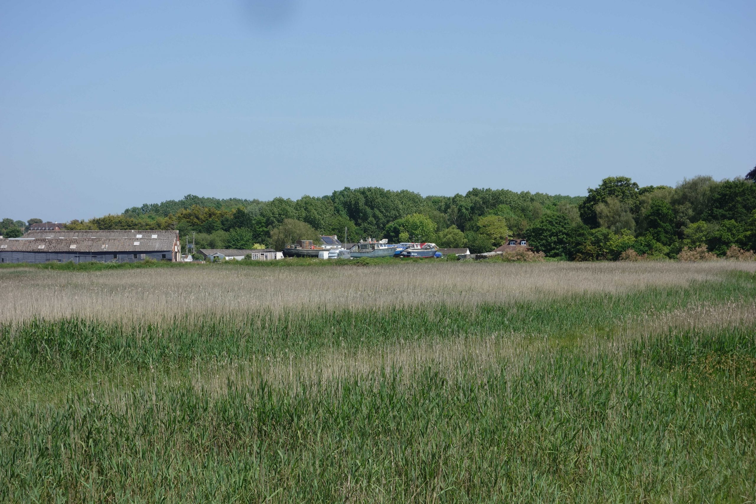
Newcourt Sidings
A U.S. supply base was established just beyond Old Rydon Lane in time for the D-Day landings in 1944. After the war, it became a Royal Naval Stores Depot and continued to be served by rail until the late 1970s. Vast stocks of spares were kept for every ship in the water, most never to be used. It was said that the jobs there were undemanding in the extreme.
The depot closed in 1997 and the site is now a housing estate whose roads commemorate different conflicts.


A few weeks after taking the photograph of the street sign above, the scout turned towards the front in Lympstone where a lithe young lady in lycra was having a rest while on a ride from Exeter. When a conversation was struck up, she told the scout that she was a self-employed physiotherapist. Because some of her patients were cyclists, she had decided to take up the pursuit. She was well equipped and the scout remarked that she could have passed for an old hand. She said that she lived near the IKEA store and that she had needed to get out. The scout let slip that many of the roads in the new development had wartime names and she revealed that her home was in Jutland Way. To prove his point, the scout immediately said: “Battle of Jutland, 1916, the decisive naval battle of the First World War.” She seemed impressed by the scout’s knowledge and so he added that he had recently photographed a River Plate road sign. She knew this as the main road through the estate. Without too much detail, the scout recounted the story of the Graf Spee and her humane and honourable captain. The lithe one asked if this was the scout’s ‘thing’, to which he replied: “Don’t start me on my ‘thing’.” Very kindly, she promised that she would tell her children what she had learnt. The scout left her with, “have an enjoyable ride,” and she replied with, “nice to have met you,” which the scout took not as the farewell of someone who hoped to God she would never see him again.
As the scout continued on his way, he thought of that Clash of the Titans in the North Sea, the greatest ever action of its kind, that not much more than a century later would mean nothing to someone living in a Jutland Way. Perhaps one day he will bump into a resident of Trafalgar Place in Exeter.
Colin G. Maggs, in his “The Exeter and Exmouth Railway,” wrote:
These American Naval Depot sidings were built with remarkable speed. At 12.10 pm on Saturday 2nd October, 1943 the United States Navy authorities asked the SR Western Divisional superintendent to meet them at 2.30 pm that afternoon to discuss making a temporary siding on a green field so that 150 wagons of stores on their way from the North might be unloaded. The Divisional engineer also attended the meeting and arranged to have sufficient material to lay 1,200 ft of siding delivered by 11 am on Monday the 4th. He was almost as good as his word for it was there by noon. Twenty-four hours later the Americans had laid 1,000 ft of track, the SR Divisional engineer’s staff had laid the connection and raised a shallow embankment to link with the siding. By noon on Wednesday wagons were in position and by 5 pm the siding was complete with signalling.
Newcourt
From “All the Stations in Devon, Cornwall and Somerset”:
Newcourt, on the Exmouth Branch, between Digby & Sowton (Clyst St. Mary & Digby) and Topsham, the first station to be opened in Devon for 20 years and the first genuinely new public station for 77 years,* came into use on 4th June, 2015.
Its single platform and elaborate associated works cost £2,200,000. The station is intended to serve the massive housing development on the site of the former R.N. Stores Depot (which originated in 1943 as a U.S. Navy supply depot for the invasion of France) and nearby rugby ground.
The station that (re)opened in 1995 was its neighbour, Digby & Sowton, all of 1,000 yards away. Which begs the question: why, with old communities in Devon beside a railway, yet deprived access to it, should Newcourt be the place to get a new station?
* Liddaton Halt, on the Launceston Branch, between Lydford and Coryton, was opened in 1938.
This film, mostly shot within the naval depot, begins with a sweep across the countryside seen in the above three photographs, with the double line branch in the foreground.
Behind the trees at left lies the former gate lodge of New Court, a house still standing amid the urban sprawl. The footpath joined Newcourt Road, which was diverted via this bridge when the motorway was built, picking up its former course to the right of the camera. +
Growth is well established on the right hand abutment. Thanks to much recent work, the remains of disused bridges belonging to National Highways now look better cared for than many of those which are operational.
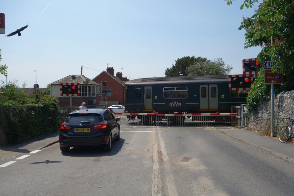
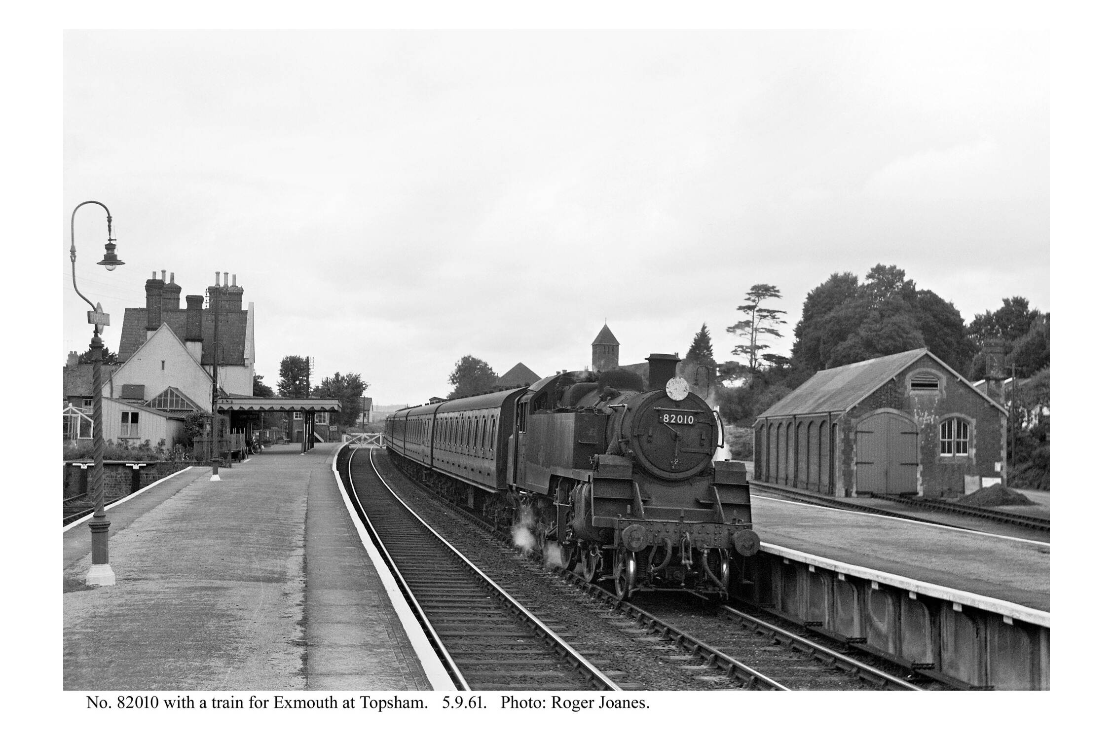
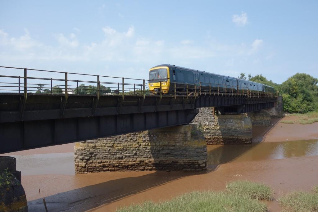
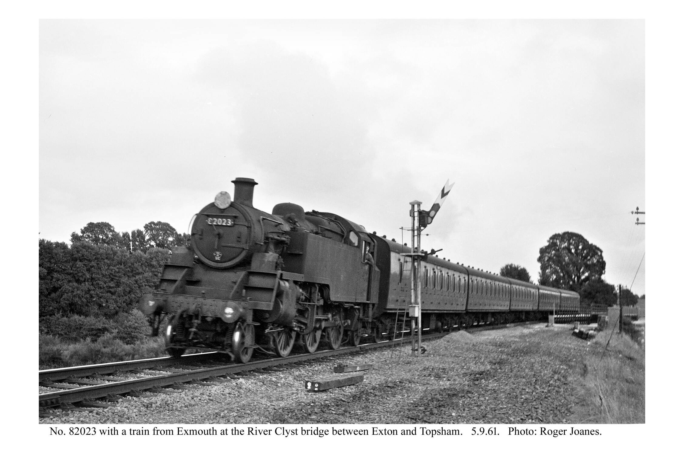
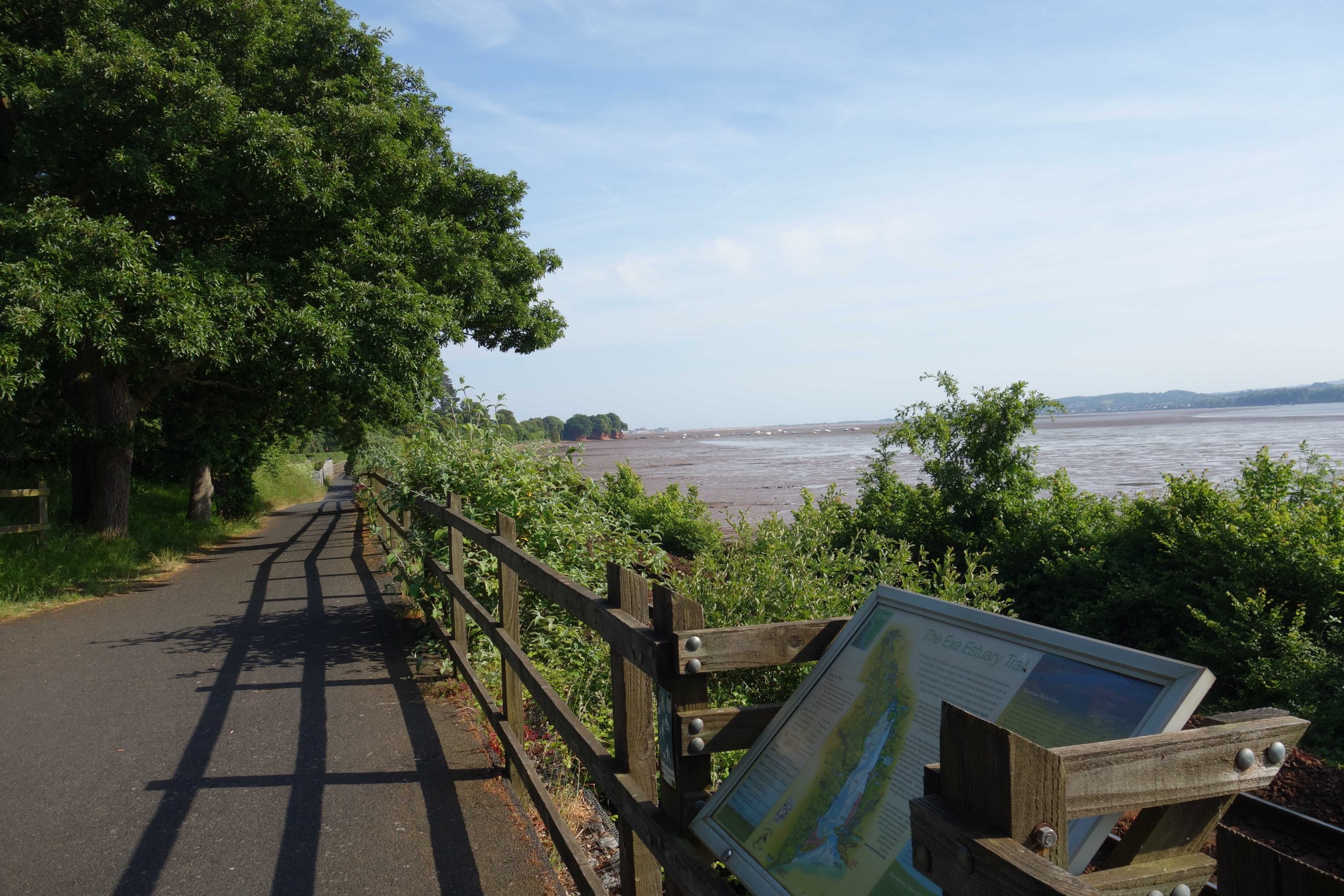
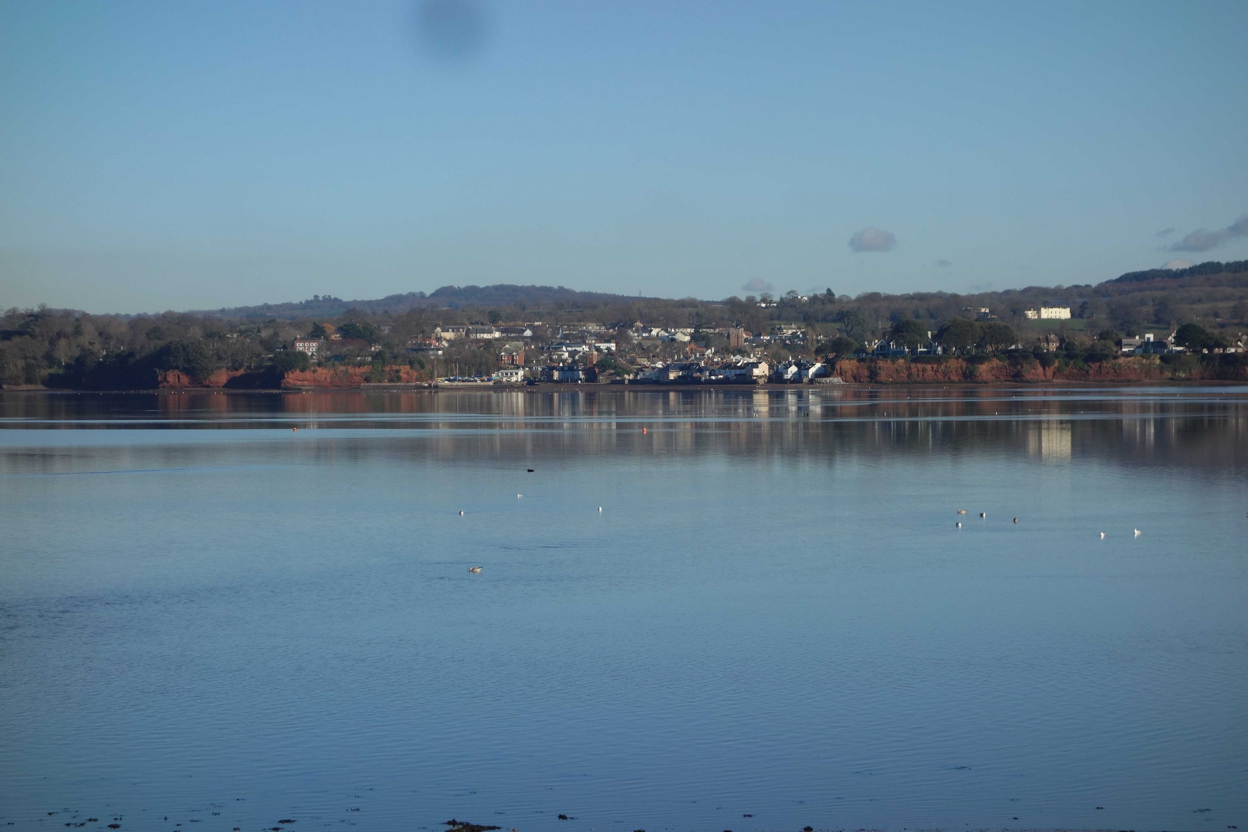
Topsham
Copyright: Roger Joanes. Shared under Creative Commons. +
Earlier in the year, the scout had approached a trackworker standing on the pavement with a stop board. He was waiting for authority from the signalman to let his six-man gang start a job that he would once have been able to do between trains. He had voted to accept the pay offer, he told the scout, because he wanted to put a deposit down on his summer holiday. As it turned out, the overall vote was in his favour.


Topsham Quay Line


Topsham was entirely separate from Exeter in the scout’s memory, but is now part of the city, both physically and administratively.
Copyright: Roger Joanes. Shared under Creative Commons. +
Odams’ Siding
The private siding made a trailing connection with the line towards Exmouth and was served by trips from Topsham. An example of a very short distance rail traffic was guano landed at Topsham and worked to Odams’.


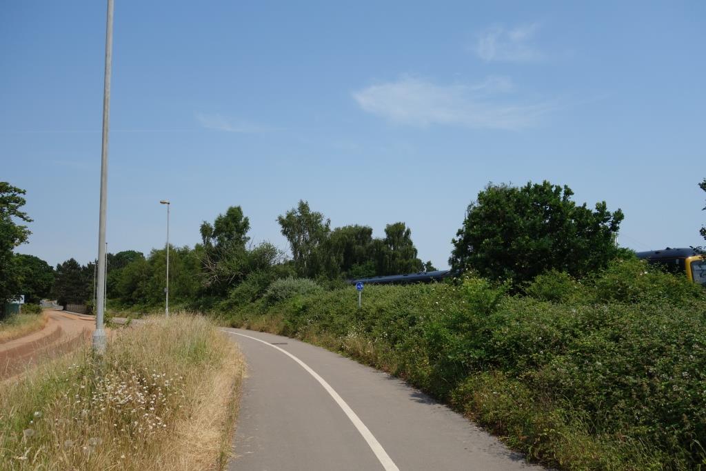
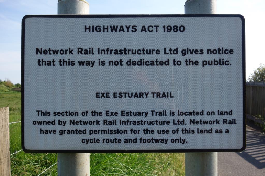
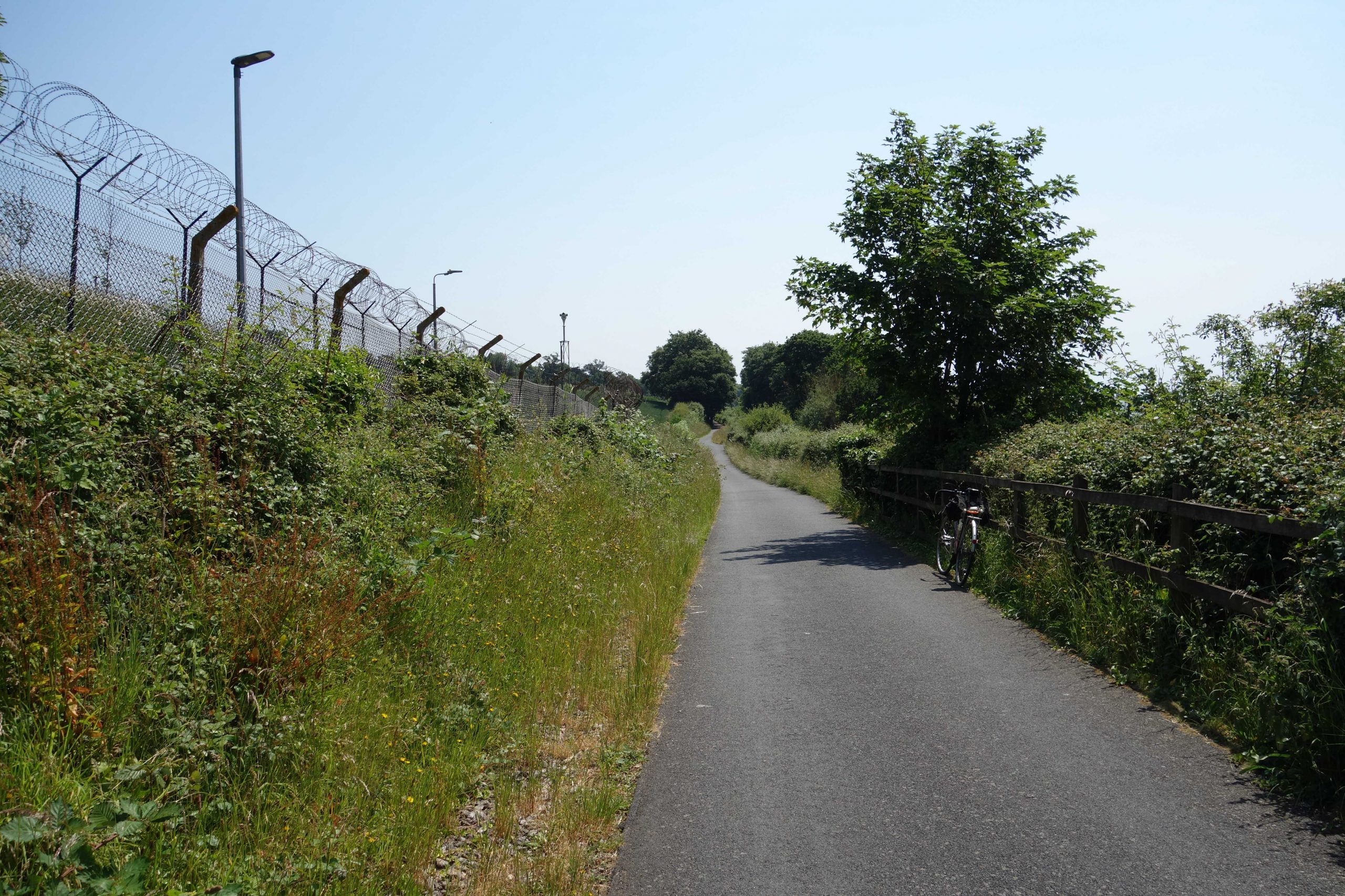
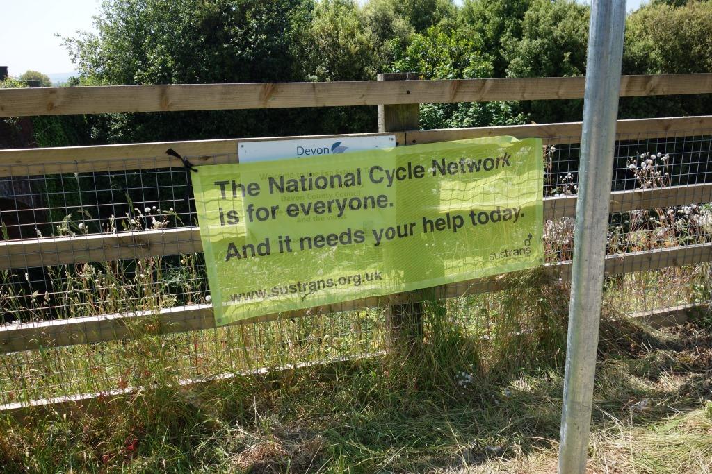
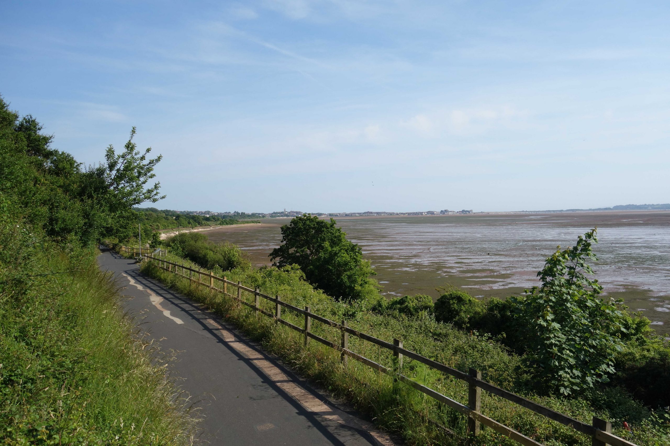
Before the bridge over the Clyst was built, the Exe Estuary Trail was routed via Topsham Bridge, Marsh Barton (opposite today’s Dart’s Farm) and Odams’ Siding. The scout was told by someone in the know at Sustrans that the county only had a ten-year lease, which must have been extended.
The path now sees very little use and the scout was surprised to find that the length that takes part of the siding formation had been completely resurfaced.
The county road network is in an appalling state, yet a huge expense has been incurred here on a path that was quite adequately surfaced.
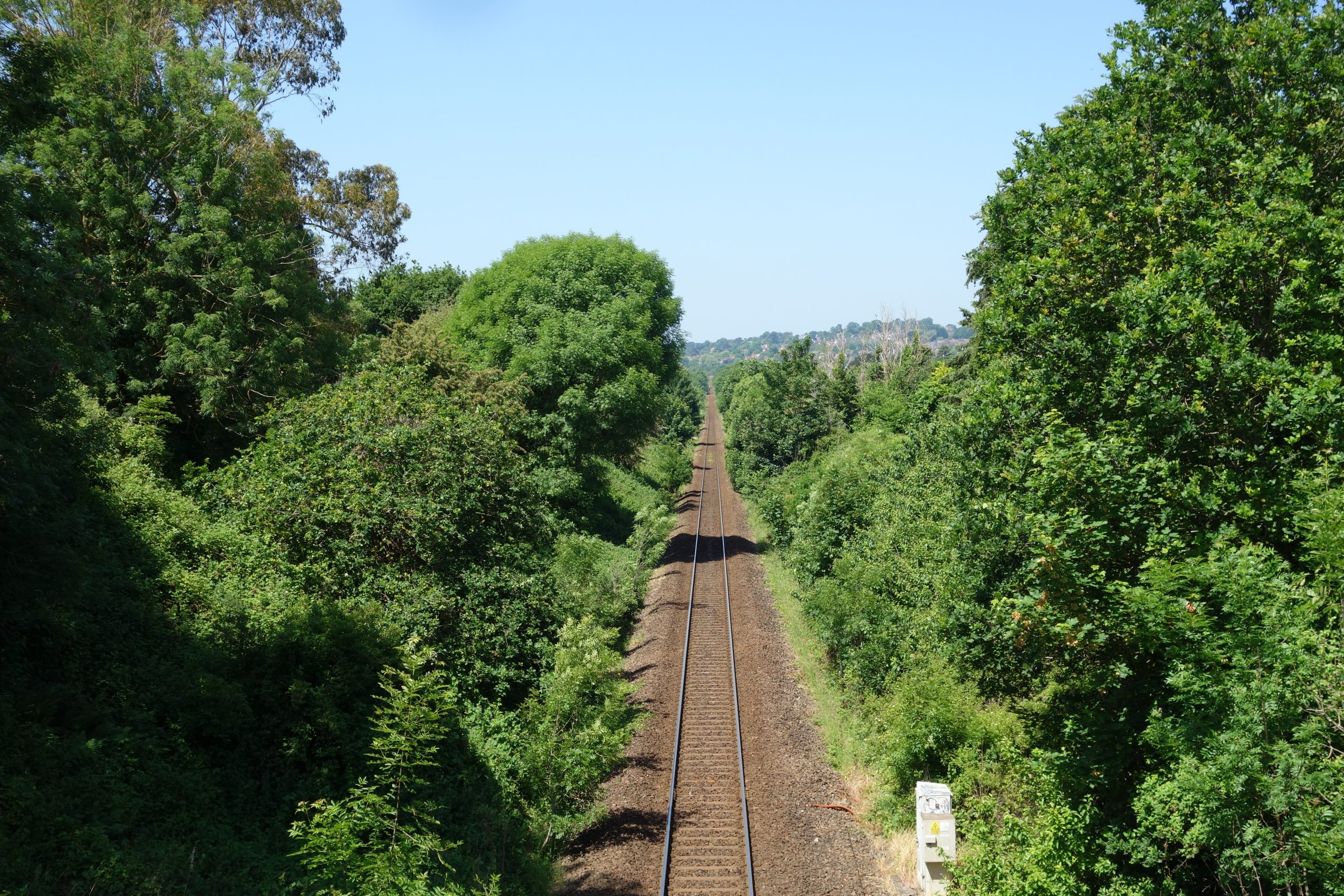
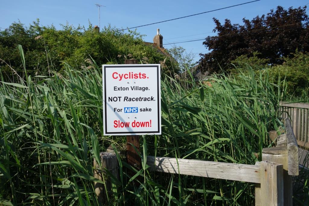
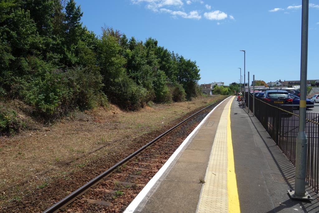
Woodbury Road/Exton
The station was Woodbury Road until 1958. The passenger fare book from here, kept in the collection at Christow, was recently deposited in the fake booking office at Okehampton.


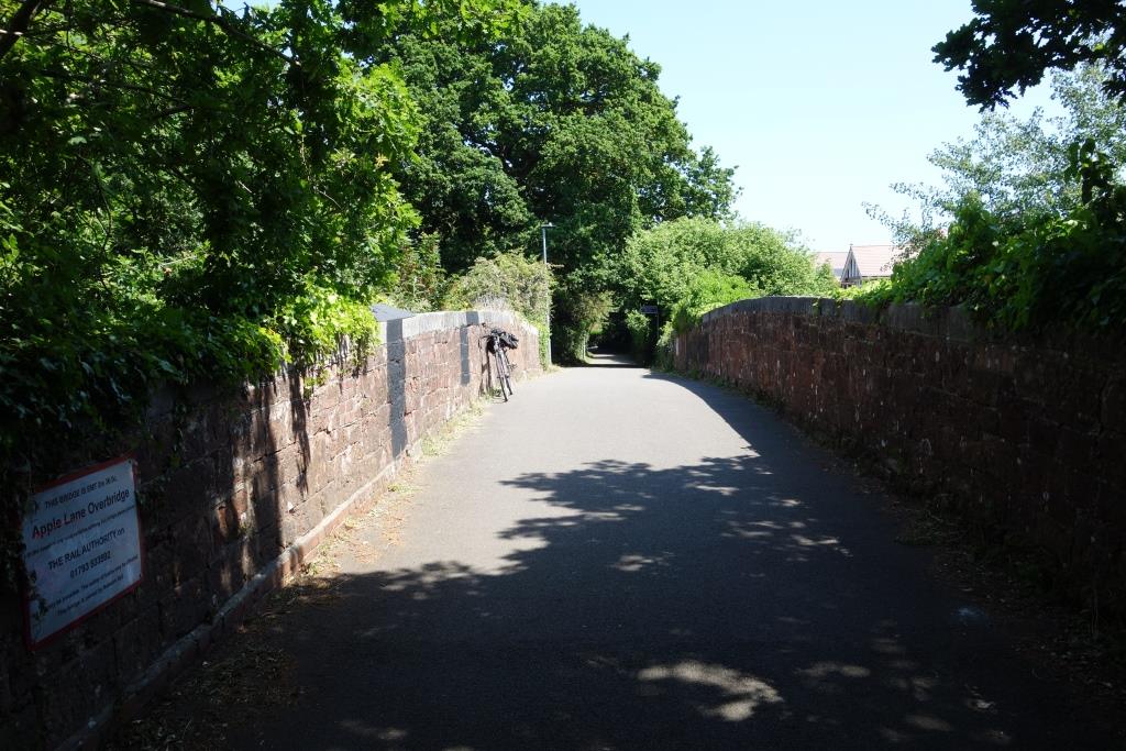
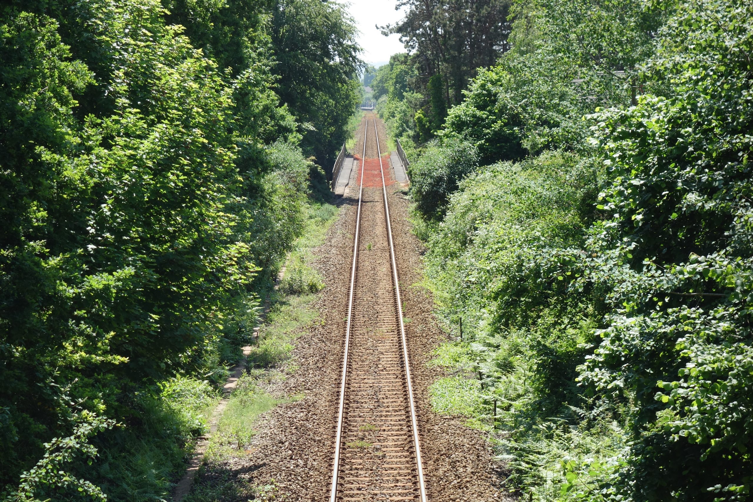
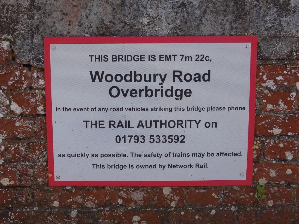
Bridge No. 15, just beyond the station was damaged by floodwater in September, 1960. After being temporarily repaired, a bridge was brought from Lapford to replace it, one of the many on the North Devon that was built for a doubling of the line that did not materialize.


Gently decaying steel spans are still deflected by the passage of trains.
2024: Had the standard changed, making the old enclosed shelter too close to the platform edge?


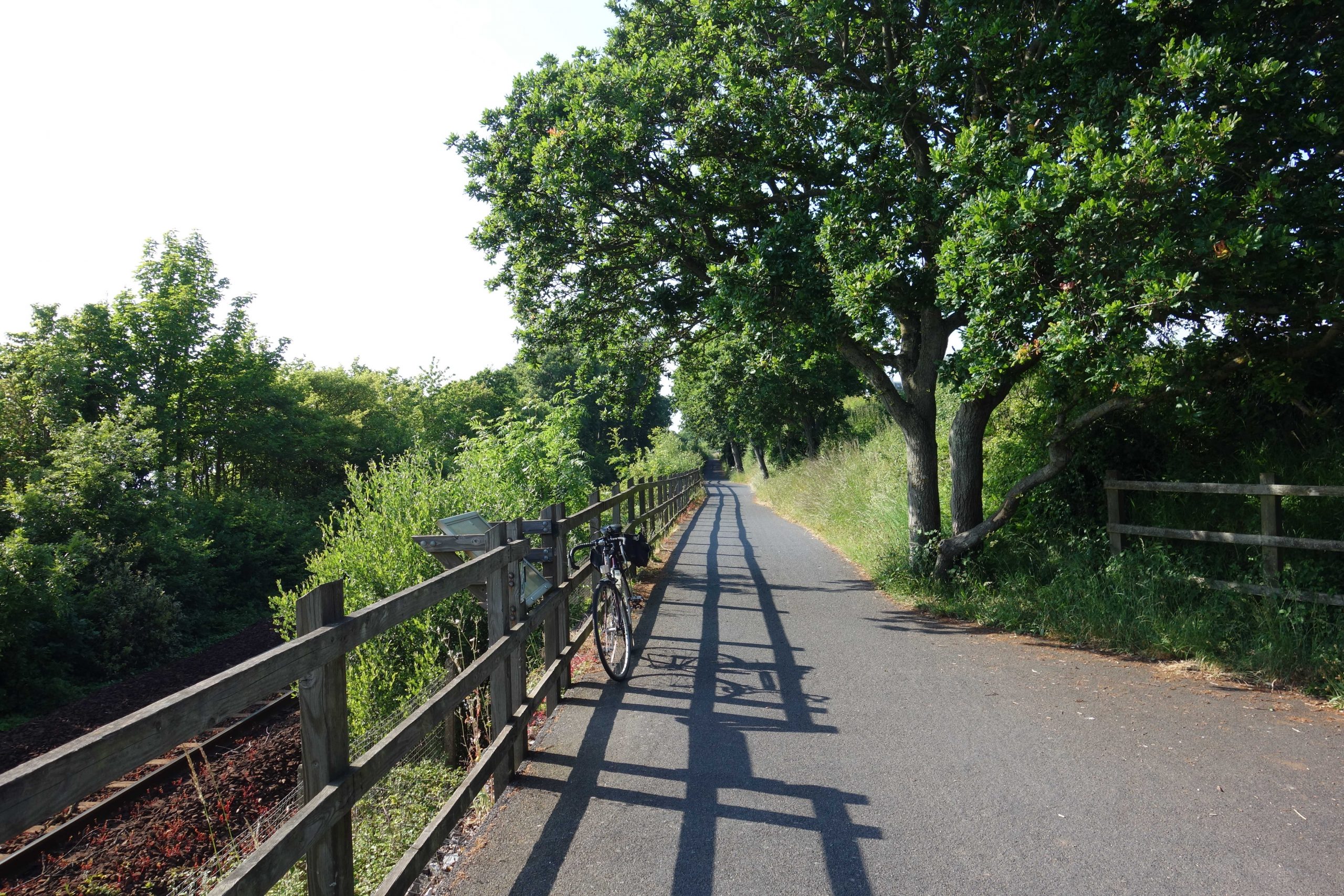
The fields of this newly thatched former farmhouse, with connected buildings surrounding a yard, are now sprinkled with expensive homes, many of whose occupants have had to suffer cyclists cutting through their enclave.
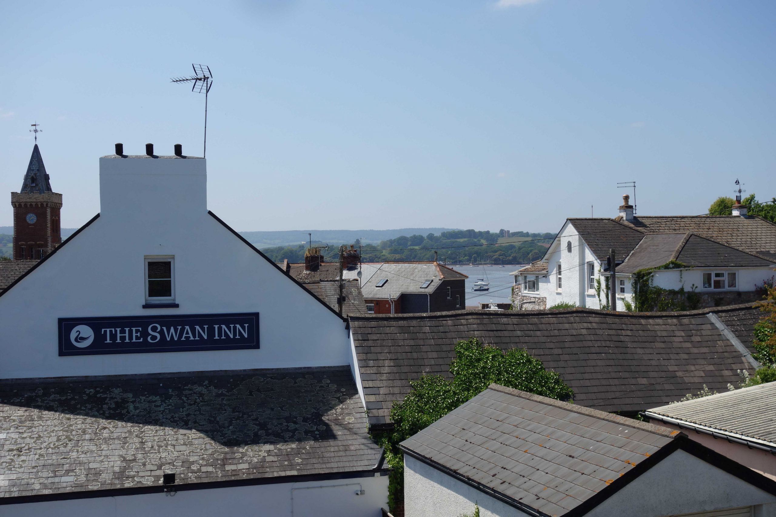
From the corner by the “Puffing Billy” (once the “Railway Inn”) to the station is actually not much more than an eighth of amile.
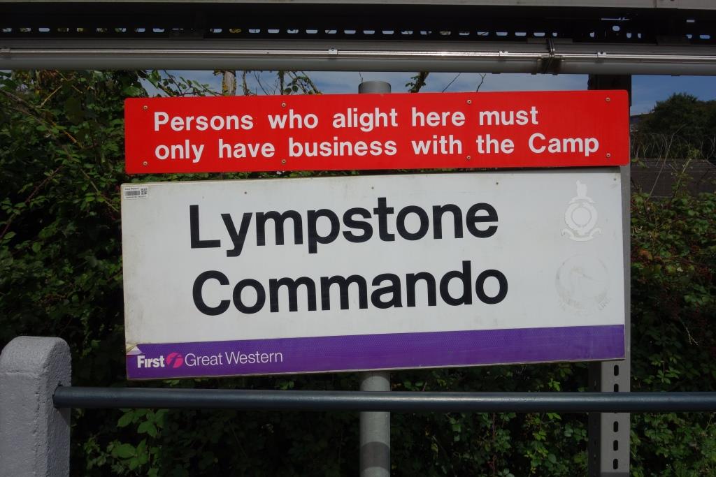
Lympstone Commando
This station was opened in 1976 for the exclusive use of the Commando Training Centre Royal Marines. It was built in three weeks by three men from the B.R. Works Department using sections from the disused Down platform at Weston Milton.
It is the one operational station in Devon that the scout has not used. A few years ago, while ticking off the 123 stations in Dorset, Somerset, Devon and Cornwall (out of the 554 there were), the scout got himself off by claiming that Lympstone Commando was not a network station. Nevertheless, just to cover it both ways, he stopped one day and asked the security officer at the camp gate if he could use the halt, explaining his obsessive mission. The officer agreed but foolishly the scout rode on to Exmouth, thinking that he would catch the train later. When he returned, there had been a shift change and the earlier man’s relief, pointing to the cameras, said that he would be shot if he allowed a civvy onto the platform (actually, some of the camp civilian staff use the halt).
Arguably, now that there is public access between the camp and the railway, and given that the bulk of the passengers are extremely fit young men, the private station could be closed. The camp perimeter is less than a quarter of a mile from Exton, which would benefit from more passengers. Train operation would also benefit from one less stop and Exton becoming non-request. No one at Christow will be taking these thoughts any further.
August, 2023: On the way back from Exmouth, the scout noticed that the halt gate was open and there appeared to be no one manning the security post. He rode on a little way and then went back. A notice on the camp gate advised that it was closed and that those wishing to enter should “walk around.” A Down train was due but the scout did not want to stop it, thus letting go another opportunity; watching from near Exton, he saw that it did not stop to put down.
With the railway gate unmanned, it would have been much quicker for camp passengers to have used Exton.
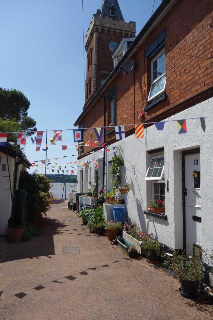
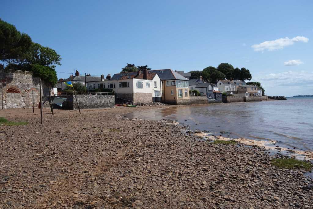
Lympstone
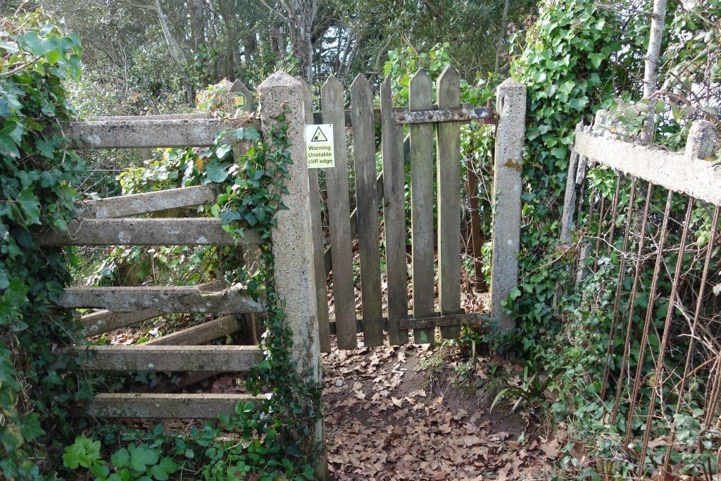
The Exmouth Junction fence panel at right is more reinforcing wire than concrete.
Just beyond the gate is the edge of the cliff.
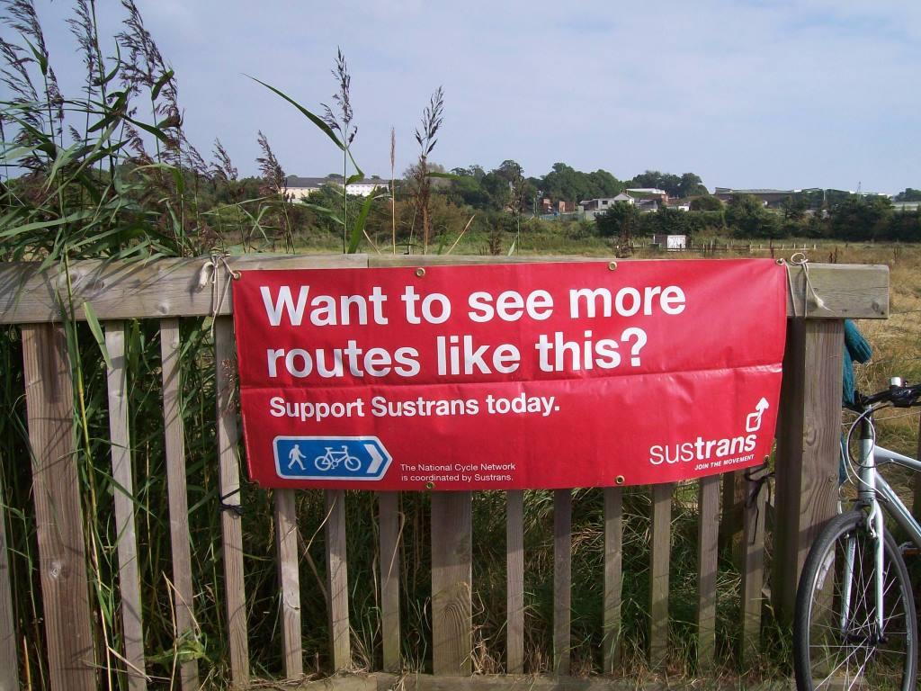
The banner is attached to the fence seen to the left in the photo above. In summer, the charity employs people to canvass support at places along the trail. They call out to passing cyclists: “Have you any time for Sustrans?” The scout always replies politely but pointedly: “No!”


Summer, 2025: The track authority’s contractors started to clear the lineside growth.


. The work has not gone far enough.")
. It will not be maintained, and ...")
 they'll leave it until it gets as bad as it was before doing it again.")
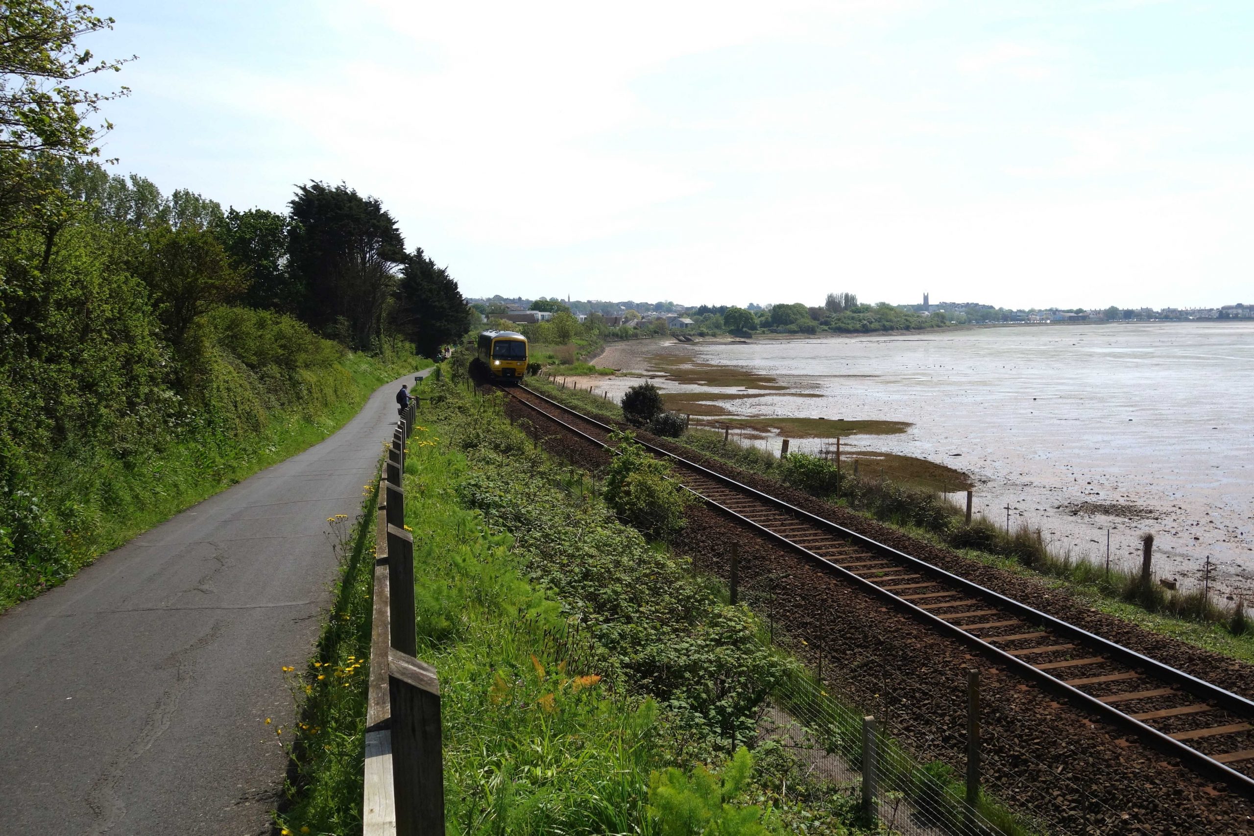
Lympstone was a token station but trains could not cross here, although there may have been times when a short goods was kept in the siding. It allowed there to be two trains on line between Topsham and Exmouth, going in the same direction.


On one occasion when the scout passed the cobbles seen above, an old boy was weeding them, although the six inches of concrete he told the scout lay beneath must have hampered propagation. He had lived in Scotland and the scout asked him how he had come to be in Lympstone. He said that he and his wife had written down their criteria; his had included being able to live without a car and drink a sundowner by water. Their ambitions coincided but the move, as so often happens, was decided by chance.
Despite his noble, late-life resolution, he had not become a train user.
Pressed for his thoughts about the estuary trail being routed through the village, he said that it had been forced on the village with little consultation. The dangerous incidents which he described could have been of average motorists riding bicycles.


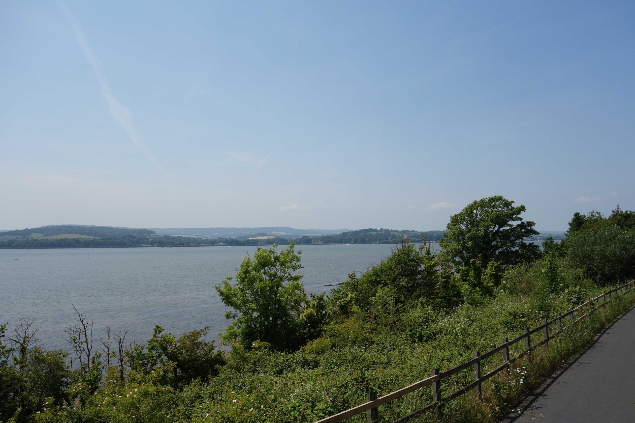
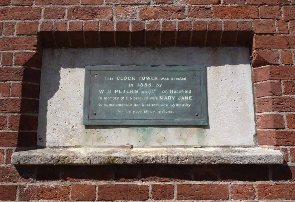
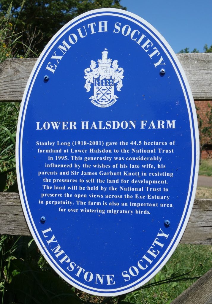
The land on the right is part of Lower Halsdon Farm, left to the National Trust in 1996 by Stanley Long on the proviso that it would benefit the community. He had turned down the £4-million offered by housing developers. There was once vague talk of a new station north of Exmouth.
A path just off camera leads to Exeter Road. A La Ronde is about a mile from here by this route.
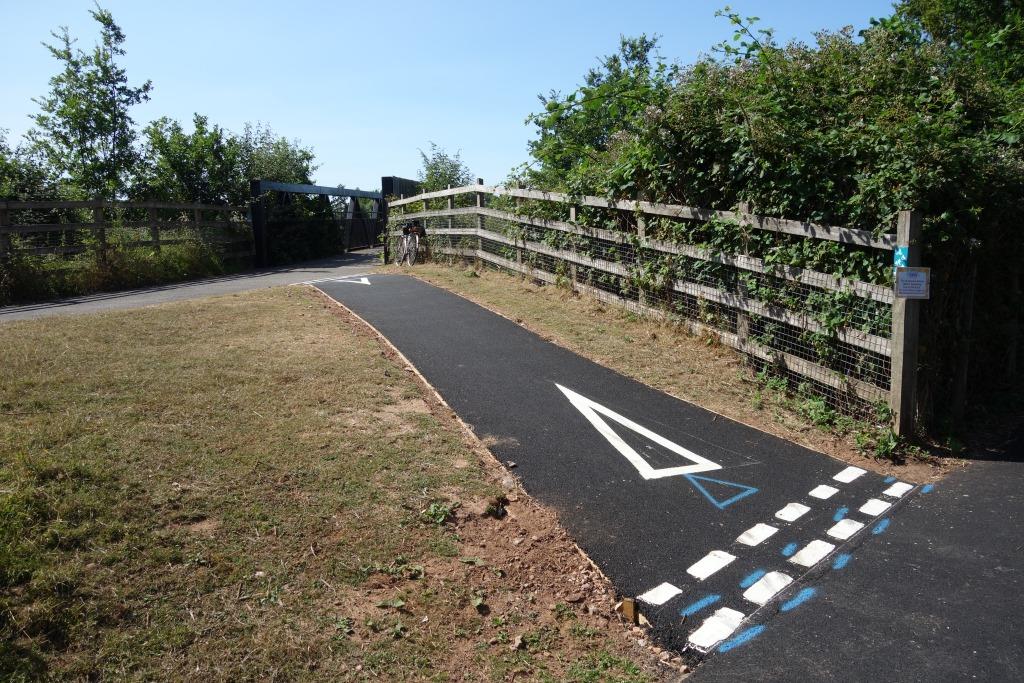
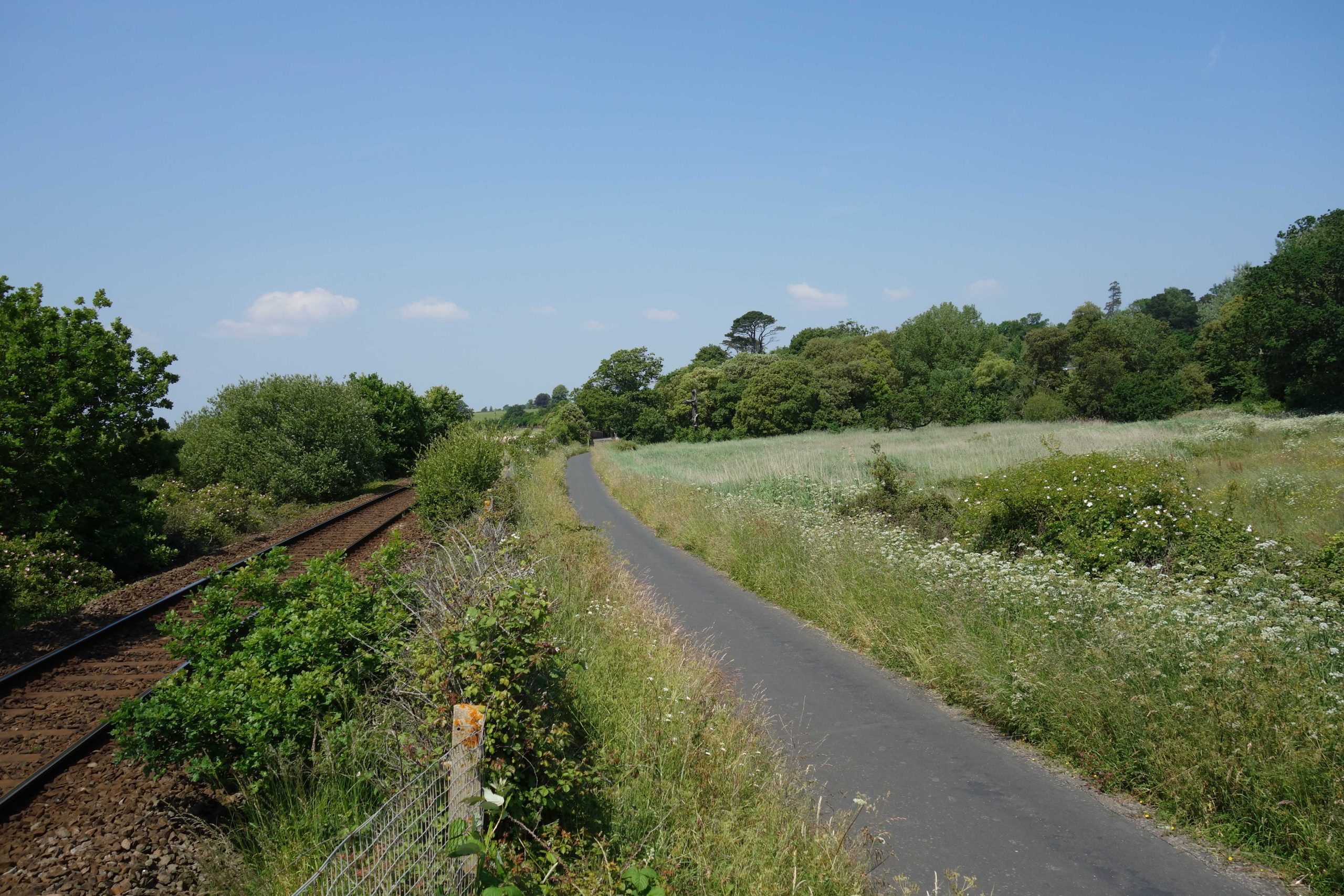
Just out of sight ahead is the trestle carrying the path over marsh cut off from the estuary by the railway. Work started in autumn, 2023, to replace The Boardwalk. +


")


Warren’s Siding
The line to Exmouth runs along the bottom of the photograph, while the Tipton line is seen curving away to the right.
Withycombe Raleigh, seen at top middle, is still a separate village.


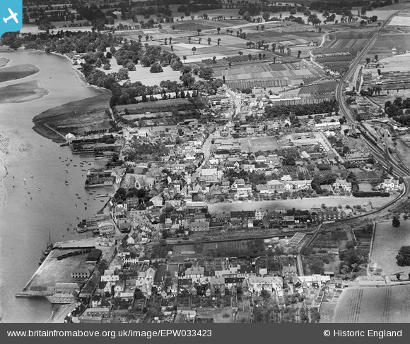
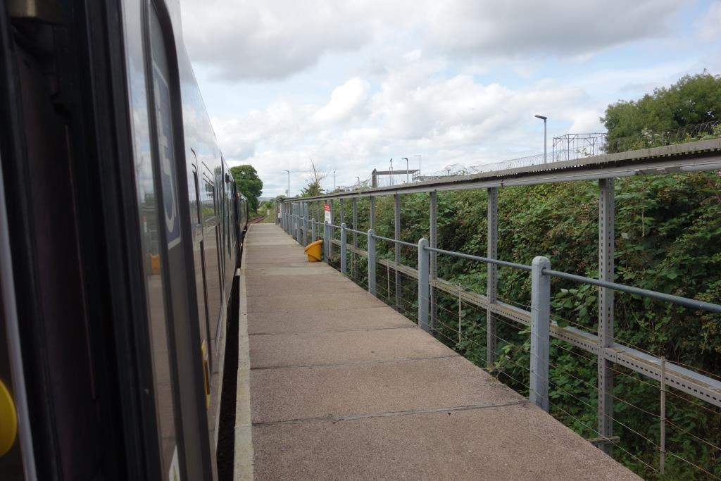
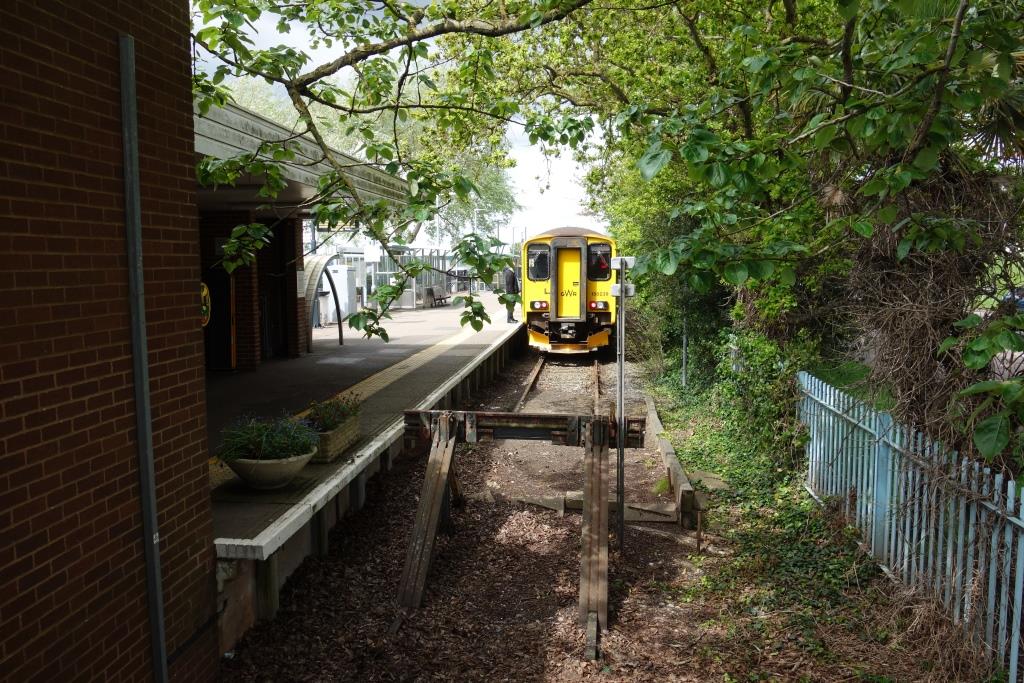
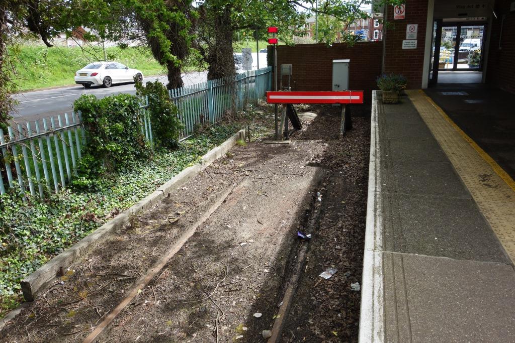
Exmouth
The station is well covered in No. 75.
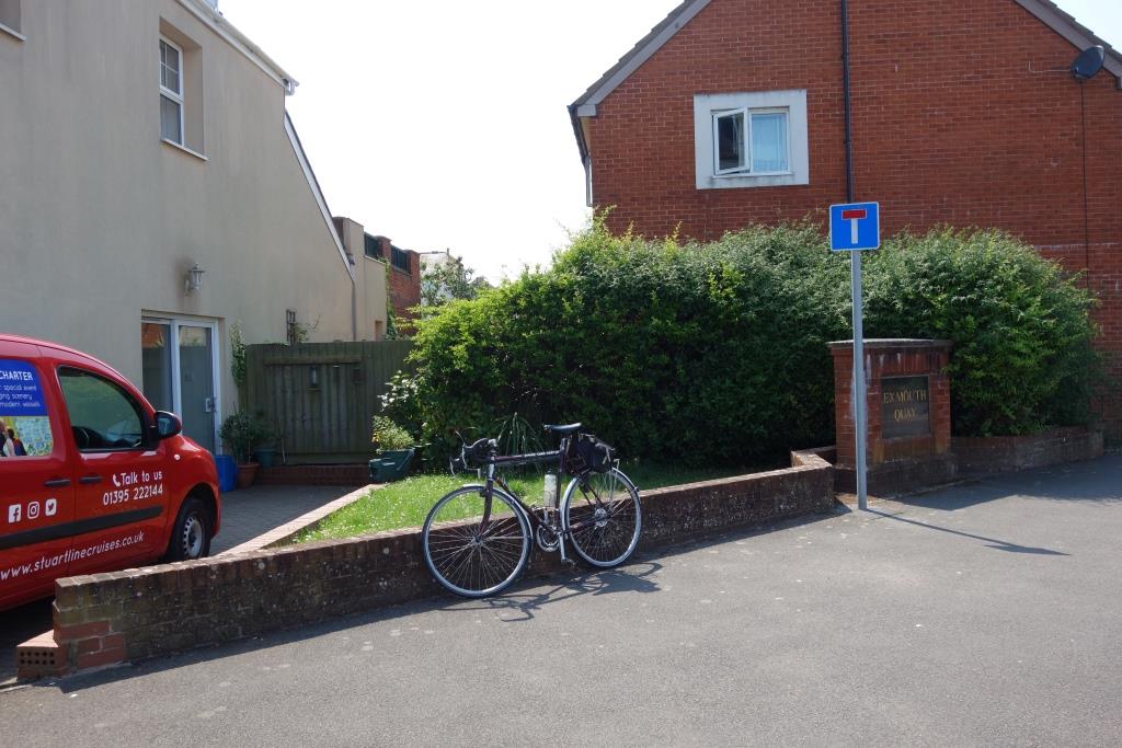
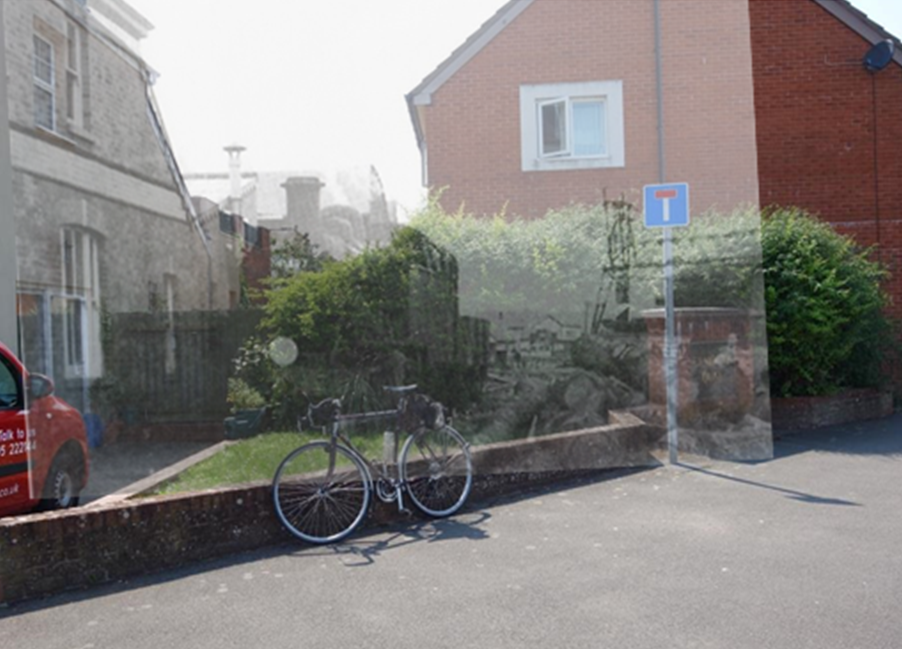
Exmouth Dock Line
Unlike the old port of Topsham, Exmouth Dock was entirely new in 1868. Its promotion had been fully supported by the L. & S.W.R.
The scout remembers walking the dismantled line with his Father before it became a road. Traffic had ceased in 1967.


A turn of the century 25 in. survey shows a longer line than in later years.
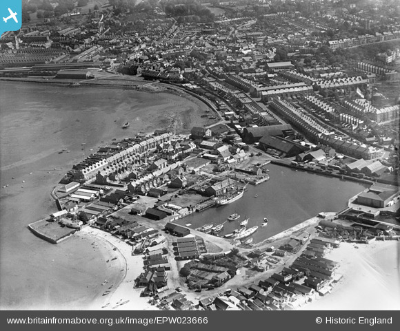
At the bottom is the Shelley Road shanty town, usually referred to as Shelley Beach, where the scout remembers walking with his parents.
Camperdown Terrace, which began as Trinity Road, is obvious at middle right.
This part of Exmouth was a sand spit corresponding to the Warren. In 1928, the station and dock line were on the water’s edge; the new goods yard had been built on reclaimed land. Since then, much more land has been created for car parking and amenity.
Photos cribbed from the web have been matched with shots taken “today” in “Exmouth—then and now.”


This was Exmouth’s Great Western station, for it was where the ferry from Starcross landed when this service was run in conjunction with the railway. The ferry company was an “agent,” able to sell through tickets from its booking office on the quay and accept parcels.
A summer-only service, independent of the railway, still operates. The vessel, Orcombe, was built by the Devon Dock Pier & Steamship Company in Exmouth in 1952.