
This is another refresher that the scout will do in stages, there being so much ground to cover.
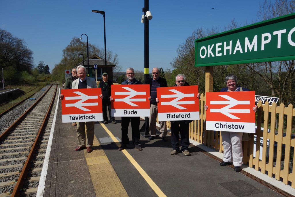
All the loud trumpeting made the return of a regular train service to Okehampton seem like a miraculous achievement, but the truth was that a line which had never really become disused was simply reinstated, in large part as an exemplar for the “Restoring Your Railway”—or “Reversing Beeching”—diversion.
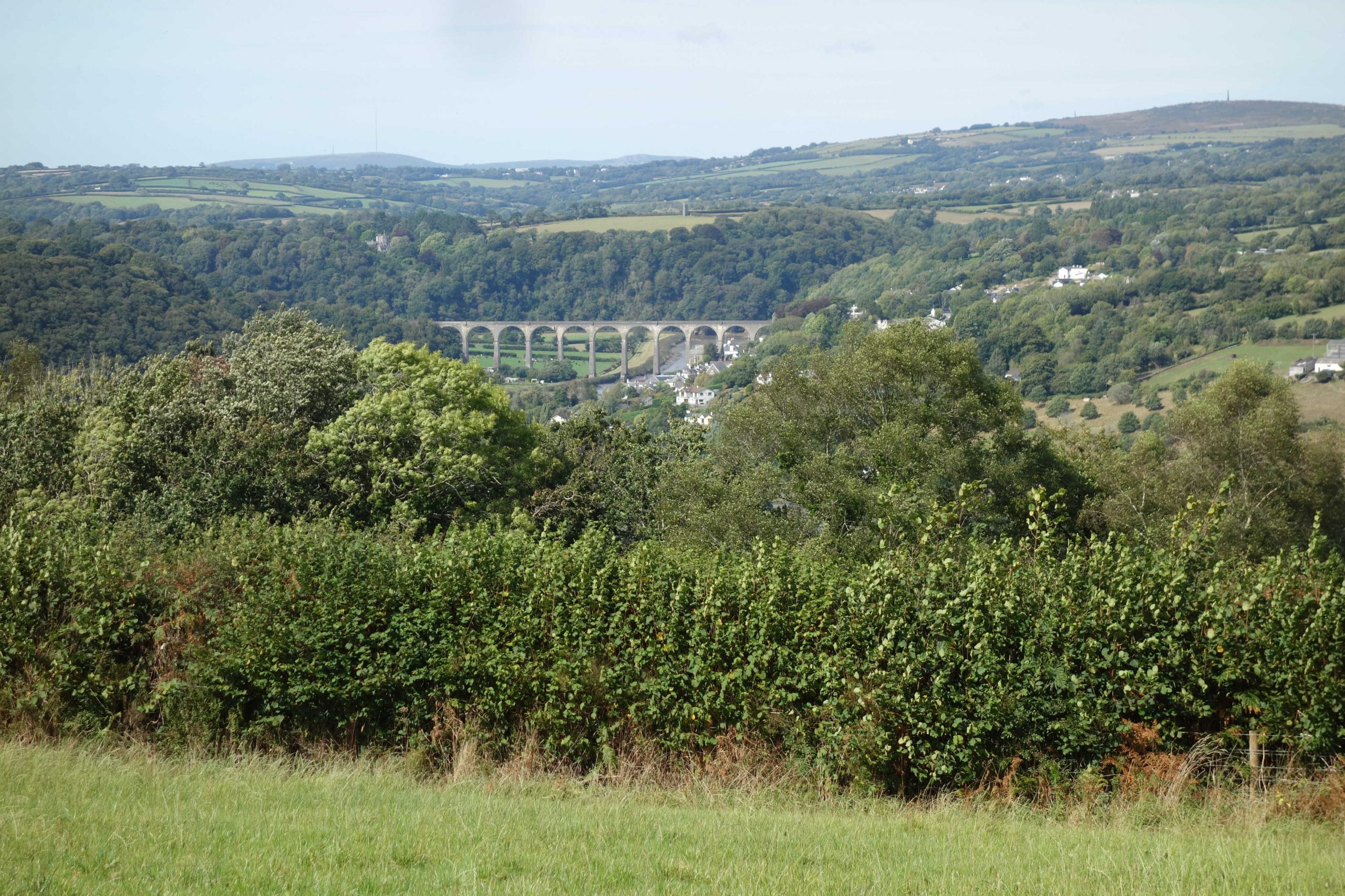
Okehampton was a terminus after it first opened but the line soon went on, reaching its furthest extent west at Padstow, on the North Cornwall coast, and south at Turnchapel, outside Plymouth.
Today, Okehampton is a terminus again but 100 miles of dismantled railway lie beyond. This mileage does not include the Plymouth lines serving the Southern’s former main stations, Devonport and Friary; Callington; and the humble N.D. & C.J.R. between Torrington and Halwill.
Mileages: Okehampton to Bere Alston, 22¾; Meldon Junction to Bude, 28¼; Halwill Junction to Padstow, 49¾. Total: 100¾ miles.
All four stations could once have been reached by going in this direction.
In 2022, the scout followed the former main line to Coleford Junction and the old turnpike to Exeter.
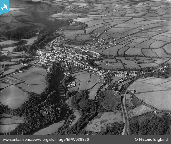
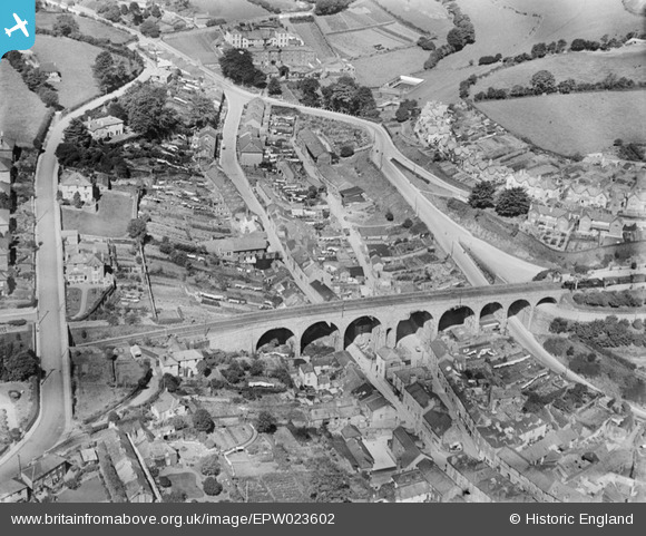
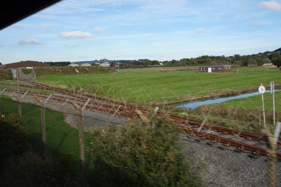
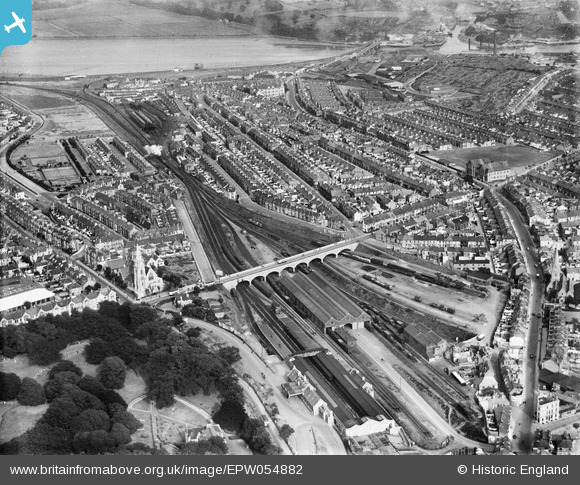
The station can be seen at centre right, with the line curving towards the south-west, past the military sidings and beneath Park Road, today’s Tors Road.
Meldon Quarry
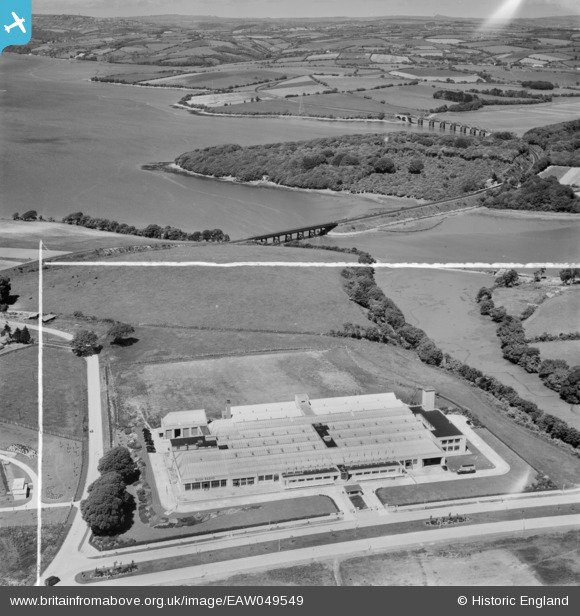
Quite by surprise and at first shrouded in a cloak of mystery, the quarry was reactivated in 2025 by Meldon Aggregates, Ltd., which firm has a lease from Aggregate Industries. The mobile plant and machinery brought in reminded those at Christow of what happened at Ryecroft Quarry in 2000.


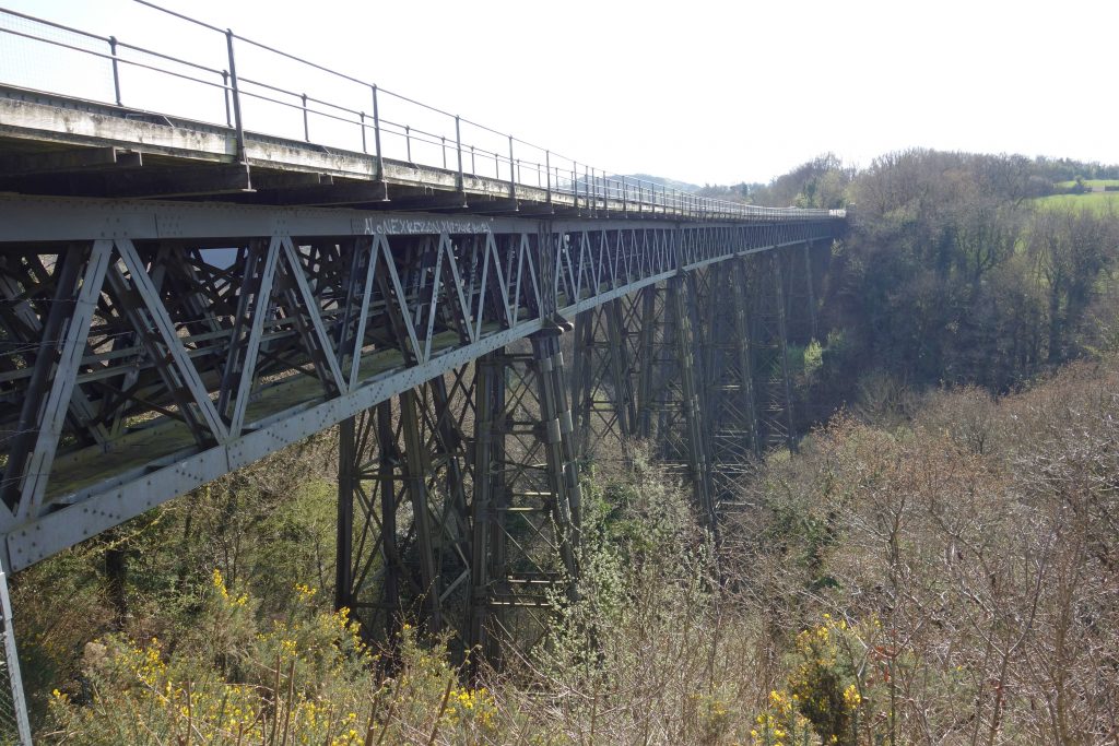
Meldon Viaduct
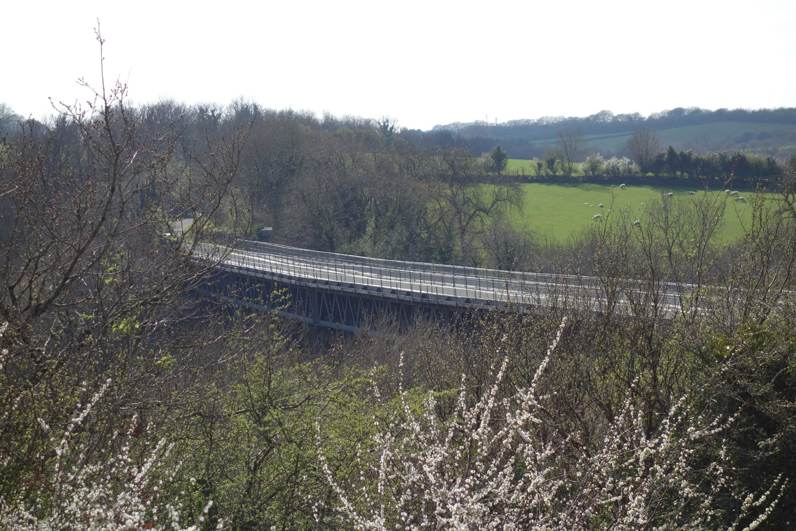
Cyclists often move as fast as the trains once did: there was always a 20 m.p.h. restriction. +
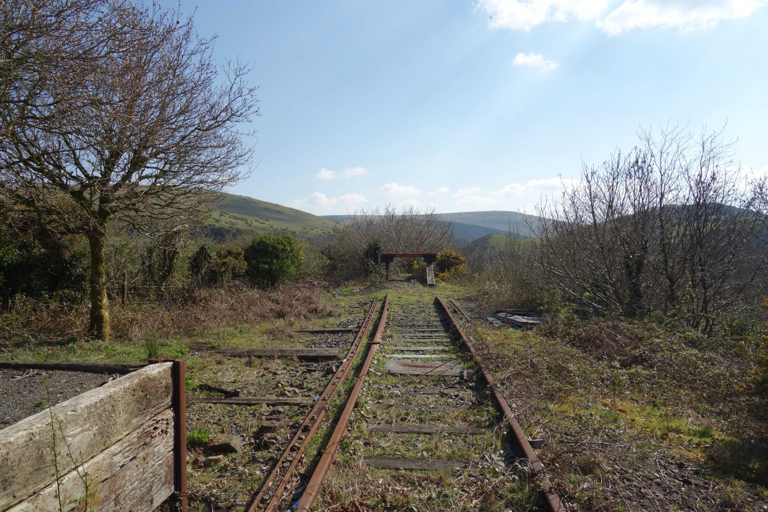
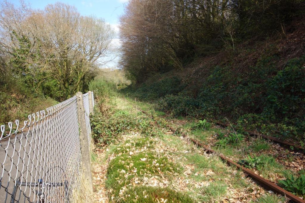
Meldon Junction
These photos were taken in February, 2025.


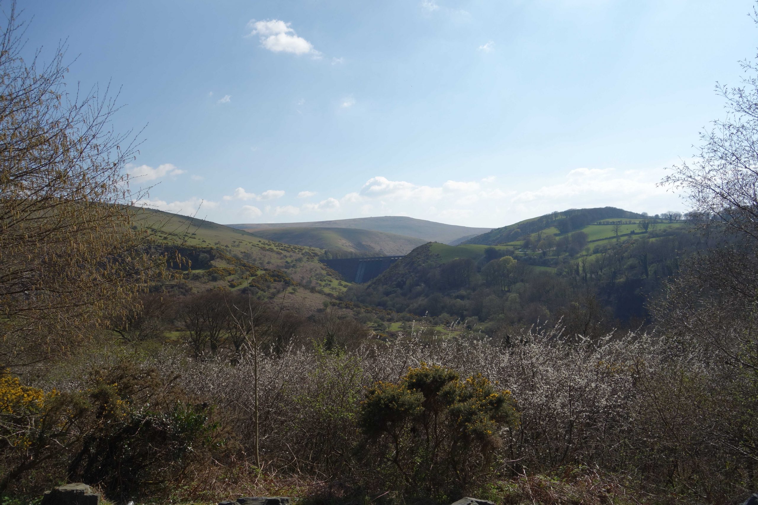
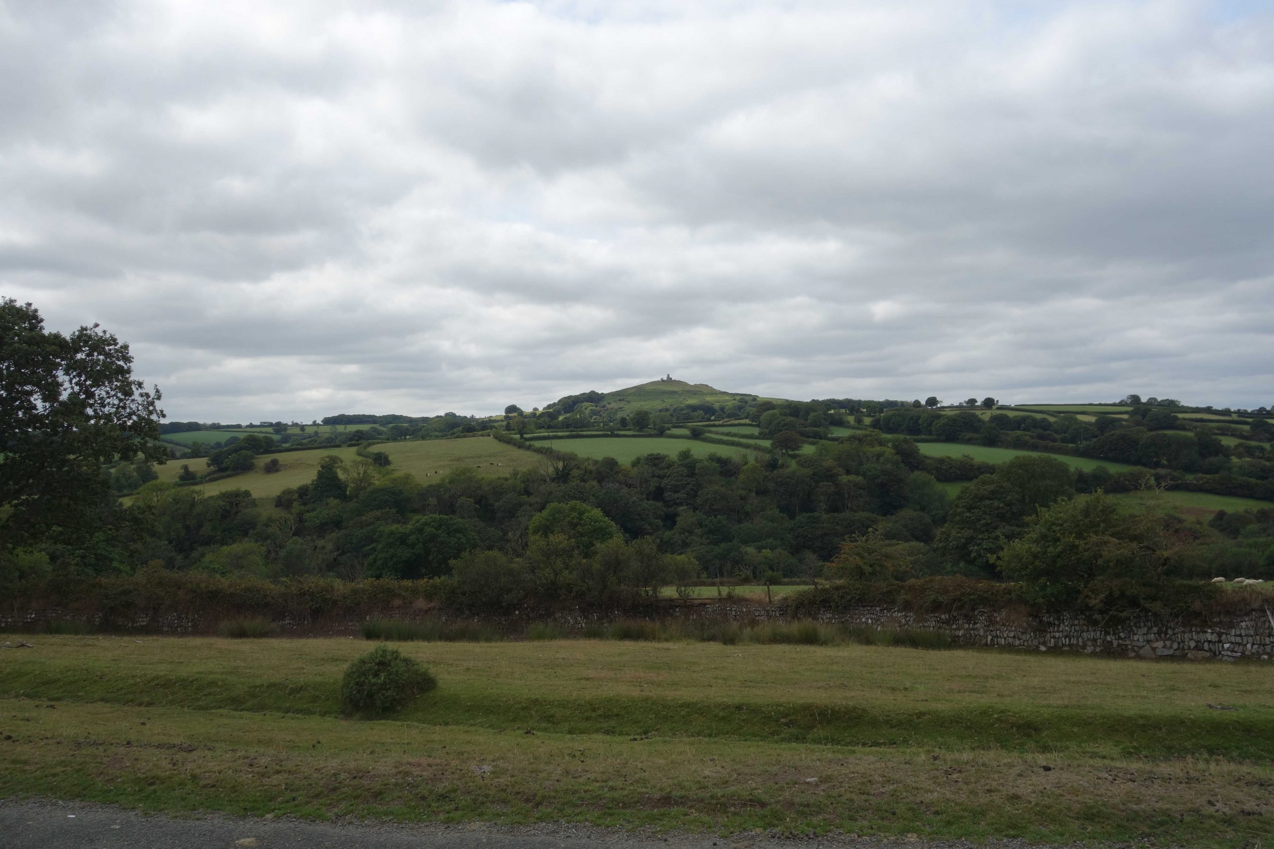
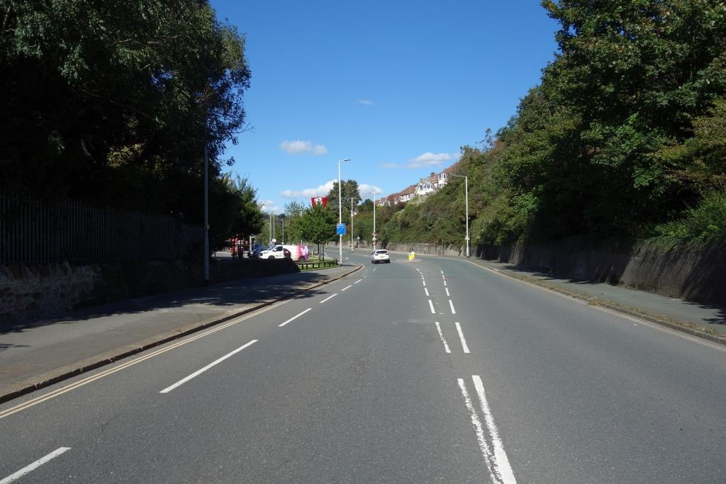
Modern-day passengers, perhaps expecting to have a scenic journey between Exeter and Okehampton, often remark about the line being in a green tunnel for much of the way. Actually, the most majestic scenery was always enjoyed beyond Okehampton, where the line sweeps down from its summit at 950 feet on the slopes to the north and west of Dartmoor.
A cyclist knows that he is over the hump, once the highest point on the Southern system.


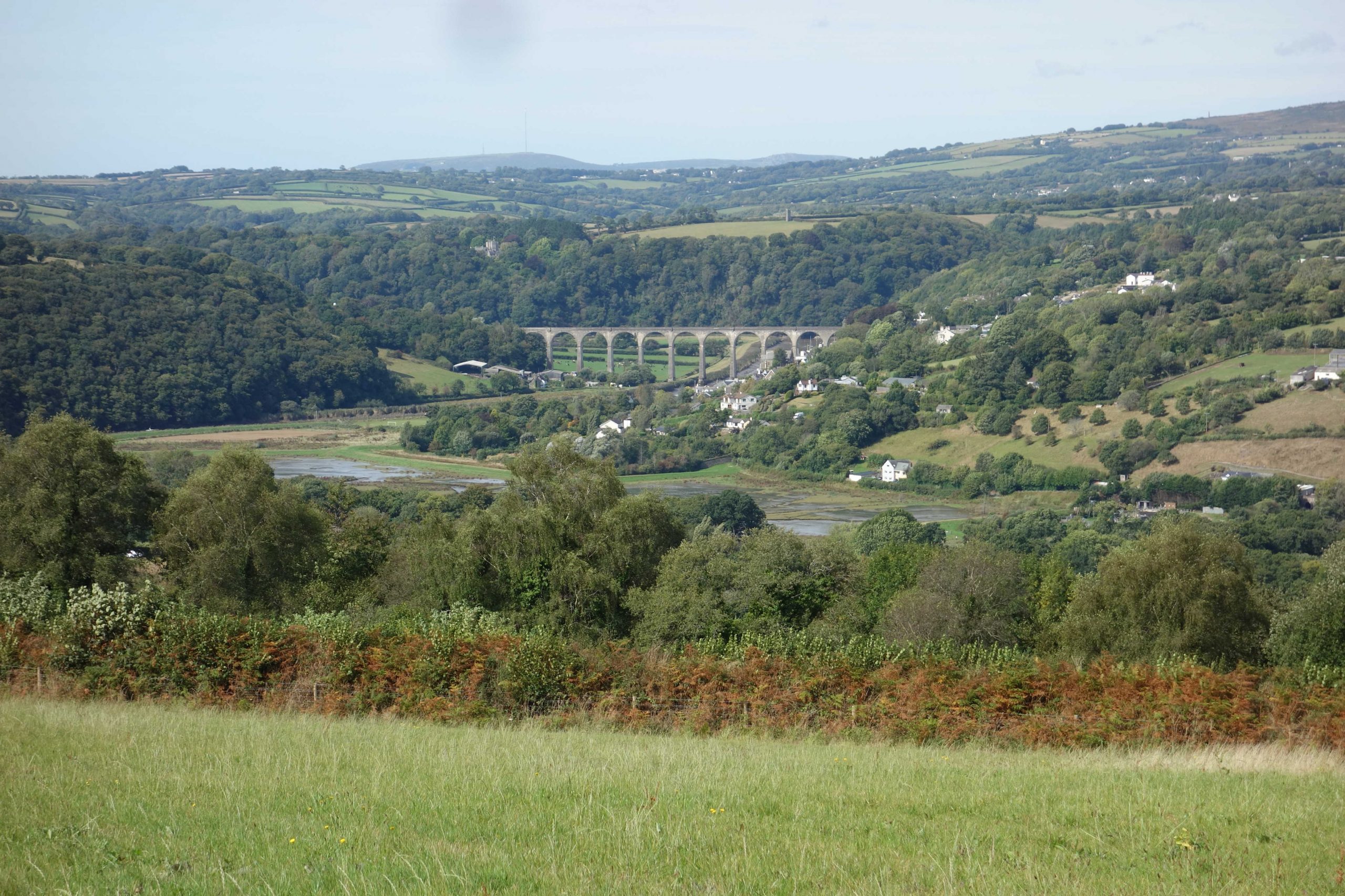
Lake Viaduct


Concrete Huts for Track Workers
The first of several hundred pre-cast re-inforced concrete huts for the use of Permanent Way staff throughout the system has been made at the Exmouth Junction Concrete Depot, and was placed in position on the incline leading to Exeter Central Station in the early hours of Sunday July 28th.
Weighing eight tons the complete hut was conveyed to the site on a well wagon and off-loaded on to its permanent position by steam crane.
The hut is fitted with a fireplace, tool rack and, for messing purposes, a table and forms. It is completely rain proof, and the interior walls have an absorbent finish to prevent condensation. The frames of the three windows and door are painted in the S.R’s standard colour of green.
The huts are being built to the design of the Western Divisional Engineer (Mr. W.H. Shortt) under the supervision of the Resident Engineer at the Concrete Depot, Mr. G.E. Bedford, and their provision is a further indication of the progressive policy of the Company in regard to the accommodation of their outdoor staff.
From The S.R. Magazine, September, 1946
Rattlebrook Peat


Bridestowe


Between Worting Junction and Devonport Junction, the maximum permissible speed for loco-hauled trains was 85 m.p.h. This was practically meaningless once Okehampton was reached. A few short unrestricted sections gave no advantage and the maximum speed from Bridestowe to Ford was 40 m.p.h.


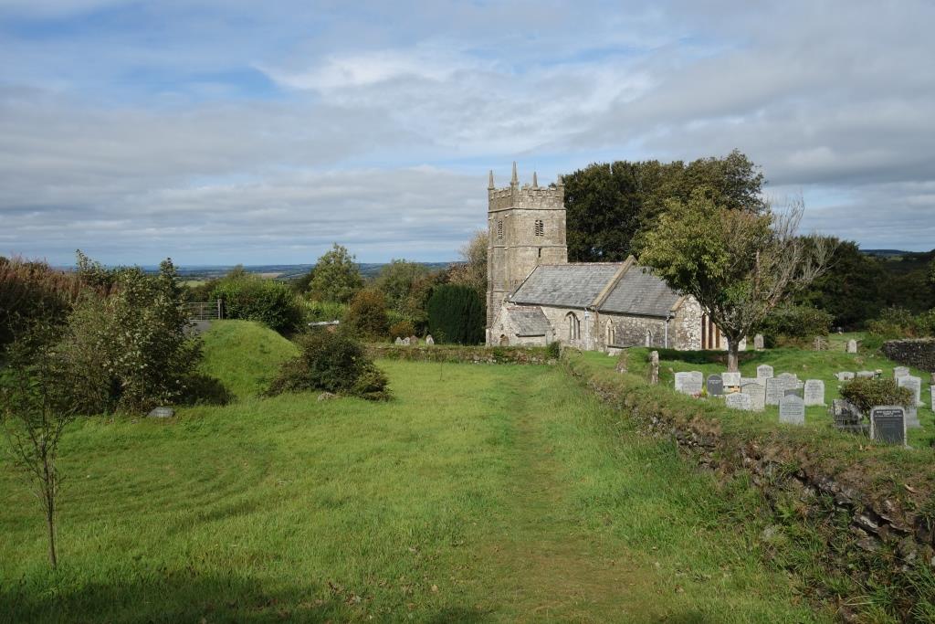
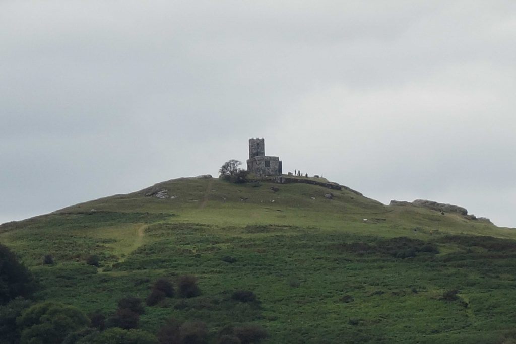
The castle and St. Petrock’s are obvious.


Lydford
The broad gauge Launceston Branch opened in 1865. The station buildings at the then Lidford were on the Up platform, used by trains going towards Plymouth.
In 1874, the terminus of the L. & S.W.R. line from Okehampton was built next to the earlier station. New buildings were erected on each side of the enlarged station and the original building became a waiting room on the island platform.
From old surveys, it appears that the new line took part of the G.W. goods yard and restricted access to the shed. This may have become a transfer shed for broad and standard gauge wagons.
In 1876, a connection was made between the two lines and the South Western exercised running powers by working its trains through to Devonport over a single, mixed gauge branch line. This was unsatisfactory and in 1890 a new double line between Lydford and Devonport was opened. It crossed the G.W. line at Wringworthy and served a new Tavistock Station.
There was no connection between the two standard gauge lines at Lydford until one was installed in 1943 as a wartime precaution. Three sidings were added between the two lines and another five beside the Southern line blocked the road to the station frontage.
Coordination and economy were achieved by the South Western taking over the station and erecting a joint signal box on the island platform.
The exposed western flank of Dartmoor saw heavy snow in harsh winters, with drifts blocking the railway. An old Relief Station Master told the scout of the time he got away from Lydford on the last train to get through. Others told of being marooned there. Snowdrifts were so deep that after the plough had cleared the lines on one occasion, two trains passed, each unseen by the other. Or so the story went.


The Launceston Branch closed to passengers in 1962 and the main line was closed between Meldon and Bere Alston in 1968.
Staff at Christow frequently dismiss claims that the British railway system was far too large and that there was much unnecessary provision. This charge should more properly be laid against roads, particularly the vast amount of space that has to be provided for vehicles not moving.
But, in the case of the Plymouth, Devonport & South Western Junction, which built the line from Lydford to Devonport, it has to be admitted that a more unified railway would have doubled the Launceston Branch between Wringworthy and Lydford, and would have had joint stations at Mary Tavy and Brentor. A junction would have been necessary at Wringworthy but there would have been one less bridge.


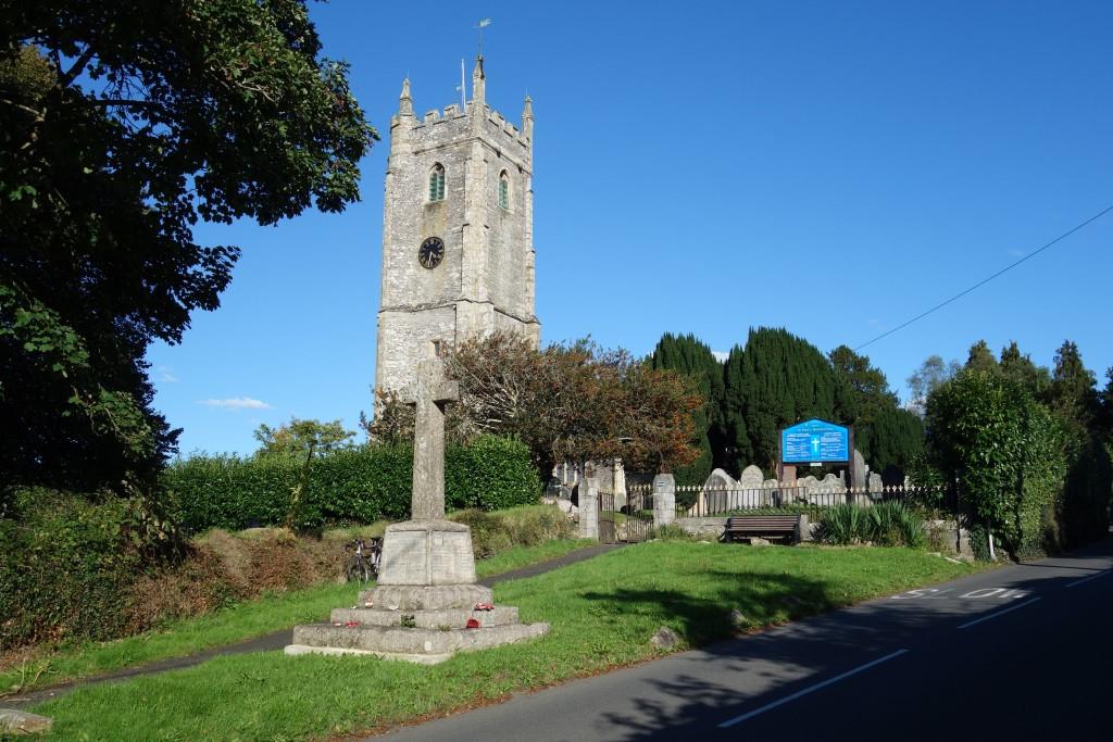
Brentor


Channel Four’s “Losing Track” chapter which shows Brentor and the war memorial in the village comes to mind.
Mary Tavy


Few today wonder how it occurred that a high capacity, guided transport system, operating in its own highly-engineered reservation, fell into ruin and road haulage gained supremacy.
A 30 m.p.h. restriction applies through the village from just ahead, for about half a mile. Not long after he set off towards Okehampton, the scout saw an articulated lorry laden with huge concrete “Lego” blocks overtake a car towing a caravan.
Wringworthy
The P.D. & S.W. was taken across the existing Great Western line by a slightly skewed, very long, double line arch. The bridge involved much more masonry than would have been required for a girder bridge, but steel would have needed more maintenance in the long run.
The scout had been to Wringworthy Farm twice before but had not taken photographs of the bridge. The first visit was in the late 1970s. This time, the owner was a little wary of allowing photographs and asked to see where they would be posted. The scout sent a wire on his return home and the owner kindly agreed to his photo being published for the few readers of this column.


Before the new line was opened in 1890, South Western trains had reached Plymouth by way of the Launceston Branch, which had been made dual gauge in 1876.
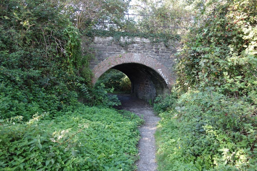
 beneath the former Okehampton and Tavistock turnpike.")

A little further on, a right turn leads to Old Exeter Road, which climbs alongside the railway. A path leads up to the track and this continues past the former quarry’s private siding and loading plant towards Tavistock.
Wallabrook Viaduct


The idiot headmaster of Kelly College, the lower tier public school where farmers send their sons to have them made semi-literate, has built his house on the track. The length of line that adjoined the grounds was bought by the school. A Kelly Old Boy, a pal of the scout, used to be distracted from conjugating his Latin verbs by passing trains.
The track can be regained part way down Old Exeter Road, whence the path continues to the station.
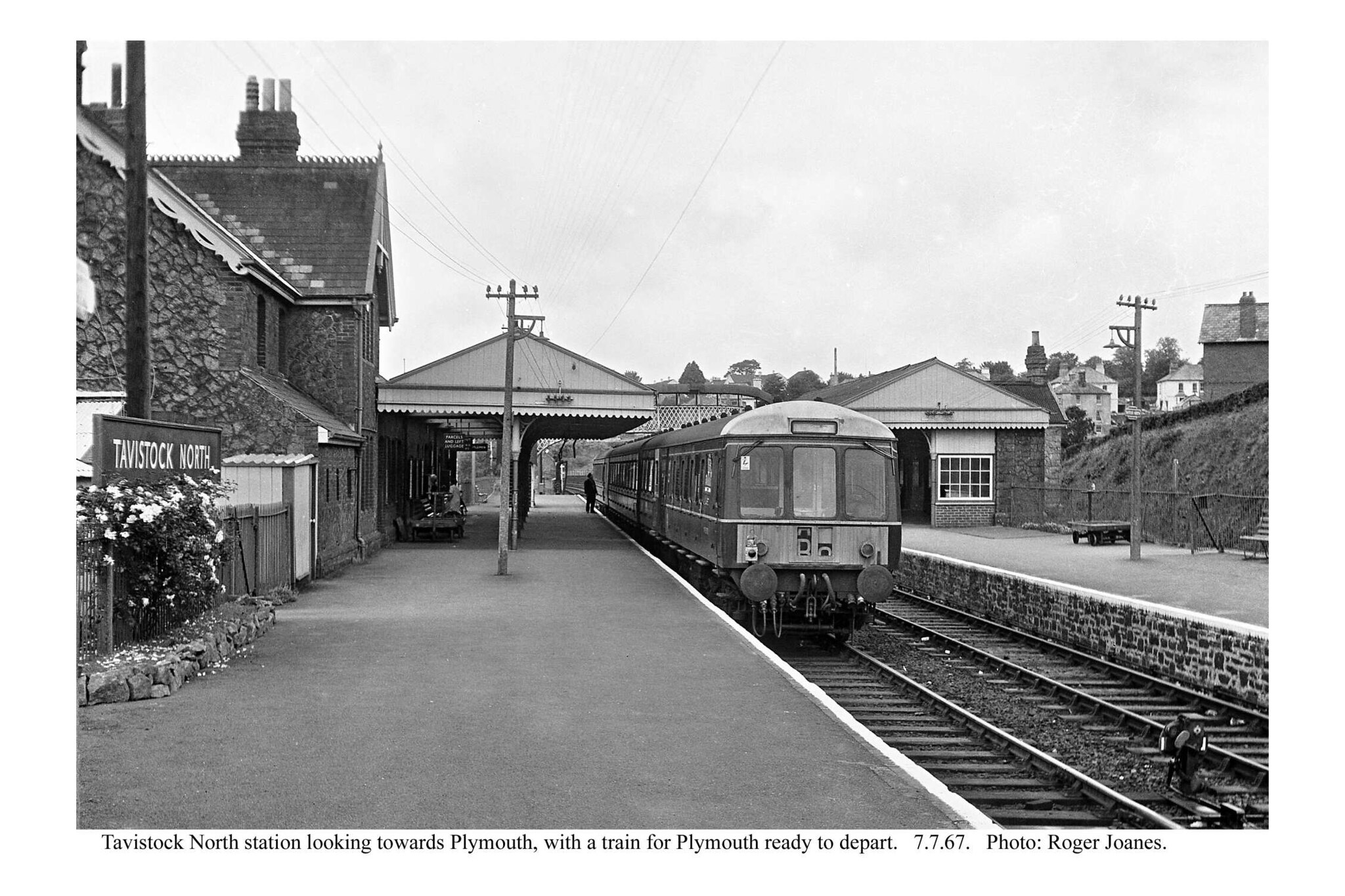
Tavistock (North)
Tavistock’s two stations became North and South after nationalization.


Bannawell Street Viaduct


The viaduct is just in view at left and is followed by Glanville Road, Old Launceston Road and a high accommodation bridge. New Launceston Road is seen climbing from the town at bottom right.


Bernard Mills kindly provided three photographs of diesel trains for the reverses of the two B.R. totems made as publicity props. The following one was not used.


A single dwelling is built on the formation by the former Callington Road Bridge. This obstacle, replacing the once low bridge and the housing at the station were enough to rule out putting the line back to North Station, if ever a line is built at all from Bere Alston.
Callington Road Bridge
The O.S. has it as Abbotsfield Road Bridge.


Shillamill Viaduct
The Tavistock Canal passes beneath the viaduct, which spans the River Lumburn.


More photos of the canal may be found in “Dartmoor Circular.”


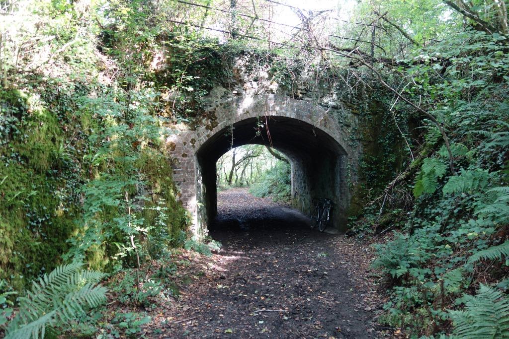
Shillamill Tunnel


A short film taken from the front of an engine in 1899.


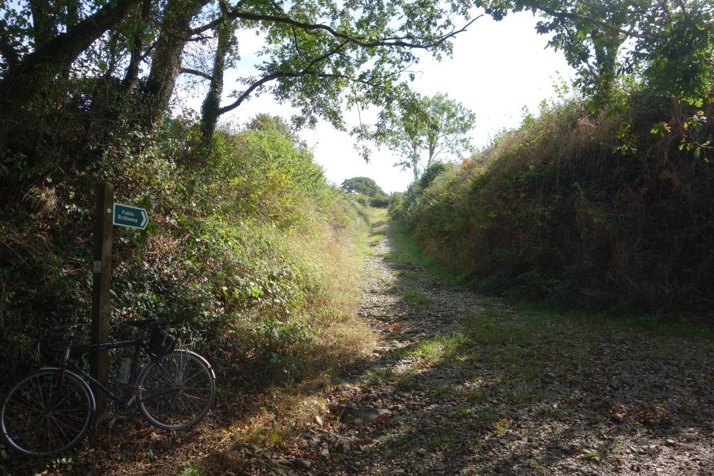
A little further towards Bere Alston, a bridleway which drops down to the line affords a splendid view of the Tamar Valley.


The story of Bunkers Hill “B,” and the plans to reinstate the line to Tavistock, was told in detail in connection with Greenwall Lane Bridge on the Teign Valley Branch, which was about to be demolished in 2013. It was then more than two decades since the first feasibility study was done. Now, more than three decades have passed.
Bere Alston


 sits next to a discarded dumpy bag, which, like buddleia, could be an emblem of Network Rail.")


A ride along the Callington Branch.
. Kit Hill can be seen in the distance at left.")

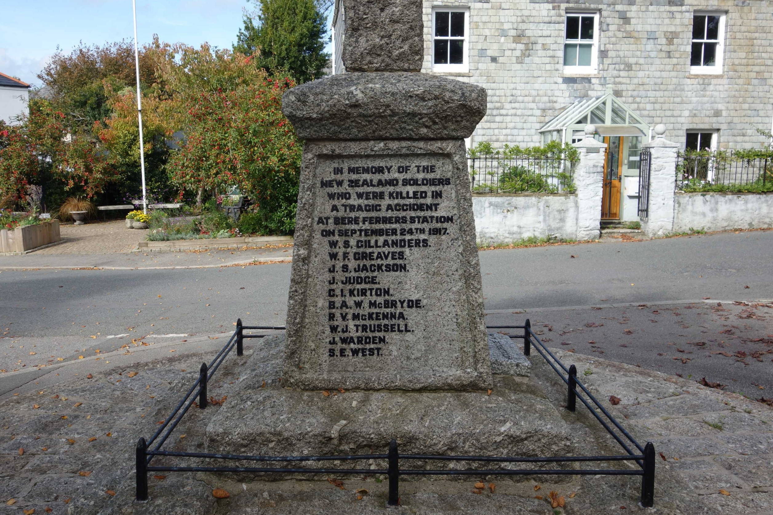
Bere Ferrers


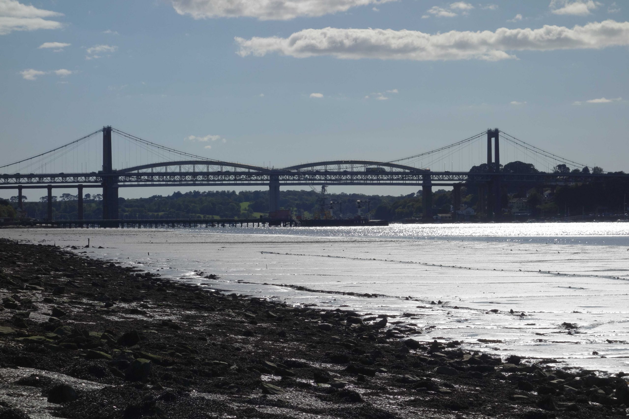
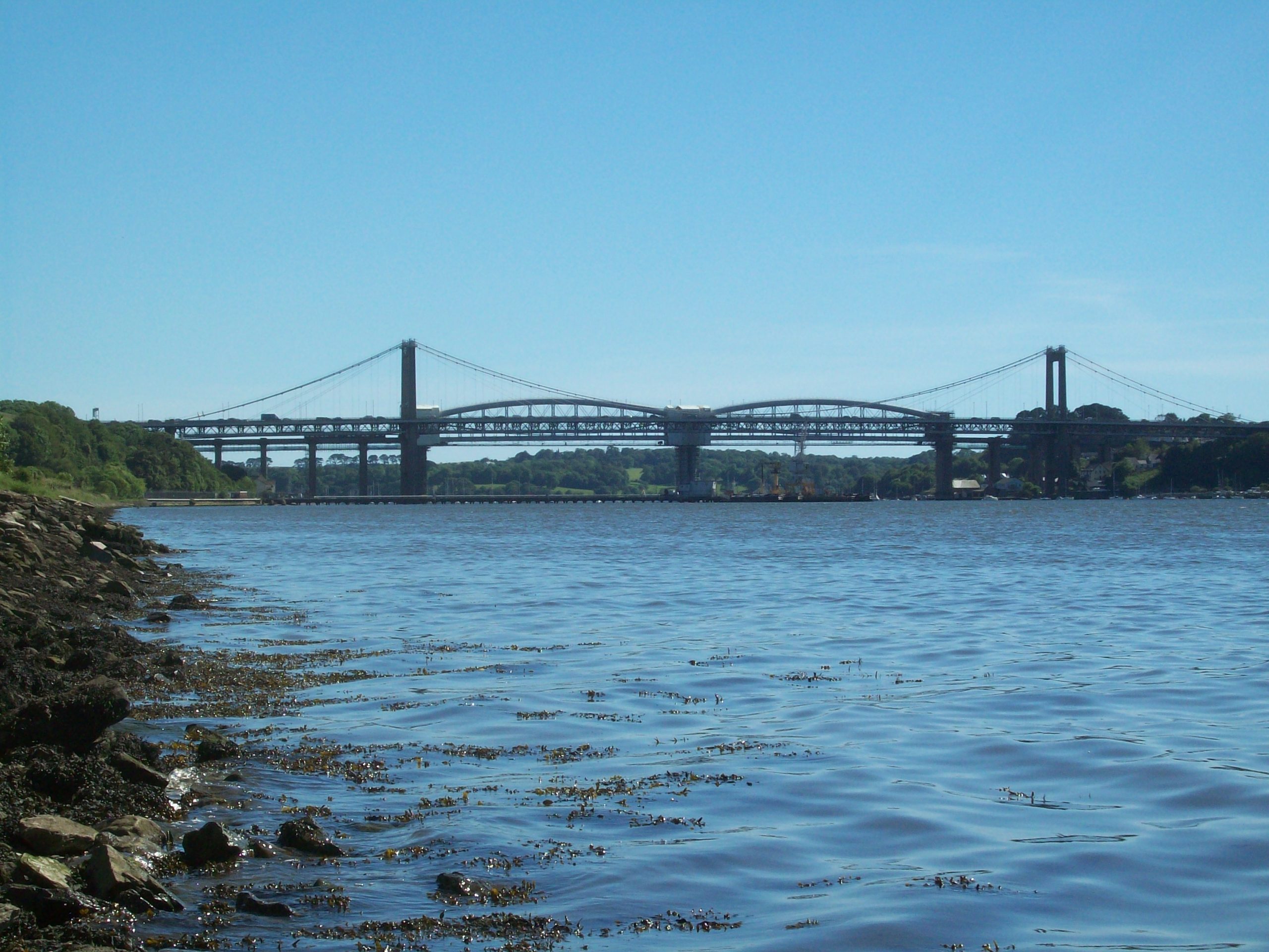
Tavy Bridge
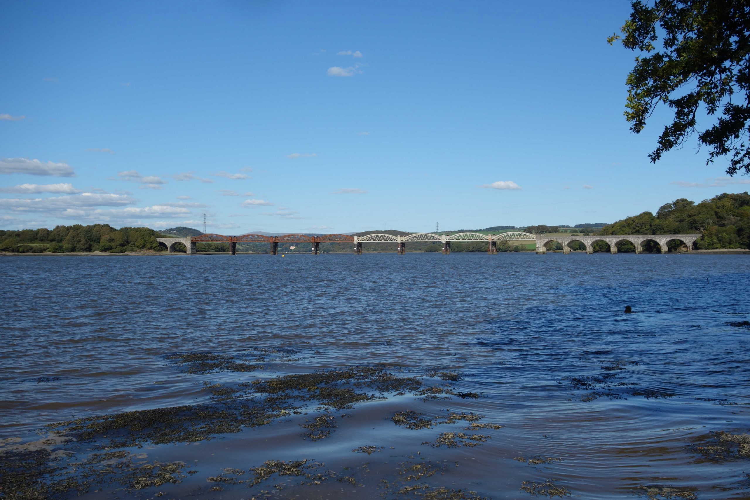
After descending to the tip of the Bere Peninsula, the line crosses the Tavy estuary just before it joins the Tamar. The speed had been raised to 55 m.p.h. over the bridge but has since been brought back to 40 again.


Hear the sound of a train crossing the bridge, now more slowly than they once did.
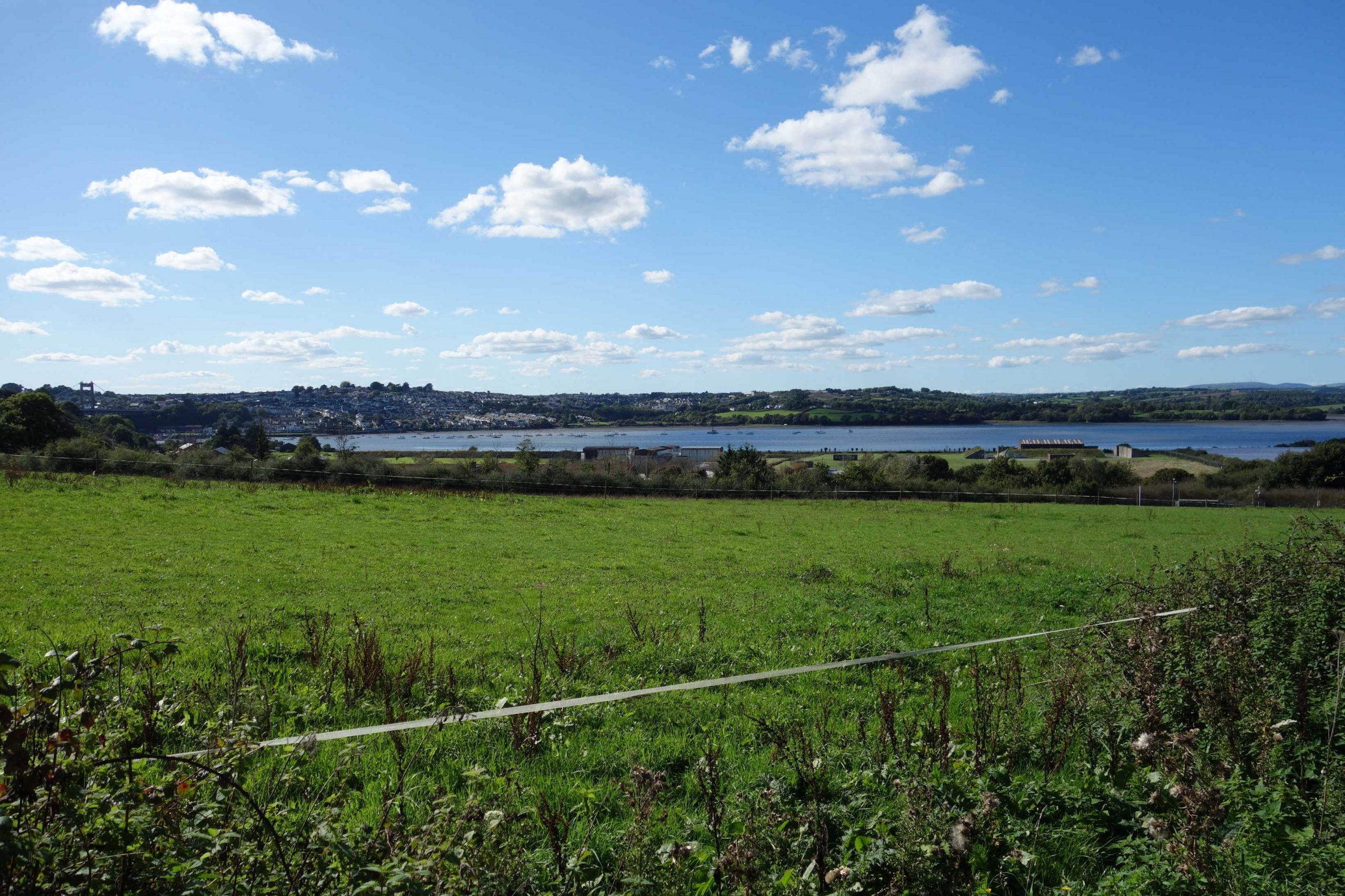
Tamerton Foliot
The station was opened in 1898, after the line had been built, and took the spelling of the village as it was: Tamerton Foliott. The accommodation bridge that had been built was able to span the platforms.


Tamerton Bridge


Warleigh Wood and Warleigh Point are at top centre.
The railway passes on the water’s edge and there are siding connections, with lines entering the storage bunkers, which are unlikely ever to be used again.
The scout used to be most fascinated, when he was a frequent traveller on the line in the late 1970s, by the narrow gauge railway which passed beneath the main line and went out onto the jetty, and which followed the line towards Devonport before curving away out of sight to serve bunkers buried in the hill.
The ministry and sprawling development wiped out the hamlets of Lower Ernesttle and Little Ernesettle. It is not known what happened to Higher Ernesettle, which vanished from the map around the turn of the 19th century. +
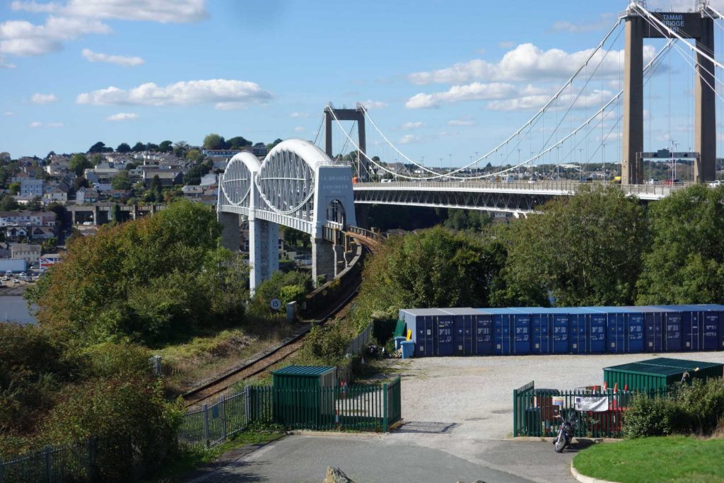
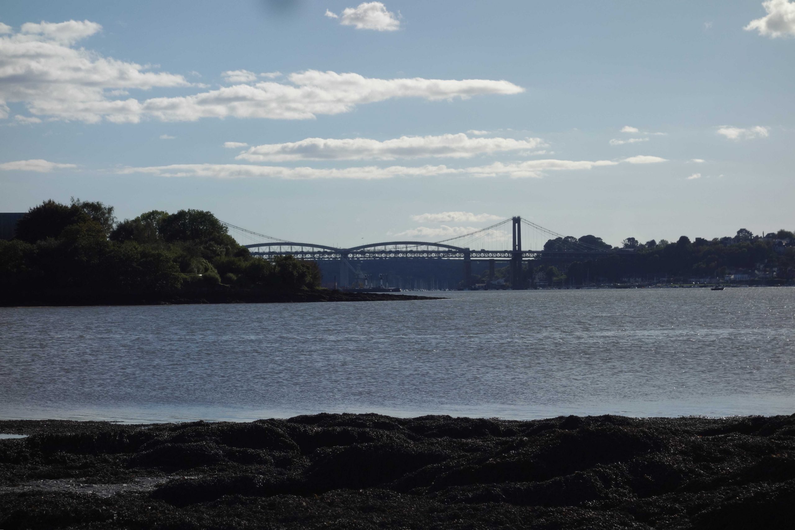
The scout has been through the tubes of Brunel’s masterpiece and been part way up the top of the tube on the Cornish side. The ladders have since been removed as they partly obscured the inscriptions at each end.


St. Budeaux (Victoria Road)
The South Western main line between St. Budeaux and Devonport (excl.) was closed in 1964. Thereafter, trains used the junction installed during wartime and continued via the Great Western main line to North Road.


St. Budeaux Junction


The O.S. marks Wolseley Road first as New Saltash Road and then Saltash Road.
Weston Mill Halt


When the P.D. & S.W.J. entered what is now the City of Plymouth, until it reached Devonport, its construction was mostly across open ground. The line was taken across Weston Mill lake on a high embankment, with a bowstring girder bridge spanning the water. Eventually, the swamp was drained and Weston Mill Drive, today’s St. Budeaux Bypass, was taken beneath the bridge.


Camel’s Head Halt


Ford


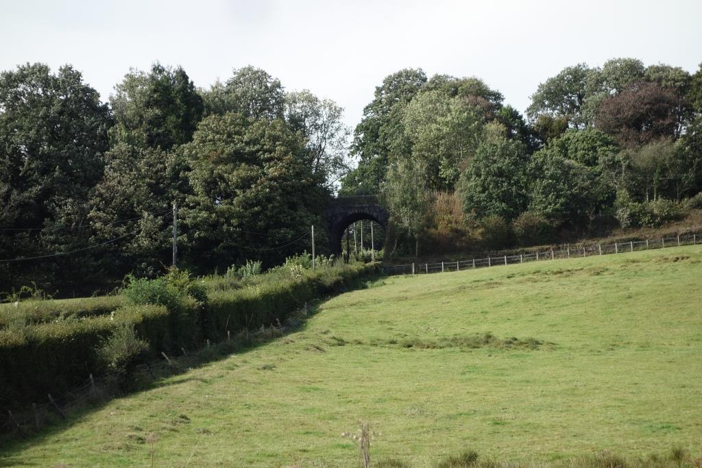
Ford Viaduct
 Viaduct remains as a monument.")


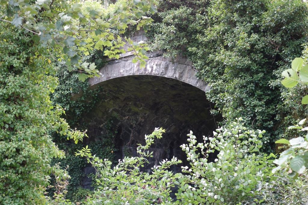
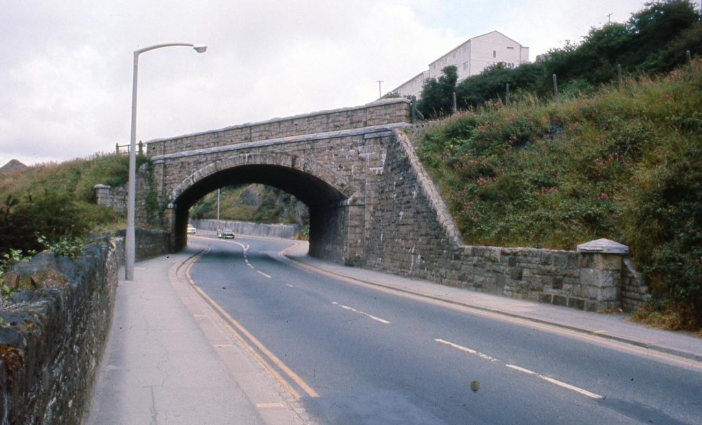
Ford Tunnel


Some years ago, the scout had walked through the tunnels with a couple of pals. They were ungated, or the gates were open, at the time. A little way into Ford, the scout had pointed to the vertical white lines on the walls which indicated the position of Devonport Tunnel. At that very moment, rather like the experience on the London Underground, a train was heard passing above. There were corresponding white lines in Devonport Tunnel.
It is remarkable, considering the city environment, that only two buildings are directly above the tunnels.
Albert Road Halt
The P.D. & S.W.J. must have taken advantage of a patch of open space to make a gap between the two tunnels. There was just enough room for the halt, another of those opened in 1906. It closed in 1947.
Devonport Park Tunnel


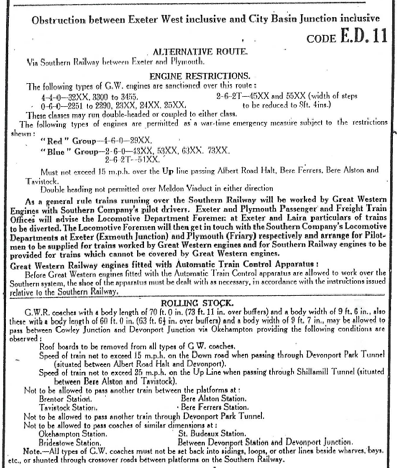
The tunnels brought to mind the restrictions on Great Western coaching stock, particularly the wide-bodied type, working over this route in an emergency and the junior clerk was sent to find the “Notice Shewing Arrangements for the Diversion of Through Trains to Alternative Routes in cases of Emergency,” a copy of which languishes in the office at Christow.
The relevant section is reproduced here.
Under the “Rolling Stock” heading in the Teign Valley and Moretonhampstead branches diversionary route instructions is the short “No restrictions.”
Devonport (King’s Road)
The station was opened in 1876 as a terminus, when trains worked over the Great Western’s Launceston Branch and the main line from Tavistock Junction to Devonport Junction. In 1890, with the opening of the P.D. & S.W.J., it became a through station and Down became Up.


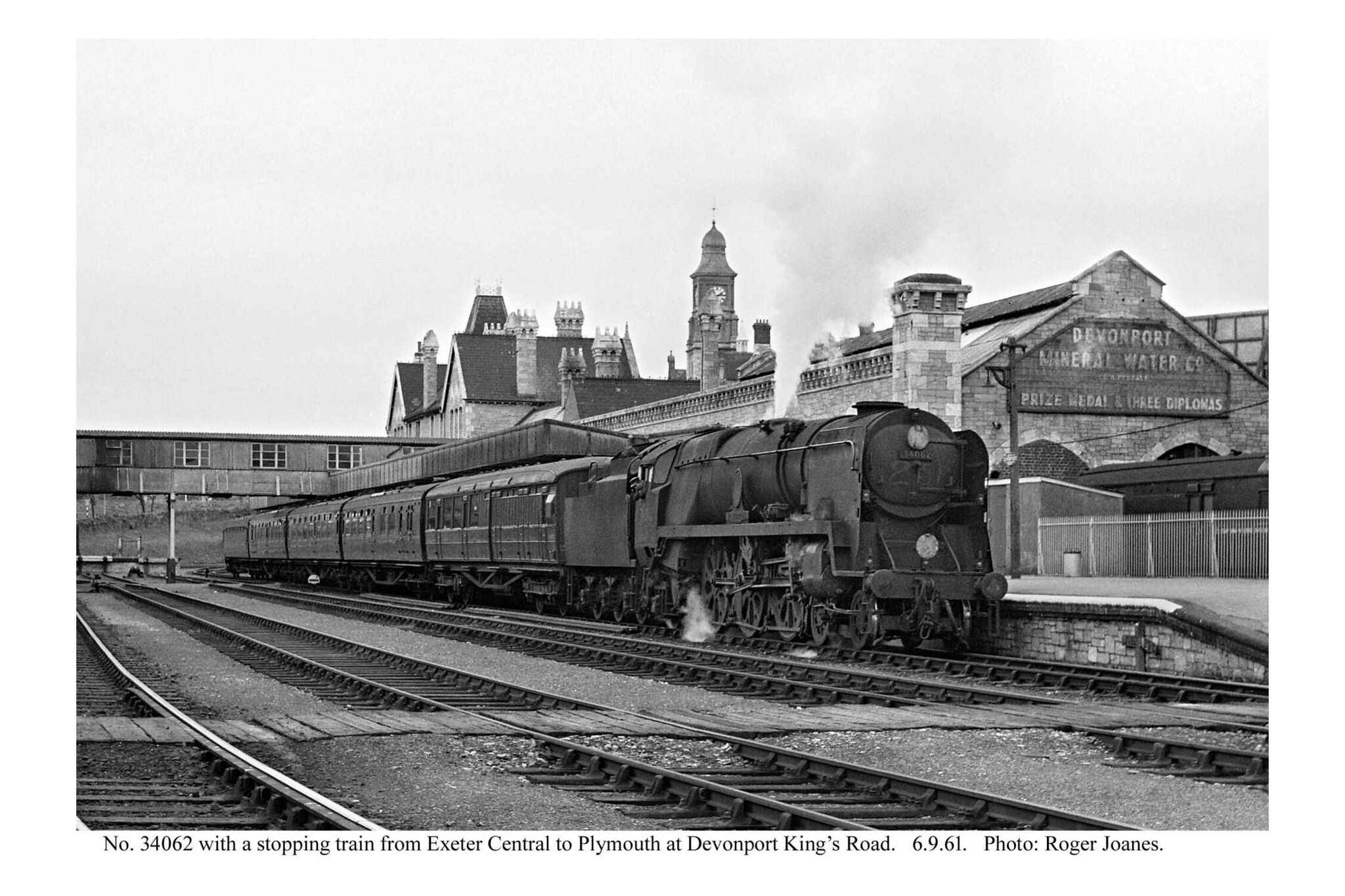
Copyright: Roger Joanes. Shared under Creative Commons. +
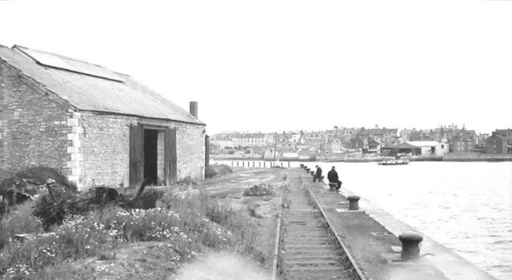
Stonehouse Pool Branch
The line was opened with the station and was the South Western’s bid to capture some of the transatlantic trade, but without the Royal Mail contract held by the Great Western at Millbay. Ocean Quay Station was opened but the traffic never developed. Passenger traffic ceased in 1910 and the line was officially closed in 1970.


He went back after he’d taken this shot and said that there had been a tunnel behind them that the line had dropped down from the station to Ocean Quay, where transatlantic liners were once serviced by lighters. The scout chatted to them, first mistaking them for mature students and then teachers; they were catering staff. One asked: “Where’s your helmet?” To which the scout replied: “I’m of the generation that doesn’t give a shit.”


Devonport Junction
Trains first came from Waterloo via North Road. When the Friary terminus was opened in 1891, London trains approached the junction, as at Cowley Bridge, from the opposite direction.


Lipson Junction
Mount Gould Junction
The curve from Lipson Junction joined the Great Western’s Sutton Harbour Branch at what the O.S. originally marked as Mount Gold, after three farms which overlooked the Plym Estuary.


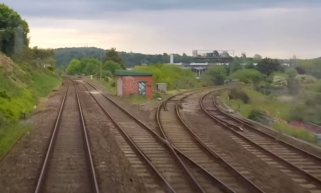
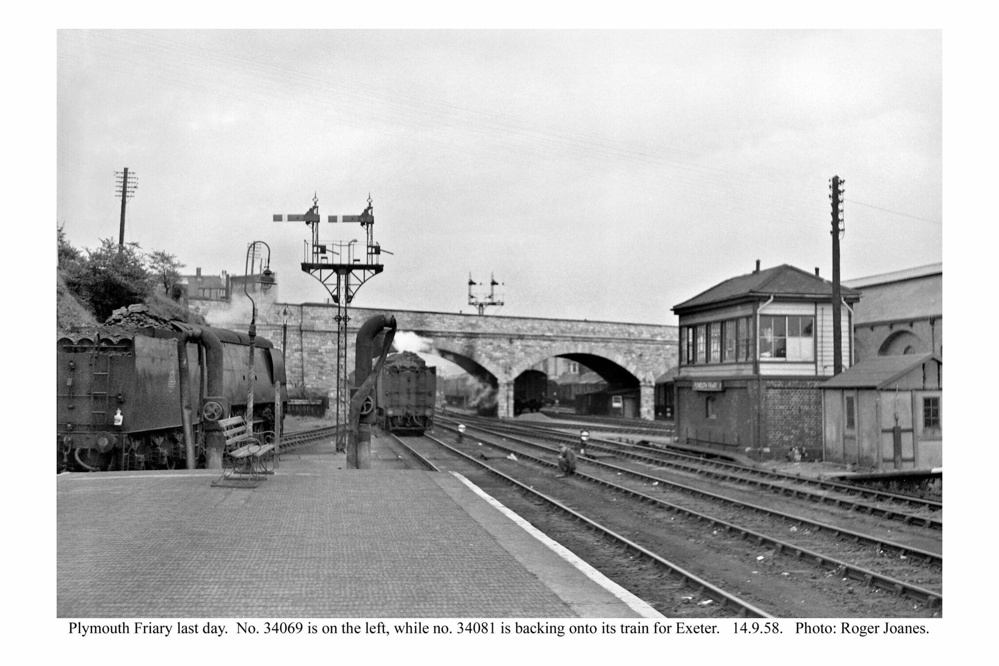
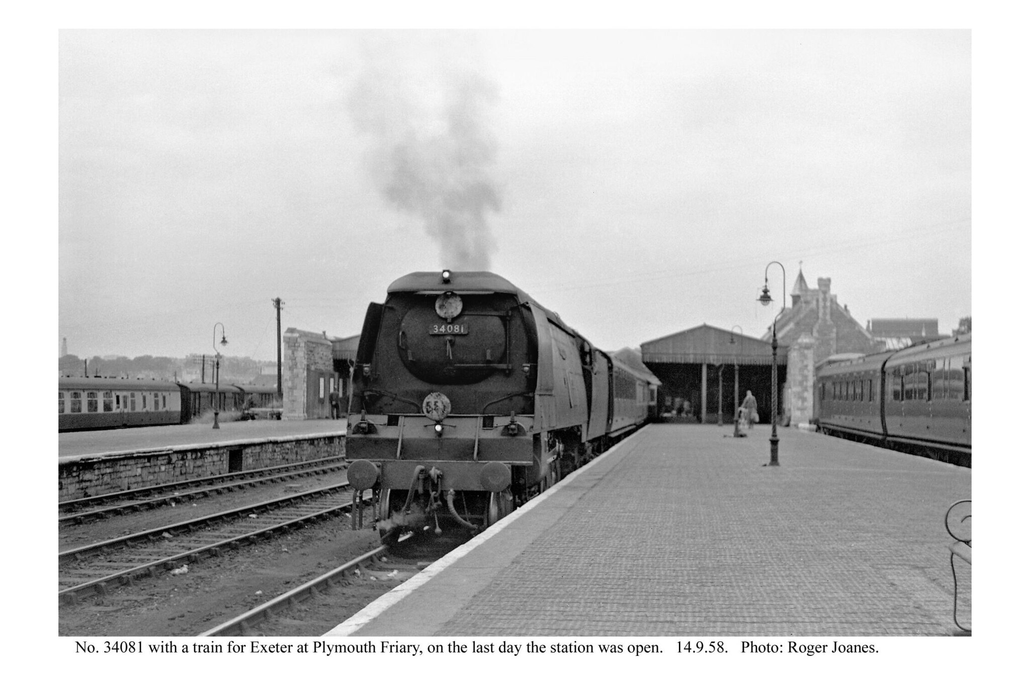
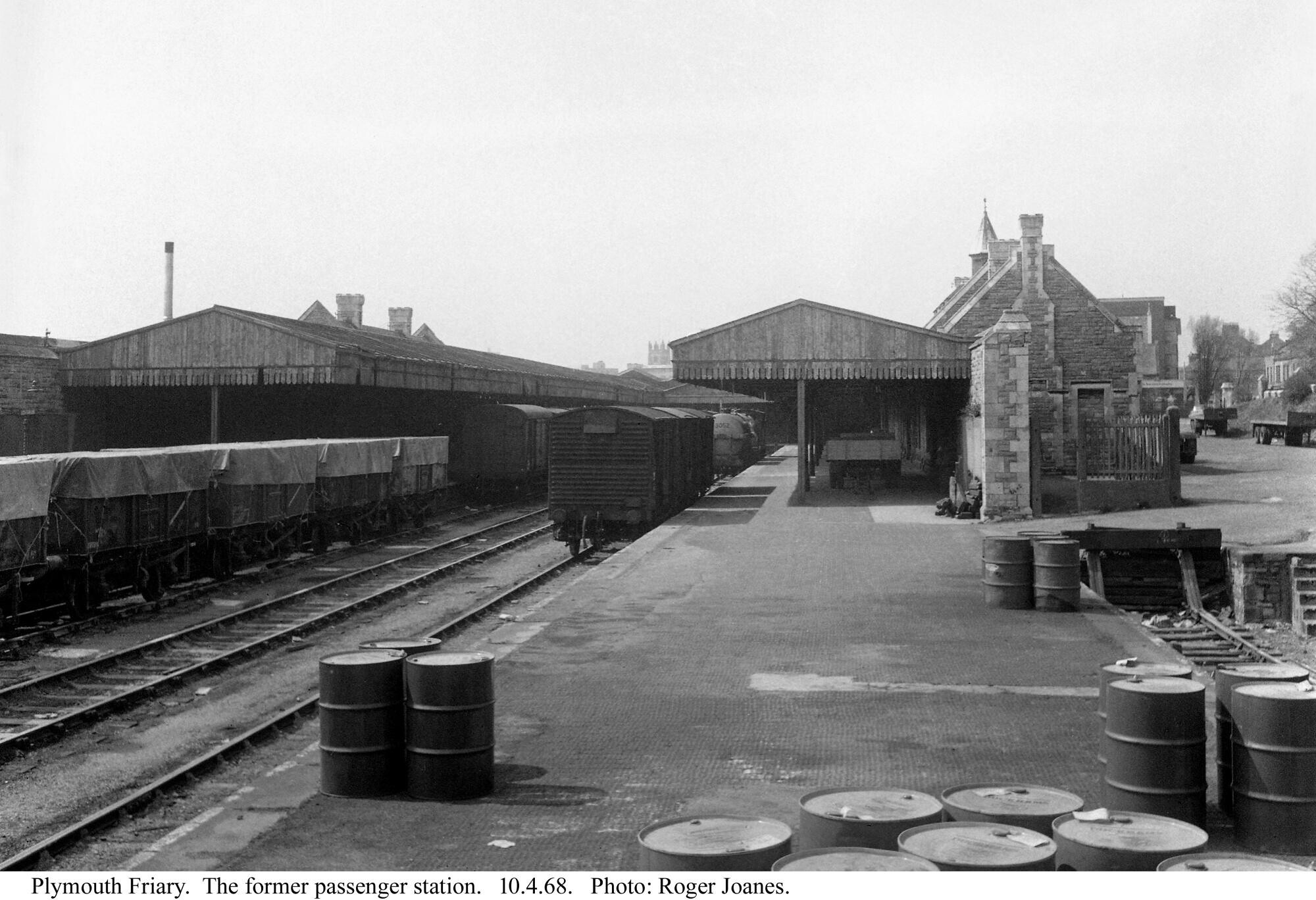
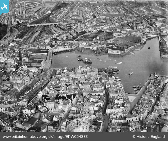
Plymouth (Friary)
There were three principal stations in Plymouth: Millbay, North Road and Friary. Devonport and Stonehouse were separate towns until the Borough of Plymouth was created in 1914. The “Three Towns” became the City of Plymouth in 1928.
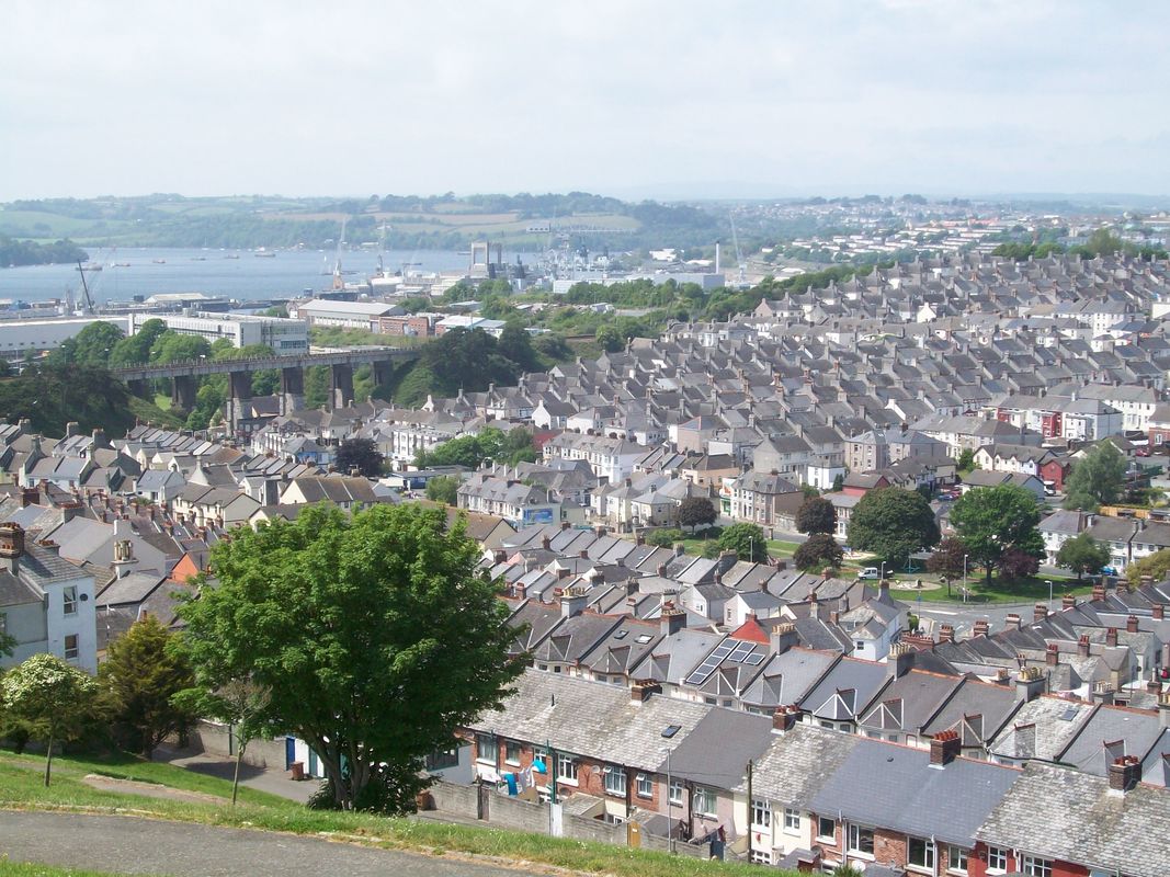
Friary closed to passengers in 1958 but continued to handle goods traffic. The station became a Freight depot under the “concentration” scheme which continued into the 1980s, with trips being run to Plymstock and Cattewater. The city with a population of around 260,000 now generates no rail freight traffic, inward or outward.


Destruction at Friary in 1989.
The wide frontage is obvious at bottom centre. The Goods Shed is above and the goods yard is to the right. The North Quay Branch is seen descending in its cutting to the right of the Goods Shed. The lip above the tunnel portal can be seen. It was possibly the tunnel or St. john’s Church which determined which side of Exeter Street, seen at right, would be cleared to allow widening.
At top left, above the trace of steam, can be seen the Loco Shed and above that the line to Turnchapel and Cattewater is seen curving to run alongside the Plym.
At the end of the station buildings, allotments are being kept where the friary once stood.
The junior clerk is often a bob or two out when cashing up, so when he was asked to work out the mileage from Waterloo to Friary, which included three sections of foreign metals, there’s no certainty that he came up with the correct figure. However, 233 miles and 65 chains must not be far adrift.
But there was more. A short branch took the line down to the quayside at Sutton Harbour.
And there were the branches to Cattewater and Turnchapel.
North Quay Branch


The Great Western’s Sutton Harbour Branch enters at top right and runs alongside Lockyer’s Quay and Bayly Wharf at middle right. The Great Western’s North Quay connection can be seen passing beneath St. John’s Bridge, which is still there today.
The fish market can be made out on the other side of the harbour at right.
In four years’ time, much of the city would be razed to the ground by enemy bombing.
At top left, the bomb damaged Charles’s Church, isolated on a roundabout as a memorial, is obvious. +