
The scout’s route refresher over the Devon & Somerset began in August, 2011, when he joined the Railway Ramblers’ visit to Dulverton. They walked the line from there to Exe Bridge and parts of the line, through Nightcote Tunnel, to East Anstey, where the owner had kindly laid on tea and cake.
The task, laden with sadness, was continued in 2017, following the line between East Anstey and Barnstaple, and finished in 2018, revisiting what is left between Taunton and Morebath Junction Halt.
The photographs are arranged in line order but they were taken on a number of rides in either direction.
When at Taunton School in the early 1970s, the scout got as far as Wiveliscombe, where railway stationery was still strewn around the booking office. He remembers looking at Milverton Station from the road bridge. In the late ‘70s, he rode from Barnstaple to Taunton but remembers very little of it and took no photographs.
This little album is not intended to be a complete study of the line’s remains, only of those features that caught his eye.
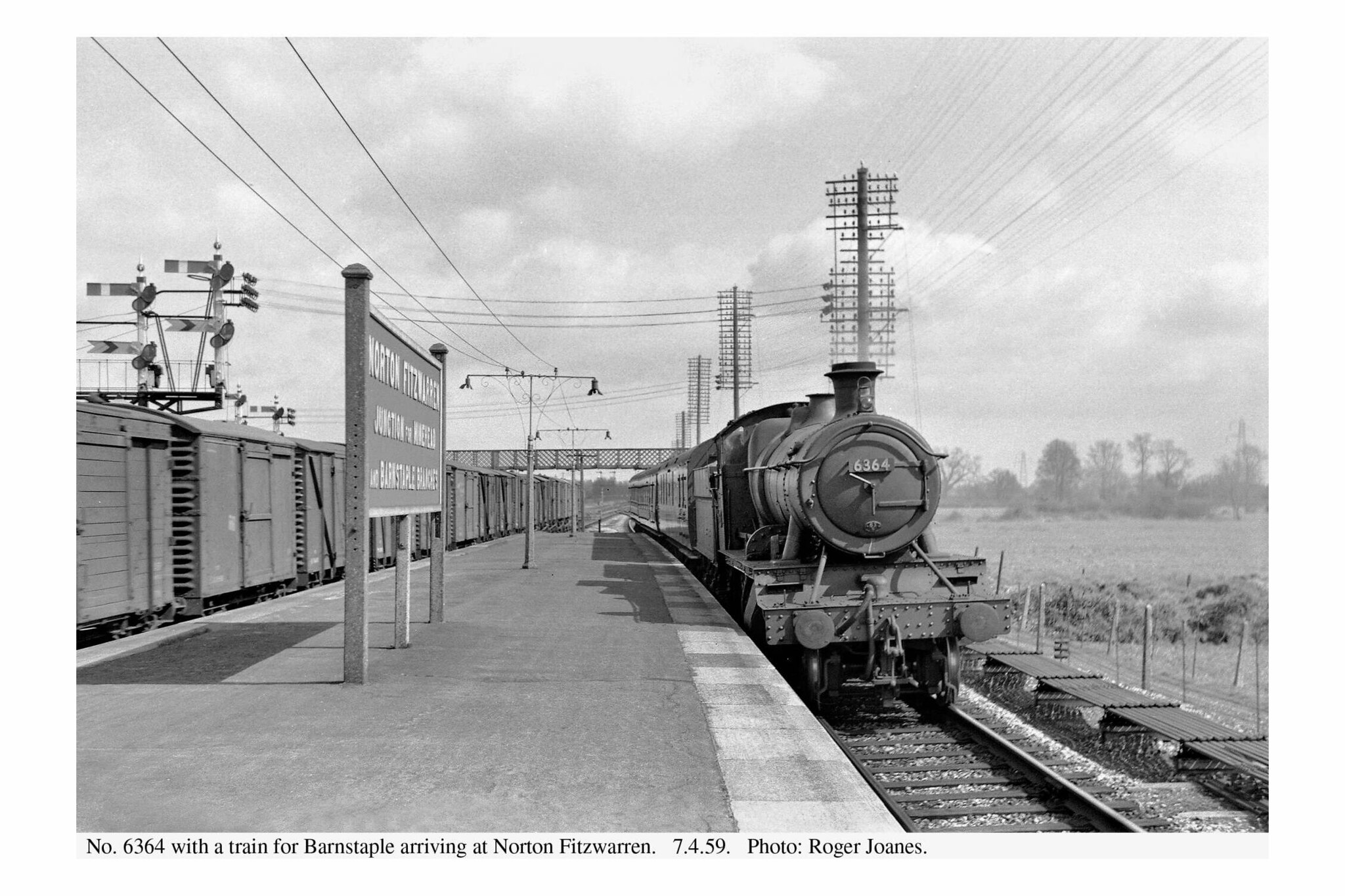
Norton Fitzwarren

Copyright: Roger Joanes. Shared under Creative Commons. +
Copyright: Roger Joanes. Shared under Creative Commons. +
The first underline bridge on the branch, Allerford, is evidence of the 1937 doubling of the line from Norton Fitzwarren to Milverton. Only one abutment remains and it is clear that widening took place to the north to carry a new Up line.


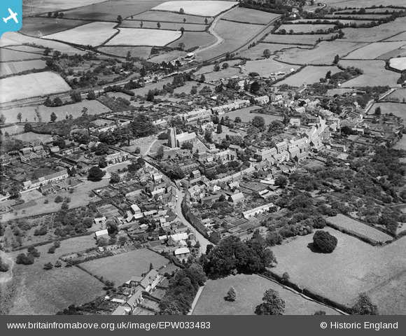
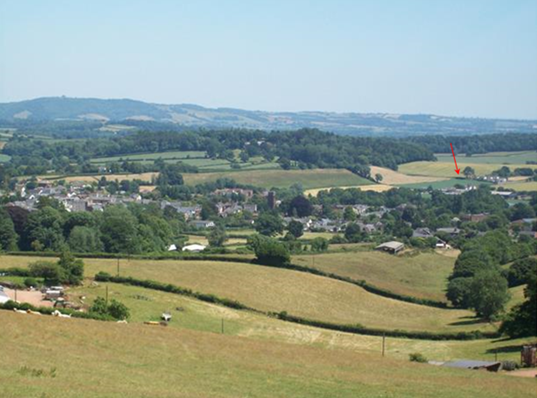
Milverton
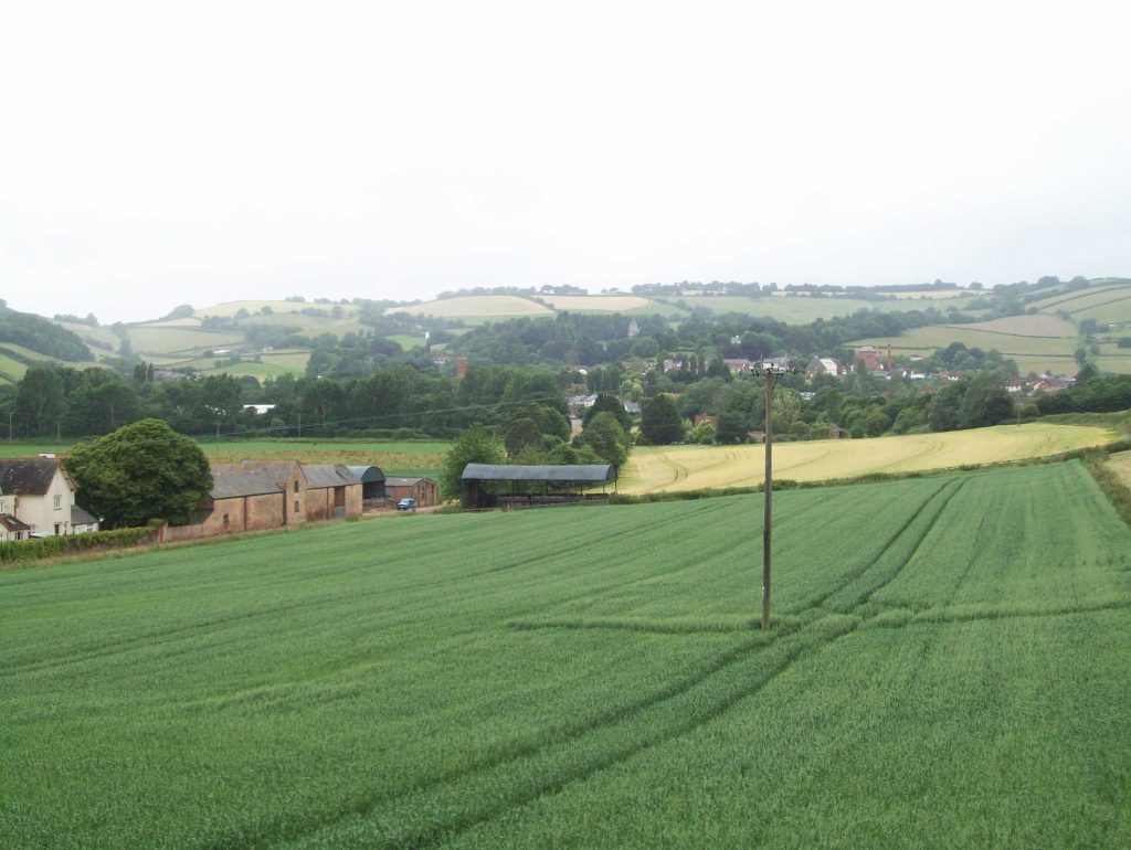
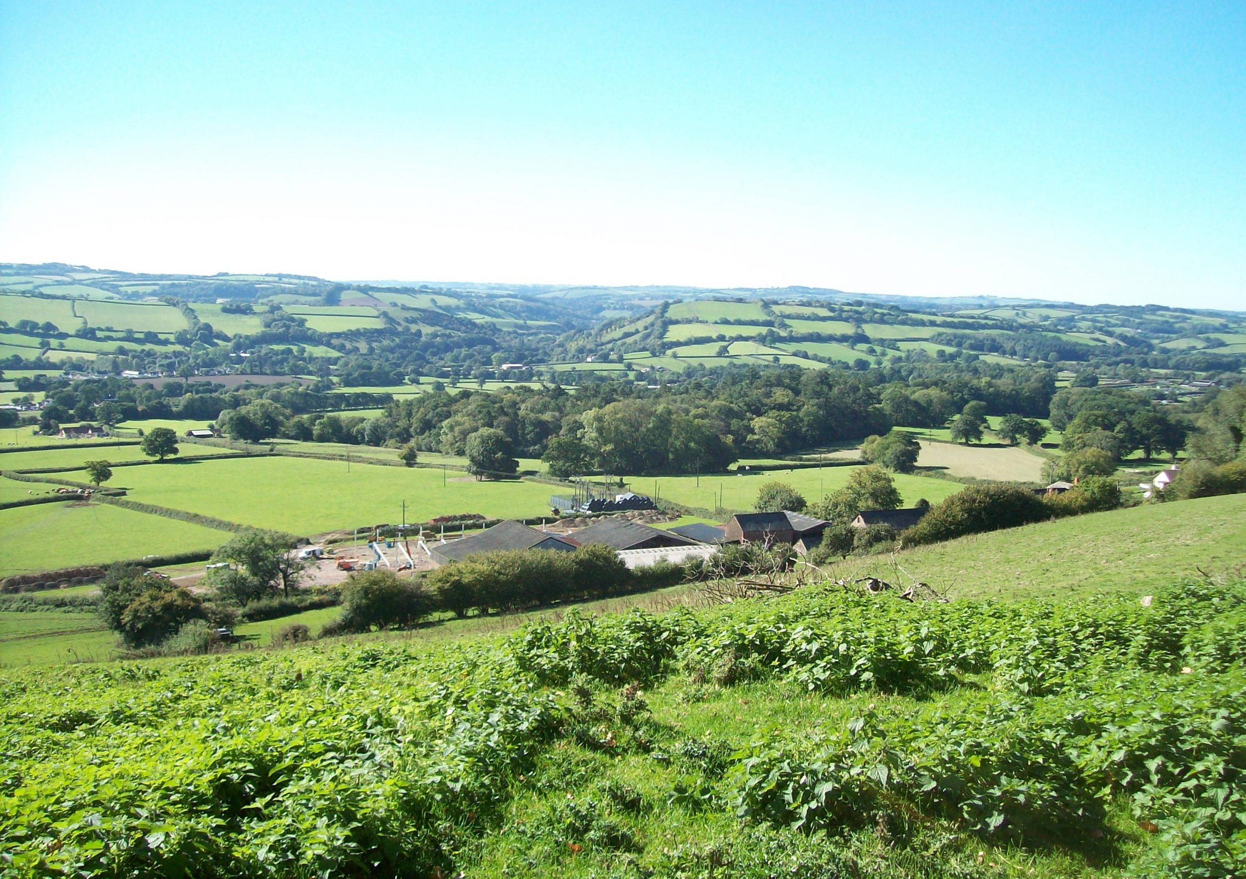
The railway took fright at the sight of the hills and swung south from Wiveliscombe in search of a pass.
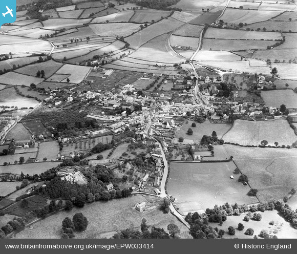
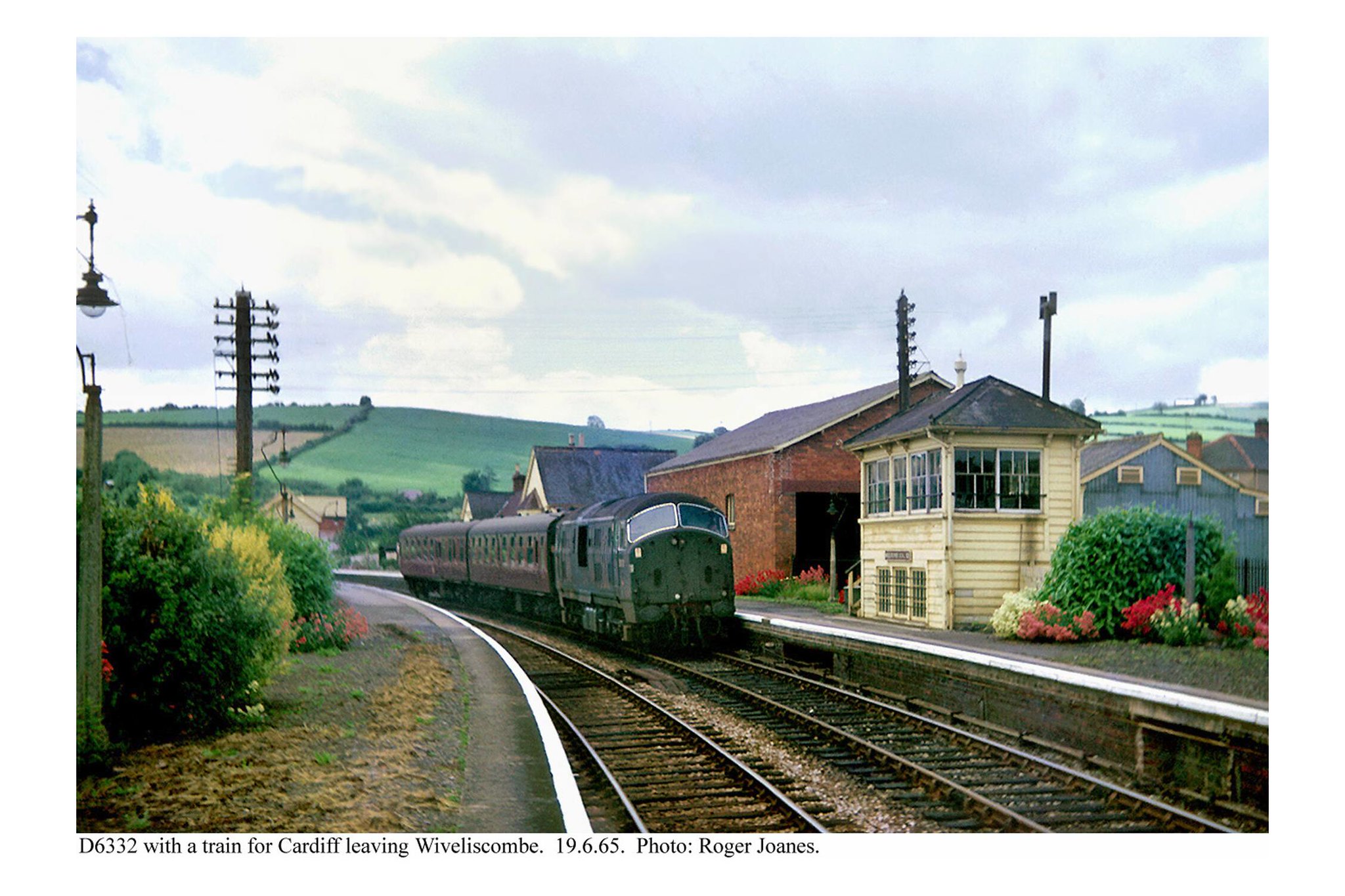
Wiveliscombe


The short Croft Way now allows the town centre to be bypassed by motor traffic.
The scout’s bicycle is leaning against a parapet.
At centre right, marked by scots pine and a row of cottages, is Castle Bridge, and below can be seen a bit of the trading estate that now surrounds the closed station.
In the distance are the Quantocks and at their foot lies the Minehead Branch, only five miles away from Wiveliscombe.
It being past the scout’s lunchtime on this ride, he descended into town with some alacrity, skidded to a halt at the Co-op and bought his “Meal-Deal” sandwich to eat in a shaded spot provided by the little public park around the corner.
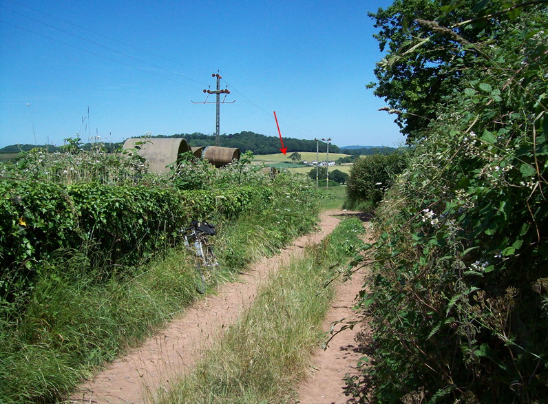
After lunch, he took in the sleepy settlements of Bathealton (whence the tunnel got its name), Kittisford, Appley and Greenham, passed the terminus of the Westleigh Quarry line at Canonsleigh, then went on through Westleigh and over Pugham Crossing to Sampford Peverell. +


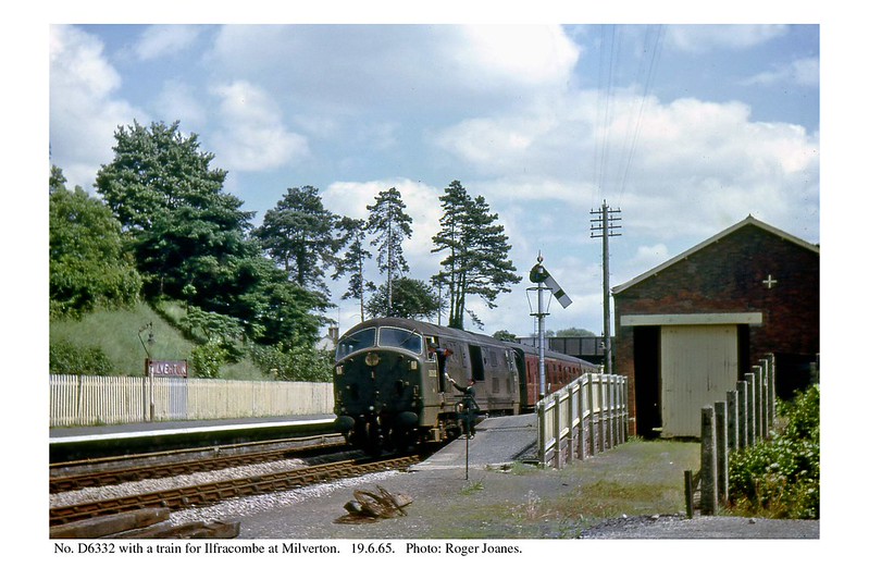
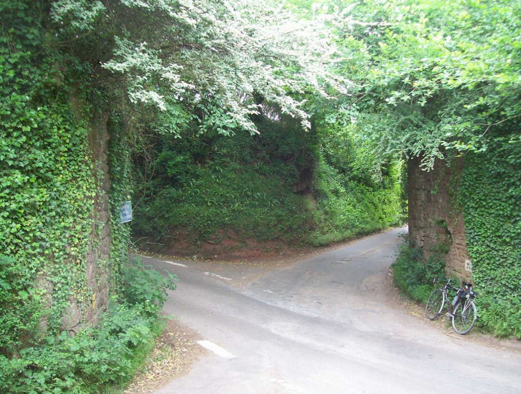
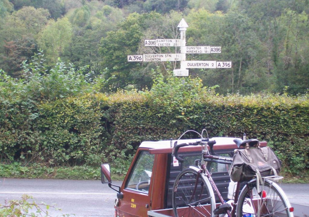
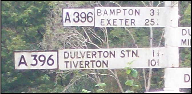
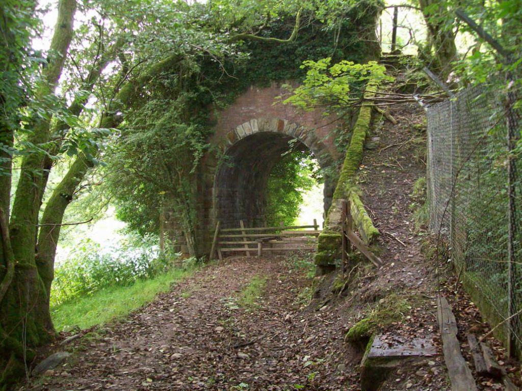
Venn Cross


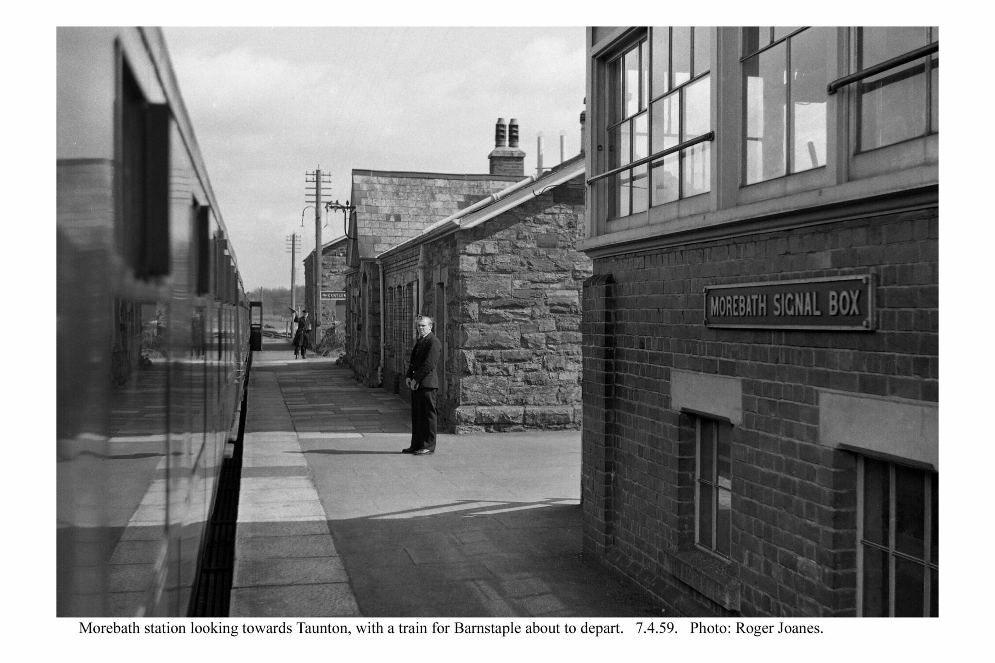
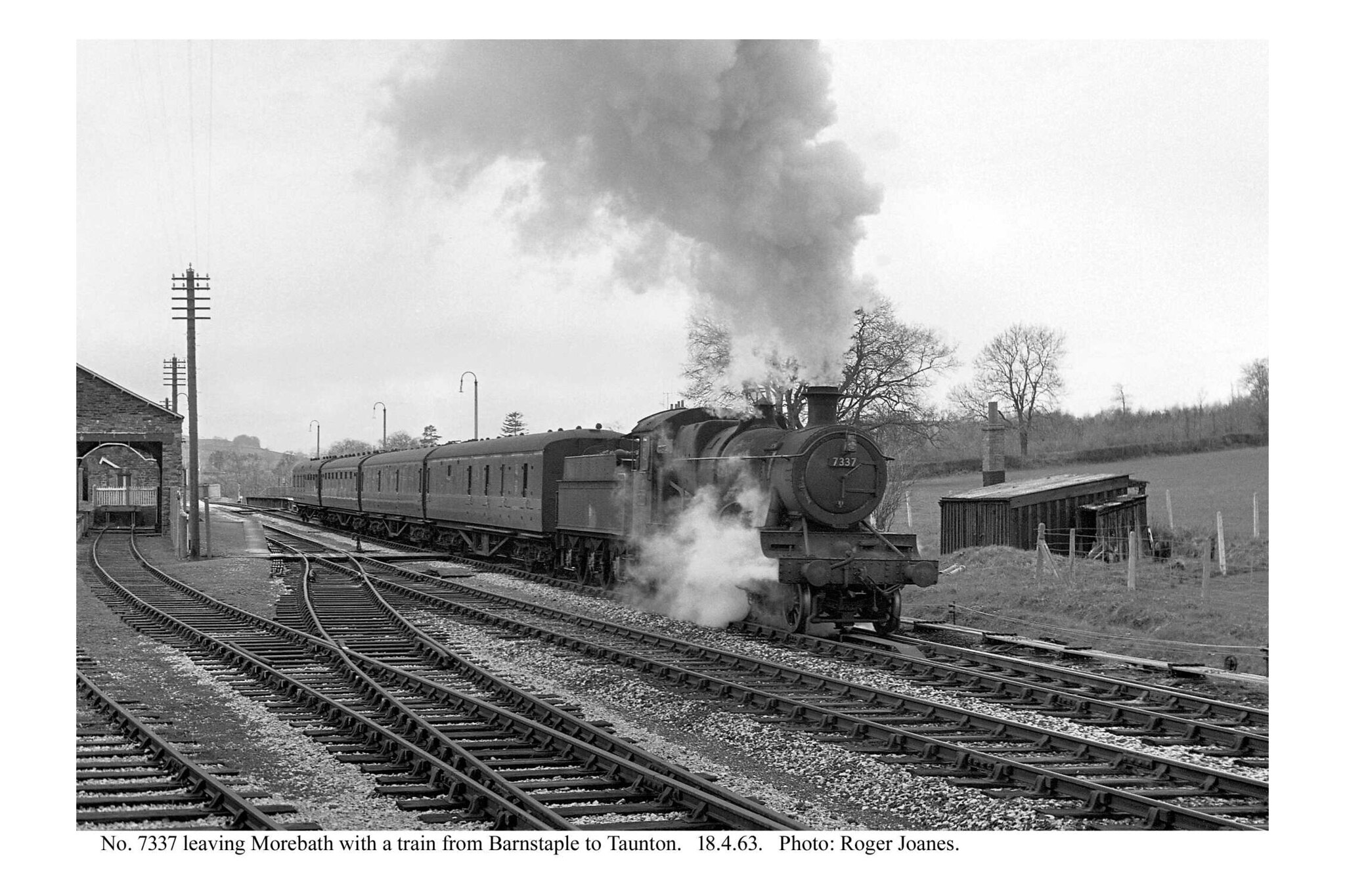
Morebath


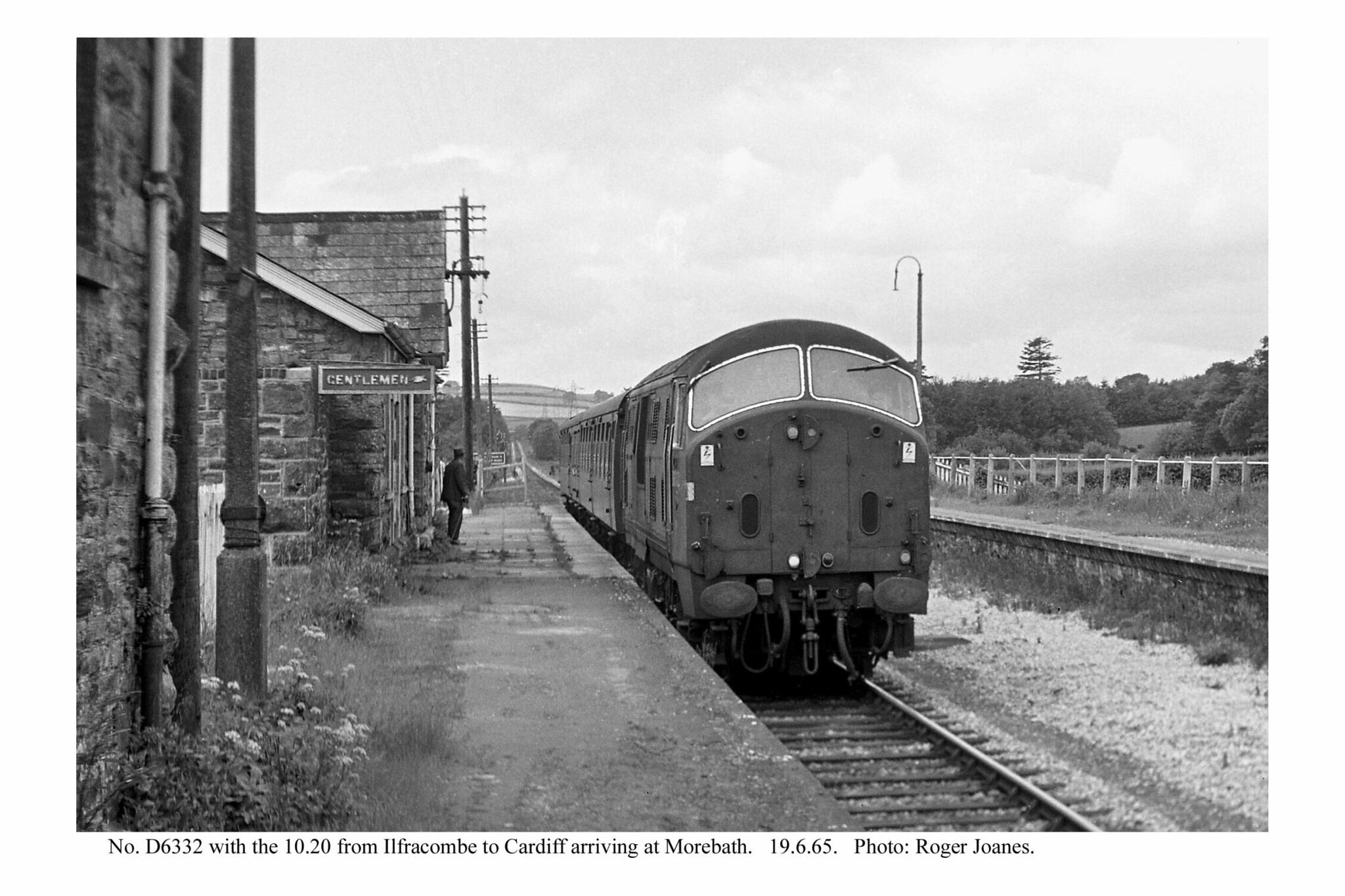


Morebath Junction Halt


At the occupation crossing, also a bridleway, in Ashtown Farm, just along from the halt, the scout found the farmer on his motorized quadricycle and chatted with him about the railway and the area, where he had been all his life. He well remembered the trains.
On this occasion, the E. & T.V.R. utilicon was returning from Dunster, where the railway’s motor trolley was temporarily based.


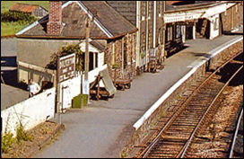
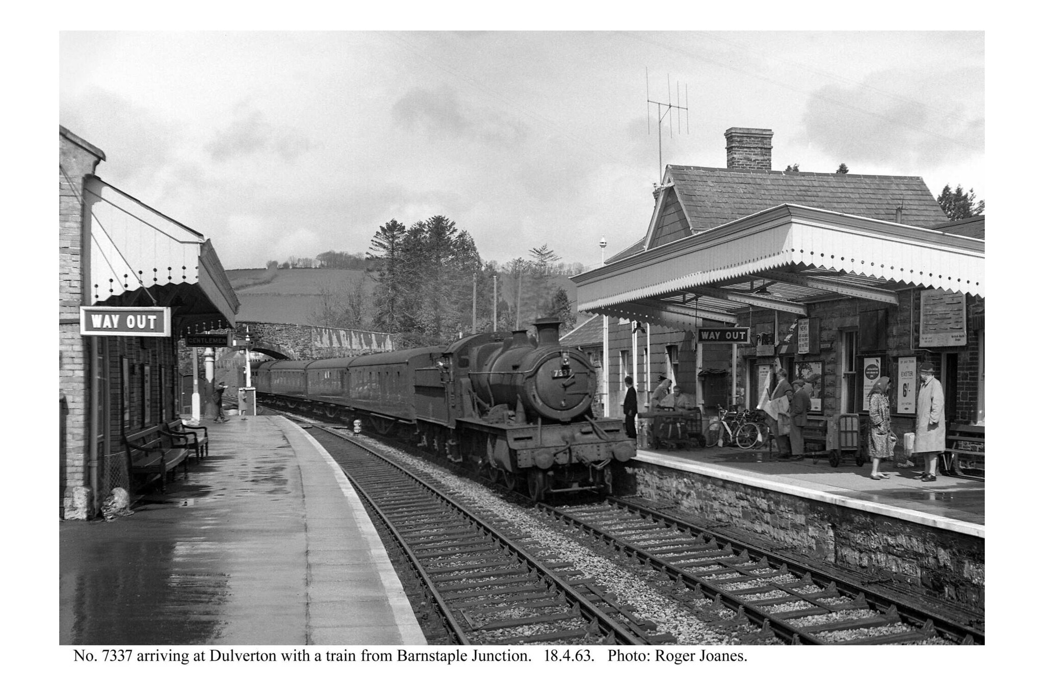
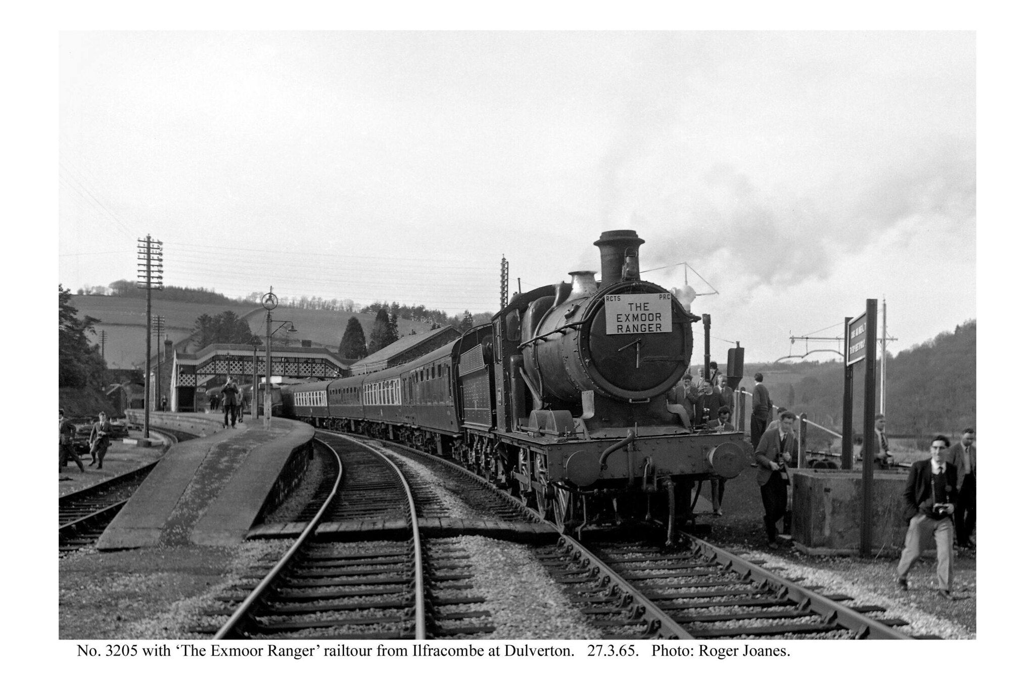
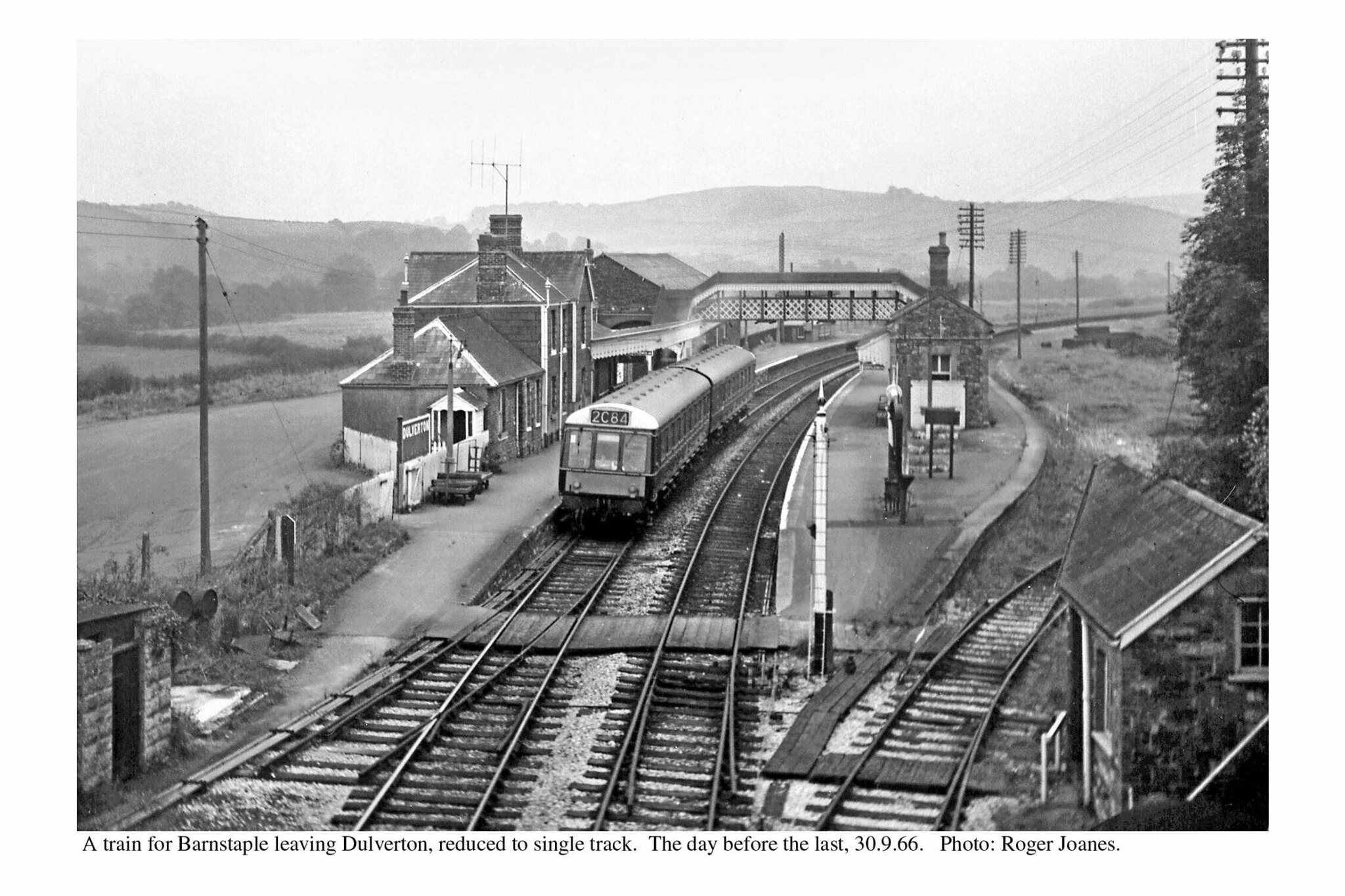
Dulverton


A furnishing that often appears in photographs of Dulverton Station is the unusual sheeted platform barrow.
It was this that inspired staff at Longdown to make a reproduction, which was replaced by a better design when the trolley was overhauled at Christow in 2016.
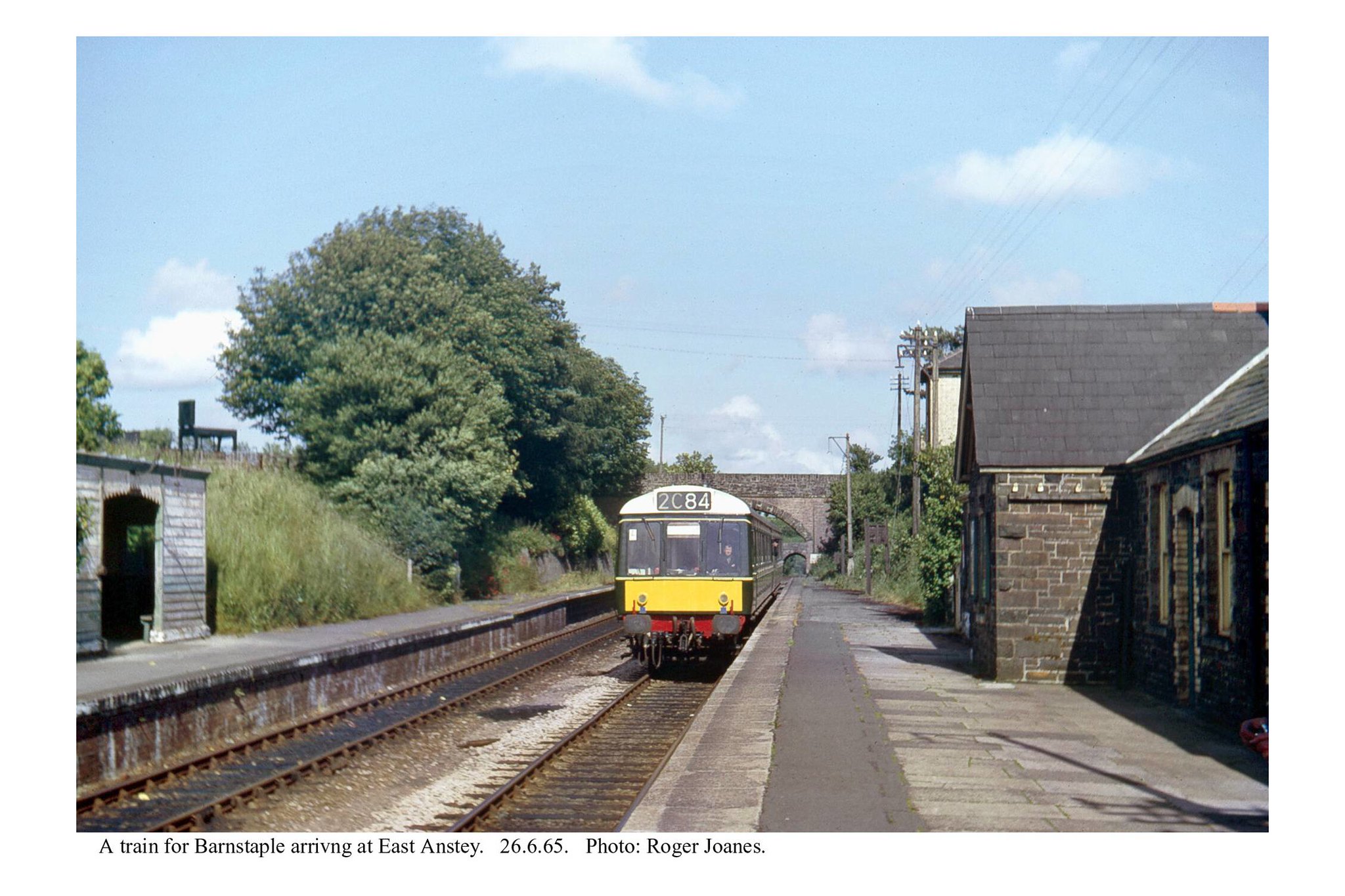
East Anstey
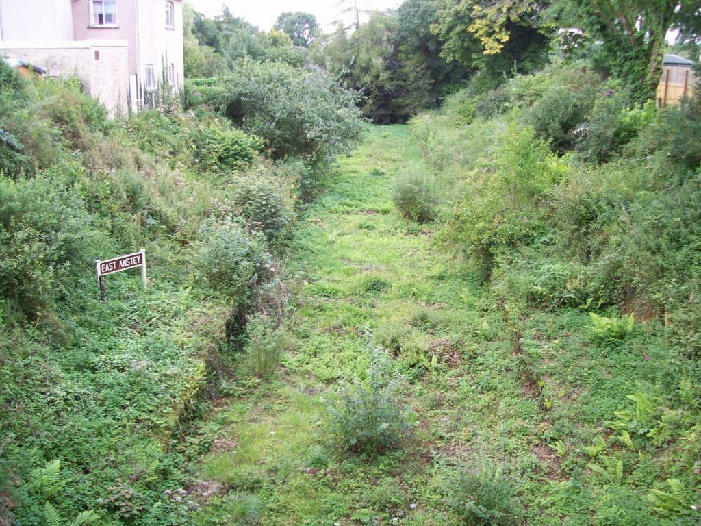
Were it to close and its track lifted, any operational station today would look like this in less than ten years. Some are halfway there as it is.


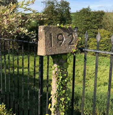
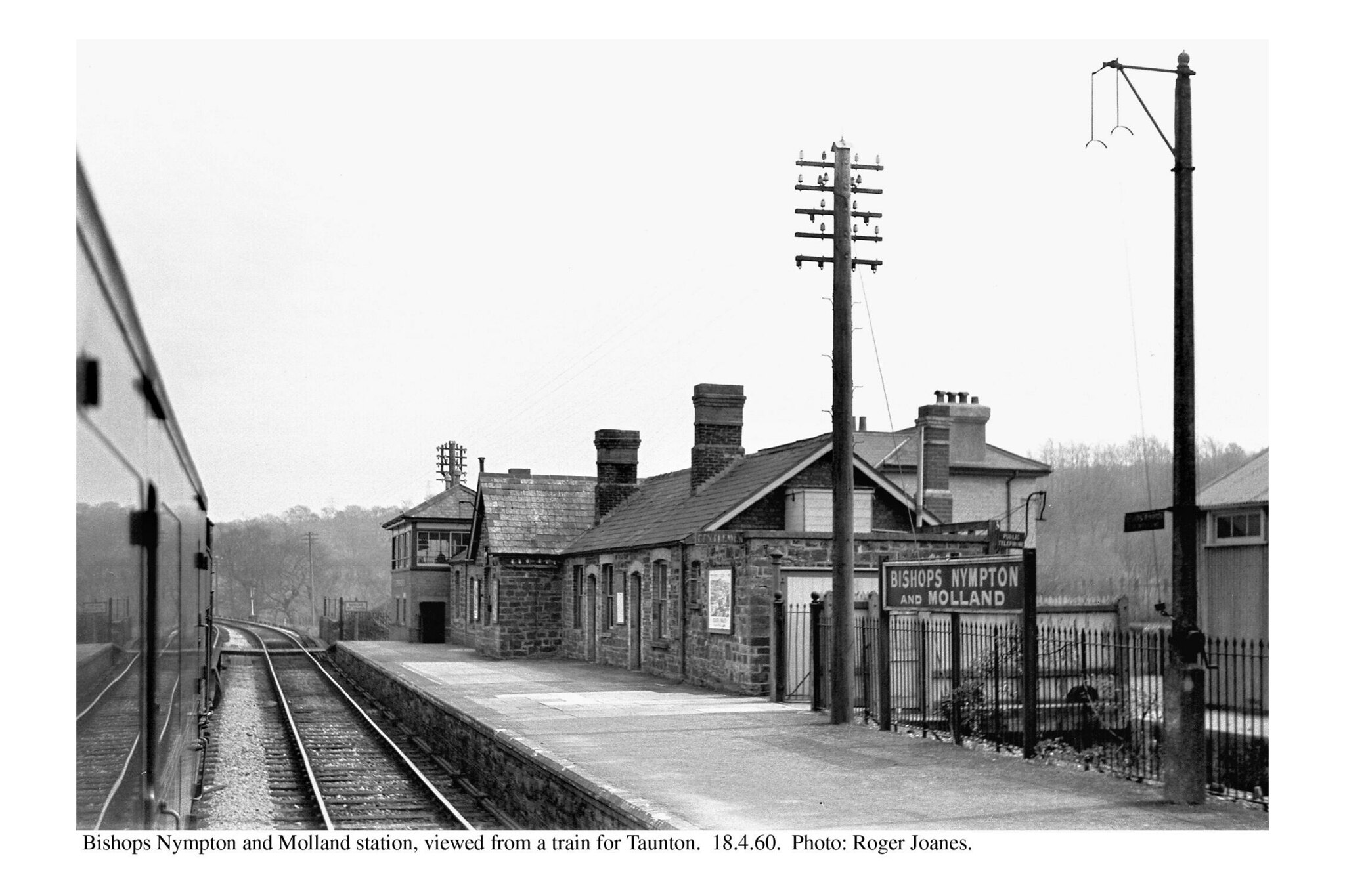
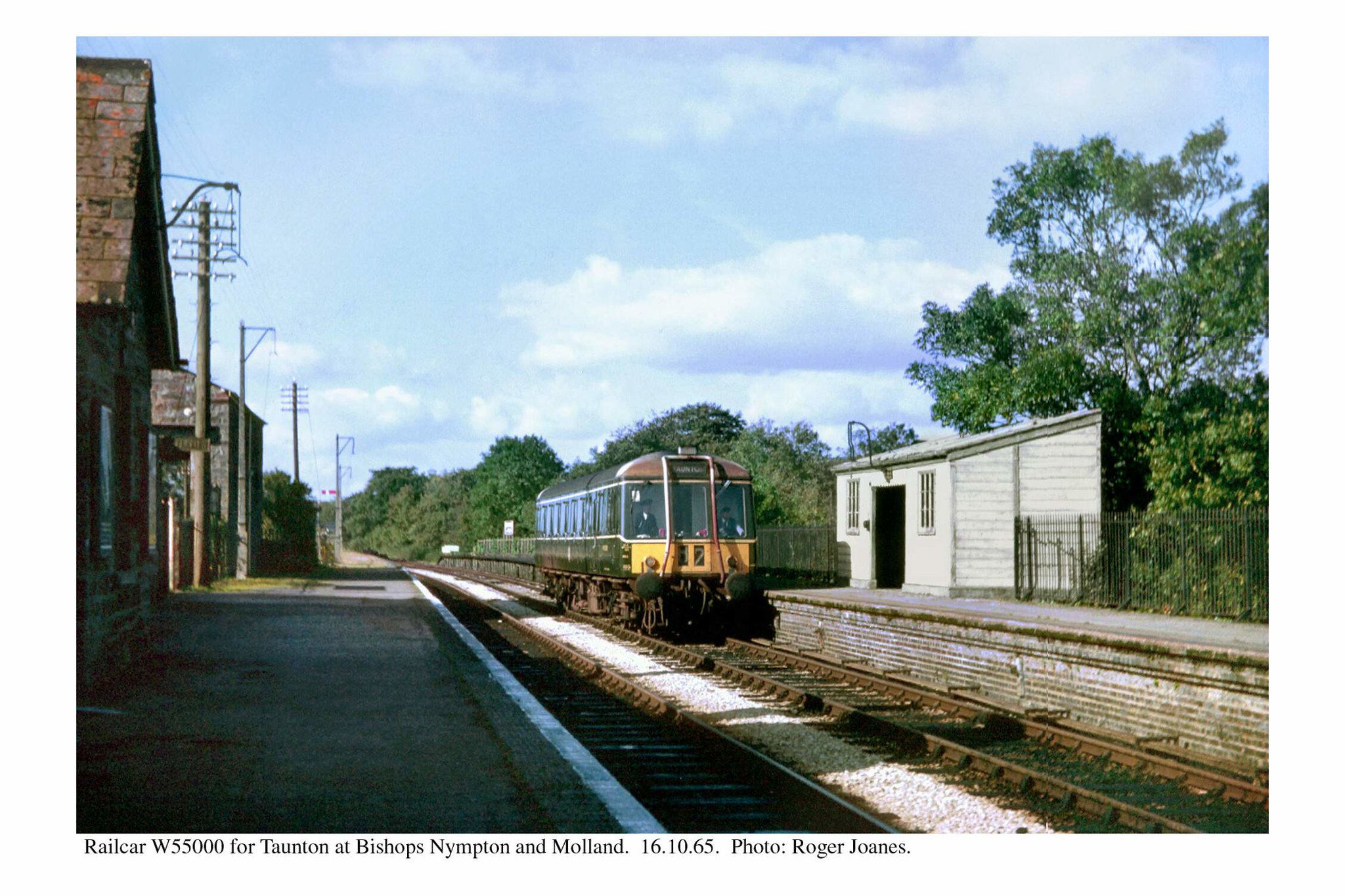
Bishop’s Nympton & Molland


At the time, an estate agent’s particulars of the station buildings included this shot of the milepost on the Up platform; the agent asked whether it was the platform number.
The bridge at Bottreaux Mill is just over two miles away so this should be M.P. 193. The timetable mileage is 193¼.
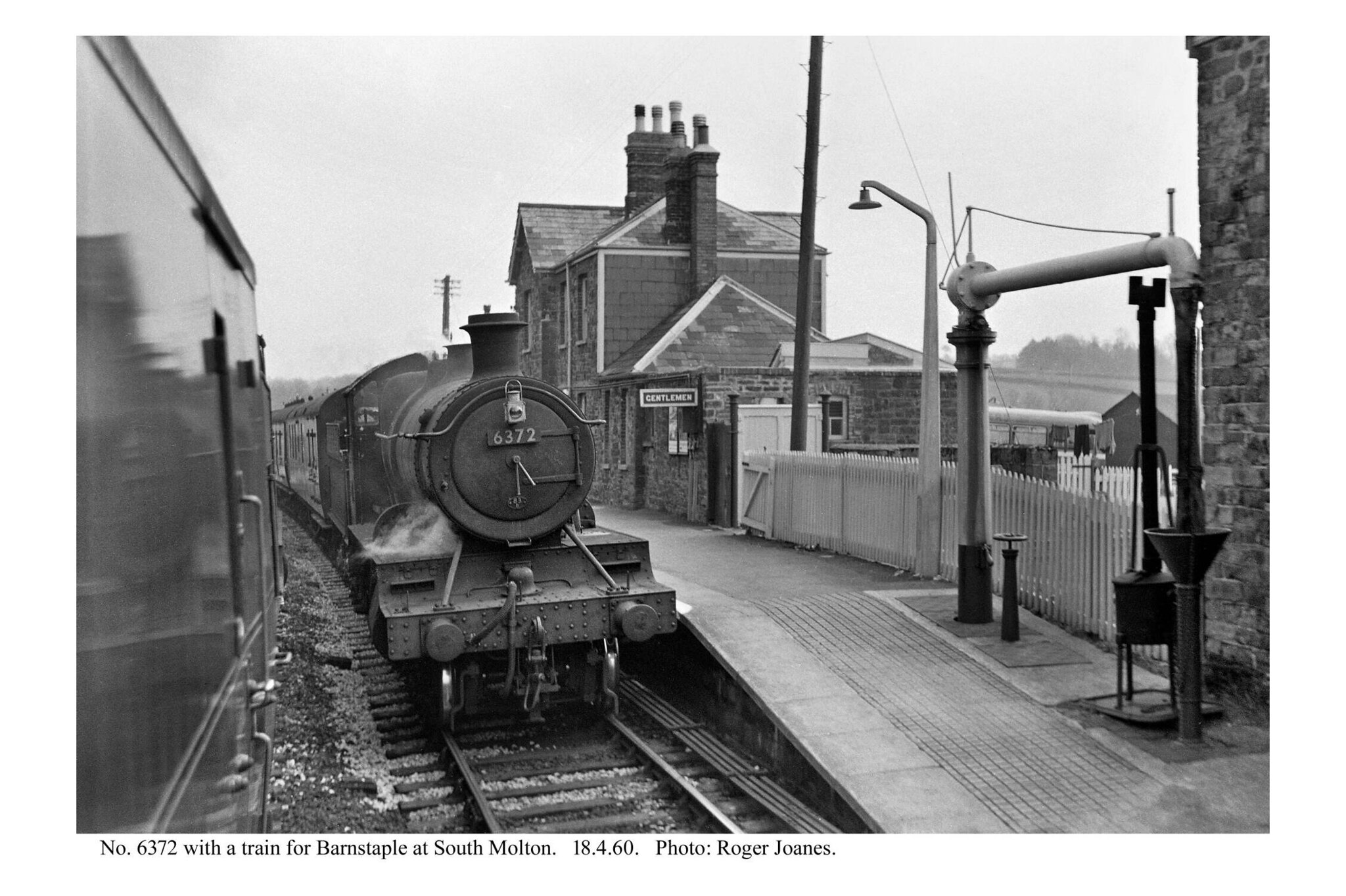
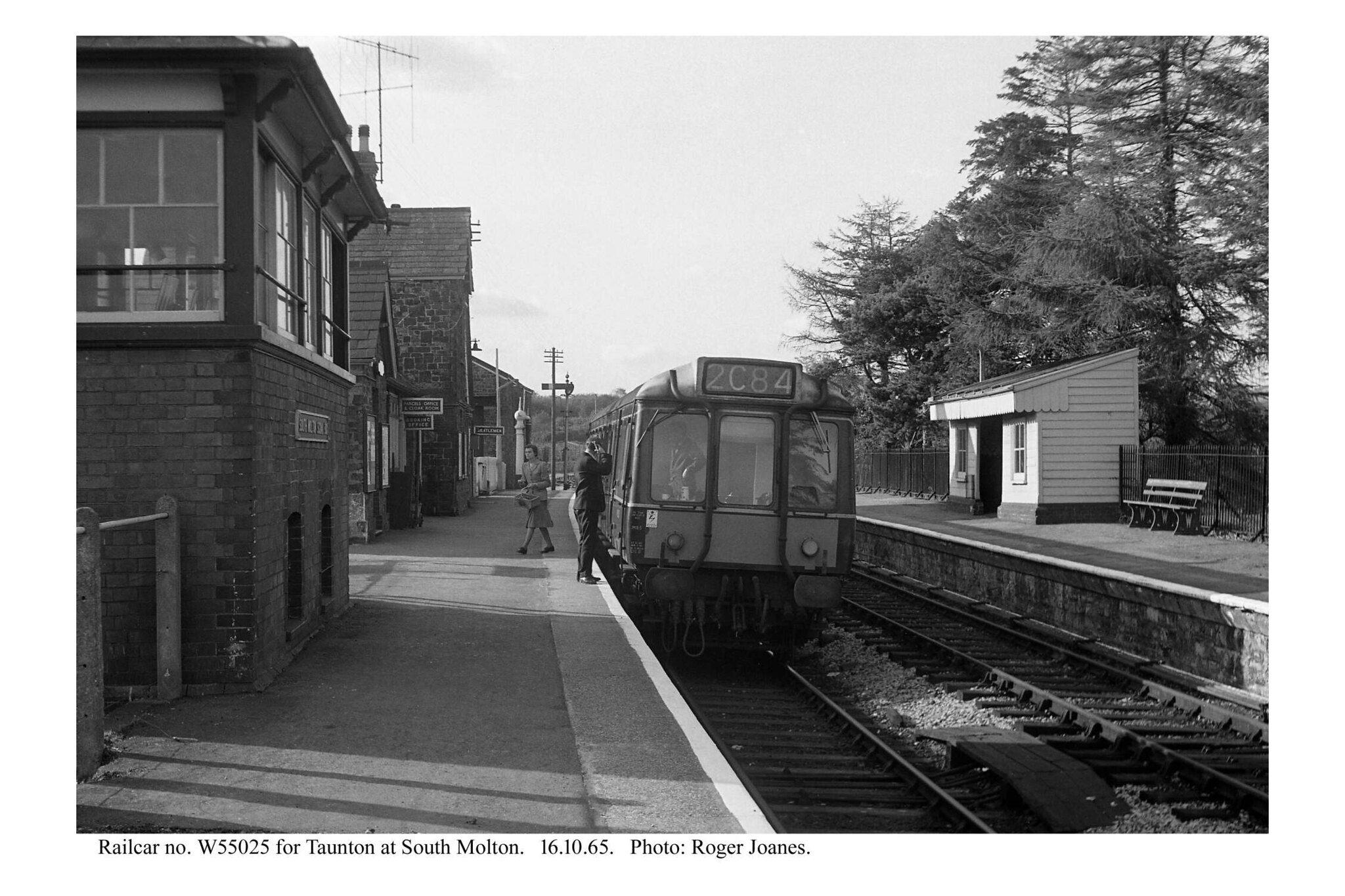
South Molton


Castle Hill Tunnel


Castle Hill Viaduct


It was while the scout was sitting on the safety barrier in the fifth photograph above, waiting his moment, that two young fellows stopped to ask if he was all right, which is recounted in the story at the end.
“The North Devon Link [Road] crosses the Bray Valley on the line of a disused railway, so the piers of a redundant viaduct were pressed into service. They were extended in height, using masonry to match the original. The deck is of pre-stressed concrete, but because the curvature of the road is different from that of the railway, it is built off-centre on the piers.”
Taken from Devon Roads by Michael Hawkins, Devon Books.


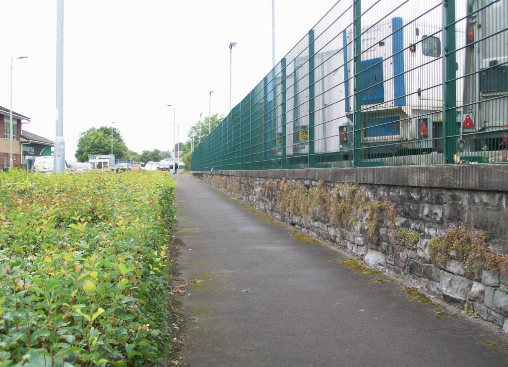
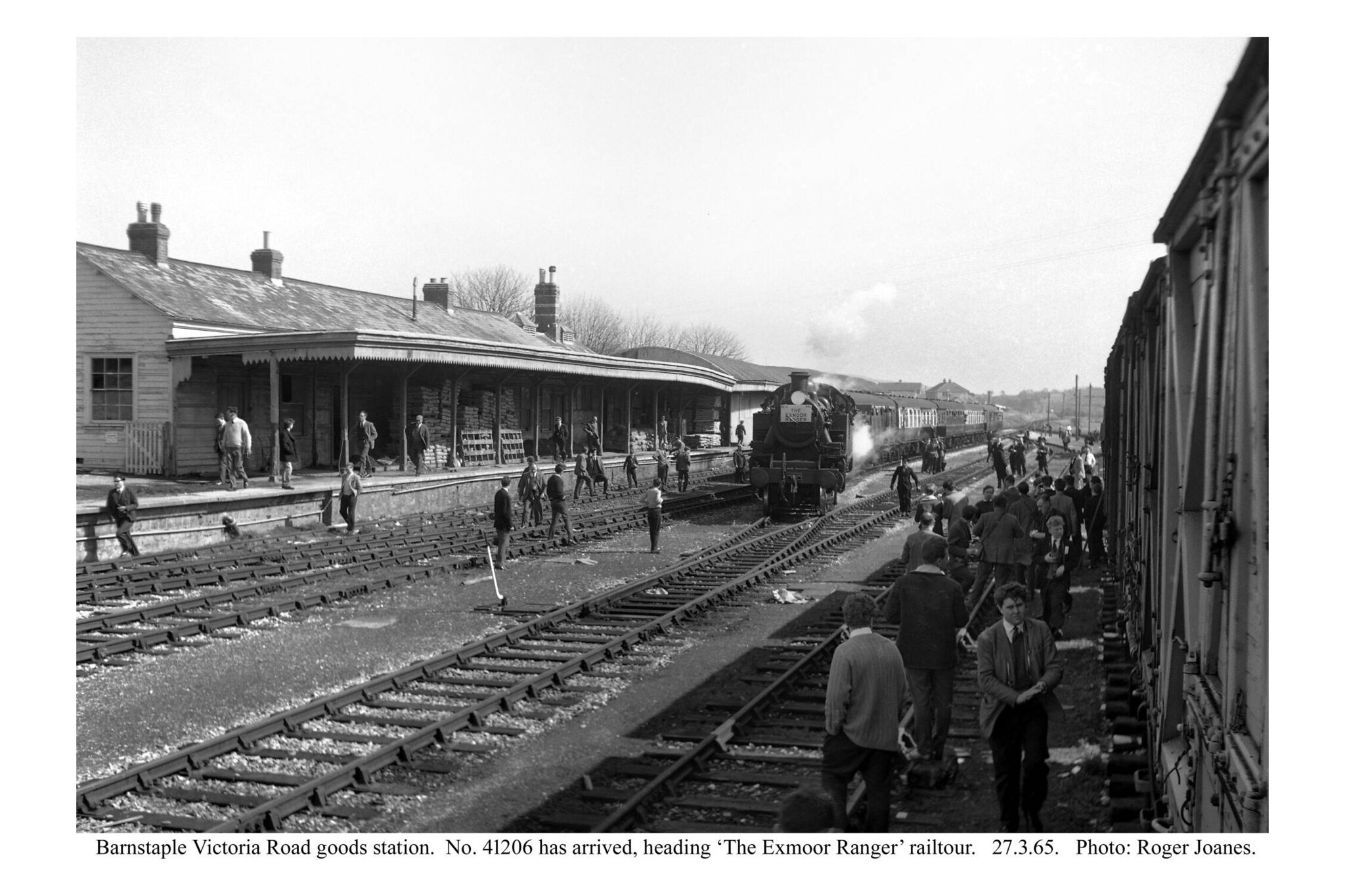
Barnstaple (Victoria Road)
When the scout came here with his Dad in the early 1970s, the station was still being used by National Carriers Limited, an offshoot of the nationalized railway. Track materials were lying around.
An Amusing Story—in part
One grey day, with thunder forecast, the scout got off the train at Eggesford and rode to South Molton. Kings Nympton is closer but his train was not booked a request stop. The crossing train was just pulling in as he left and even after calling in at the Fox & Hounds to see where the cattle pen siding had been, it seemed ages before his train overtook him beside the main road.
From South Molton to Barnstaple, the North Devon Link road is built upon the course of the railway from Taunton, closed in 1966. The scout hadn’t followed the route since the late ‘70s and had never seen beneath the viaduct built on the piers of the original railway structure at Castle Hill.
After putting away a hog-roast bun with all the trimmings at Mole Valley in South Molton, convinced he was in for a soaking, he set off along the road which has been in the news since it was built because of crashes. He dived into woods to find the tunnel which was of no use to the road builders and then went over and under the nearby viaduct.
Although heavy, the traffic came in waves, probably caused by bunching behind lorries, and so it was possible to snap an empty viaduct. He had captured one end and was sitting on the crash barrier at the Barnstaple end waiting for the moment when a car pulled up with two young chaps. The driver leant across his passenger and asked, “Are you all right?”
“Yes,” the scout replied, fearful that they would cause an accident; he had only just been thinking that it would not be safe to stop here in a vehicle. “Just having a rest, are you [granddad]?”
“Yes.” He didn’t burden them with his purpose but just added, “Thanks for stopping.”
Chuckling to himself, with the sky darker still, he headed to Barnstaple, not realizing that he’d set in motion a search.
It was a quick ride. The weight and speed of the traffic right beside him he found strangely exhilarating, although he was of course brooding on the madness of it all. In no time it seemed he was at the old terminus in Barnstaple, one of its three stations.
Little remains of it: just the Goods Shed and a bit of the platform. He was waiting to cross the road, by now choked with slow moving traffic, when a police car passed him and he felt that he’d been observed. The same car passed him after he’d crossed the road. Next, he spotted a constable walking in his direction. If he’d done something wrong, he thought, he wished he knew what it was so that he could come up with a story.
Finally, the constable came up to him and very politely enquired whether he’d just ridden from South Molton. Wondering whatever sort of surveillance there was now, he answered: “Yes.”
“Did you stop on the bridge?”
“Yes,” he said. “It’s a fine piece of engineering.”
“There have been incidents on that bridge,” the constable told him.
“Oh? … Ohhh!” The scout suddenly realized how his behaviour may have looked and imagined a busybody motorist calling in: “Some old git’s leaning over the parapet. Think he’s going to jump.”
“We’ve been looking for you, but didn’t think you would have got this far.”
“Not bad for an old git,” the scout quipped.
Anyway, case solved, he told the constable that underneath the new concrete deck was the original masonry and that the road had been a railway. He pointed at the platform wall behind him and the Goods Shed opposite and the line that used to connect with the other stations and allow trains to work through to Ilfracombe. He told him of the summer Saturdays when 10,000 passengers might pass through the seaside terminus. “Now look at the place,” the scout said. “It’s a shithole.” “Mind you, it was a shithole when the railway was open,” he added.
“I’ve worked there,” said the constable, “and couldn’t possibly comment.”
“This can’t go on,” the scout said. “We have to rebuild the railways and return to public transport, walking and cycling.”
After a lengthy chat, the scout’s new friend in blue said that he was pleased to have met him and went on his way. And the scout felt that, as coppers’ duties go, his had been a pleasant encounter. This same officer may have been called to the crashes a few days later, at spots that the scout had just passed, when a mother and child were killed, followed a day or so later by another child.
The road that used to be a railway was back in the news.
Copyright: Roger Joanes. Shared under Creative Commons. +
To the left is the terminus, to the right is East Junction and the line to Taunton, and behind the camera is the Great Western line to Barnstaple Junction, whence its trains would have exercised running powers over the Southern to Ilfracombe.
The former embankments ahead have been reduced.
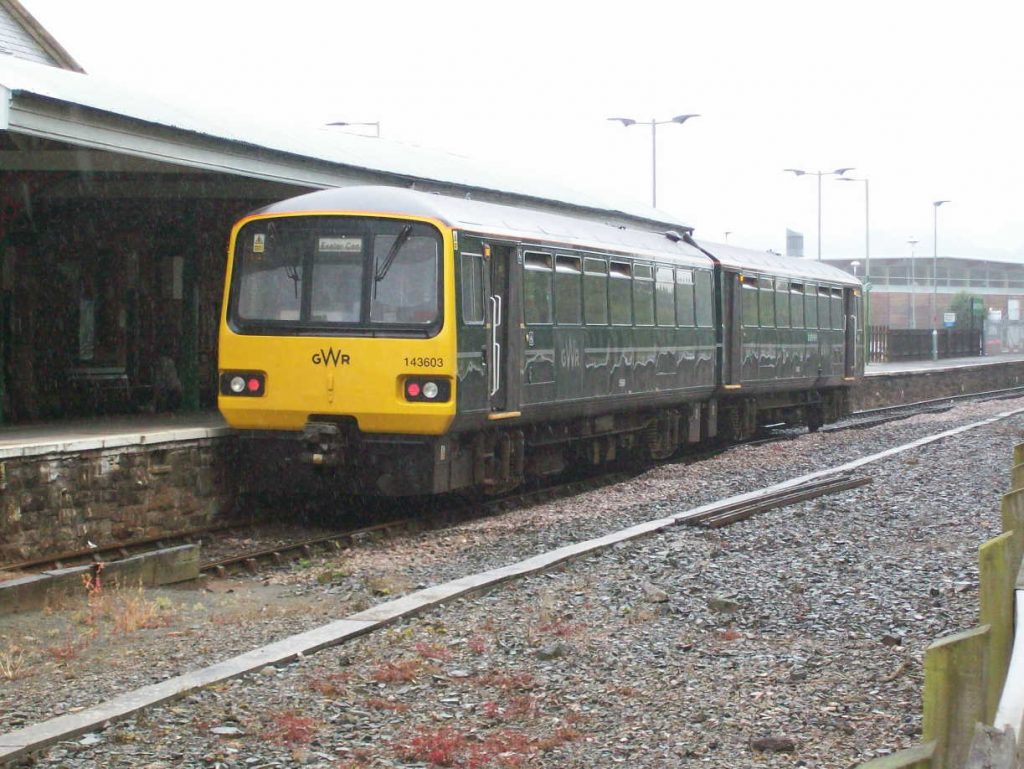
The rain which the scout had been sure would drench him since he left South Molton on this ride, finally came down while he was comfortably seated in the station café at Junction Station sipping tea and reading the paper. He dashed out to snap all that remains of rail transport in North Devon: a 1980s railbus on a single line that doesn’t even reach the end of one platform of a former three-platform station, hemmed in by retail sprawl and by vastly more road infrastructure than will ever be needed in the long term.
As the train was about to depart, a cyclist fell into the unit looking like a drowned rat. He had not been so lucky.
The Ugly Usurper
The B3227 occupies nearly a mile of the route from the former Milverton Station towards Barnstaple.
The accursed North Devon Link Road occupies almost the entire course of the Barnstaple Branch for the 10½ miles between South Molton and Victoria Road, including the former stations at Filleigh and Swimbridge.
In July, 2018, Devon County Council put forward a proposal to spend £93-million on a scheme to improve and make safer this notorious road.
Only 19% of North Devon District’s railway stations remain open.
All of the stations in Exmoor National Park are closed.
The text above was included in letters written to North Devon District Council and Exmoor National Park Authority in support of the planning applications made by the Lynton & Barnstaple Railway in 2016.
The North Devon Railway Report (subtitled: The findings of the North Devon Railway Enquiry), published by David & Charles in 1963, recommended that:
“Subject to the provision of new bus services for local passengers, and to the improvement of the train service via Barnstaple for long-distance travellers, the Taunton-Barnstaple line should be closed entirely.”
Like many of the reports published in the 1960s, it seemed as if the writers were only thinking of public transport, certainly in rural areas, providing for a transitional period, and that in the end everyone would own a car and all goods would be on the roads.