A compilation of photographs taken on various rides over the yearsfrom 2003.
Par
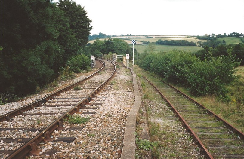
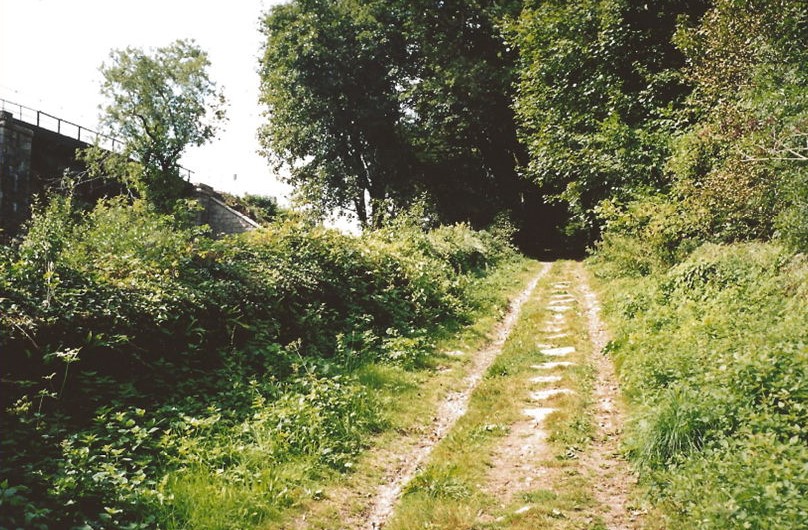
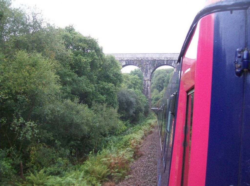
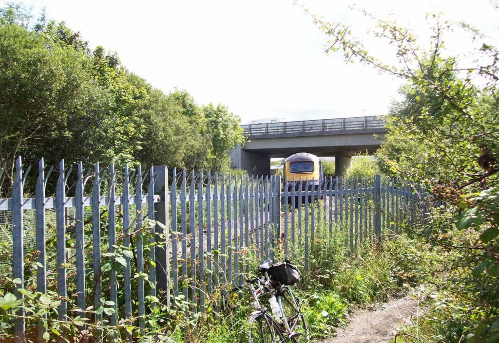
Pontsmill
At the foot of Luxulyan bank, the main line is seen at left crossing the River Par by means of Prideaux Viaduct, while at right, on the course of the original tramway, is the siding which served the Pontsmill area.
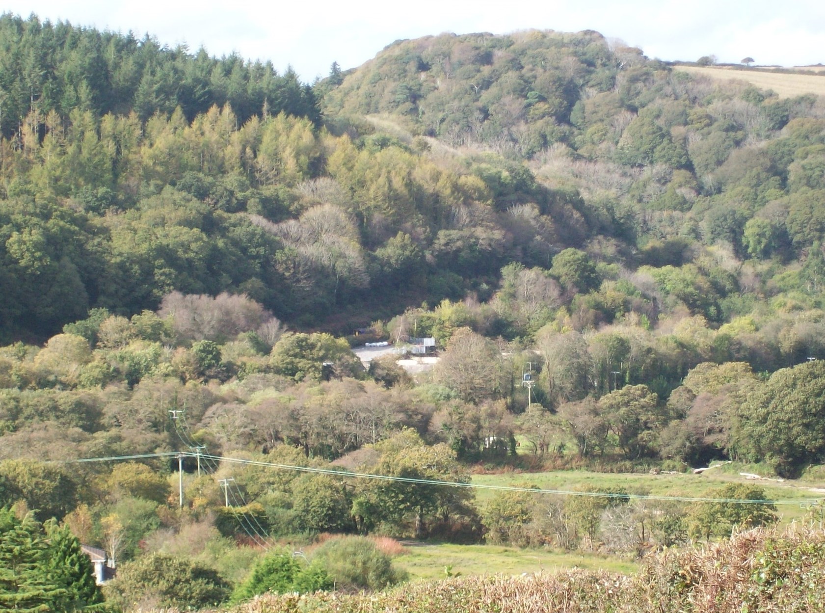
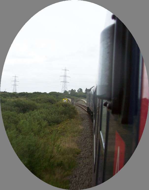
Above: From Porcupine, a Par to Newquay D.M.U. is glimpsed just above the clearing at centre passing the old Pontsmill clay driers as it climbs the severe incline which follows the beautiful Luxulyan Valley.
The landscape would once have been bare, with much industrial activity on show. +
Right: Where the train was seen.
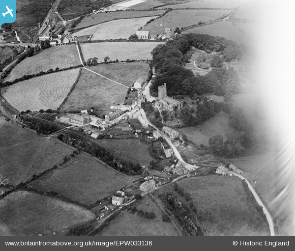
The cutting going from left to right in the top half of this 1953 view is the Cornwall Mineral Railways line of 1874. Below it is the Ponts Mill Clay Works. The left hand corner of the building is about where the clearing is in the photograph above. Below the works is the course of the Treffry Tramway, latterly serving the valley below the Carmears incline. It had extended to and beyond the Central Cornwall Dry, which can be seen in the woods at top right. At far right is another dry, which the O.S. marks as Ponts Mill. Just on picture at far left is the Prideaux Wood Dry, once served by a siding. There was also a narrow gauge line connecting it with the Pontsmill Works. Below the course of the original tramway can be seen the tree-lined Par Canal and crossing it at centre is the course of the siding leading to a mine or quarry at Porcupine (bottom).
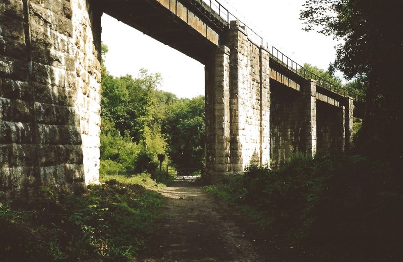
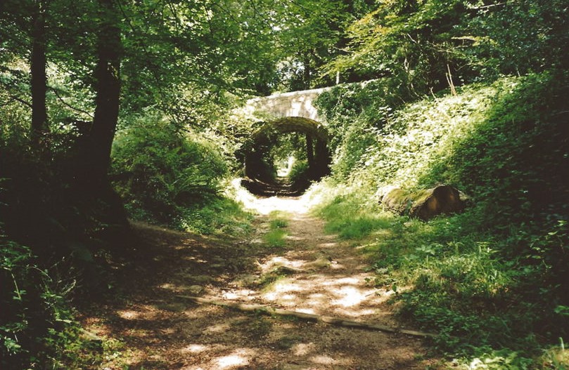
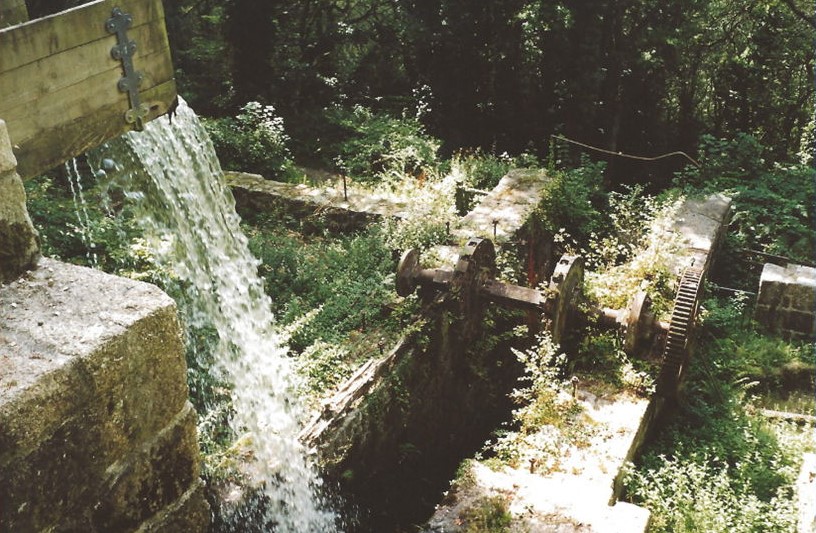
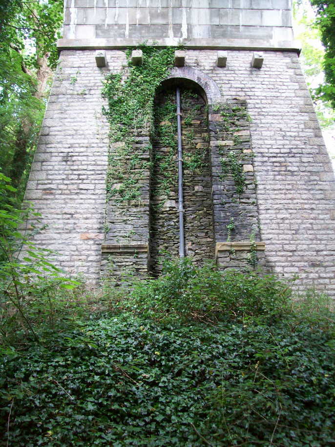
Beneath Pontsmill Viaduct, carrying the 1874 line, can be seen the stone block sleepers of the private branch which served Rocks Mill Quarry and the later Trevanny driers, whose rail connection lasted until the early 1950s. The existing line on the valley floor must have necessitated the massive pier, which carries both straight and skew spans.At the foot of the 1:9 Carmears incline, the 1874 route can be seen to have gained considerable height as it crosses Pontsmill Viaduct at left. A heavily overgrown “modern” line still continues to within 14 chains of here but is now disconnected from the network.Part way up the Carmears incline. This quickly became disused after the opening of the new locomotive-worked line.The ruins of Wheelpit China Stone Mill, built on the site of the waterwheel which powered the incline. The water has flowed along the leat from Treffry Viaduct.
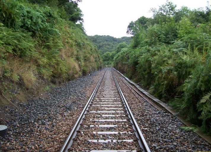
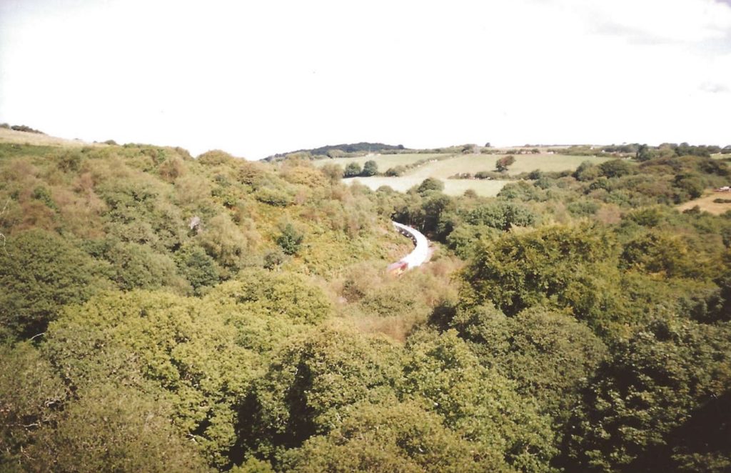
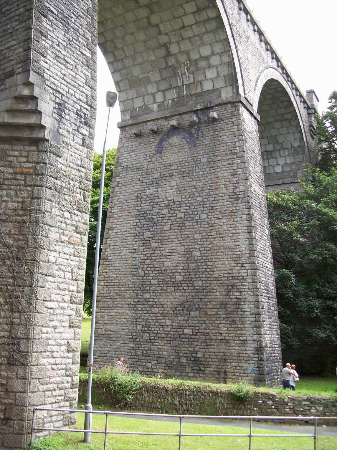
Treffry Viaduct
The E. & T.V.R. scout is not one to wait long for a train to furnish a location, unless he knows for certain that one is due, so on his first visit here in 2003, after riding over the hill from Lostwithiel, it was fortunate that the flange squeal of a mineral working could be heard as he approached along the old Carbeans branch, giving just time to get a shot from the end of the viaduct. On no visit since has a train appeared.
Treffry Viaduct seen from the 08.57 S.O. Plymouth to Newquay on 8th September, 2018. This was likely to be the last weekend when H.S.Ts. formed the through London services on the branch. It was a damp morning and the slippery rail had caused wheelslip part way up the bank, reducing speed to 15 m.p.h. However, the driver was soon able to recover line speed.
25th May, 1991: The leading power car of the first Up train of the day became derailed between the tunnel and the viaduct. In a splendid show of initiative, passengers were transferred to the rear power car which was uncoupled and driven back to Luxulyan. The breakdown “train” which came from Par and the rerailing operation were filmed.
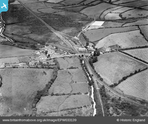
The village and St. Cyriacus & St. Julietta’s Church is at centre in this 1930 view. The rock cuttings on either side of the tunnel are deep but nothing like as wide as they would have been in earth, not rock. Cornwall Mineral Railways must have decided upon an unlined tunnel beneath the road and houses. The bridge from which the scout took the photos above is at centre left. Luxulyan Station is at top left.Another 1930 view is of Bridges, where the C.M.R. built its Luxulyan Station. The original line remained open above the incline. A single open wagon stands on the line beyond the gate, which is seen in the modern photo below. Treskilling Dry and its private siding, and the line going towards Goonbarrow, are seen at the top.After the new line was built along the valley by the Cornwall Minerals, the Carmears incline was abandoned but the tramway above it remained to serve Colcerrow and Carbeans granite quarries and Wheelpit China Stone Mill, traffic being taken over the viaduct to and from Luxulyan. All the stone traffic had ceased by the early 1930s but Treffry Siding remained on part of the tramway until 1964, its points being used as a trap at the summit of the incline when shunting at Luxulyan. The gate, with its red target, is still there. The main line can just be seen to the right. The former tramway leading to the viaduct is behind the camera.
Bugle
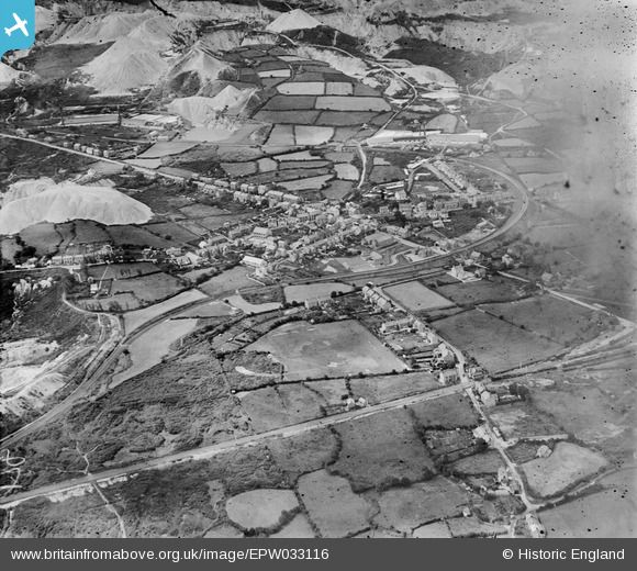
This view of the East Goonbarrow China Clay Works in 1930 shows the impact that extraction had on the landscape. From the ground, it was not the pits but the sky tips which were most prominent. The branch crosses the bottom of the picture. Goonbarrow Junction is out of sight at left. The line passes over Molinnis Crossing before reaching Bugle Station at far right. The freight-only Goonbarrow Branch is seen crossing the middle of the picture before snaking around and leaving at top left. The A391, St. Austell Road, passes beneath it and over the Newquay Branch at the station.
Goss Moor
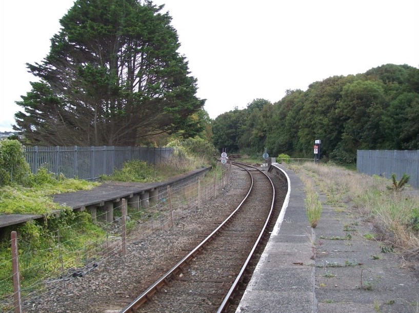
St. Dennis Junction
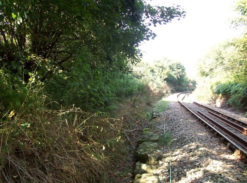
A summer Saturday through train heading for Newquay suffers the 15 m.p.h. permanent slack at the former St. Dennis Junction, where the 1874 Cornish Minerals line, having run parallel with the turnpike that was to become the A30 from “Iron Bridge,” curves away before curving back to make a junction with the old tramway and pass beneath the road, which is behind the camera. Into the space made by this manoeuvre came the A30 dual-carriageway, whose bridge was of sufficient span to clear, not just the remaining operational line, but also the tramway route to Hendra which later became an extension of the Newquay and Cornwall Junction branch from Burngullow. By 2007, when the new road opened, there was only the single line, so why such a span? Was the bridge designed when there was still a junction? Or was it because there had been talk of re-laying the line to Drinnick Mill and diverting the Newquay trains to St. Austell over a branch which had never carried passengers? If this had happened, the line between Goonbarrow and St. Dennis junctions would have been abandoned, allowing the road builders to remove the low bridge and widen the existing road across Goss Moor, rather than skirt north of it as they did. With the decline—or “restructuring”—of the china clay industry, Imerys, the successor of English China Clays, working with the blessing of Cornwall Council, engaged the Swiss Eco-Bos to plan new model villages to help restore and revitalize the mining area. A new railway was briefly mentioned as one of the gains that might be had from the developments, which are still being planned in 2017. With the quite fantastic costs of railway construction and no rail industry pressure, in the event it is much more likely that the branch from Burngullow will become a cycle path. However, for once, the road builders unwittingly may have provided for rail expansion at St. Dennis Junction.Between St. Dennis Junction and St. Columb Road, the Cornwall Minerals Railway opened a tortuous loop in 1874 to avoid Treffry’s original 530-yard Toldish Tunnel, which had been intended only for standard gauge open wagons drawn by horses. The divergence is obvious today and stone block sleepers from the tramway can be seen nearby supporting the formation. Anyone searching for the long-abandoned overbridge and tunnel mouths may hear the squealing of modern trains on the curves of the deviation. The bridge under the A392: Now within three miles of the terminus and after five hours from Paddington, the guard of this summer Saturday through train will be about to announce the imminent arrival at Cornwall’s holiday capital to his boisterous passengers eagerly anticipating their weeks of sun, sea and sightseeing. The Premier Inn on the busy crossroads of the A392 and A3058 at Quintrell Downs is probably not what Joseph Treffry, the Cornish landowner and entrepreneur who made such an impression on the area, would have wanted as a memorial.
Quintrell Downs
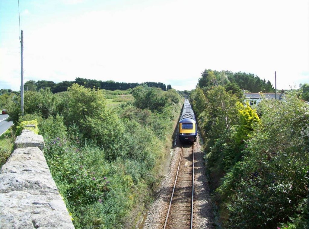
A train, which later in its journey to Paddington will be tearing through level crossings at over 100 m.p.h., comes to a stand at Quintrell Downs while the barriers are lowered across the road ahead. A length of Barlow rail lies in the four-foot.On what was possibly the last summer Saturday when H.S.Ts. would form the through London services on the branch, 8th September, 2018, the 11.30 S.O. Newquay to Paddington, The Atlantic Coast Express, is seen making its way along Treffry’s tramroad not far from the town. The name was given by the Southern Railway to its multi-destination holiday train, the last portion of which terminated at Padstow. This ceased in 1964 and the line was closed two years later. Eventually, Newquay was left as the only station on the north coast between St. Ives and Weston-super-Mare. +
Trenance Viaduct
The scout spotted that the double line viaduct, which was only completed in 1939, showed signs of the earlier structures, but his understanding was limited. The late Bill Harvey cast his bridge engineer’s eye over it in his August, 2020, “Bridge of the Month.”
The viaduct crosses the A3058, Edgcumbe Avenue. +
Part of the original pier incorporated into the new. +
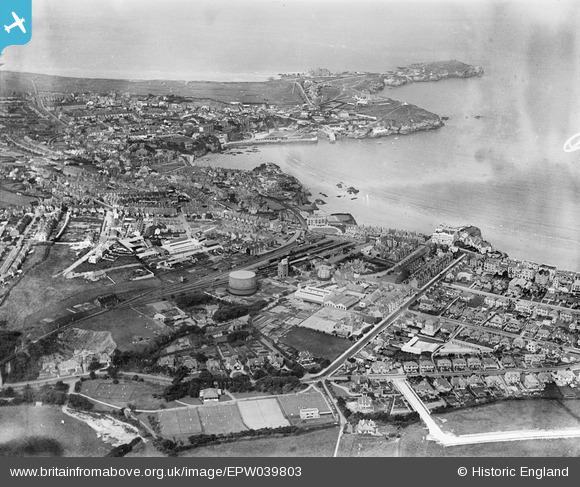
Newquay
The once busy terminus had three platforms, the longest in Cornwall, but only part of one is still in use. Most of the other two can still be seen, making a dismal picture.
For some years around the turn of the century, the line was championed by an active and well informed rail user group, Friends of the Atlantic Coast Line, or FoCAL in short, which used to be mentioned in the pocket timetable. One improvement among many that the group called for was the reinstatement of a second platform at the terminus. In 2025, this came about as part of the Mid-Cornwall Metro, a rather misguided scheme to connect Newquay and Falmouth, which are 23½ miles apart by road and 52 by rail.* The idea seemed to come from nowhere but was quickly awarded £56-million, with £6-million coming from the unitary authority. The bulk of the expenditure has been on the Newquay Branch, which has gained the reinstated platform, a passing loop on Goss Moor and a new signalling system (yet to be brought into use in November, 2025). These will allow an hourly service, with long distance trains in summer. There will also be a new footbridge and lifts at Par. Apart from it being questionable whether a significant number of through passengers will materialize, there is the inadvisability to consider of connecting two branch lines, both of which will be at capacity, over a main line which now enjoys a half-hourly service. Rather like at Dawlish, a very large sum of money will have been spent without any addition to route mileage. Not that £56-million would have come close to the amount needed to reopen, for example, one of the branches to Fowey.
* This could be reduced to 44¾ miles if the old Newquay & Cornwall Junction were to be rebuilt, which would enable trains to work via St. Dennis Junction and Burngullow to St. Austell; or 34½ miles if the later Newquay Branch were reopened, allowing trains to pass via Tolcarn Junction and Chacewater to Truro.
In this 1932 view from above, the station stands out at centre. The Harbour Branch can be seen curving to run through the town. Towan Head is at top right. The gasholder dominated many photographs of the station.
Newquay Harbour Branch
Treffry’s tramway became the harbour branch when the C.M.R. opened Newquay Station. The line was closed in 1926 but its route is easily followed today.
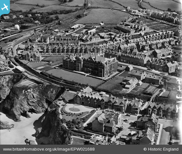
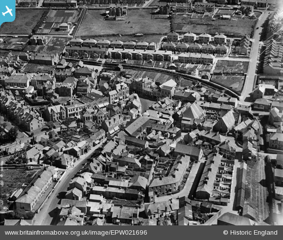
The harbour branch is seen crossing Cliff Road and curving away from the station in 1928. The magnificent Hotel Victoria is at centre. Trenance Viaduct can just be seen at top centre.Again in 1928, the course of the tramway is obvious. Today it is Manor Road. Rails appear to remain at bottom right.
The E. & T.V.R. scout, having on occasion sent a few photographs to the esteemed elders of the Cornwall Railway Society, in time rather got into the habit after his outings of submitting a short story, often under the general heading of “Route Learning” or “Route Refresher.”. Read more