Here are some of the scout’s observations around Exeter.
When the time came to change—or it could be said, return—to battery electric road vehicles, staff at Christow always prayed that the opportunity would be taken generally to reappraise transport requirements. If good sense prevailed, public transport would be greatly expanded and thoroughly developed, and such self-centred transport that was then necessary would adopt a very different form, befitting a reduced role. Electric vehicles as nothing more than a practical means of transport, devoid of sexual or status symbolism, would surely be lighter, slower and smaller.
In the event, all the signs are that there is a stampede underway to replace every vehicle on the roads like-for-like, with the only outward difference being their sounds. They will be heavier and, if the whole production process were laid bare, dirtier. And what hope is there for an end to idiocy and aggression when a smug Tesla driver told the scout, after admitting that he had been a worshipper of petrol tin gods, that he had “never driven anything with the performance of this one”?
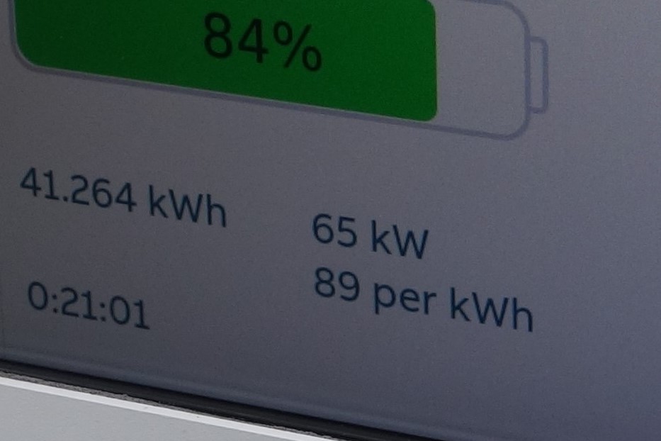
More car chargers have been installed every time the scout goes to the Services at Junction 30 on the M5, which he does occasionally to “slum” with motorists in the canteen area.
.")


The “fractions” to the right (above) indicate how many are available over how many there are in total.

The scout eats his lunch while watching poor, put-upon motorists waddle in to buy their fat, sugar and salt brain pleasurers at one of the fast-food chain counters. As he casts his scathing eye over this species, he wonders how many of them really believe that the taxation they so often howl about and the small burden of responsibility they carry, are remotely adequate to cover the damage they do to the environment, those around them, themselves and public transport provision.
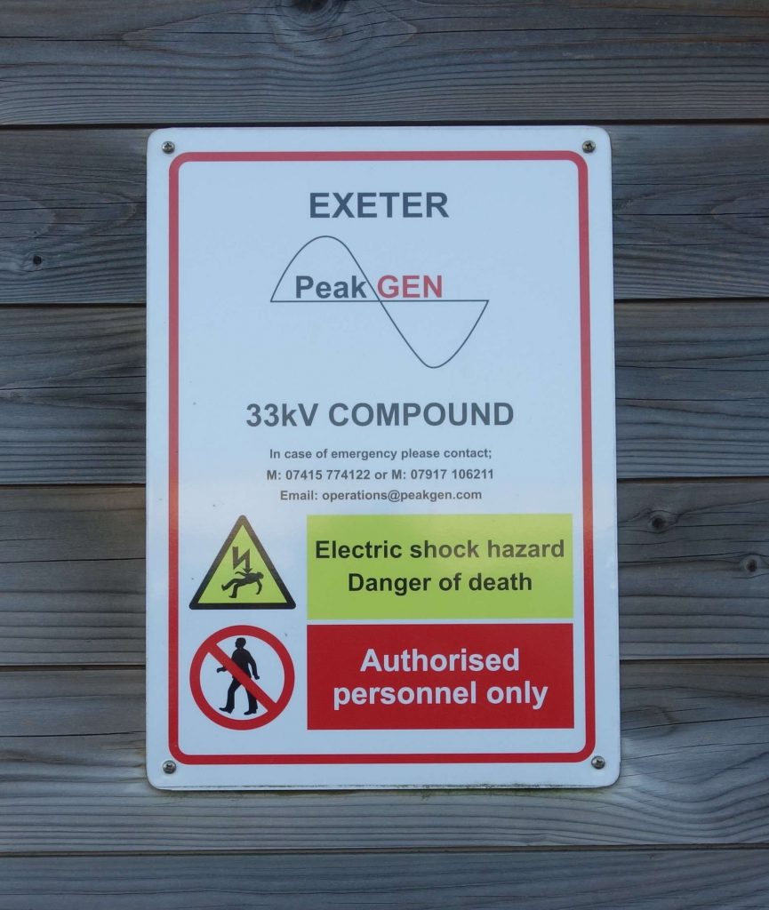
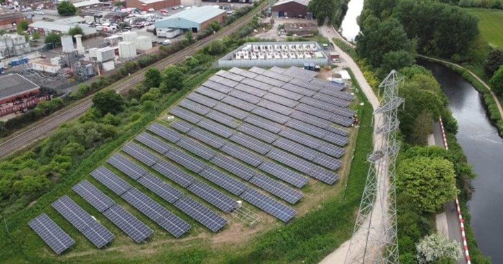
Technically, the Station Master’s bungalow at Christow is a power station, because the 5.44kW (3.6kW net) photovoltaic array on the roof outputs surplus electricity to the National Grid, even when the sun is not shining. It is one of many thousands of Microgenerators which contribute small amounts of power. Between these and the huge old-fashioned base load generators are what might be called “Pop-Up” stations, which lie tucked away all round the country, ready to be started remotely by the grid controllers to provide short duration output to meet peak or “spike” demand.
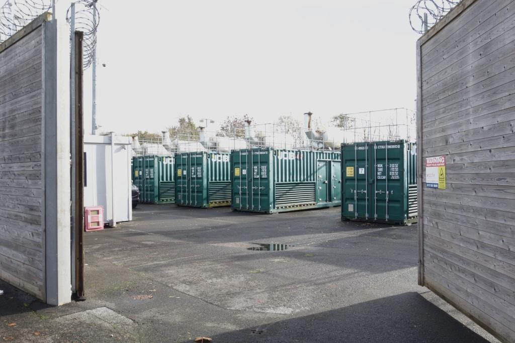
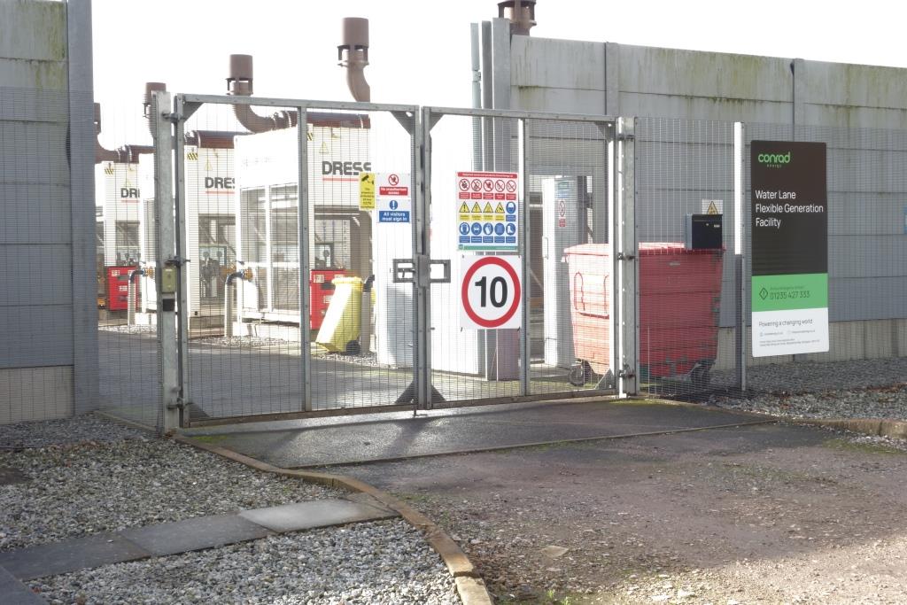
One such is hidden behind high wooden walls in a private car park in Marsh Barton. The scout found the gates open one day and asked a fellow if he could take a photograph. He was told that the ten diesel generator sets could be online in a matter of minutes but needed a bit longer if full power were demanded. The coolant is kept warm, partly to protect against freezing and partly to make starting easier.